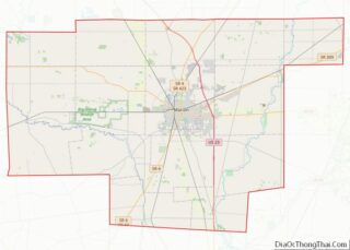
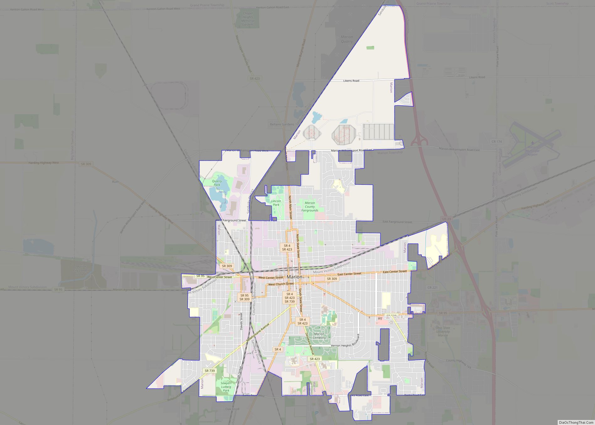
Marion is a city in and the county seat of Marion County, Ohio, United States. It is located in north-central Ohio, approximately 50 miles (80 km) north of Columbus. The population was 35,999 at the 2020 census, slightly down from 36,837 at the 2010 census. It is the largest city in Marion County and the principal city of the Marion, OH Micropolitan Statistical Area. It is also part of the larger Columbus–Marion–Zanesville, OH Combined Statistical Area, which has 2,481,525 people according to the US Census 2017 estimate.
President Warren G. Harding, a former owner of the Marion Star, was a resident of Marion for much of his adult life and is buried at Harding Tomb. The city and its development were closely related to industrialist Edward Huber and his extensive business interests. The city is home to several historic properties, some listed on the National Register of Historic Places listings in Marion County, Ohio.
Marion currently styles itself as “America’s Workforce Development Capital” given public–private educational partnerships and coordination of educational venues, from four and two–year college programs to vocational and technical training and skill certification programs. The mayor of Marion is Scott Schertzer.
| Name: | Marion city |
|---|---|
| LSAD Code: | 25 |
| LSAD Description: | city (suffix) |
| State: | Ohio |
| County: | Marion County |
| Founded: | 1822 |
| Elevation: | 981 ft (299 m) |
| Total Area: | 13.05 sq mi (33.81 km²) |
| Land Area: | 12.96 sq mi (33.58 km²) |
| Water Area: | 0.09 sq mi (0.23 km²) 0.68% |
| Total Population: | 35,999 |
| Population Density: | 2,776.84/sq mi (1,072.16/km²) |
| ZIP code: | 43301, 43302, 43306, 43307 |
| Area code: | 740, 220 |
| FIPS code: | 3947754 |
| GNISfeature ID: | 1061473 |
| Website: | https://www.marionohio.us/ |
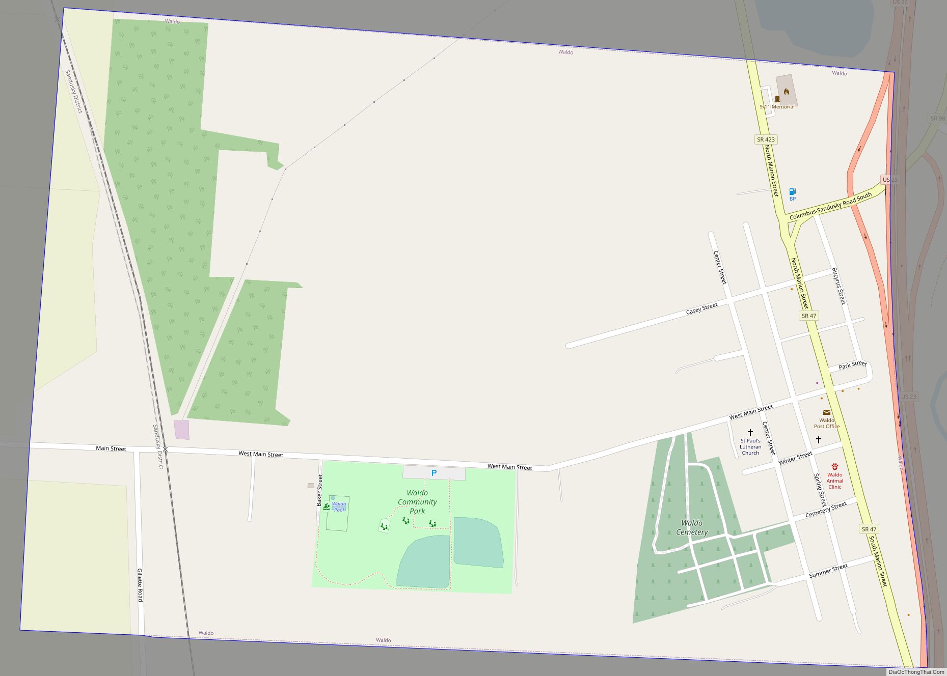
Online Interactive Map
Click on ![]() to view map in "full screen" mode.
to view map in "full screen" mode.
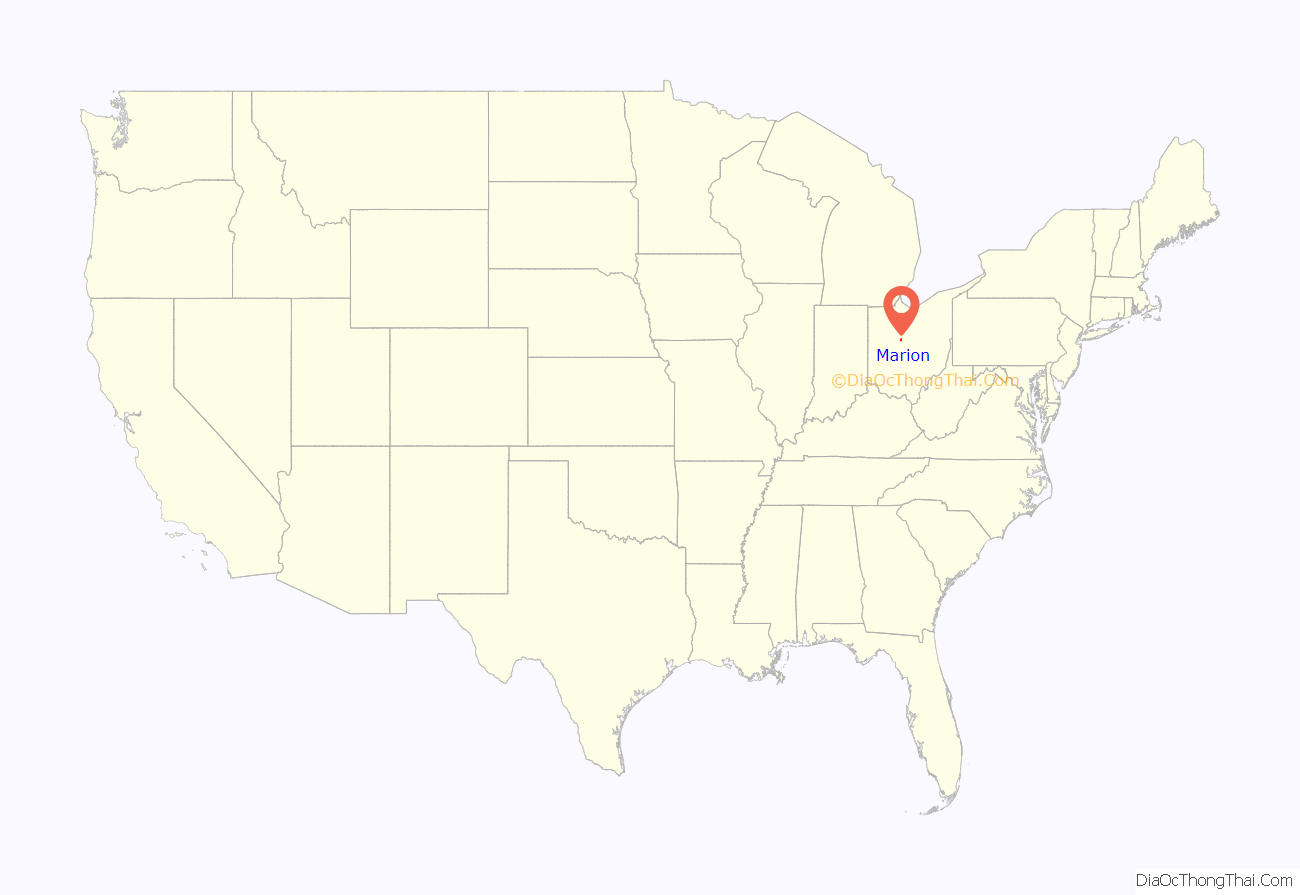
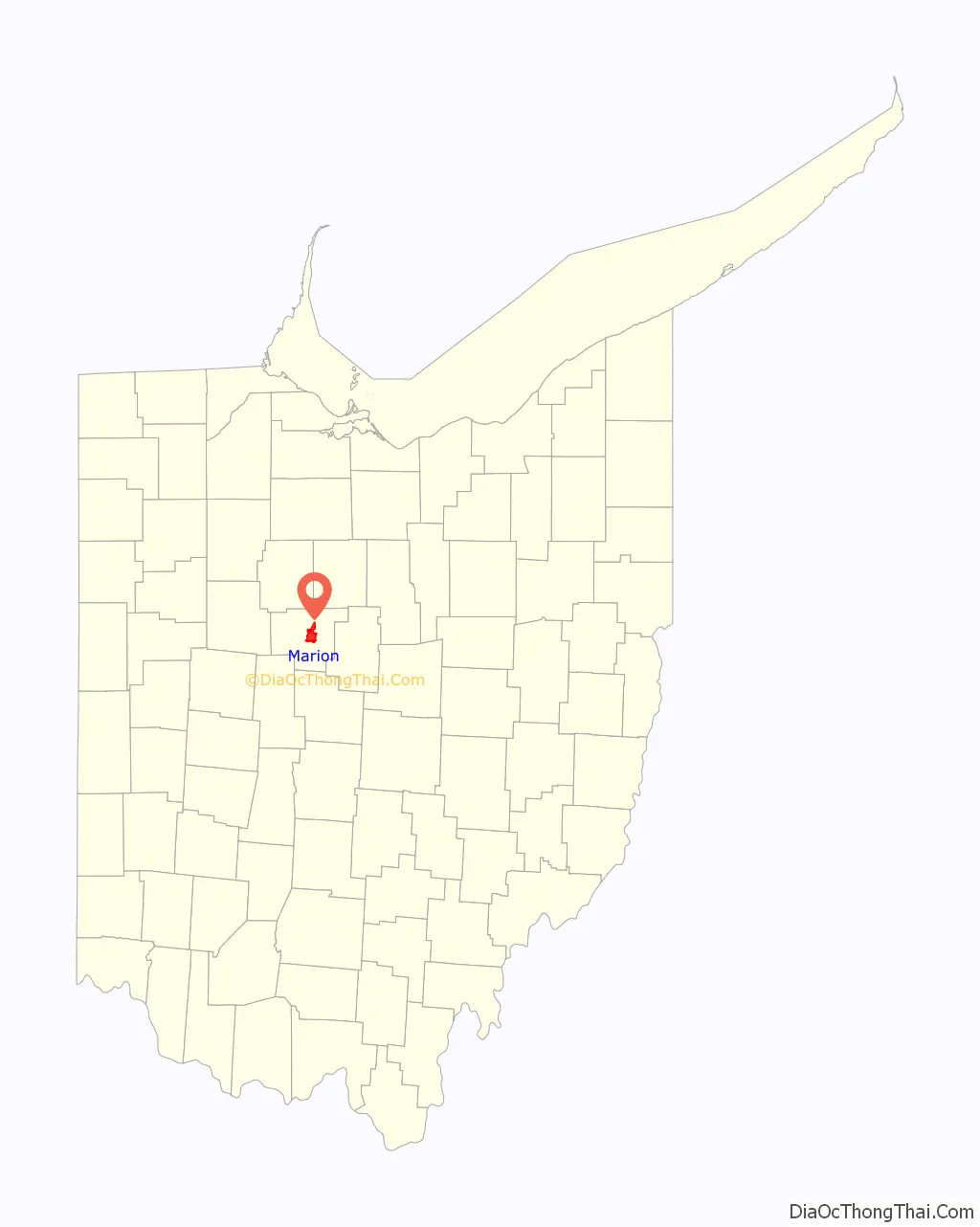
Marion location map. Where is Marion city?
History
Marion was laid out in 1822, and is named in honor of General Francis Marion. It was incorporated as a village by the Legislature of Ohio in its 1829-1830 session. On March 15, 1830, Marion elected Nathan Peters as its first Mayor.
Marion was one of Ohio’s major industrial centers until the 1970s. Products of the Marion Steam Shovel Company (later Marion Power Shovel) were used by contractors to build the Panama Canal, the Hoover Dam, and dug the Holland Tunnel under the Hudson River. In 1911, 80% of the nation’s steam shovel and heavy-duty earth moving equipment was manufactured in Marion, Ohio. NASA contracted with Marion Power Shovel to manufacture the crawler-transporters that moved the assembled Saturn V rockets (used for Project Apollo) to the launch pad.
The city is a rail center for CSX, and Norfolk Southern. Marion has long been a center of grain based (corn and popcorn) snack and other products given its close proximity to nearby growing regions in adjacent counties (ConAgra had a major presence in Marion for decades, and Wyandot Snacks has been active in Marion since the 1960s). Whirlpool Corporation is the largest employer in the city operating the largest clothes dryer manufacturing facility in the world. Nucor Steel’s facility in Marion is the largest producer of rebar and signpost in Ohio.
Marion, like many small American cities, has progressed in its sensibilities around race. During the 1800s Marion served as a stop in the Underground Railroad known in Ohio as the River to Lake Freedom Trail. In 1839, a Black man, Bill Mitchell, was accused of being a fugitive slave in Marion and was freed in the ensuing legal case. A number of Virginians seeking to reclaim him for his owner brawled in the courtroom in response. The former slave was spirited away by Marion abolitionists and he ultimately made his way to Canada. In February 1919, nearly all of Marion’s African American residents were driven out of town in response to an attack on a white woman. Marion subsequently became a sundown town, where African Americans were prevented from residing. President Harding, in spite of criticisms, employed African Americans at the Marion Star. In the 1920s, Marion city and Marion County supported Native American Jim Thorpe and his efforts to field an all–Native American NFL team called the Oorang Indians. In the 1970s, Dr. Dalsukh Madia, an Indian American, became head of the Smith Center at Marion General Hospital (now part of OhioHealth).
Today, people of color constitute 14% of Marion’s population. In July 2020 the Marion City Council, led by Mayor Scott Schertzer, unanimously passed a resolution vowing to promote racial equality and justice for its African American community.
Marion Road Map
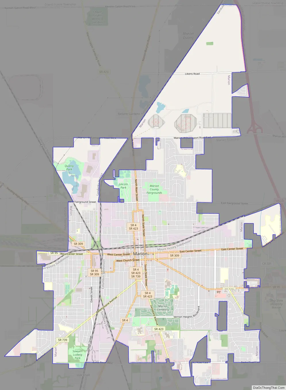
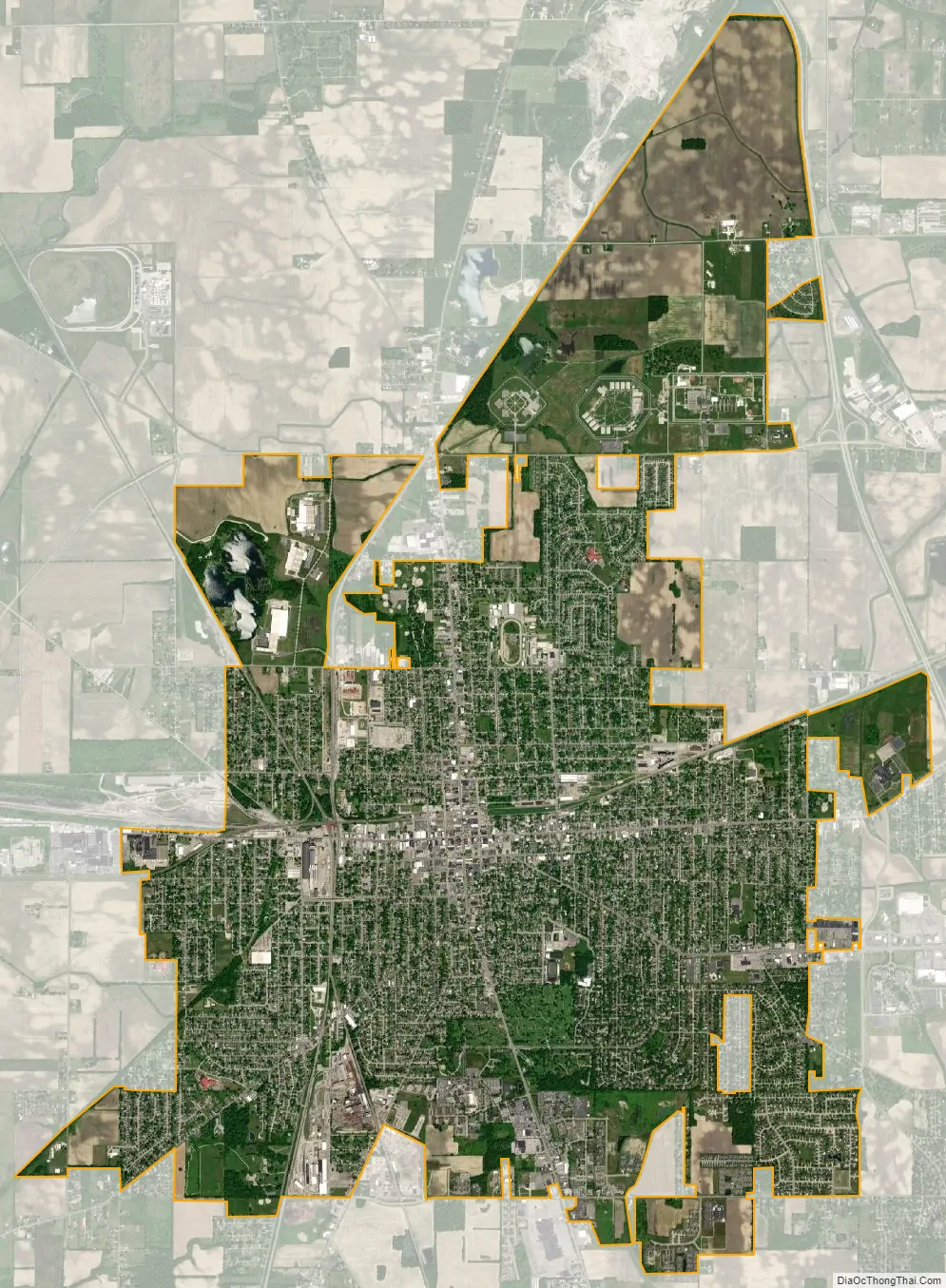
Marion city Satellite Map
Geography
Marion is located at 40°35′12″N 83°7′35″W / 40.58667°N 83.12639°W / 40.58667; -83.12639 (40.586579, -83.126404).
Marion is located in the Till plain geological area of Ohio. The flat land was formed (12,000-14,000 years ago) of glacial till that formed when a sheet of ice became detached from the main body of a glacier and melted in place, depositing the sediments it carried. Two small glacial lake plains are located to the west of the city. The county has gently rolling moraine hills left from the retreating glaciers.
Because of the glacial action, the soils are highly productive for agriculture. The soils are blount, pewamo and glynwood.
The city is located about 50 miles (80 km) north of Ohio‘s capital city, Columbus, due north along U.S. Route 23. Marion occupies most of Marion Township, which is located just outside the city limits.
According to the United States Census Bureau, the city has a total area of 11.82 square miles (30.61 km), of which 11.74 square miles (30.41 km) is land and 0.08 square miles (0.21 km) is water.
Climate
See also
Map of Ohio State and its subdivision:- Adams
- Allen
- Ashland
- Ashtabula
- Athens
- Auglaize
- Belmont
- Brown
- Butler
- Carroll
- Champaign
- Clark
- Clermont
- Clinton
- Columbiana
- Coshocton
- Crawford
- Cuyahoga
- Darke
- Defiance
- Delaware
- Erie
- Fairfield
- Fayette
- Franklin
- Fulton
- Gallia
- Geauga
- Greene
- Guernsey
- Hamilton
- Hancock
- Hardin
- Harrison
- Henry
- Highland
- Hocking
- Holmes
- Huron
- Jackson
- Jefferson
- Knox
- Lake
- Lake Erie
- Lawrence
- Licking
- Logan
- Lorain
- Lucas
- Madison
- Mahoning
- Marion
- Medina
- Meigs
- Mercer
- Miami
- Monroe
- Montgomery
- Morgan
- Morrow
- Muskingum
- Noble
- Ottawa
- Paulding
- Perry
- Pickaway
- Pike
- Portage
- Preble
- Putnam
- Richland
- Ross
- Sandusky
- Scioto
- Seneca
- Shelby
- Stark
- Summit
- Trumbull
- Tuscarawas
- Union
- Van Wert
- Vinton
- Warren
- Washington
- Wayne
- Williams
- Wood
- Wyandot
- Alabama
- Alaska
- Arizona
- Arkansas
- California
- Colorado
- Connecticut
- Delaware
- District of Columbia
- Florida
- Georgia
- Hawaii
- Idaho
- Illinois
- Indiana
- Iowa
- Kansas
- Kentucky
- Louisiana
- Maine
- Maryland
- Massachusetts
- Michigan
- Minnesota
- Mississippi
- Missouri
- Montana
- Nebraska
- Nevada
- New Hampshire
- New Jersey
- New Mexico
- New York
- North Carolina
- North Dakota
- Ohio
- Oklahoma
- Oregon
- Pennsylvania
- Rhode Island
- South Carolina
- South Dakota
- Tennessee
- Texas
- Utah
- Vermont
- Virginia
- Washington
- West Virginia
- Wisconsin
- Wyoming