Nelsonville is a city in northwestern Athens County, Ohio, United States, located about 60 miles (97 km) southeast of Columbus. The population was 5,373 at the 2020 census. It is home to Hocking College as well as Rocky Brands. Nelsonville is surrounded by Ohio’s only national forest, the Wayne National Forest.
| Name: | Nelsonville city |
|---|---|
| LSAD Code: | 25 |
| LSAD Description: | city (suffix) |
| State: | Ohio |
| County: | Athens County |
| Elevation: | 679 ft (207 m) |
| Total Area: | 4.78 sq mi (12.39 km²) |
| Land Area: | 4.68 sq mi (12.12 km²) |
| Water Area: | 0.11 sq mi (0.27 km²) |
| Total Population: | 4,612 |
| Population Density: | 985.89/sq mi (380.62/km²) |
| ZIP code: | 45764 |
| Area code: | 740 |
| FIPS code: | 3953886 |
| GNISfeature ID: | 1076504 |
| Website: | https://cityofnelsonville.org/ |
Online Interactive Map
Click on ![]() to view map in "full screen" mode.
to view map in "full screen" mode.
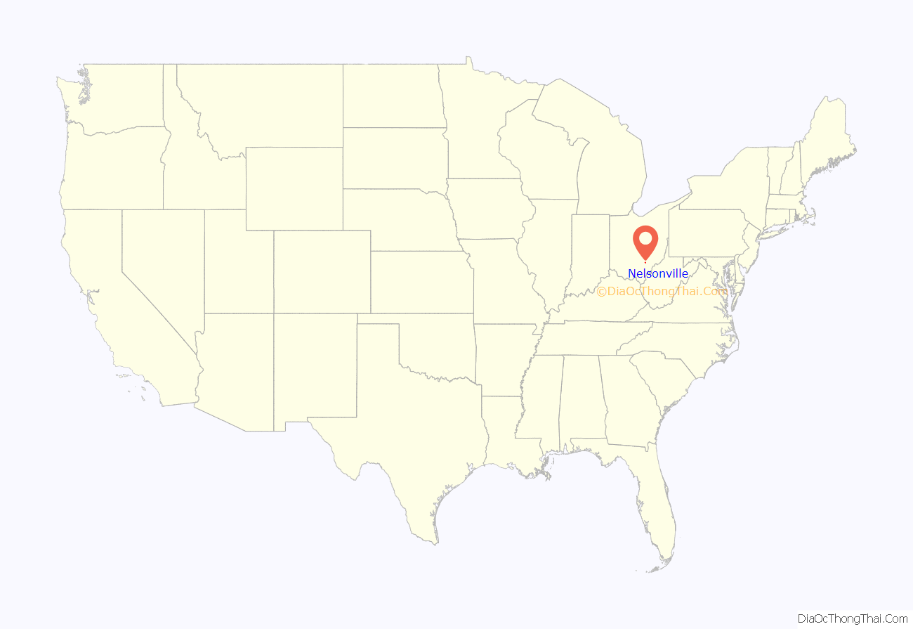
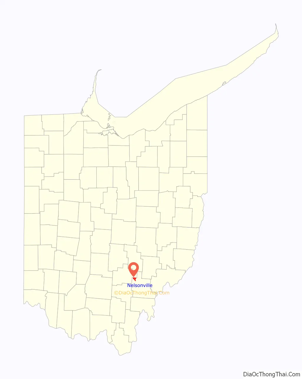
Nelsonville location map. Where is Nelsonville city?
History
First settled in 1814 by the Daniel Nelson, Nelsonville was incorporated in 1838 with Charles Cable as its first mayor. Nelsonville blossomed into a classic Appalachian town by the mid-19th century, relying on the extractive industries of coal, clay and salt. Like many large mining towns, Nelsonville was home to a large hotel, The Dew House, and a thriving theater, Stuart’s Opera House, both located on the Public Square.
During the American Civil War’s famed Morgan’s Raid, Confederate cavalry under Brig. Gen. John Hunt Morgan paused in Nelsonville in July 1863 and burned ten wooden canal boats. However, the 400 confederates failed to destroy a covered bridge over the Hocking Canal when citizens rushed to extinguish the blaze after the raiders rode off. This allowed Union cavalry to continue their pursuit of the fleeing Confederates when they arrived in Nelsonville two hours later. Upon arriving in town, the Union cavalry was delighted that the townspeople had prepared a feast for them.
In 1888, Nelsonville became the first city in the United States west of the Allegheny Mountains to have citywide electric street lights.
Nelsonville was admitted into the national Main Street Program and named a Preserve America Community. The central business district has also been placed on the National Register of Historic Places, and both the Dew House and Stuart’s Opera House have been listed separately. Nelsonville was home to a number of companies that used the area’s dense clay to produce many different types of bricks, particularly glazed paving bricks, some with a distinctive star pattern. Many of the sidewalks in the public square and historic district contain these bricks. In more recent years, its main industrial base was the Rocky Shoes & Boots factory, which has since moved out of the country, but continues to maintain the new Rocky Gear Store, set in the renovated, original factory next to Rocky Brands corporate offices.
Nelsonville Road Map
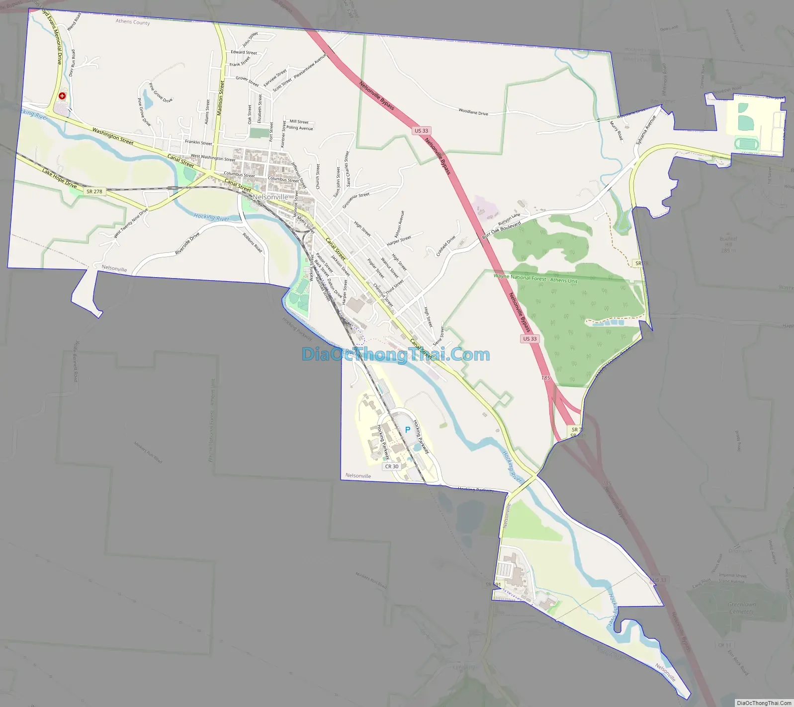
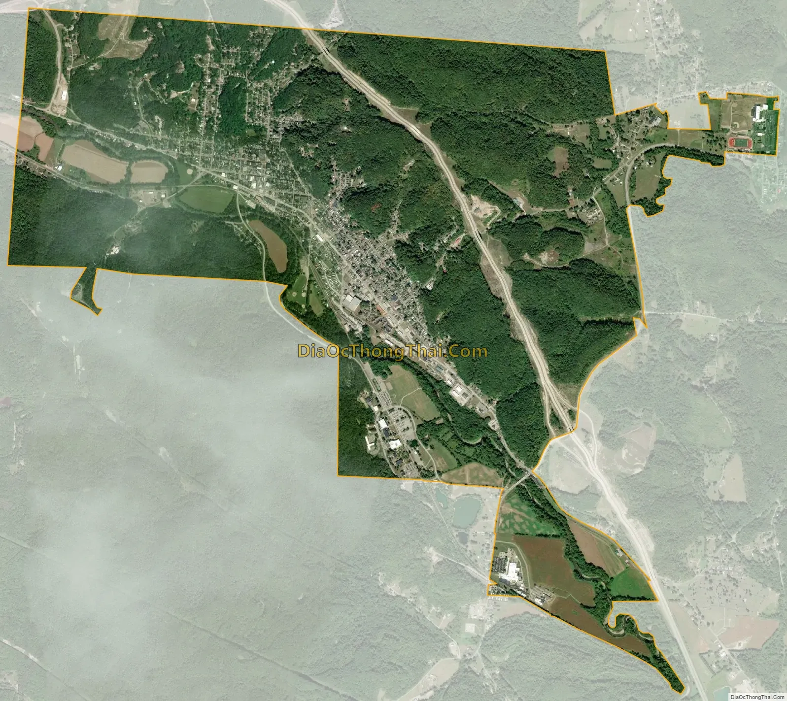
Nelsonville city Satellite Map
Geography
Nelsonville is located at 39°27′19″N 82°13′32″W / 39.45528°N 82.22556°W / 39.45528; -82.22556 (39.455167, −82.225650), along the Hocking River; Monday Creek flows through the eastern part of the city. One of the main streets, Canal Street, is located over where the old Hocking Canal once ran.
According to the United States Census Bureau, the village has a total area of 5.00 square miles (12.95 km), of which 4.89 square miles (12.67 km) is land and 0.11 square miles (0.28 km) is water.
Nelsonville is located on U.S. Route 33. A bypass was completed in December 2013 for the village.
See also
Map of Ohio State and its subdivision:- Adams
- Allen
- Ashland
- Ashtabula
- Athens
- Auglaize
- Belmont
- Brown
- Butler
- Carroll
- Champaign
- Clark
- Clermont
- Clinton
- Columbiana
- Coshocton
- Crawford
- Cuyahoga
- Darke
- Defiance
- Delaware
- Erie
- Fairfield
- Fayette
- Franklin
- Fulton
- Gallia
- Geauga
- Greene
- Guernsey
- Hamilton
- Hancock
- Hardin
- Harrison
- Henry
- Highland
- Hocking
- Holmes
- Huron
- Jackson
- Jefferson
- Knox
- Lake
- Lake Erie
- Lawrence
- Licking
- Logan
- Lorain
- Lucas
- Madison
- Mahoning
- Marion
- Medina
- Meigs
- Mercer
- Miami
- Monroe
- Montgomery
- Morgan
- Morrow
- Muskingum
- Noble
- Ottawa
- Paulding
- Perry
- Pickaway
- Pike
- Portage
- Preble
- Putnam
- Richland
- Ross
- Sandusky
- Scioto
- Seneca
- Shelby
- Stark
- Summit
- Trumbull
- Tuscarawas
- Union
- Van Wert
- Vinton
- Warren
- Washington
- Wayne
- Williams
- Wood
- Wyandot
- Alabama
- Alaska
- Arizona
- Arkansas
- California
- Colorado
- Connecticut
- Delaware
- District of Columbia
- Florida
- Georgia
- Hawaii
- Idaho
- Illinois
- Indiana
- Iowa
- Kansas
- Kentucky
- Louisiana
- Maine
- Maryland
- Massachusetts
- Michigan
- Minnesota
- Mississippi
- Missouri
- Montana
- Nebraska
- Nevada
- New Hampshire
- New Jersey
- New Mexico
- New York
- North Carolina
- North Dakota
- Ohio
- Oklahoma
- Oregon
- Pennsylvania
- Rhode Island
- South Carolina
- South Dakota
- Tennessee
- Texas
- Utah
- Vermont
- Virginia
- Washington
- West Virginia
- Wisconsin
- Wyoming