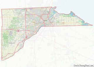
Ottawa Hills is a village in Lucas County, Ohio, United States. The population was 4,517 at the 2010 census. The village was developed on both sides of the Ottawa River (Ohio) and serves as a bedroom community and suburb of Toledo. The Ottawa Hills school district ranked first in the state in student performance for the 2007–2008 school year.
| Name: | Ottawa Hills village |
|---|---|
| LSAD Code: | 47 |
| LSAD Description: | village (suffix) |
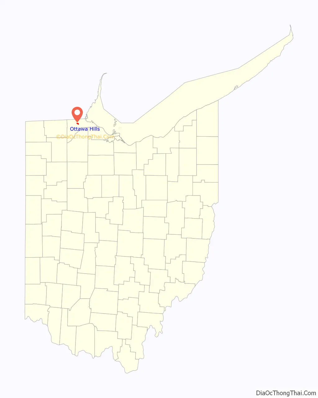
| State: | Ohio |
| County: | Lucas County |
| Elevation: | 604 ft (184 m) |
| Total Area: | 1.90 sq mi (4.91 km²) |
| Land Area: | 1.88 sq mi (4.87 km²) |
| Water Area: | 0.02 sq mi (0.04 km²) |
| Total Population: | 4,790 |
| Population Density: | 2,546.52/sq mi (983.35/km²) |
| FIPS code: | 3959010 |
| GNISfeature ID: | 1065219 |
| Website: | www.ottawahills.org |
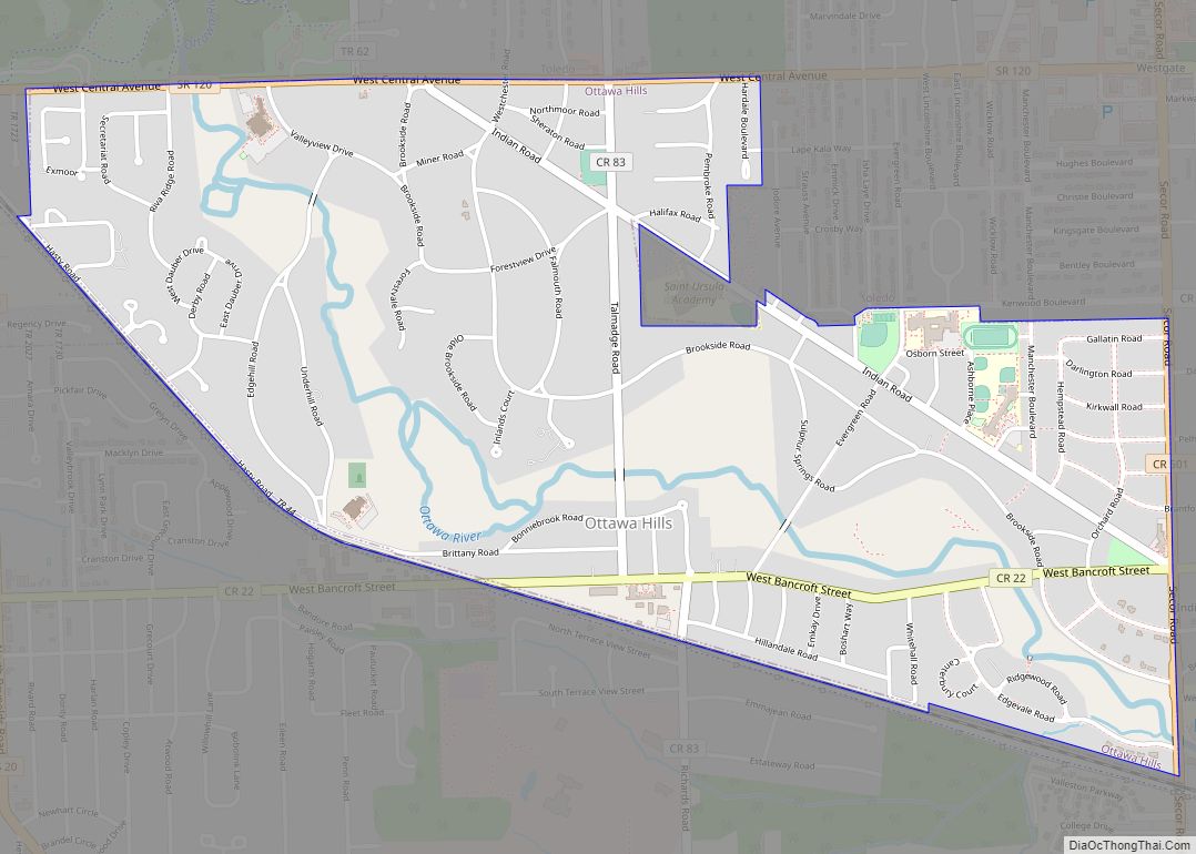
Online Interactive Map
Click on ![]() to view map in "full screen" mode.
to view map in "full screen" mode.
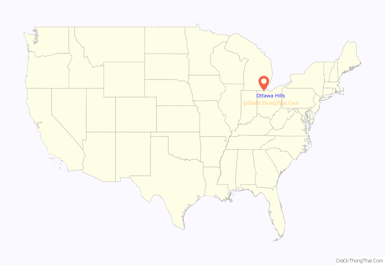
Ottawa Hills location map. Where is Ottawa Hills village?
History
The Village of Ottawa Hills was developed beginning in 1915. John North Willys, president of the Overland Company, acquired approximately 1,200 acres (4.9 km) beginning at the intersection of Bancroft Street and Indian Road and extending along the Ottawa River to Central Avenue.
He started development that year, as reported by The Toledo Times:
John North Willys turned to the E. H. Close Realty Company for the development of Ottawa Hills. The E. H. Close Realty Company had developed more than 1,000 acres (4.0 km) of land in Toledo and the surrounding area. Planners, engineers, and architects with national reputations were involved in the layout and design of the Village. They were also established various restrictive covenants to assure proper quality development and construction of homes.
Several annexations have substantially changed the shape of the village from the original 1,200 acres (4.9 km). Much of the early development of the village conforms to the original plans that date back to 1915. The portion of the village adjacent to Secor Road and south of Bancroft Street, Plat 1, is very similar in layout and design to the original plans. Many of the oldest homes are located in Plat 1. E. H. Close himself lived in this plat in one of the first homes built in the Village.
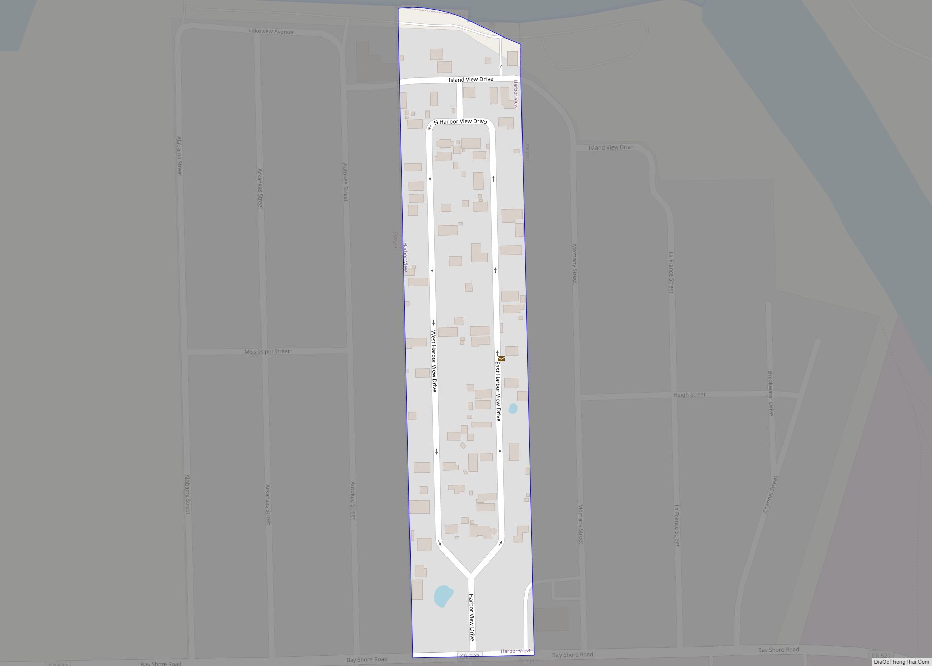
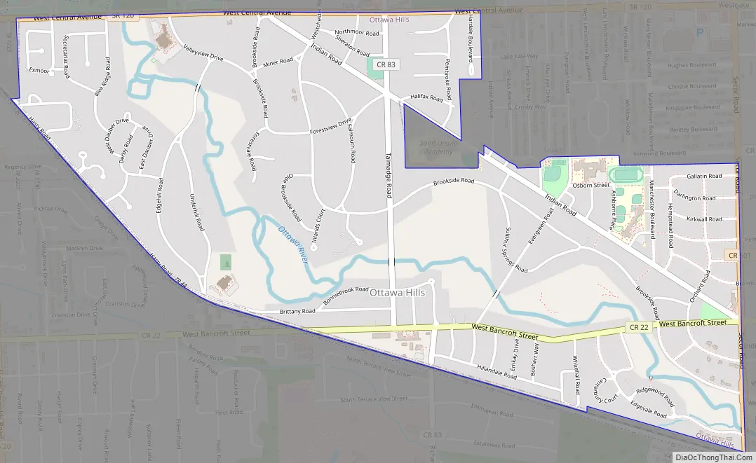
Ottawa Hills Road Map
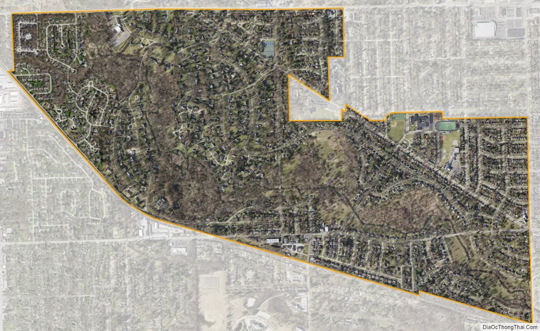
Ottawa Hills city Satellite Map
Geography
According to the United States Census Bureau, the village has a total area of 1.87 square miles (4.84 km), of which 1.85 square miles (4.79 km) is land and 0.02 square miles (0.05 km) is water.
See also
Map of Ohio State and its subdivision:- Adams
- Allen
- Ashland
- Ashtabula
- Athens
- Auglaize
- Belmont
- Brown
- Butler
- Carroll
- Champaign
- Clark
- Clermont
- Clinton
- Columbiana
- Coshocton
- Crawford
- Cuyahoga
- Darke
- Defiance
- Delaware
- Erie
- Fairfield
- Fayette
- Franklin
- Fulton
- Gallia
- Geauga
- Greene
- Guernsey
- Hamilton
- Hancock
- Hardin
- Harrison
- Henry
- Highland
- Hocking
- Holmes
- Huron
- Jackson
- Jefferson
- Knox
- Lake
- Lake Erie
- Lawrence
- Licking
- Logan
- Lorain
- Lucas
- Madison
- Mahoning
- Marion
- Medina
- Meigs
- Mercer
- Miami
- Monroe
- Montgomery
- Morgan
- Morrow
- Muskingum
- Noble
- Ottawa
- Paulding
- Perry
- Pickaway
- Pike
- Portage
- Preble
- Putnam
- Richland
- Ross
- Sandusky
- Scioto
- Seneca
- Shelby
- Stark
- Summit
- Trumbull
- Tuscarawas
- Union
- Van Wert
- Vinton
- Warren
- Washington
- Wayne
- Williams
- Wood
- Wyandot
- Alabama
- Alaska
- Arizona
- Arkansas
- California
- Colorado
- Connecticut
- Delaware
- District of Columbia
- Florida
- Georgia
- Hawaii
- Idaho
- Illinois
- Indiana
- Iowa
- Kansas
- Kentucky
- Louisiana
- Maine
- Maryland
- Massachusetts
- Michigan
- Minnesota
- Mississippi
- Missouri
- Montana
- Nebraska
- Nevada
- New Hampshire
- New Jersey
- New Mexico
- New York
- North Carolina
- North Dakota
- Ohio
- Oklahoma
- Oregon
- Pennsylvania
- Rhode Island
- South Carolina
- South Dakota
- Tennessee
- Texas
- Utah
- Vermont
- Virginia
- Washington
- West Virginia
- Wisconsin
- Wyoming