Parma is a city in Cuyahoga County, Ohio, United States, located on the southern edge of Cleveland. As of the 2020 census, its population was 81,146. Parma is the seventh largest city in the state of Ohio, the largest suburb in the state, and the second largest city in Cuyahoga County after Cleveland.
| Name: | Parma city |
|---|---|
| LSAD Code: | 25 |
| LSAD Description: | city (suffix) |
| State: | Ohio |
| County: | Cuyahoga County |
| Founded: | 1816 |
| Incorporated: | December 15, 1924 (village) & January 1, 1931 (city) |
| Elevation: | 863 ft (263 m) |
| Land Area: | 20.02 sq mi (51.86 km²) |
| Water Area: | 0.05 sq mi (0.12 km²) |
| Population Density: | 4,052.64/sq mi (1,564.74/km²) |
| ZIP code: | 44129, 44130, 44134 |
| Area code: | 440 & 216 |
| FIPS code: | 3961000 |
| GNISfeature ID: | 1049063 |
| Website: | www.cityofparma-oh.gov |
Online Interactive Map
Click on ![]() to view map in "full screen" mode.
to view map in "full screen" mode.
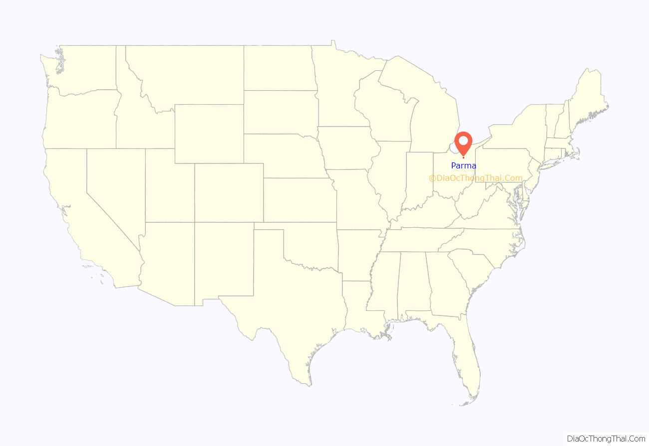
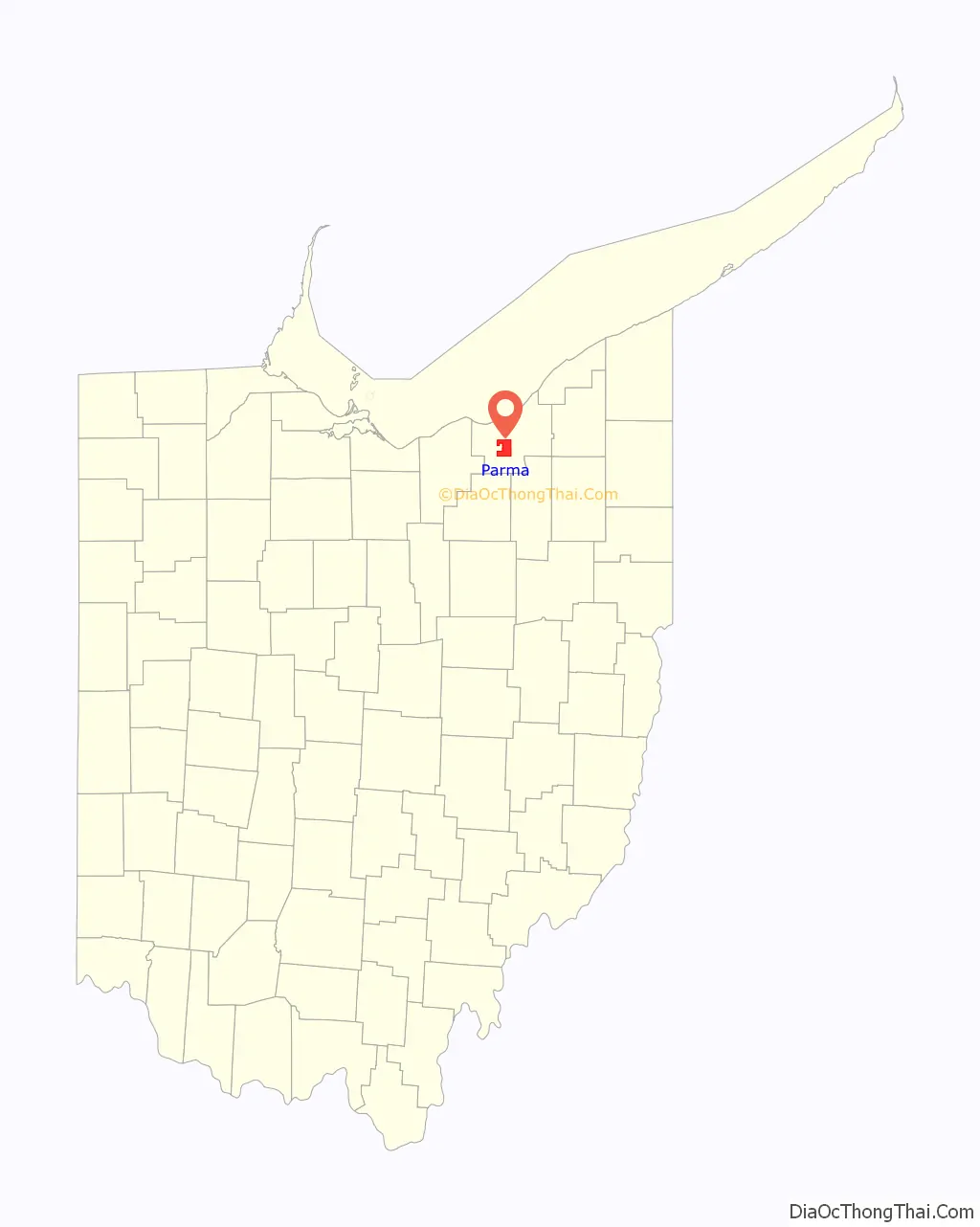
Parma location map. Where is Parma city?
History
Greenbriar (1806–1826)
In 1806, the area that would eventually become Parma and Parma Heights was originally surveyed by Abraham Tappan, a surveyor for the Connecticut Land Company, and was known as Township 6 – Range 13. This designation gave the town its first identity in the Western Reserve. Soon after, Township 6 – Range 13 was commonly referred to as “Greenbriar”, supposedly for the rambling bush that grew there. Benajah Fay, his wife Ruth Wilcox Fay, and their ten children, arrivals from Lewis County, New York, were the first settlers in 1816. It was then that Greenbriar, under a newly organized government seat under Brooklyn Township, began attending to its own governmental needs.
Parma Township (1826–1924)
Self-government started to gain in popularity by the time the new Greenbriar settlement contained twenty householders. However, prior to the establishment of the new township, the name Greenbriar was replaced by the name Parma. This was largely due to Dr. David Long who had recently returned from Italy and “impressed with the grandeur and beauty…was reminded of Parma, Italy and…persuaded the early townspeople that the territory deserved a better name than Greenbriar.”
Thus, on March 7, 1826, a resolution was passed ordering the construction of the new township. It stated,
On the same day, a public notice was issued to qualified electors by the County Commissioners. They met at the house of Samuel Freeman on April 3, 1826, to elect township officers according to the law. It was then that the first eleven officers were elected to lead the new government.
During this time, Parma Township remained largely agricultural. The first schoolhouse was a log structure built on the hill at the northern corner of what is now Parma Heights Cemetery. A memorial plate on a stone marks the spot. In 1827, the township was divided into road districts. The Broadview Road of today was then known as Town Line Road as well as Independence Road. Ridge Road was known then as Center Road as it cut through the center of town. York Road was then known as York Street as arrivals from the state of New York settled there. Pearl Road then had many names which included Medina Wooster Pike, Wooster Pike, the Cleveland Columbus Road, and the Brighton and Parma Plank Road.
A stone house, built in 1849 and known as the Henninger House, was occupied by several generations of Henningers and is still standing today. The house rests on one of the higher points in Cuyahoga County, which provided visibility for the entire northeastern part of Parma Township. This was also the same site where the Erie Indians, centuries before, stood to read and send fire signals as well as pray to their spirits.
By 1850, the US census listed Parma Township’s population at 1,329. However, the rising population of the township had slowed over the decades. The Civil War affected Parma much as it did other towns and villages in the nation. Three out of four homes sent a father, sons, or sometimes both, to fight in the war. By 1910, the population of the township had increased to 1,631.
In 1911, Parma Heights, due to the temperance mood of the day, separated itself from the Parma Township after by a vote of 42 to 32 and was incorporated as a village comprising 4.13 square miles.
The Village of Parma (1924–1930)
By 1920, the US census showed Parma Township had a population of just 2,345, but the following decade proved to be a time of significant growth and development for Parma. It was in the 1920s that Parma Township transformed from a farming community into a village. On December 15, 1924, Parma was incorporated as a village.
The largest and fastest growing development of that time was H. A. Stahl’s Ridgewood Gardens development, which started in 1919, continued through the 1920s, and into the 1930s. A resident of Shaker Heights, Ohio’s first Garden City, H. A. Stahl developed Ridgewood as an ambitious “model village” project patterned along the lines of and rivaling the earlier Shaker Heights project with “churches, schools, motion picture theater, community house, and other features forming a part of all well-developed residence communities”. Ridgewood was designed and marketed as a Garden City on 1,000 acres of land to accommodate about 40,000 residents “325 feet above Lake Erie, in the healthiest section of the South Side, free from the smoke of industries, or the congestion and noises of sections nearer the Public Square.”
The City of Parma (1931–present)
On January 1, 1931, Parma became a city with a population of 13,899. Whereas the incorporation of the village of Parma was met with much optimism, the newly established city of Parma faced the uncertainty of the Great Depression which had almost entirely stopped its growth. Money was scarce, tax income was limited, and some began to talk of annexation of both the city and school district to Cleveland. Both annexation issues, however, were soundly defeated as Parma voters overwhelmingly voted against them and silenced proponents of annexation. Not long after this, Parma was once again solvent due in large part to the newly created Gallagher Act, a 1936 Ohio law that aided cities threatened with bankruptcy and the determination of Parma’s Auditor, Sam Nowlin. By 1941, a building boom appeared to be underway in Parma just as the United States was about to enter World War II.
After World War II, Parma once again began to experience tremendous growth as young families began moving from Cleveland into the suburbs. Between 1950 and 1960, Parma’s population soared from 28,897 to 82,845. By 1956, Parma was unchallenged as the fastest growing city in the United States. The population peaked in 1970 at 100,216.
In 2016, Parma’s population had declined to 81,601, though it remains one of the Cleveland area’s top three destinations young adults (aged 22 to 34) are increasingly choosing as a place to live, along with Lakewood and downtown Cleveland and in 2016 was recognized by Businessweek as one of the best places to raise kids in Ohio.
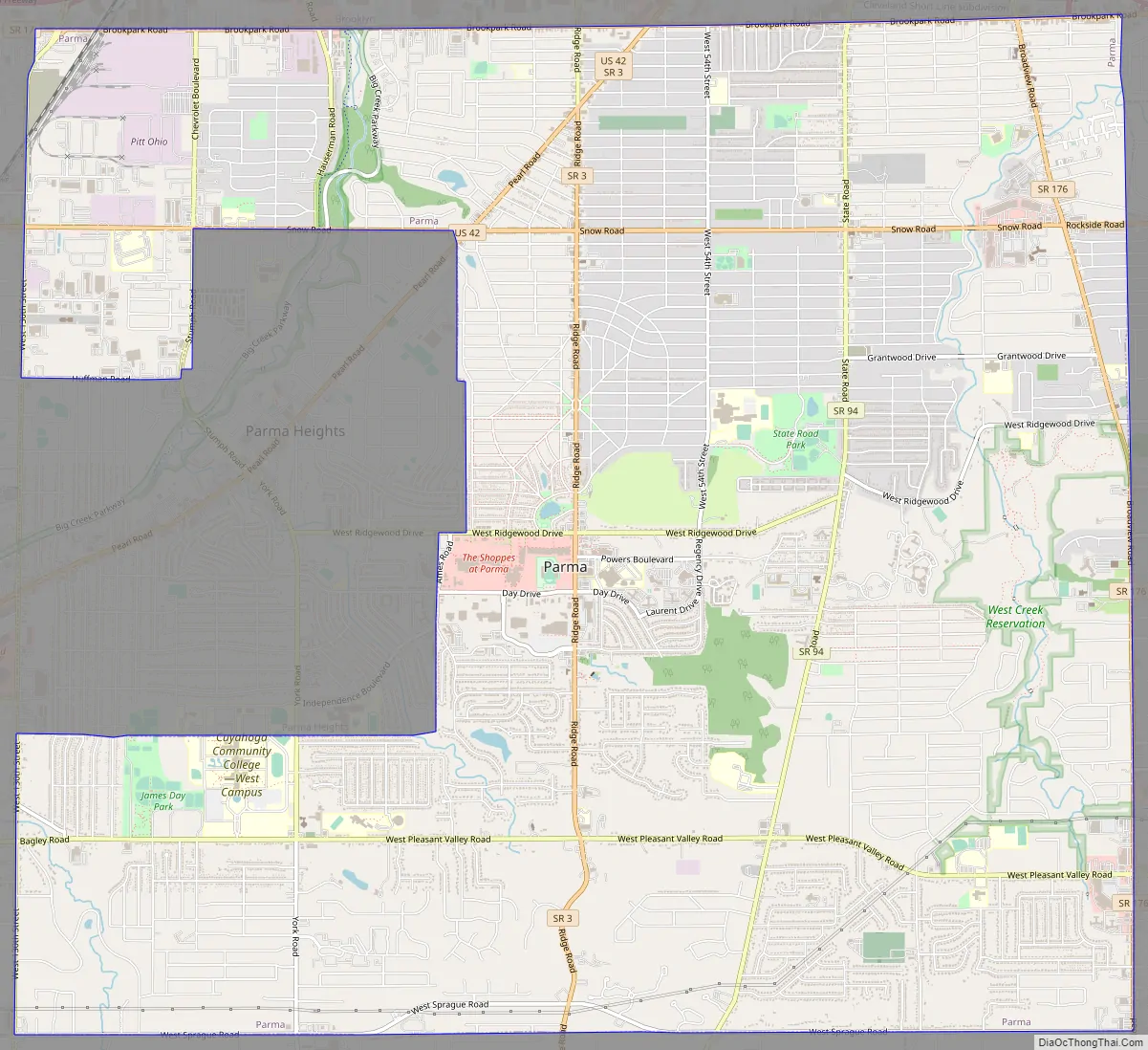
Parma Road Map
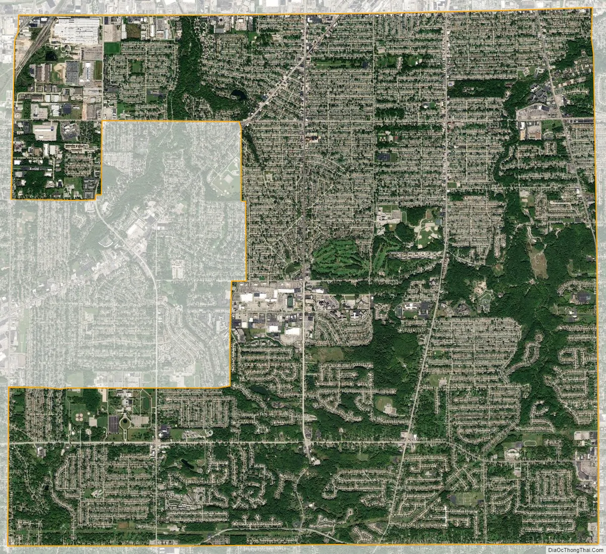
Parma city Satellite Map
Geography
Parma is southwest of Cleveland; it is bounded by Cleveland and Brooklyn on the north, Brooklyn Heights, and Seven Hills on the east, North Royalton and Broadview Heights on the south, and Brook Park, Middleburg Heights, and Parma Heights on the west.
According to the United States Census Bureau, the city has a total area of 20.07 square miles (51.98 km), of which 20.02 square miles (51.85 km) is land and 0.05 square miles (0.13 km) is water.
Two major changes and developments have recently occurred regarding two principal sites within the city:
- The West Creek Preservation Agency has worked to preserve various historic and natural sites in the city, including the Henninger House and the West Creek Watershed.
- Henninger House, built in 1849 and the oldest standing home in Parma, is planned to be part of the proposed Quarry Creek Historic District.
Surrounding communities
Parma is bounded by Cleveland and Brooklyn on the north, Brooklyn Heights, and Seven Hills on the east, North Royalton and Broadview Heights on the south, and Brook Park, Middleburg Heights, and Parma Heights on the west.
See also
Map of Ohio State and its subdivision:- Adams
- Allen
- Ashland
- Ashtabula
- Athens
- Auglaize
- Belmont
- Brown
- Butler
- Carroll
- Champaign
- Clark
- Clermont
- Clinton
- Columbiana
- Coshocton
- Crawford
- Cuyahoga
- Darke
- Defiance
- Delaware
- Erie
- Fairfield
- Fayette
- Franklin
- Fulton
- Gallia
- Geauga
- Greene
- Guernsey
- Hamilton
- Hancock
- Hardin
- Harrison
- Henry
- Highland
- Hocking
- Holmes
- Huron
- Jackson
- Jefferson
- Knox
- Lake
- Lake Erie
- Lawrence
- Licking
- Logan
- Lorain
- Lucas
- Madison
- Mahoning
- Marion
- Medina
- Meigs
- Mercer
- Miami
- Monroe
- Montgomery
- Morgan
- Morrow
- Muskingum
- Noble
- Ottawa
- Paulding
- Perry
- Pickaway
- Pike
- Portage
- Preble
- Putnam
- Richland
- Ross
- Sandusky
- Scioto
- Seneca
- Shelby
- Stark
- Summit
- Trumbull
- Tuscarawas
- Union
- Van Wert
- Vinton
- Warren
- Washington
- Wayne
- Williams
- Wood
- Wyandot
- Alabama
- Alaska
- Arizona
- Arkansas
- California
- Colorado
- Connecticut
- Delaware
- District of Columbia
- Florida
- Georgia
- Hawaii
- Idaho
- Illinois
- Indiana
- Iowa
- Kansas
- Kentucky
- Louisiana
- Maine
- Maryland
- Massachusetts
- Michigan
- Minnesota
- Mississippi
- Missouri
- Montana
- Nebraska
- Nevada
- New Hampshire
- New Jersey
- New Mexico
- New York
- North Carolina
- North Dakota
- Ohio
- Oklahoma
- Oregon
- Pennsylvania
- Rhode Island
- South Carolina
- South Dakota
- Tennessee
- Texas
- Utah
- Vermont
- Virginia
- Washington
- West Virginia
- Wisconsin
- Wyoming


