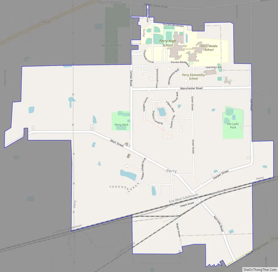
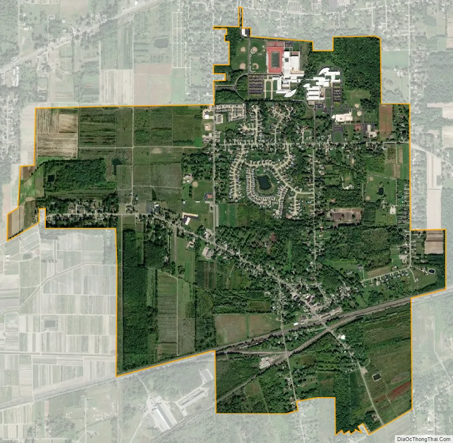
Perry is a village in Lake County, Ohio, United States. The population was 1,663 at the 2010 census.
| Name: | Perry village |
|---|---|
| LSAD Code: | 47 |
| LSAD Description: | village (suffix) |
| State: | Ohio |
| County: | Lake County |
| Elevation: | 699 ft (213 m) |
| Total Area: | 2.27 sq mi (5.88 km²) |
| Land Area: | 2.27 sq mi (5.88 km²) |
| Water Area: | 0.00 sq mi (0.00 km²) |
| Total Population: | 1,602 |
| Population Density: | 705.73/sq mi (272.50/km²) |
| ZIP code: | 44081 |
| Area code: | 440 |
| FIPS code: | 3961882 |
| GNISfeature ID: | 1044385 |
| Website: | perryvillageohio.com |
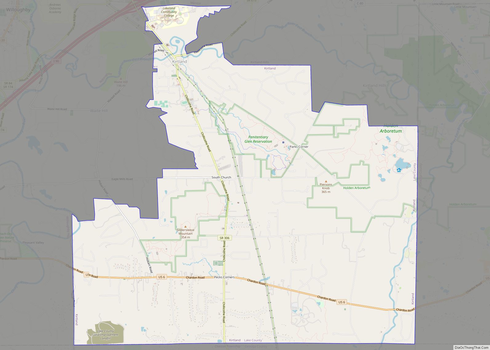
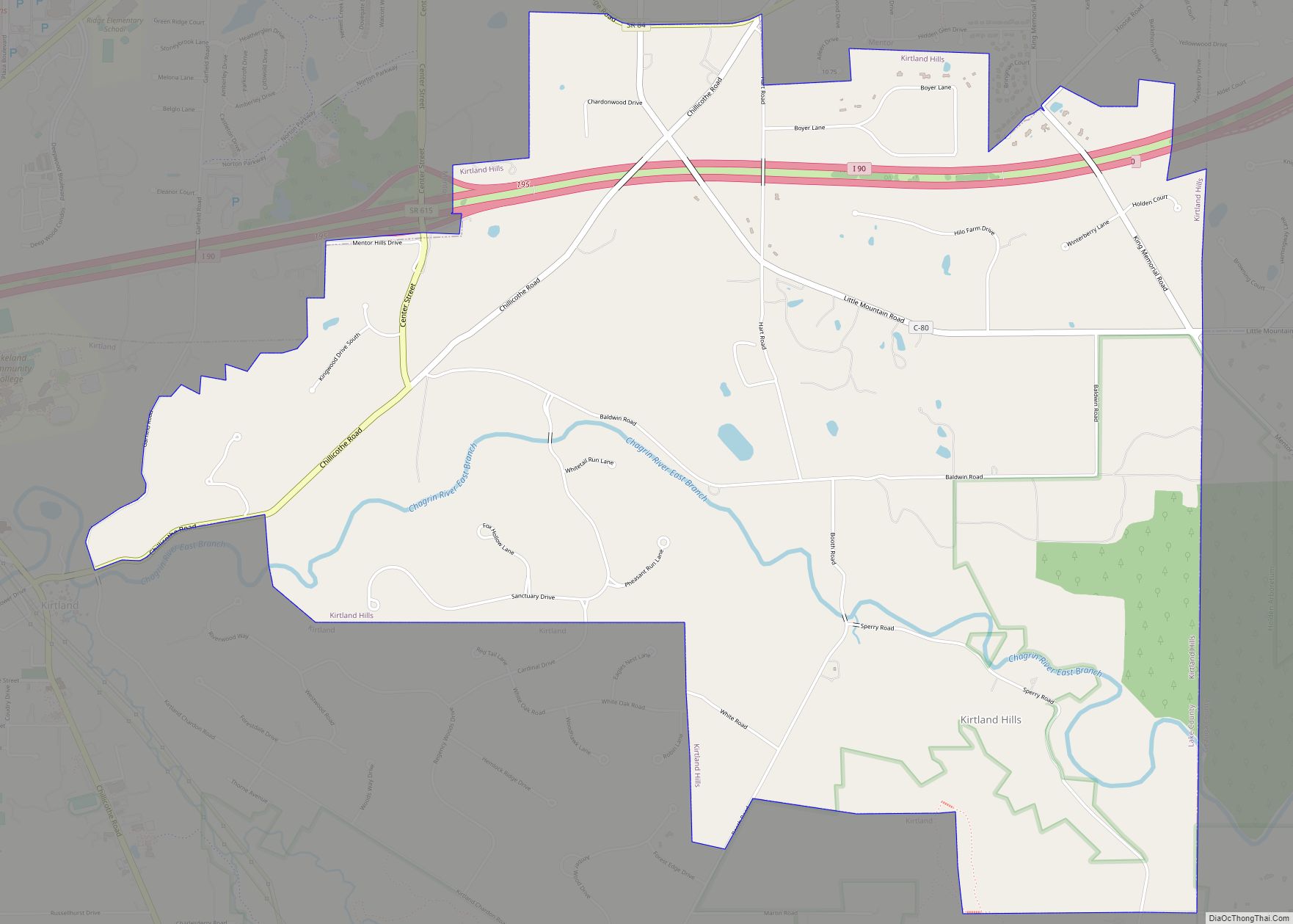
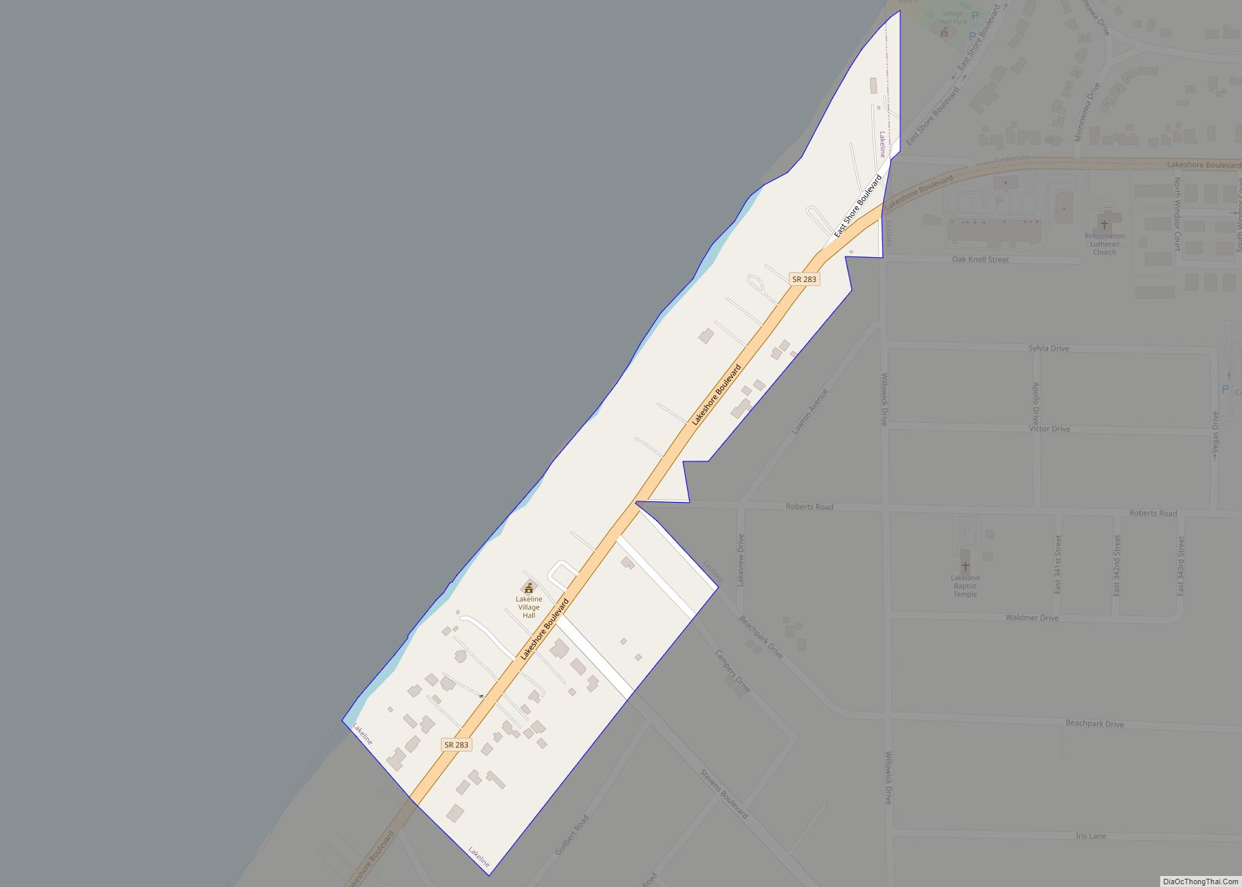
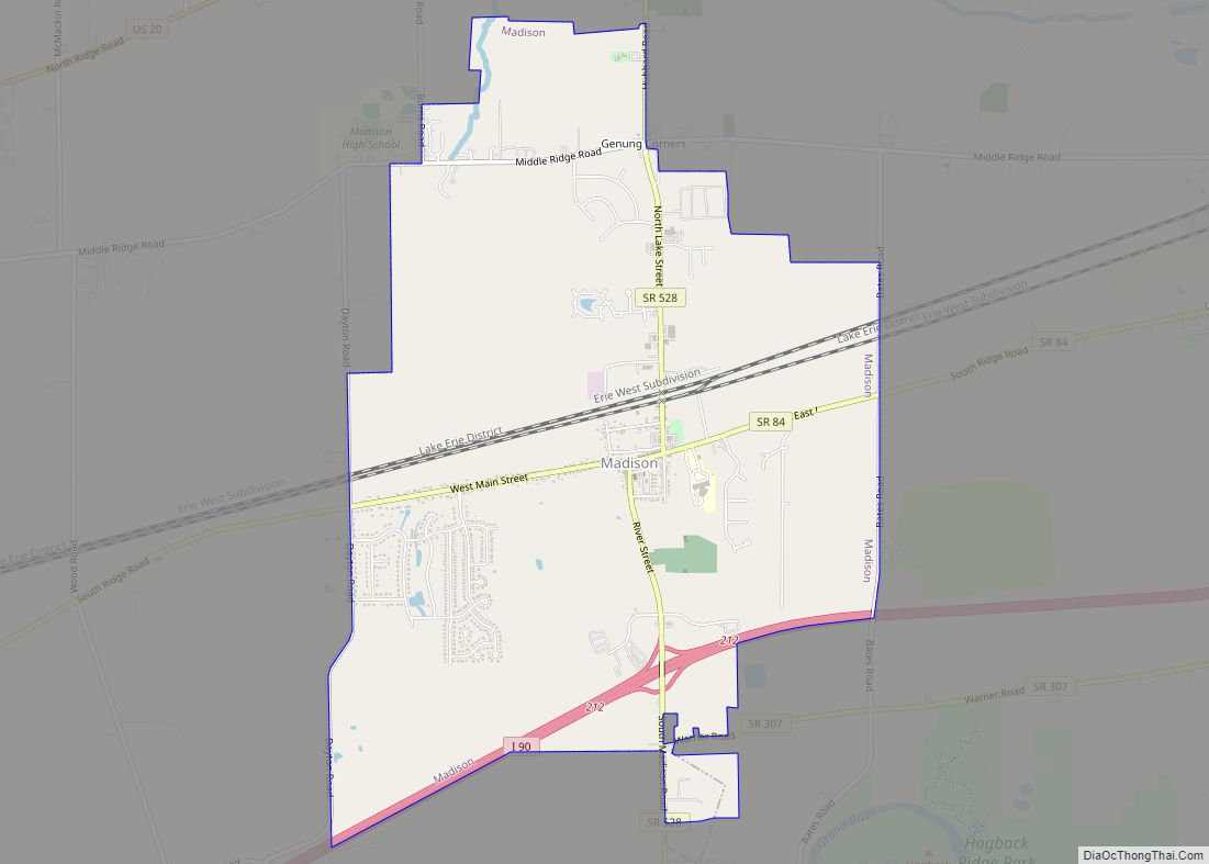
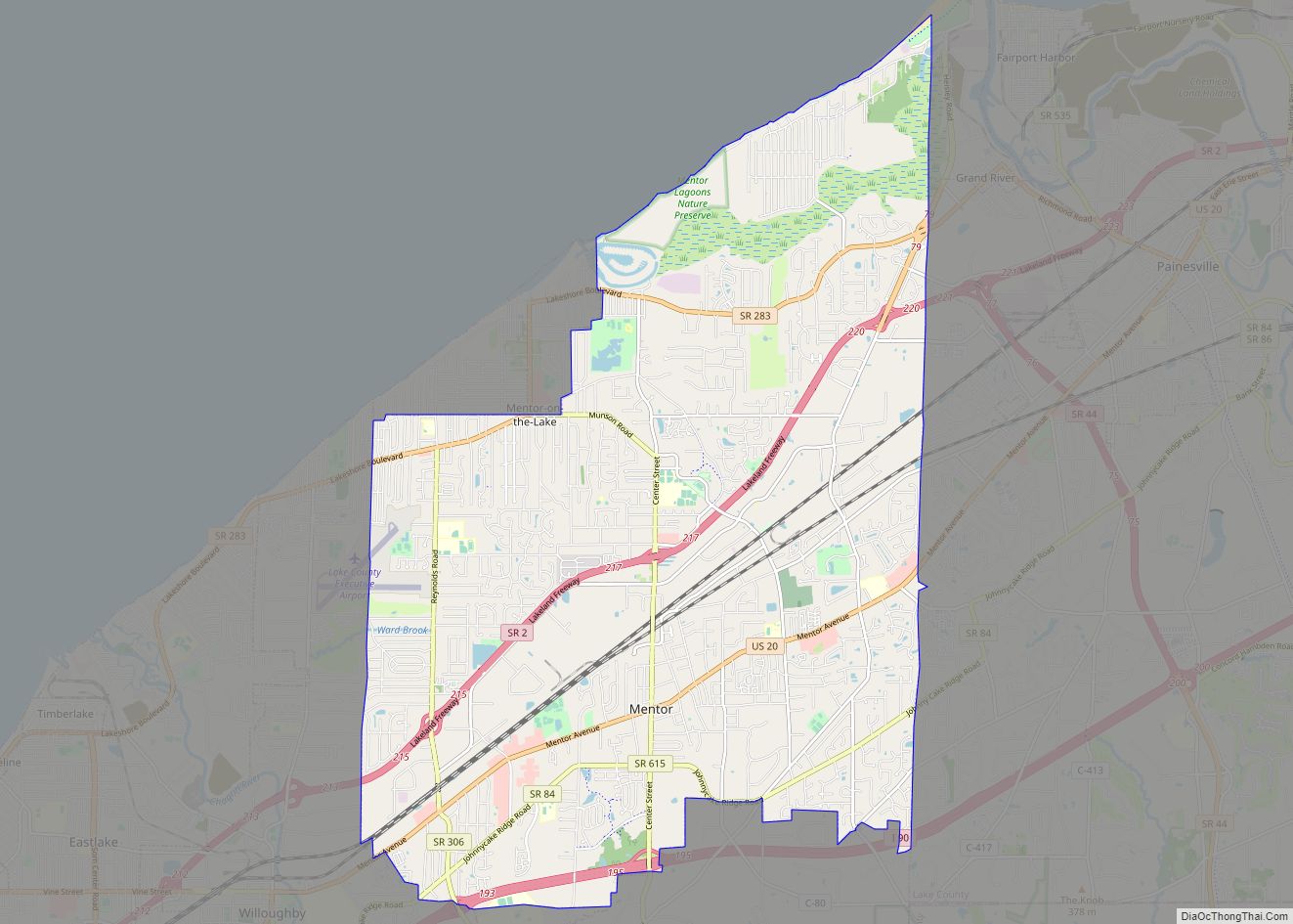
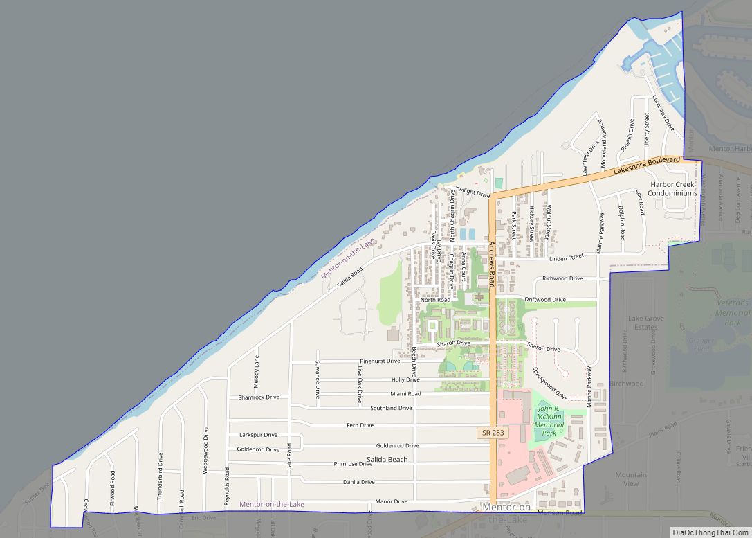
Online Interactive Map
Click on ![]() to view map in "full screen" mode.
to view map in "full screen" mode.
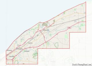
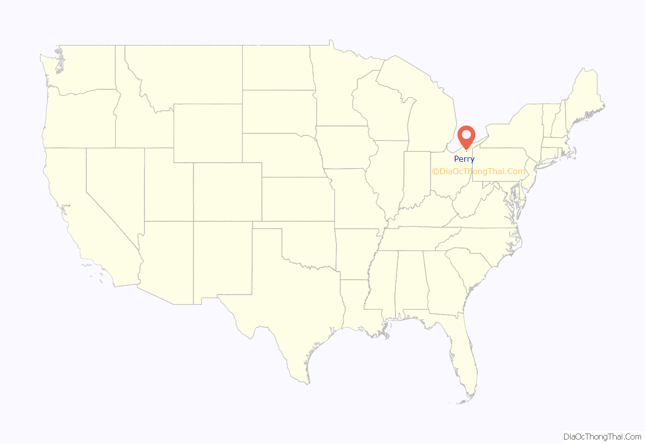
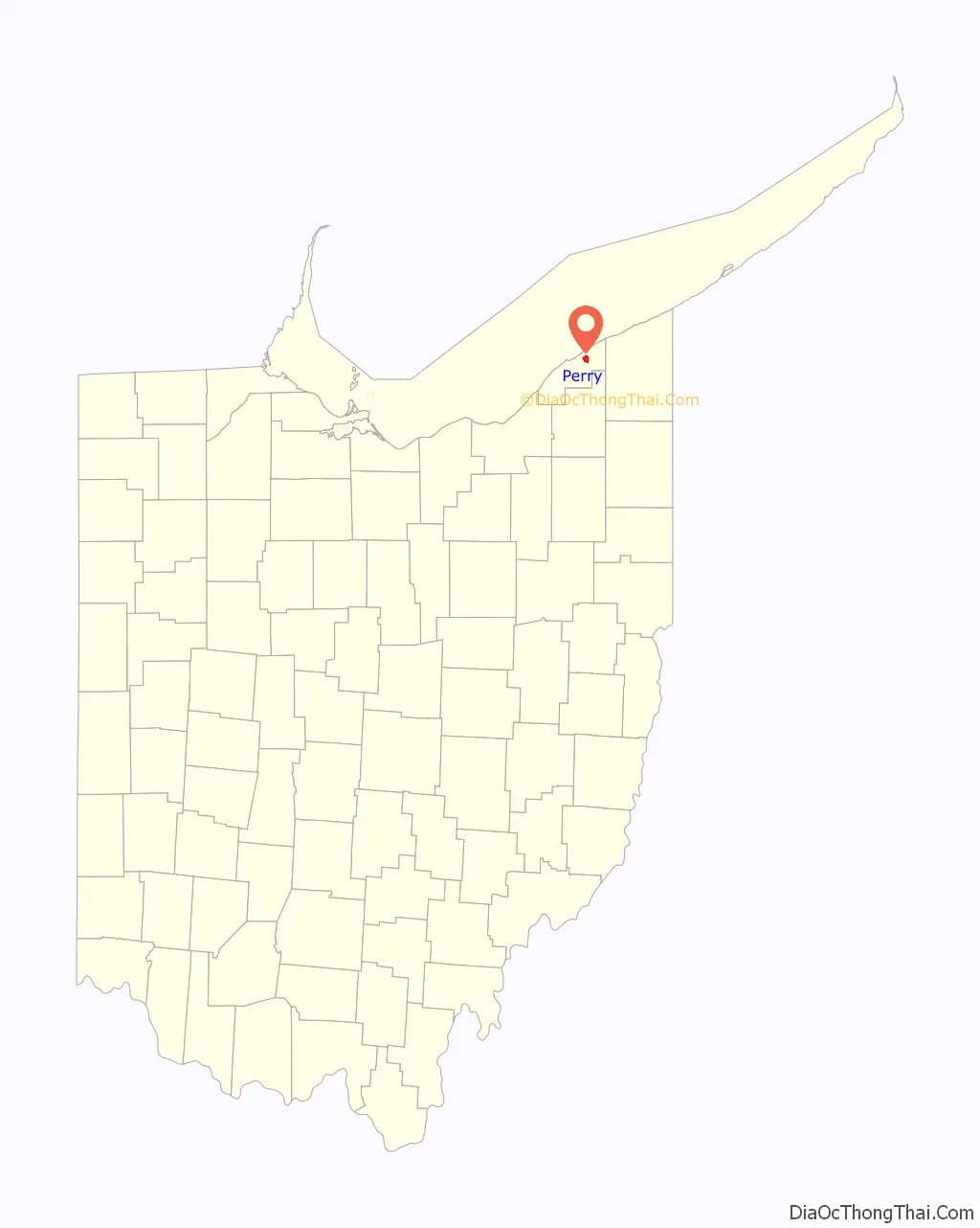
Perry location map. Where is Perry village?
History
It is named in honor of Commodore Oliver Hazard Perry to commemorate his victory over the British fleet at the Battle of Lake Erie in September 1813. The battle was a turning point in the western theater during the War of 1812. Perry is known for its public schools, whose recent construction was influenced by the nearby Perry Nuclear Generating Station.
Perry Road Map
Perry city Satellite Map
Geography
Perry is located at 41°45′33″N 81°8′18″W / 41.75917°N 81.13833°W / 41.75917; -81.13833 (41.759121, -81.138321).
According to the United States Census Bureau, the village has a total area of 2.18 square miles (5.65 km), all land.
See also
Map of Ohio State and its subdivision:- Adams
- Allen
- Ashland
- Ashtabula
- Athens
- Auglaize
- Belmont
- Brown
- Butler
- Carroll
- Champaign
- Clark
- Clermont
- Clinton
- Columbiana
- Coshocton
- Crawford
- Cuyahoga
- Darke
- Defiance
- Delaware
- Erie
- Fairfield
- Fayette
- Franklin
- Fulton
- Gallia
- Geauga
- Greene
- Guernsey
- Hamilton
- Hancock
- Hardin
- Harrison
- Henry
- Highland
- Hocking
- Holmes
- Huron
- Jackson
- Jefferson
- Knox
- Lake
- Lake Erie
- Lawrence
- Licking
- Logan
- Lorain
- Lucas
- Madison
- Mahoning
- Marion
- Medina
- Meigs
- Mercer
- Miami
- Monroe
- Montgomery
- Morgan
- Morrow
- Muskingum
- Noble
- Ottawa
- Paulding
- Perry
- Pickaway
- Pike
- Portage
- Preble
- Putnam
- Richland
- Ross
- Sandusky
- Scioto
- Seneca
- Shelby
- Stark
- Summit
- Trumbull
- Tuscarawas
- Union
- Van Wert
- Vinton
- Warren
- Washington
- Wayne
- Williams
- Wood
- Wyandot
- Alabama
- Alaska
- Arizona
- Arkansas
- California
- Colorado
- Connecticut
- Delaware
- District of Columbia
- Florida
- Georgia
- Hawaii
- Idaho
- Illinois
- Indiana
- Iowa
- Kansas
- Kentucky
- Louisiana
- Maine
- Maryland
- Massachusetts
- Michigan
- Minnesota
- Mississippi
- Missouri
- Montana
- Nebraska
- Nevada
- New Hampshire
- New Jersey
- New Mexico
- New York
- North Carolina
- North Dakota
- Ohio
- Oklahoma
- Oregon
- Pennsylvania
- Rhode Island
- South Carolina
- South Dakota
- Tennessee
- Texas
- Utah
- Vermont
- Virginia
- Washington
- West Virginia
- Wisconsin
- Wyoming