Valley City is an unincorporated community in central Liverpool Township, Medina County, Ohio, United States. The west branch of the Rocky River and Plum Creek flow near Valley City from south to north.
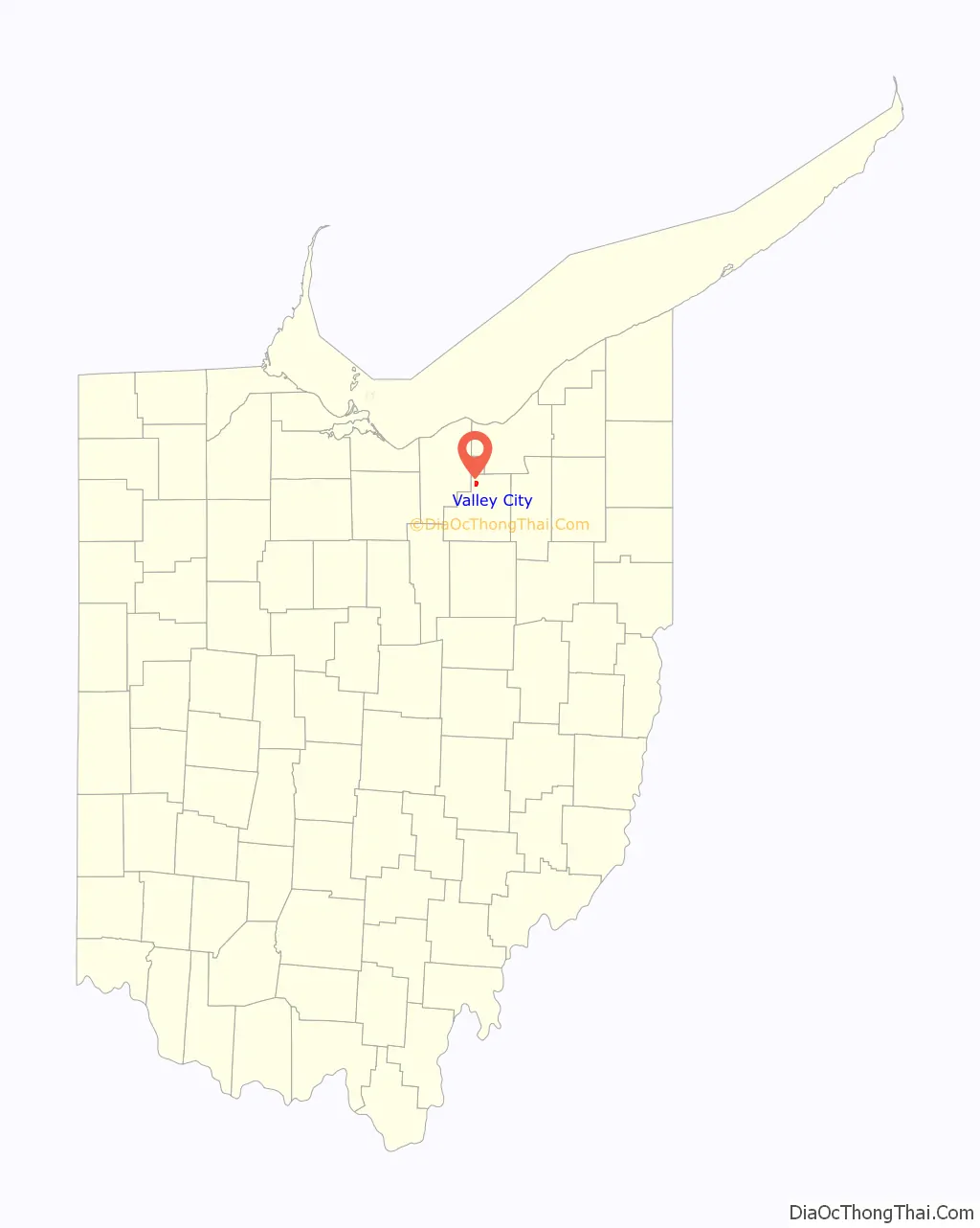
It is located at intersection of State Routes 252 and 303 in the northwest corner of Medina County. Settled in 1810, the surrounding township was established in 1816. Together with Litchfield and York Townships, Liverpool Township composes the Buckeye Local School District. Valley City is part of Ohio District 7 in the U.S. House of Representatives.
| Name: | Valley City CDP |
|---|---|
| LSAD Code: | 57 |
| LSAD Description: | CDP (suffix) |
| State: | Ohio |
| County: | Medina County |
| Total Area: | 1.87 sq mi (4.85 km²) |
| Land Area: | 1.87 sq mi (4.85 km²) |
| Water Area: | 0.00 sq mi (0.00 km²) |
| Total Population: | 943 |
| Population Density: | 503.74/sq mi (194.45/km²) |
| ZIP code: | 44280 |
| Area code: | 330 |
| FIPS code: | 3979184 |
Online Interactive Map
Click on ![]() to view map in "full screen" mode.
to view map in "full screen" mode.
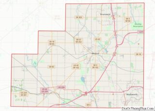
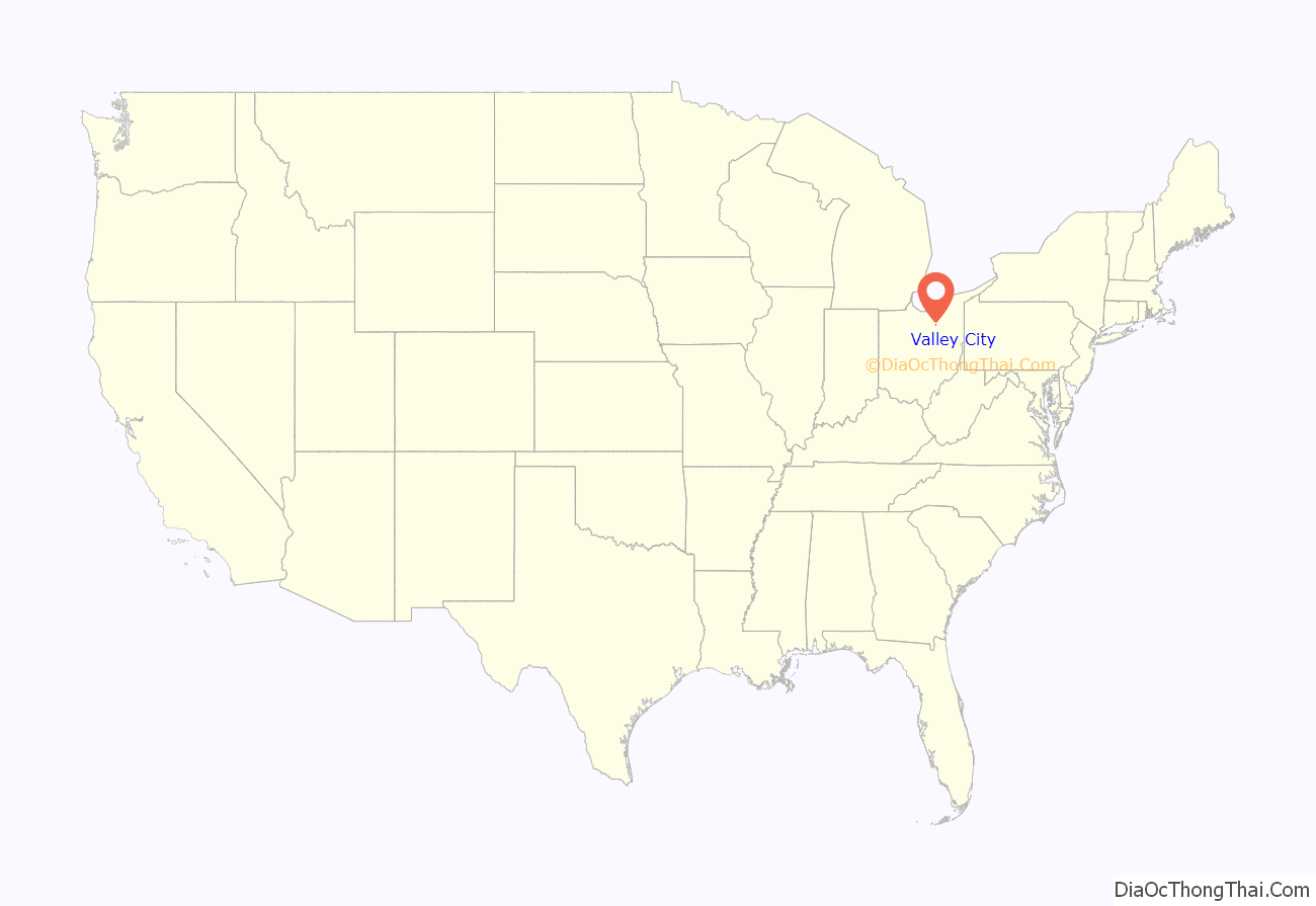
Valley City location map. Where is Valley City CDP?
History
In 1810, Seba Bronson, Jr., a Revolutionary War Veteran, arrives in the “Hardscrabble” area of Liverpool Township (corner of Columbia Rd and Grafton Rd.). As a so-called “squatter”, Bronson occupies the land, plants corn, builds a dwelling, and establishes a thriving salt works.
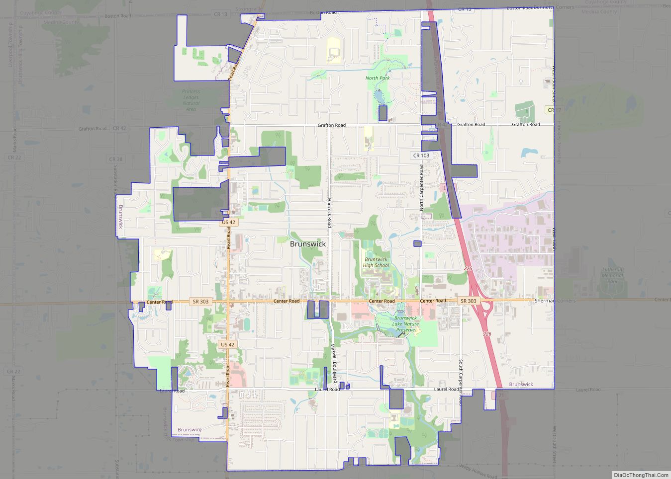
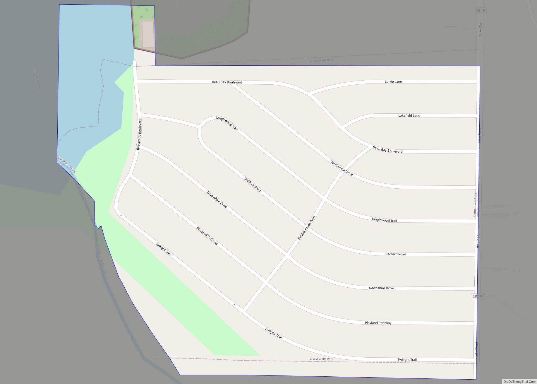
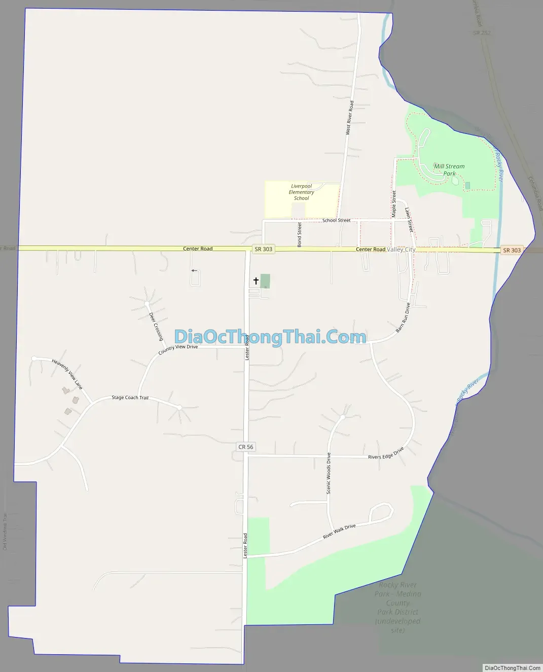
Valley City Road Map
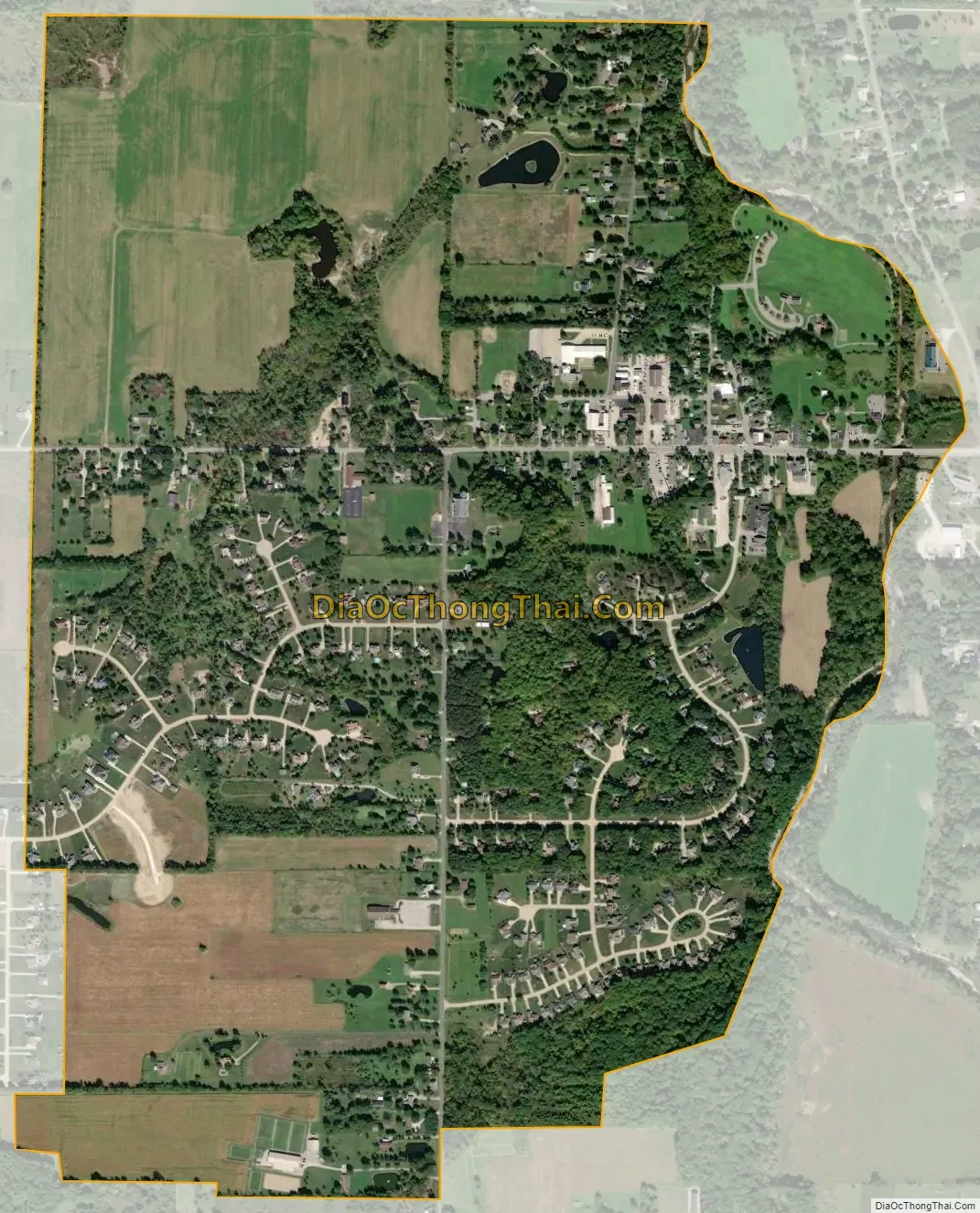
Valley City city Satellite Map
See also
Map of Ohio State and its subdivision:- Adams
- Allen
- Ashland
- Ashtabula
- Athens
- Auglaize
- Belmont
- Brown
- Butler
- Carroll
- Champaign
- Clark
- Clermont
- Clinton
- Columbiana
- Coshocton
- Crawford
- Cuyahoga
- Darke
- Defiance
- Delaware
- Erie
- Fairfield
- Fayette
- Franklin
- Fulton
- Gallia
- Geauga
- Greene
- Guernsey
- Hamilton
- Hancock
- Hardin
- Harrison
- Henry
- Highland
- Hocking
- Holmes
- Huron
- Jackson
- Jefferson
- Knox
- Lake
- Lake Erie
- Lawrence
- Licking
- Logan
- Lorain
- Lucas
- Madison
- Mahoning
- Marion
- Medina
- Meigs
- Mercer
- Miami
- Monroe
- Montgomery
- Morgan
- Morrow
- Muskingum
- Noble
- Ottawa
- Paulding
- Perry
- Pickaway
- Pike
- Portage
- Preble
- Putnam
- Richland
- Ross
- Sandusky
- Scioto
- Seneca
- Shelby
- Stark
- Summit
- Trumbull
- Tuscarawas
- Union
- Van Wert
- Vinton
- Warren
- Washington
- Wayne
- Williams
- Wood
- Wyandot
- Alabama
- Alaska
- Arizona
- Arkansas
- California
- Colorado
- Connecticut
- Delaware
- District of Columbia
- Florida
- Georgia
- Hawaii
- Idaho
- Illinois
- Indiana
- Iowa
- Kansas
- Kentucky
- Louisiana
- Maine
- Maryland
- Massachusetts
- Michigan
- Minnesota
- Mississippi
- Missouri
- Montana
- Nebraska
- Nevada
- New Hampshire
- New Jersey
- New Mexico
- New York
- North Carolina
- North Dakota
- Ohio
- Oklahoma
- Oregon
- Pennsylvania
- Rhode Island
- South Carolina
- South Dakota
- Tennessee
- Texas
- Utah
- Vermont
- Virginia
- Washington
- West Virginia
- Wisconsin
- Wyoming