West Lafayette is a village in Coshocton County, Ohio, United States. The population was 2,321 at the 2010 census.
| Name: | West Lafayette village |
|---|---|
| LSAD Code: | 47 |
| LSAD Description: | village (suffix) |
| State: | Ohio |
| County: | Coshocton County |
| Total Area: | 0.86 sq mi (2.23 km²) |
| Land Area: | 0.86 sq mi (2.23 km²) |
| Water Area: | 0.00 sq mi (0.00 km²) |
| Total Population: | 2,417 |
| Population Density: | 2,803.94/sq mi (1,082.38/km²) |
| ZIP code: | 43845 |
| Area code: | 740 |
| FIPS code: | 3983608 |
| Website: | http://www.westlafayettevillage.com/ |
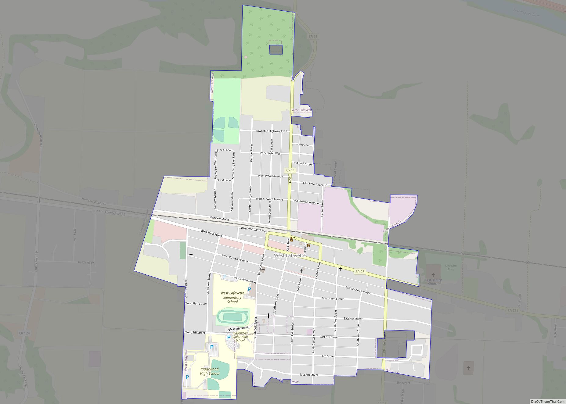
Online Interactive Map
Click on ![]() to view map in "full screen" mode.
to view map in "full screen" mode.
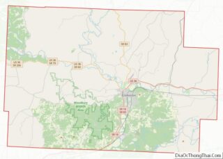
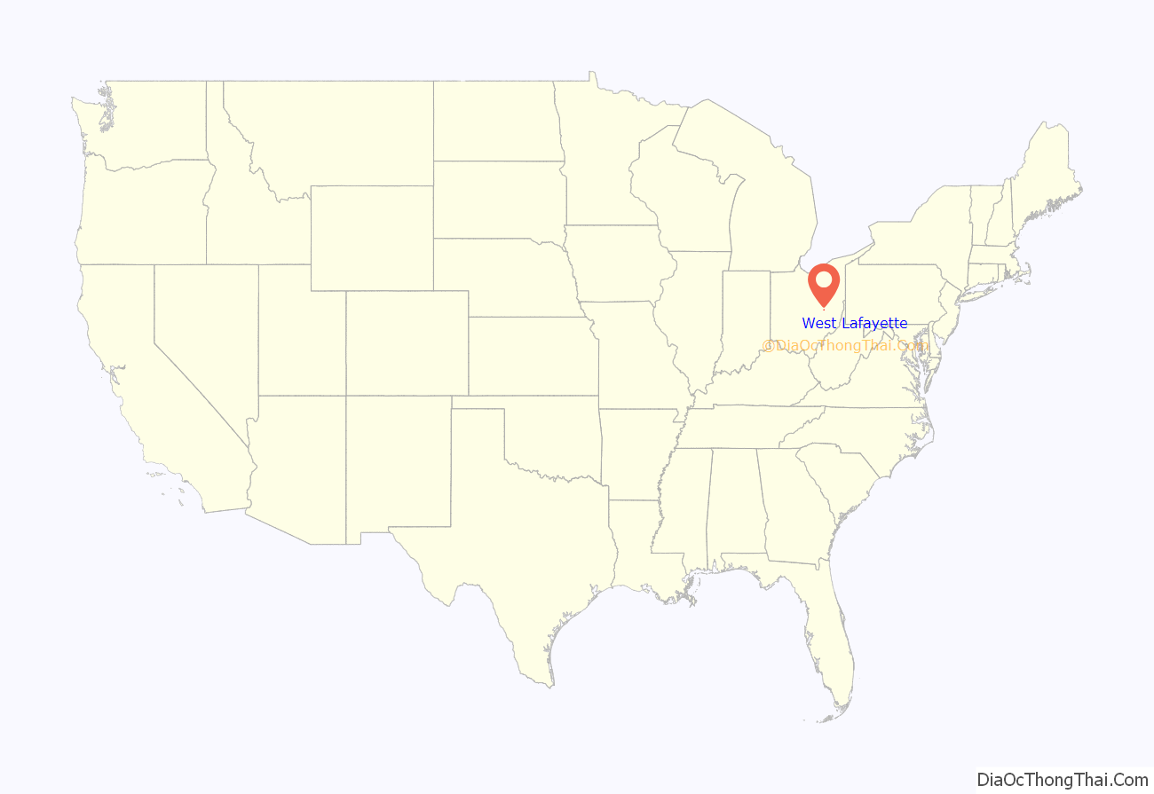
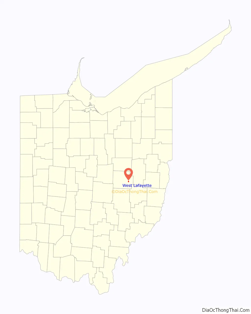
West Lafayette location map. Where is West Lafayette village?
History
West Lafayette was laid out in 1850 by Robert Shaw and William Wheeler. In 1855, the Steubenville and Indiana Railroad was built through the new town. The line became known as the Panhandle Route and was operated in the Pennsylvania Railroad system and currently by the Columbus and Ohio River Railroad (Ohio Central Railroad System). Tragedy struck this track on September 11, 1950 when the crack passenger train “Spirit of St. Louis” hit another train carrying 600 men of the 109th Field Artillery Battalion of the Pennsylvania National Guard. 33 men were killed. A memorial was placed near the site of the accident in 1990. A 105mm howitzer is at the memorial also, commemorating the manufacture of 105mm shells at Moore Enamelling across the tracks during WWII.
The village was once known as the “Enamel Center of the World”. Before plastics were invented, steel vessels covered with a ceramic called enamelware were the norm in American homes. In 1903 the Lafayette Stamping and Enameling Co. was founded. Moore Enameling and Jones Metal also manufactured enamelware. Jones Metal remains. Another industry is Yankee Wire, manufacturer of wire screens.
The West Lafayette Homecoming was begun in 1950 and continues today as the “Hometown Festival.”
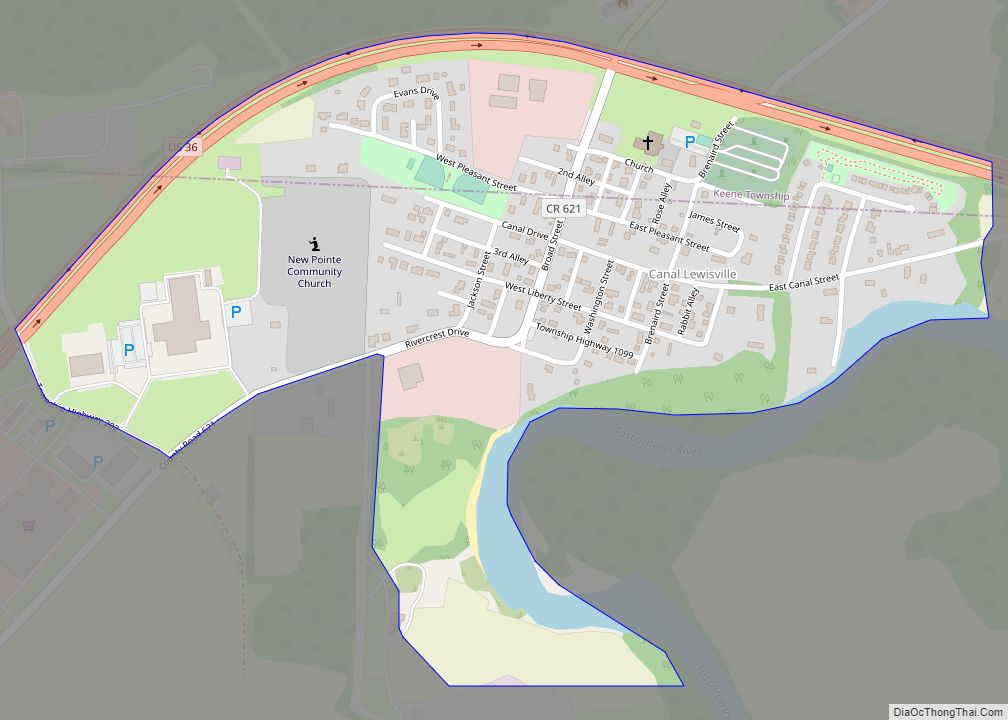
West Lafayette Road Map
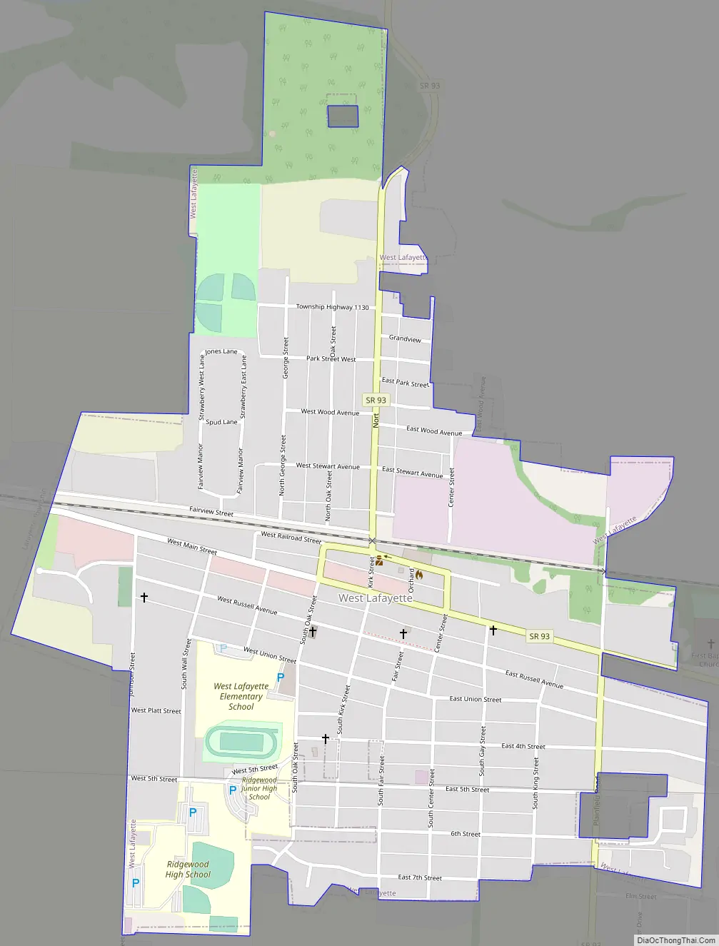
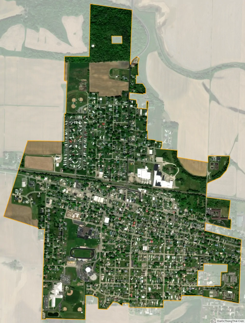
West Lafayette city Satellite Map
Geography
West Lafayette is located at 40°16′26″N 81°45′3″W / 40.27389°N 81.75083°W / 40.27389; -81.75083 (40.273956, -81.750857).
According to the United States Census Bureau, the village has a total area of 0.89 square miles (2.31 km), all land.
The village is built upon a level plain in the Tuscarawas River valley and is surrounded by forested hills and agricultural valleys. The Ohio Central Railroad passes through the town. Immediately north of the village is U.S. Route 36. Both of these are major arteries connecting Columbus with points east.
The aquifer under the village is the site of a well documented trichloroethylene (TCE) plume.
See also
Map of Ohio State and its subdivision:- Adams
- Allen
- Ashland
- Ashtabula
- Athens
- Auglaize
- Belmont
- Brown
- Butler
- Carroll
- Champaign
- Clark
- Clermont
- Clinton
- Columbiana
- Coshocton
- Crawford
- Cuyahoga
- Darke
- Defiance
- Delaware
- Erie
- Fairfield
- Fayette
- Franklin
- Fulton
- Gallia
- Geauga
- Greene
- Guernsey
- Hamilton
- Hancock
- Hardin
- Harrison
- Henry
- Highland
- Hocking
- Holmes
- Huron
- Jackson
- Jefferson
- Knox
- Lake
- Lake Erie
- Lawrence
- Licking
- Logan
- Lorain
- Lucas
- Madison
- Mahoning
- Marion
- Medina
- Meigs
- Mercer
- Miami
- Monroe
- Montgomery
- Morgan
- Morrow
- Muskingum
- Noble
- Ottawa
- Paulding
- Perry
- Pickaway
- Pike
- Portage
- Preble
- Putnam
- Richland
- Ross
- Sandusky
- Scioto
- Seneca
- Shelby
- Stark
- Summit
- Trumbull
- Tuscarawas
- Union
- Van Wert
- Vinton
- Warren
- Washington
- Wayne
- Williams
- Wood
- Wyandot
- Alabama
- Alaska
- Arizona
- Arkansas
- California
- Colorado
- Connecticut
- Delaware
- District of Columbia
- Florida
- Georgia
- Hawaii
- Idaho
- Illinois
- Indiana
- Iowa
- Kansas
- Kentucky
- Louisiana
- Maine
- Maryland
- Massachusetts
- Michigan
- Minnesota
- Mississippi
- Missouri
- Montana
- Nebraska
- Nevada
- New Hampshire
- New Jersey
- New Mexico
- New York
- North Carolina
- North Dakota
- Ohio
- Oklahoma
- Oregon
- Pennsylvania
- Rhode Island
- South Carolina
- South Dakota
- Tennessee
- Texas
- Utah
- Vermont
- Virginia
- Washington
- West Virginia
- Wisconsin
- Wyoming