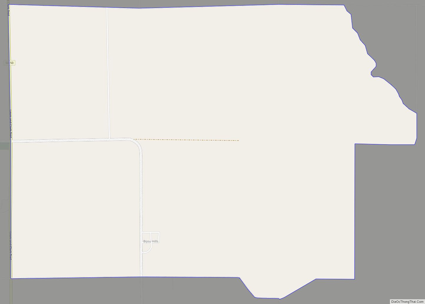
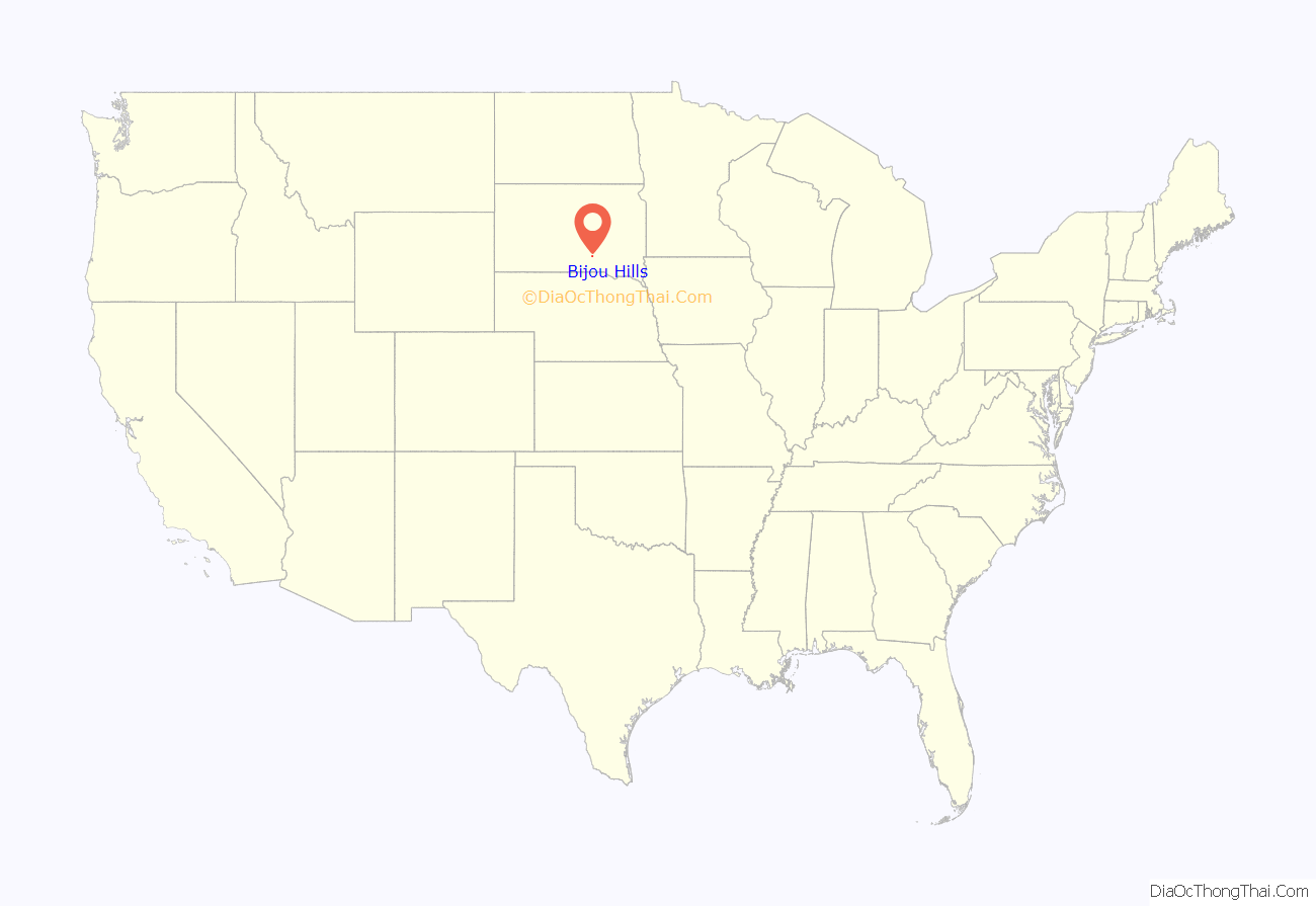
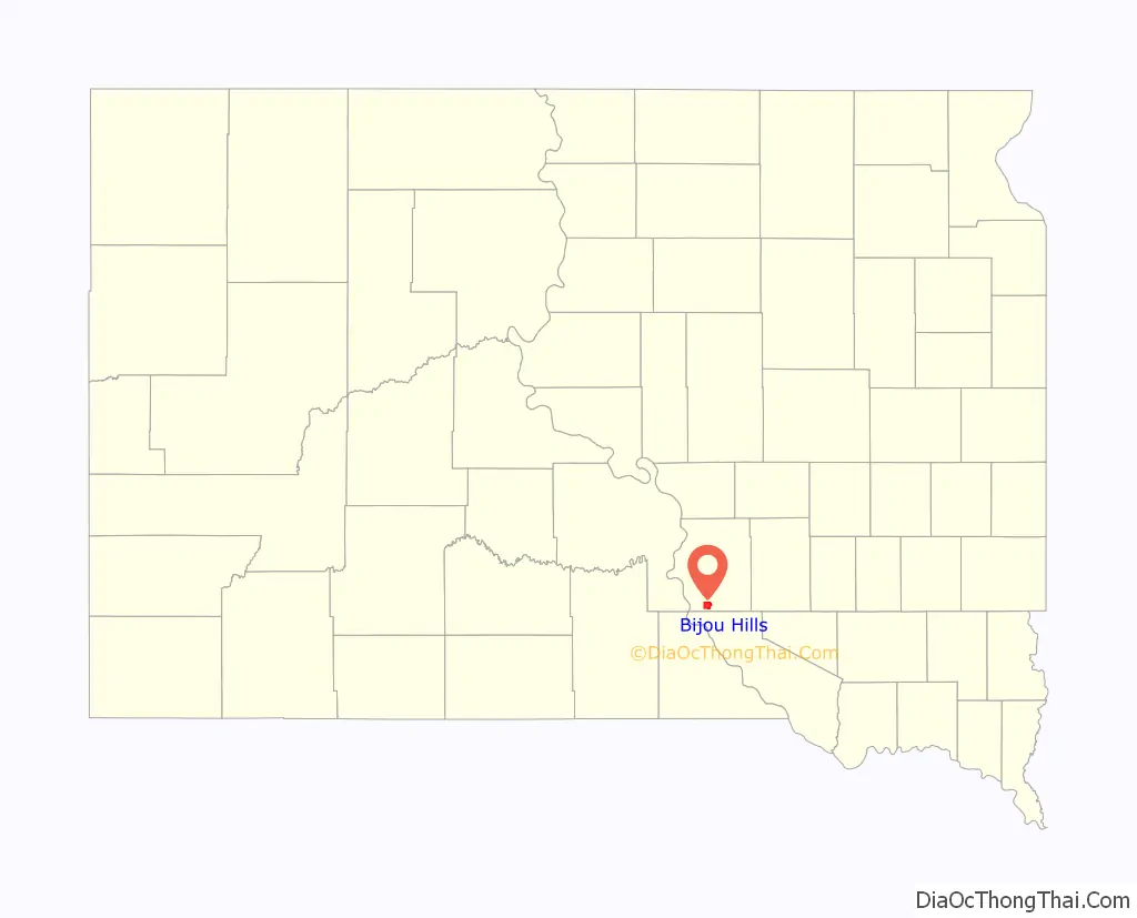
Bijou Hills (Lakota: Wíyukeze Pahá) is an unincorporated community and census-designated place in Brule County, South Dakota, United States. The population was 2 according to the 2020 census.
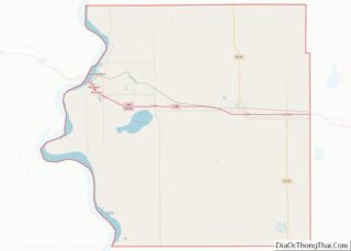
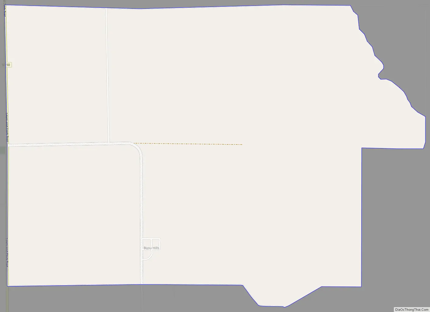
The CDP is located in southern Brule County, at the south base of a small ridge known as the Bijou Hills. The community is 1.2 miles (1.9 km) northeast of South Dakota Highway 50 and 18 miles (29 km) south of Interstate 90.
| Name: | Bijou Hills CDP |
|---|---|
| LSAD Code: | 57 |
| LSAD Description: | CDP (suffix) |
| State: | South Dakota |
| County: | Brule County |
| Elevation: | 1,770 ft (540 m) |
| Total Area: | 5.25 sq mi (13.60 km²) |
| Land Area: | 5.25 sq mi (13.60 km²) |
| Water Area: | 0.00 sq mi (0.00 km²) |
| Total Population: | 2 |
| Population Density: | 0.38/sq mi (0.15/km²) |
| FIPS code: | 4605580 |
| GNISfeature ID: | 1261095 |
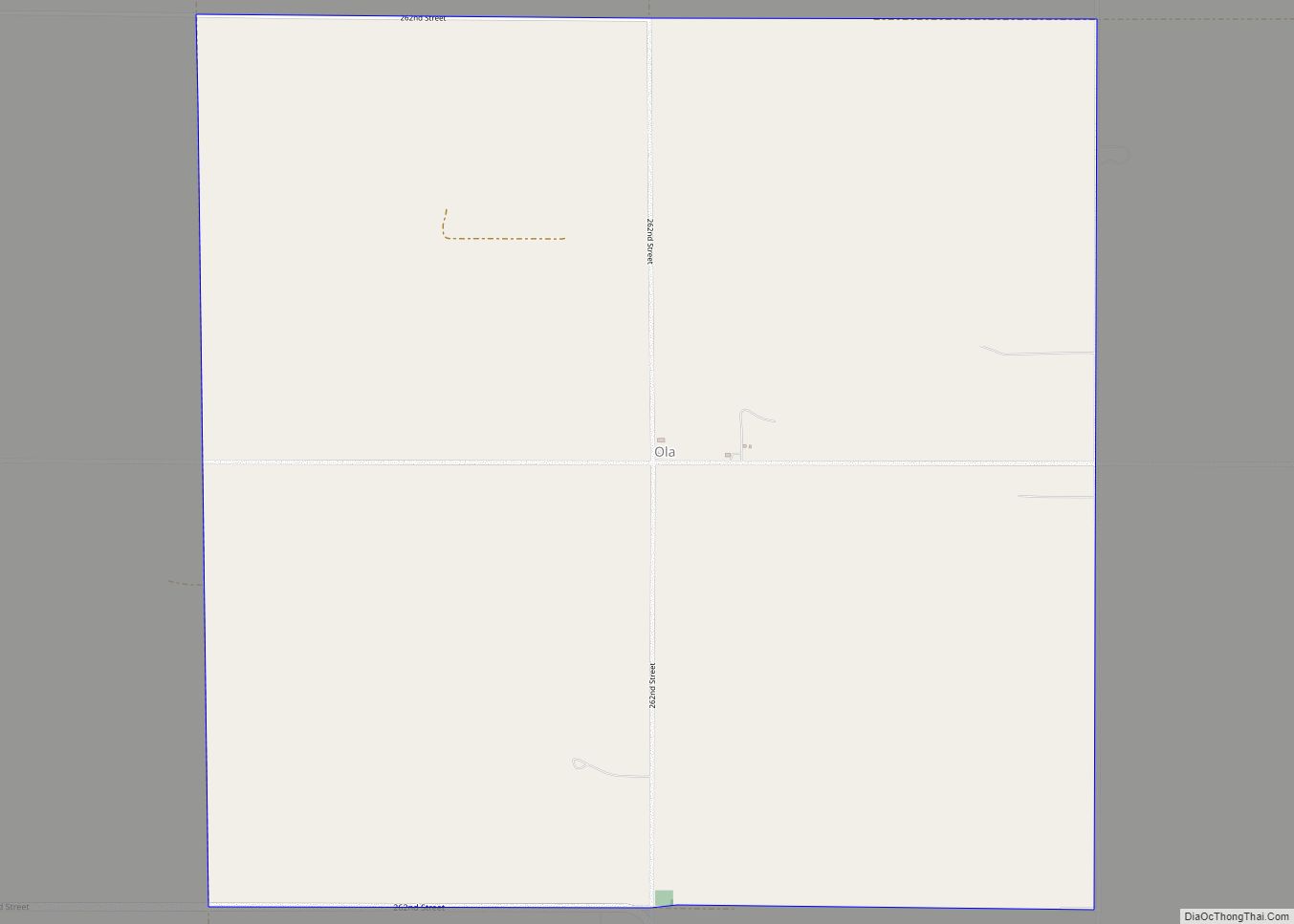
Online Interactive Map
Click on ![]() to view map in "full screen" mode.
to view map in "full screen" mode.
Bijou Hills location map. Where is Bijou Hills CDP?
History
Bijou Hills was laid out in 1875, and named after a nearby mountain range. A post office called Bijou Hills was established in 1877, and remained in operation until 1957.
In 1976, Bijou Hills was designated as a National Natural Landmark by the National Park Service.
Bijou Hills Road Map
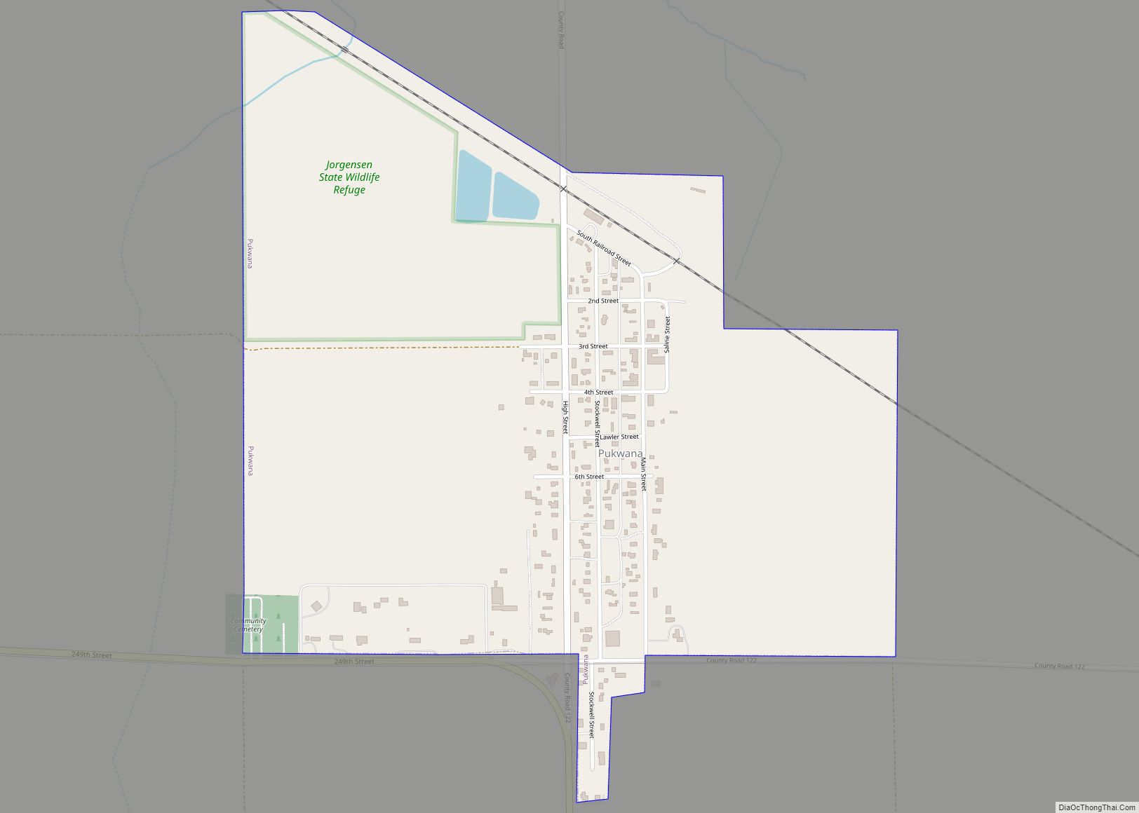
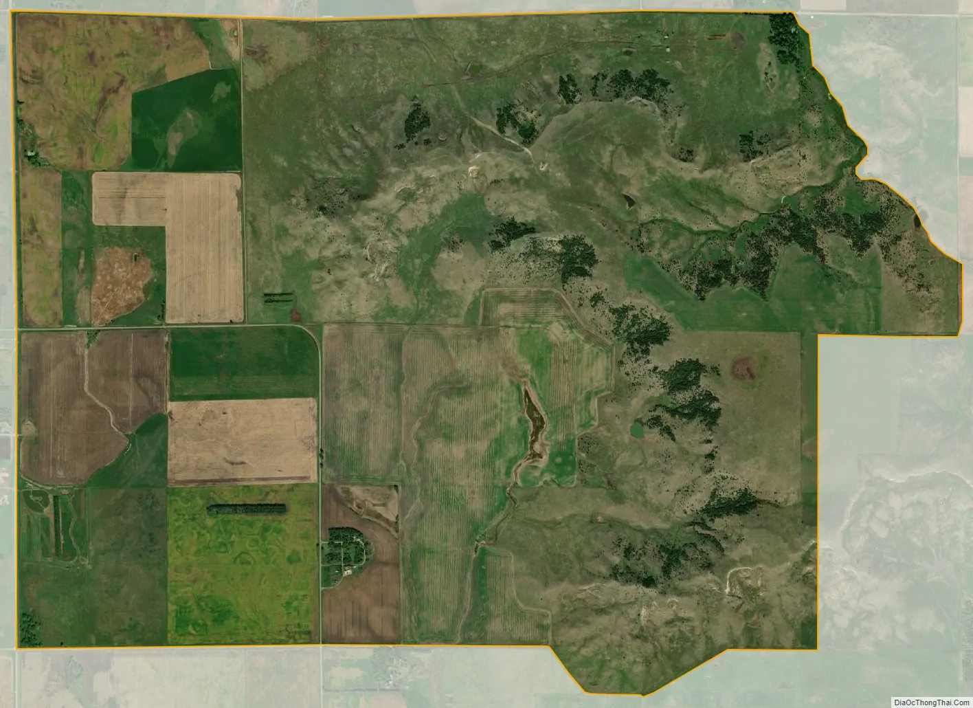
Bijou Hills city Satellite Map
See also
Map of South Dakota State and its subdivision:- Aurora
- Beadle
- Bennett
- Bon Homme
- Brookings
- Brown
- Brule
- Buffalo
- Butte
- Campbell
- Charles Mix
- Clark
- Clay
- Codington
- Corson
- Custer
- Davison
- Day
- Deuel
- Dewey
- Douglas
- Edmunds
- Fall River
- Faulk
- Grant
- Gregory
- Haakon
- Hamlin
- Hand
- Hanson
- Harding
- Hughes
- Hutchinson
- Hyde
- Jackson
- Jerauld
- Jones
- Kingsbury
- Lake
- Lawrence
- Lincoln
- Lyman
- Marshall
- McCook
- McPherson
- Meade
- Mellette
- Miner
- Minnehaha
- Moody
- Pennington
- Perkins
- Potter
- Roberts
- Sanborn
- Shannon
- Spink
- Stanley
- Sully
- Todd
- Tripp
- Turner
- Union
- Walworth
- Yankton
- Ziebach
- Alabama
- Alaska
- Arizona
- Arkansas
- California
- Colorado
- Connecticut
- Delaware
- District of Columbia
- Florida
- Georgia
- Hawaii
- Idaho
- Illinois
- Indiana
- Iowa
- Kansas
- Kentucky
- Louisiana
- Maine
- Maryland
- Massachusetts
- Michigan
- Minnesota
- Mississippi
- Missouri
- Montana
- Nebraska
- Nevada
- New Hampshire
- New Jersey
- New Mexico
- New York
- North Carolina
- North Dakota
- Ohio
- Oklahoma
- Oregon
- Pennsylvania
- Rhode Island
- South Carolina
- South Dakota
- Tennessee
- Texas
- Utah
- Vermont
- Virginia
- Washington
- West Virginia
- Wisconsin
- Wyoming