Box Elder (Lakota: čhaŋšúška; “box elder maple”) is a city in Pennington and Meade counties in the State of South Dakota. The population was 11,746 according to the 2020 census, making it the 11th most populous city in South Dakota. Ellsworth Air Force Base lies on the northeast side of the city.
Box Elder was named from nearby Boxelder Creek.
| Name: | Box Elder city |
|---|---|
| LSAD Code: | 25 |
| LSAD Description: | city (suffix) |
| State: | South Dakota |
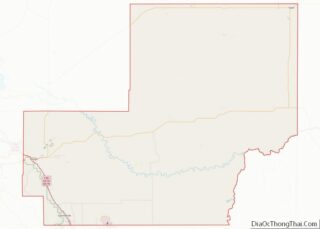
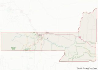
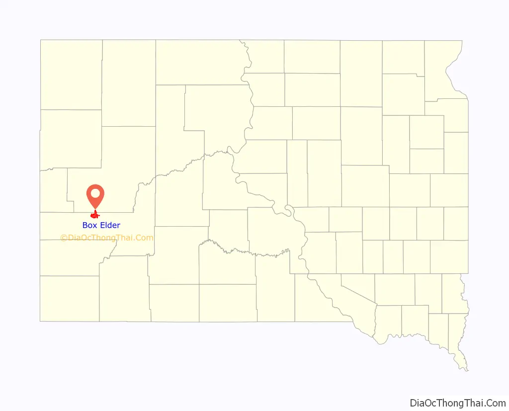
| County: | Meade County, Pennington County |
| Founded: | 1907 |
| Incorporated: | 1965 |
| Elevation: | 3,031 ft (924 m) |
| Total Area: | 14.78 sq mi (38.27 km²) |
| Land Area: | 14.75 sq mi (38.21 km²) |
| Water Area: | 0.02 sq mi (0.06 km²) |
| Total Population: | 11,746 |
| Population Density: | 796.18/sq mi (307.41/km²) |
| ZIP code: | 57719 |
| Area code: | 605 |
| FIPS code: | 4606620 |
| GNISfeature ID: | 1254028 |
Online Interactive Map
Click on ![]() to view map in "full screen" mode.
to view map in "full screen" mode.
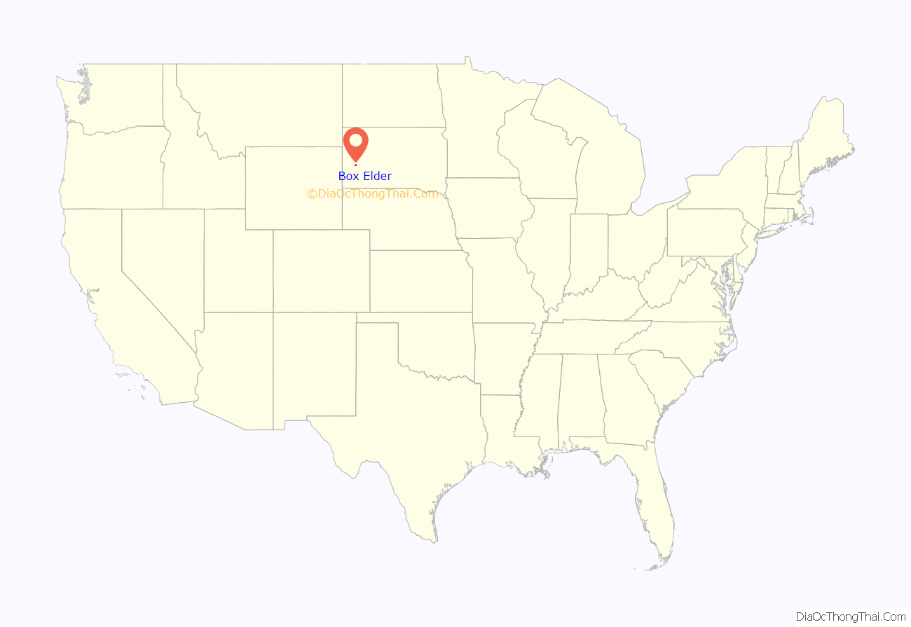
Box Elder location map. Where is Box Elder city?
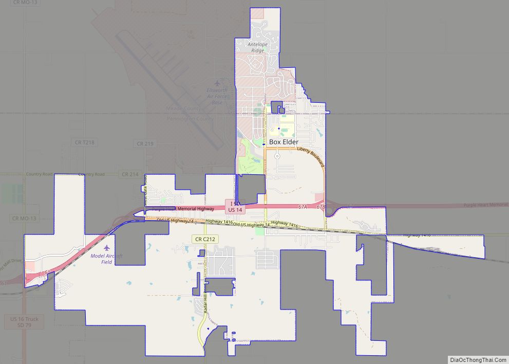
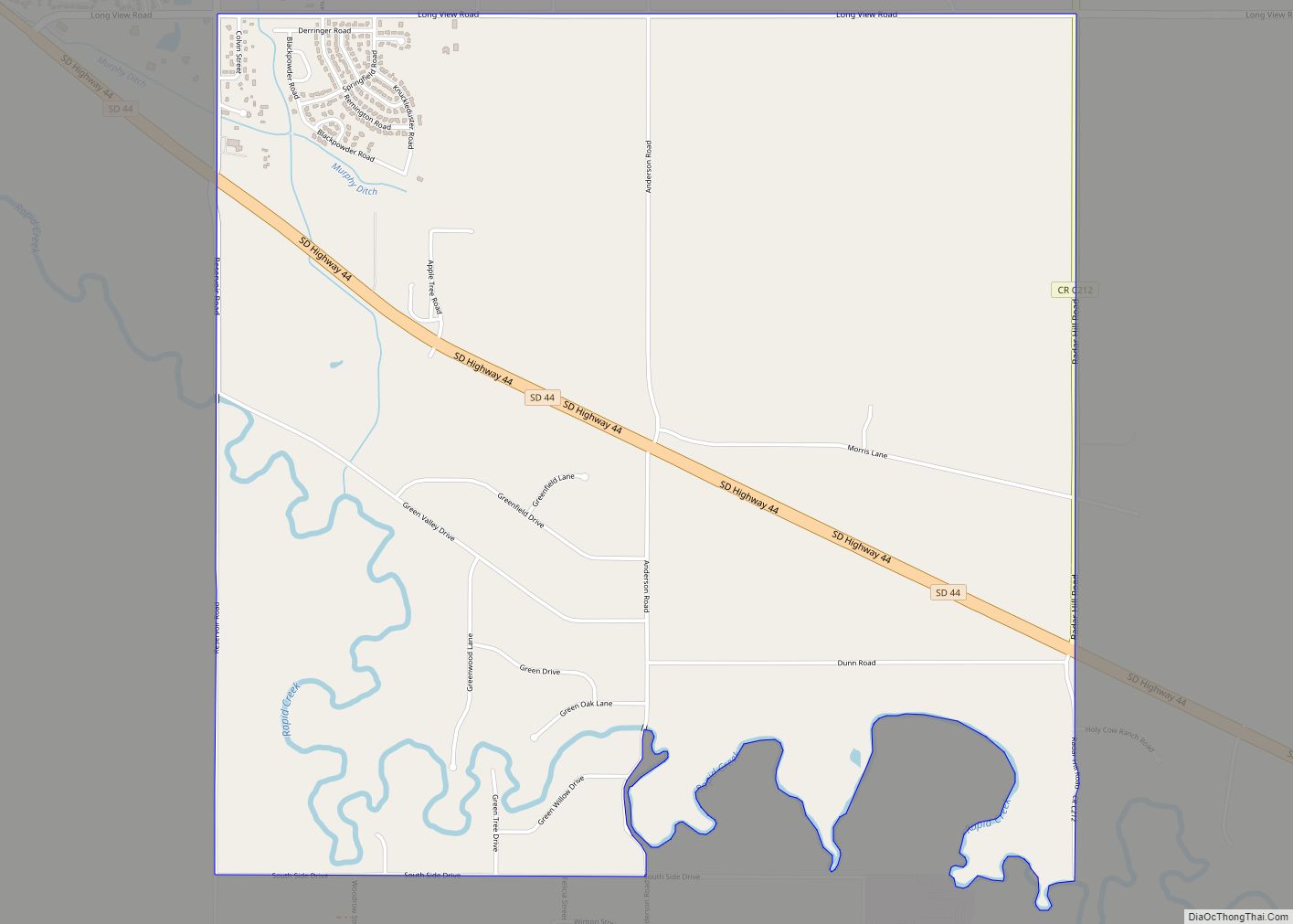
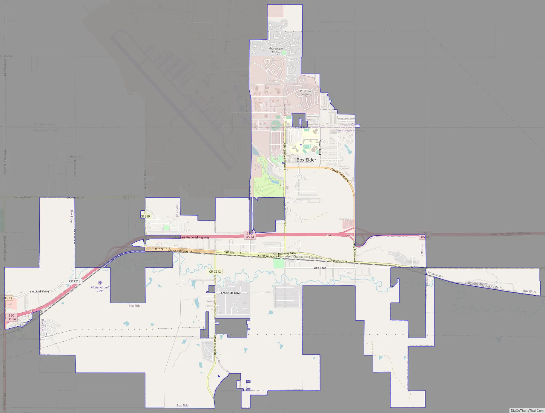
Box Elder Road Map
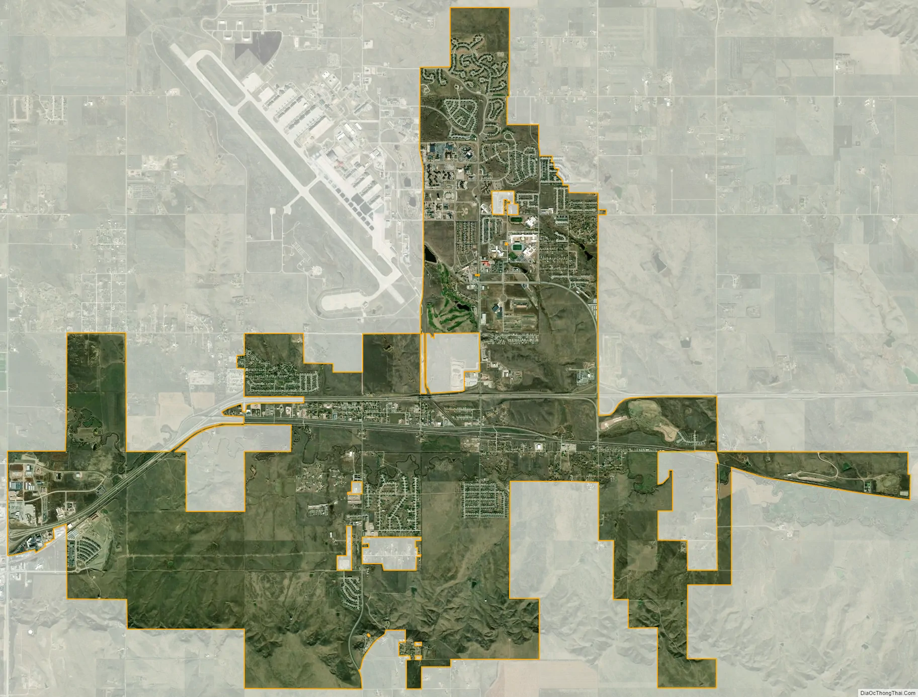
Box Elder city Satellite Map
Geography
Box Elder is located at 44°6′55″N 103°4′55″W / 44.11528°N 103.08194°W / 44.11528; -103.08194 (44.115349, -103.081997).
According to the United States Census Bureau, the city has a total area of 13.91 square miles (36.03 km), of which 13.90 square miles (36.00 km) is land and 0.01 square miles (0.03 km) is water.
Box Elder has been assigned the ZIP code 57719 and the FIPS place code 06620. It is located within minutes of Ellsworth AFB, and surrounds it on three sides.
Climate
See also
Map of South Dakota State and its subdivision:- Aurora
- Beadle
- Bennett
- Bon Homme
- Brookings
- Brown
- Brule
- Buffalo
- Butte
- Campbell
- Charles Mix
- Clark
- Clay
- Codington
- Corson
- Custer
- Davison
- Day
- Deuel
- Dewey
- Douglas
- Edmunds
- Fall River
- Faulk
- Grant
- Gregory
- Haakon
- Hamlin
- Hand
- Hanson
- Harding
- Hughes
- Hutchinson
- Hyde
- Jackson
- Jerauld
- Jones
- Kingsbury
- Lake
- Lawrence
- Lincoln
- Lyman
- Marshall
- McCook
- McPherson
- Meade
- Mellette
- Miner
- Minnehaha
- Moody
- Pennington
- Perkins
- Potter
- Roberts
- Sanborn
- Shannon
- Spink
- Stanley
- Sully
- Todd
- Tripp
- Turner
- Union
- Walworth
- Yankton
- Ziebach
- Alabama
- Alaska
- Arizona
- Arkansas
- California
- Colorado
- Connecticut
- Delaware
- District of Columbia
- Florida
- Georgia
- Hawaii
- Idaho
- Illinois
- Indiana
- Iowa
- Kansas
- Kentucky
- Louisiana
- Maine
- Maryland
- Massachusetts
- Michigan
- Minnesota
- Mississippi
- Missouri
- Montana
- Nebraska
- Nevada
- New Hampshire
- New Jersey
- New Mexico
- New York
- North Carolina
- North Dakota
- Ohio
- Oklahoma
- Oregon
- Pennsylvania
- Rhode Island
- South Carolina
- South Dakota
- Tennessee
- Texas
- Utah
- Vermont
- Virginia
- Washington
- West Virginia
- Wisconsin
- Wyoming