Camp Crook is an incorporated small town in Harding County, South Dakota, United States, on the Little Missouri River. The population was 60 at the 2020 census.
The town celebrated 125 years of existence in August 2008 during the annual county fair. It is the only town west of the Little Missouri River in South Dakota. The Custer National Forest, with its Sioux Ranger District office, also celebrated 100 years of having a presence in Camp Crook in 2008.
| Name: | Camp Crook town |
|---|---|
| LSAD Code: | 43 |
| LSAD Description: | town (suffix) |
| State: | South Dakota |
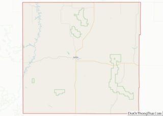
| County: | Harding County |
| Incorporated: | 1908 |
| Elevation: | 3,120 ft (951 m) |
| Total Area: | 0.14 sq mi (0.36 km²) |
| Land Area: | 0.14 sq mi (0.36 km²) |
| Water Area: | 0.00 sq mi (0.00 km²) |
| Total Population: | 60 |
| Population Density: | 431.65/sq mi (166.07/km²) |
| ZIP code: | 57724 |
| Area code: | 605 |
| FIPS code: | 4609260 |
| GNISfeature ID: | 1254208 |
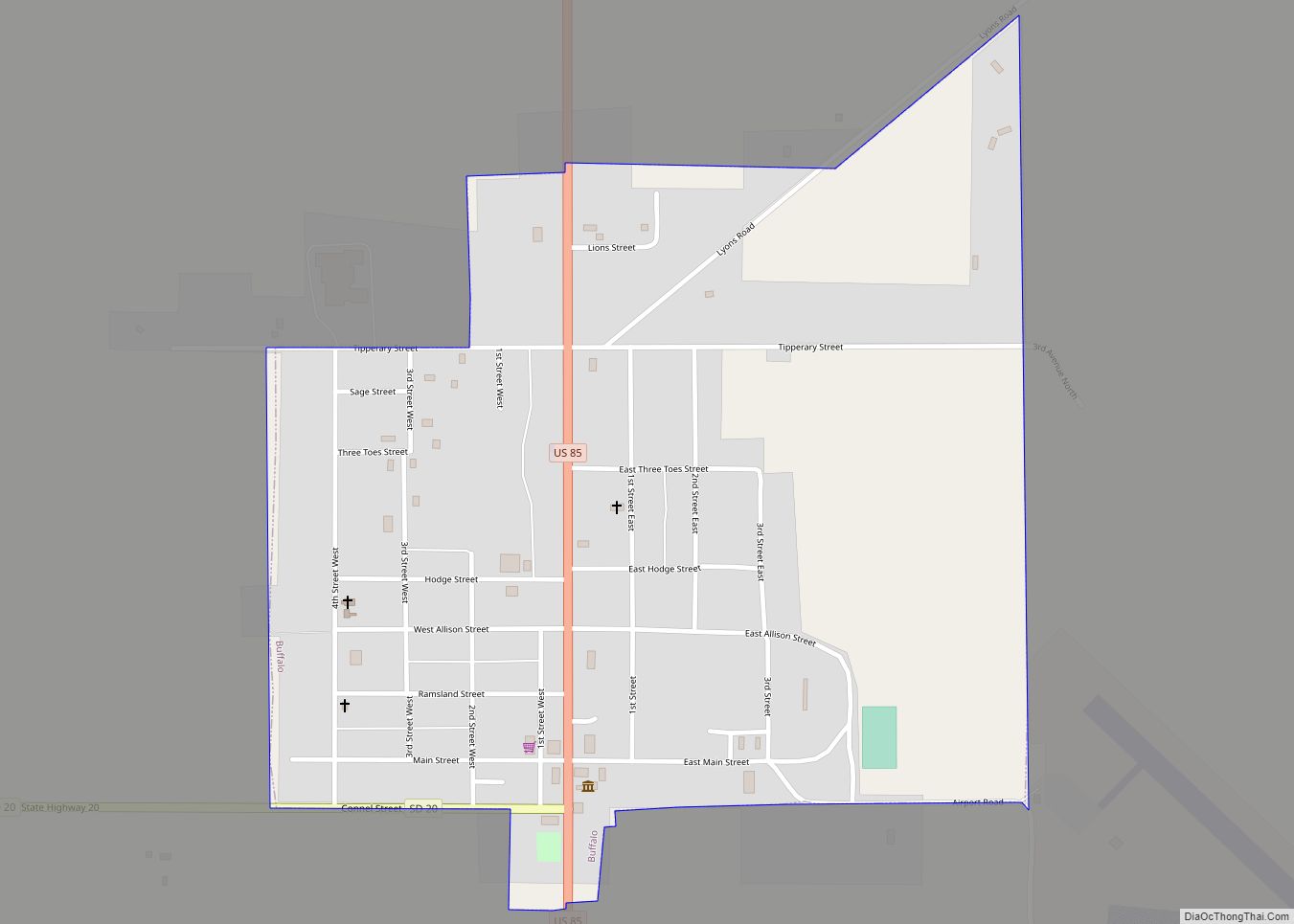
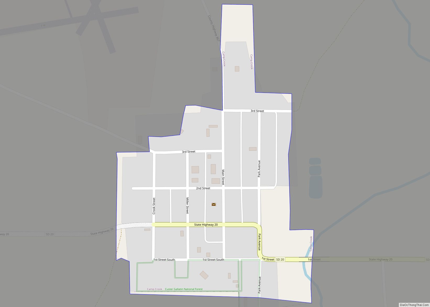
Online Interactive Map
Click on ![]() to view map in "full screen" mode.
to view map in "full screen" mode.
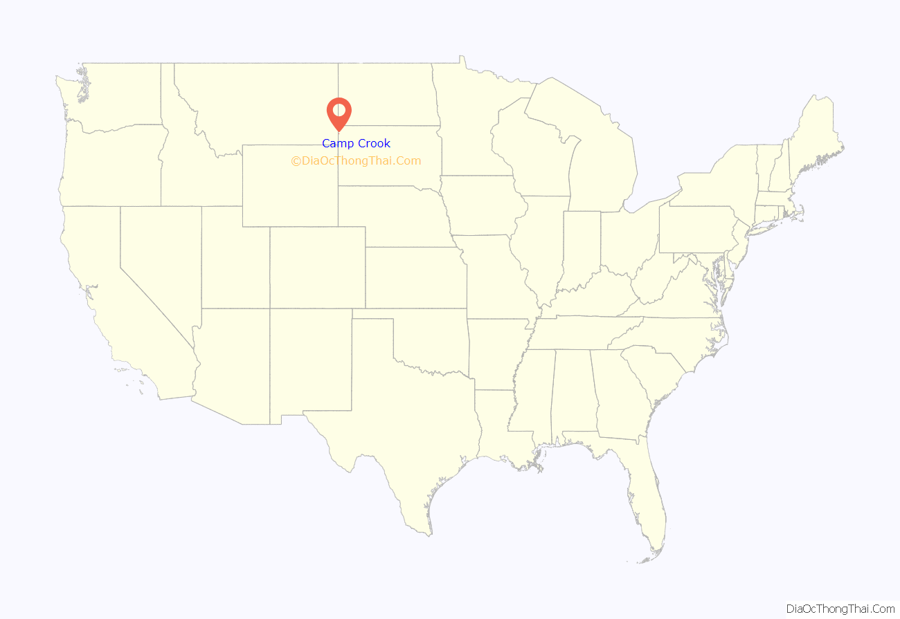
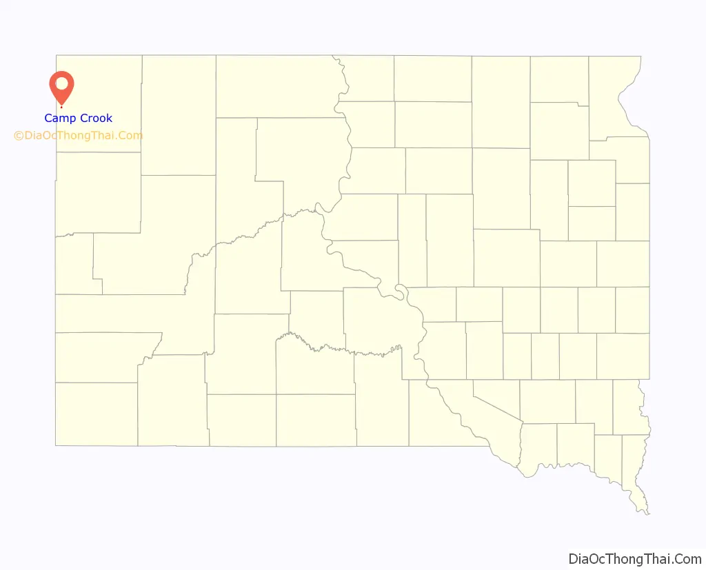
Camp Crook location map. Where is Camp Crook town?
History
The town’s name honors George Crook, a United States Army officer.
Camp Crook Road Map
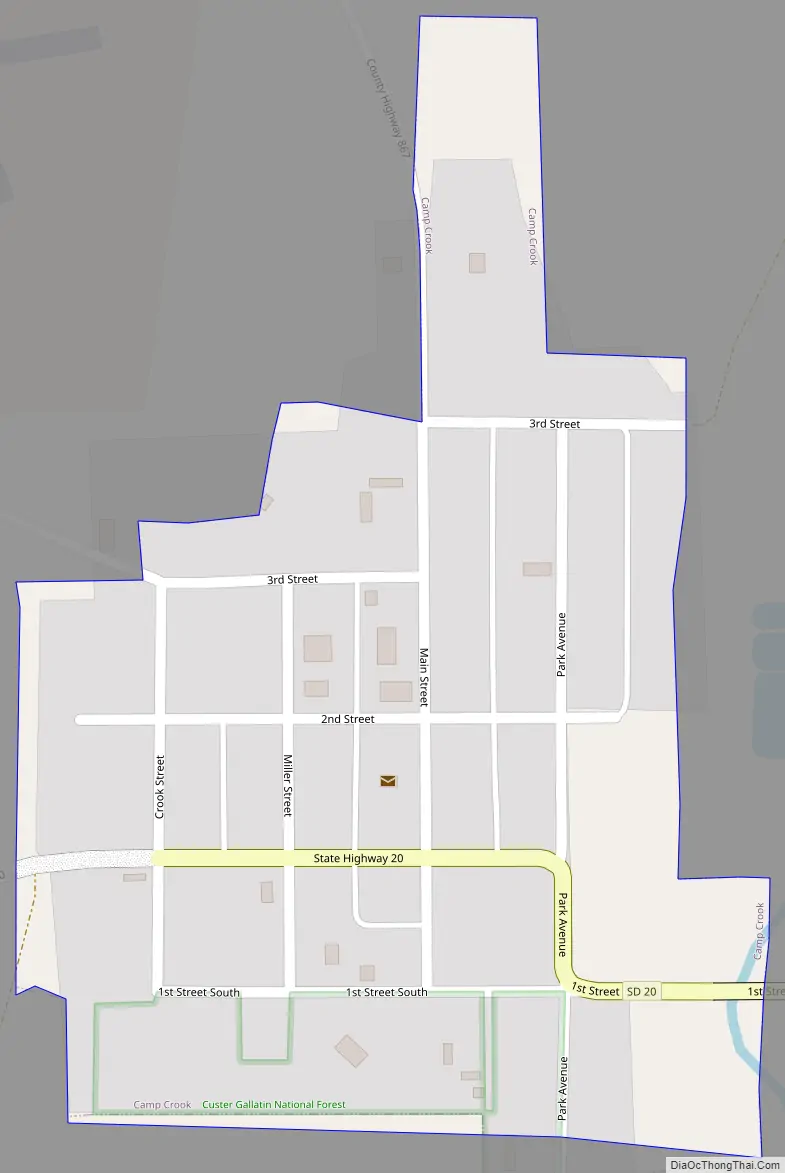
Camp Crook city Satellite Map

Geography
Camp Crook is located at 45°32′59″N 103°58′31″W / 45.54972°N 103.97528°W / 45.54972; -103.97528 (45.549727, -103.975307).
According to the United States Census Bureau, the town has a total area of 0.14 square miles (0.36 km), all land.
Camp Crook has been assigned the ZIP code 57724 and the FIPS place code 09260.
See also
Map of South Dakota State and its subdivision:- Aurora
- Beadle
- Bennett
- Bon Homme
- Brookings
- Brown
- Brule
- Buffalo
- Butte
- Campbell
- Charles Mix
- Clark
- Clay
- Codington
- Corson
- Custer
- Davison
- Day
- Deuel
- Dewey
- Douglas
- Edmunds
- Fall River
- Faulk
- Grant
- Gregory
- Haakon
- Hamlin
- Hand
- Hanson
- Harding
- Hughes
- Hutchinson
- Hyde
- Jackson
- Jerauld
- Jones
- Kingsbury
- Lake
- Lawrence
- Lincoln
- Lyman
- Marshall
- McCook
- McPherson
- Meade
- Mellette
- Miner
- Minnehaha
- Moody
- Pennington
- Perkins
- Potter
- Roberts
- Sanborn
- Shannon
- Spink
- Stanley
- Sully
- Todd
- Tripp
- Turner
- Union
- Walworth
- Yankton
- Ziebach
- Alabama
- Alaska
- Arizona
- Arkansas
- California
- Colorado
- Connecticut
- Delaware
- District of Columbia
- Florida
- Georgia
- Hawaii
- Idaho
- Illinois
- Indiana
- Iowa
- Kansas
- Kentucky
- Louisiana
- Maine
- Maryland
- Massachusetts
- Michigan
- Minnesota
- Mississippi
- Missouri
- Montana
- Nebraska
- Nevada
- New Hampshire
- New Jersey
- New Mexico
- New York
- North Carolina
- North Dakota
- Ohio
- Oklahoma
- Oregon
- Pennsylvania
- Rhode Island
- South Carolina
- South Dakota
- Tennessee
- Texas
- Utah
- Vermont
- Virginia
- Washington
- West Virginia
- Wisconsin
- Wyoming