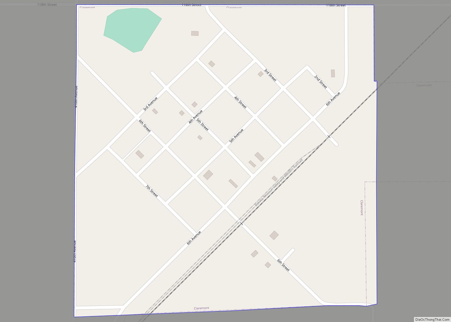
Hecla is a city in Brown County, South Dakota, United States, located only a few miles south of the North Dakota border. The population was 193 at the 2020 census. State Highway 37 runs along the east side of town.
| Name: | Hecla city |
|---|---|
| LSAD Code: | 25 |
| LSAD Description: | city (suffix) |
| State: | South Dakota |
| County: | Brown County |
| Incorporated: | 1890 |
| Elevation: | 1,302 ft (397 m) |
| Total Area: | 0.34 sq mi (0.89 km²) |
| Land Area: | 0.34 sq mi (0.89 km²) |
| Water Area: | 0.00 sq mi (0.00 km²) |
| Total Population: | 193 |
| Population Density: | 561.05/sq mi (216.39/km²) |
| ZIP code: | 57446 |
| Area code: | 605 |
| FIPS code: | 4627980 |
| GNISfeature ID: | 1255502 |
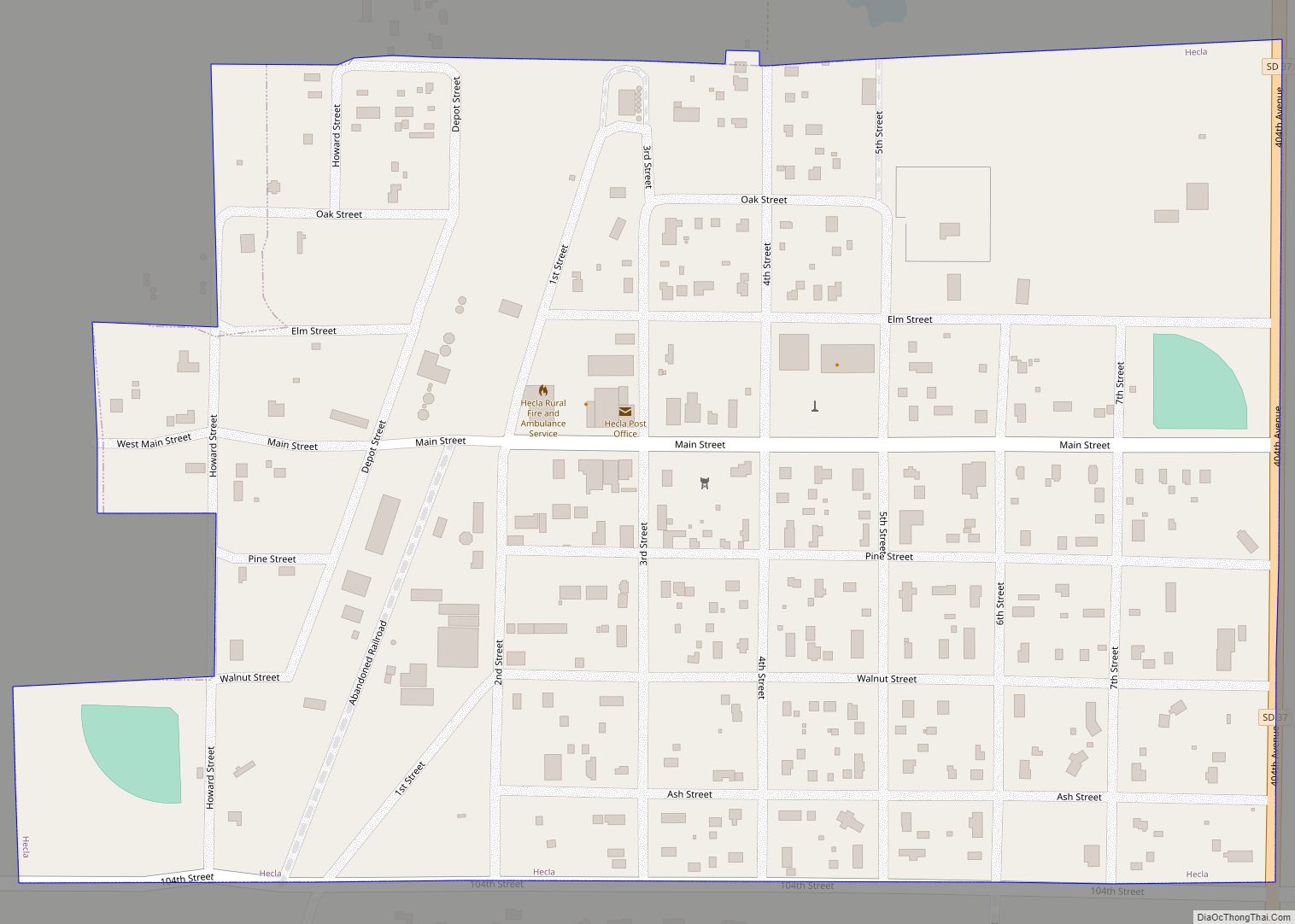
Online Interactive Map
Click on ![]() to view map in "full screen" mode.
to view map in "full screen" mode.
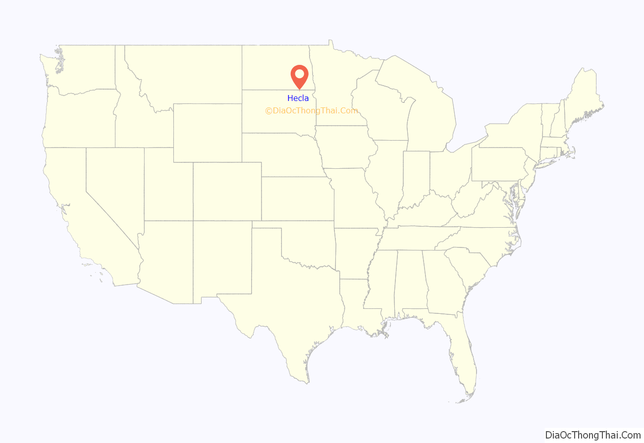
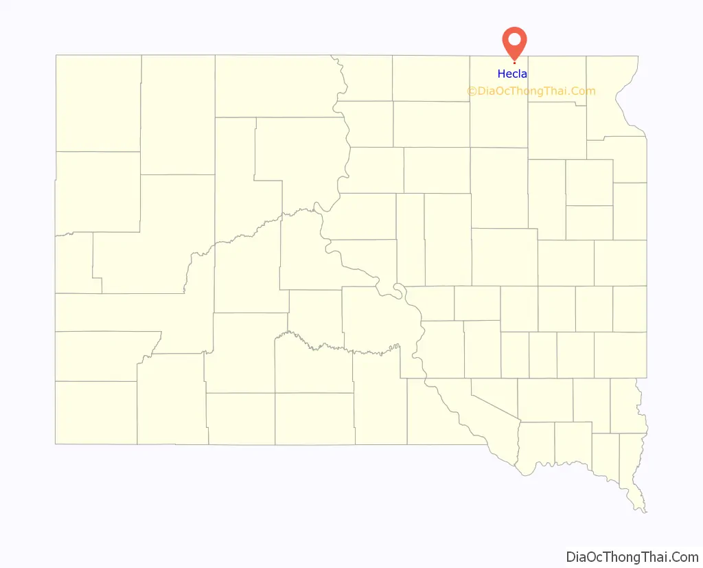
Hecla location map. Where is Hecla city?
History
Hecla was platted in 1886. It was named after Hekla, a stratovolcano in Iceland. A post office has been in operation in Hecla since 1886. Hecla was the first place to have a soil conservation district in South Dakota.
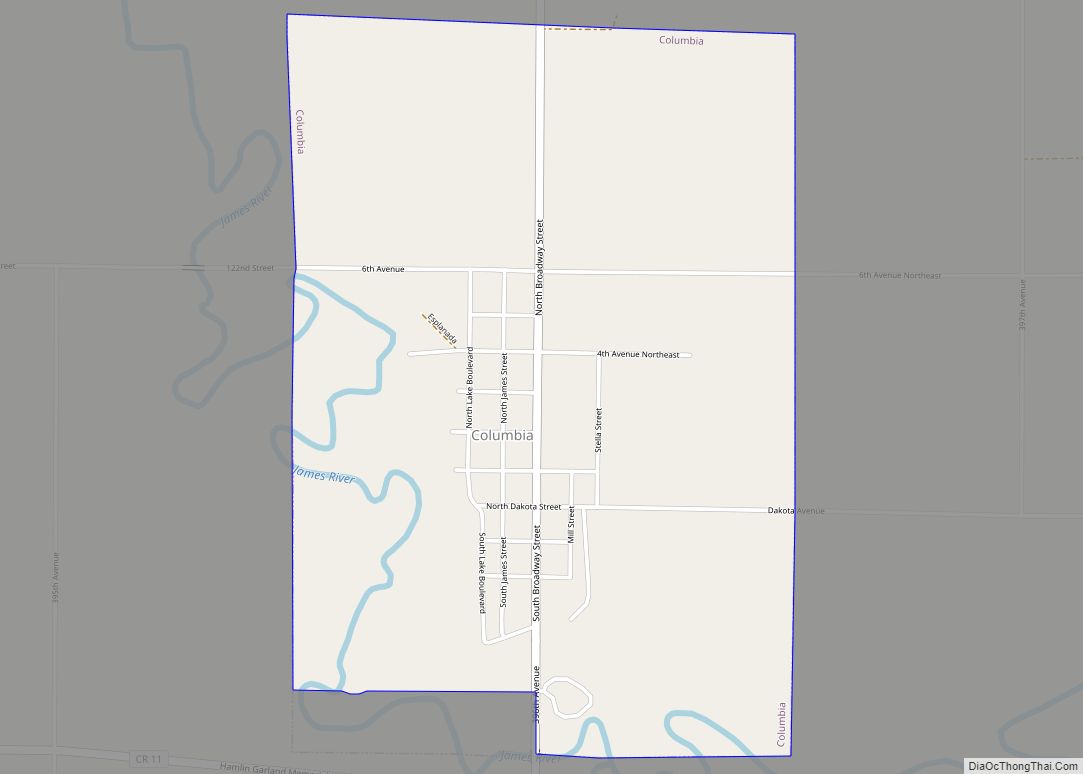
Hecla Road Map
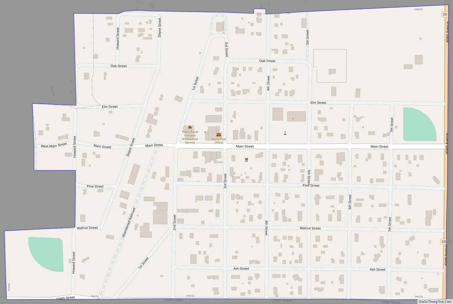
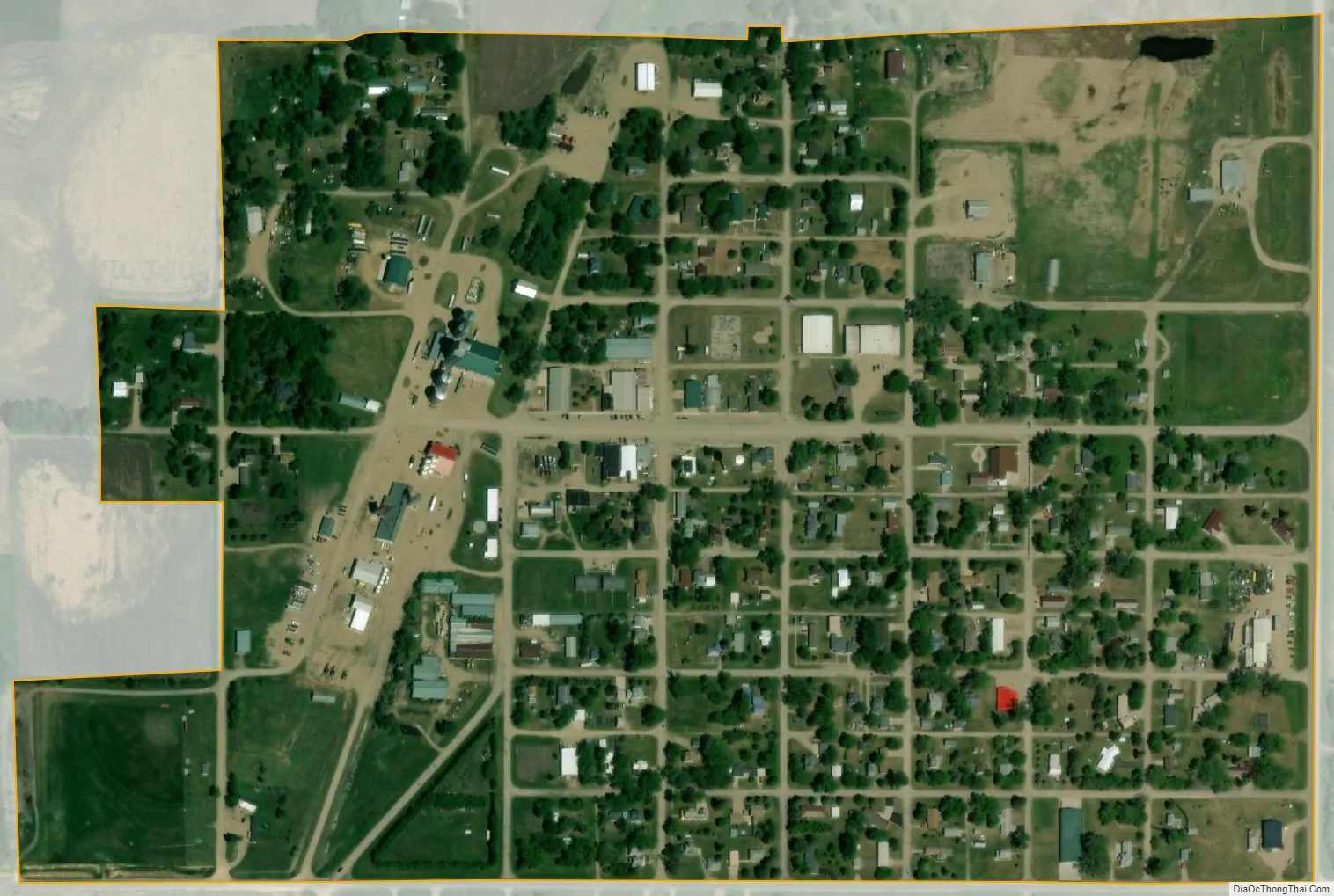
Hecla city Satellite Map
Geography
Hecla is located at 45°52′55″N 98°9′7″W / 45.88194°N 98.15194°W / 45.88194; -98.15194 (45.882018, -98.151810).
According to the United States Census Bureau, the city has a total area of 0.34 square miles (0.88 km), all land.
Hecla has been assigned the ZIP code 57446 and the FIPS place code 27980.
The Civil Township of Hecla (which includes a portion of South Dakota political township-128-N by range-61-W east of the James River) surrounds the municipal boundary of the City of Hecla. Liberty Township is located to west of the City of Hecla and includes a portion of South Dakota political township-128-N by range-61-W west of the James River in addition to township-128-N by range-62-W.
See also
Map of South Dakota State and its subdivision:- Aurora
- Beadle
- Bennett
- Bon Homme
- Brookings
- Brown
- Brule
- Buffalo
- Butte
- Campbell
- Charles Mix
- Clark
- Clay
- Codington
- Corson
- Custer
- Davison
- Day
- Deuel
- Dewey
- Douglas
- Edmunds
- Fall River
- Faulk
- Grant
- Gregory
- Haakon
- Hamlin
- Hand
- Hanson
- Harding
- Hughes
- Hutchinson
- Hyde
- Jackson
- Jerauld
- Jones
- Kingsbury
- Lake
- Lawrence
- Lincoln
- Lyman
- Marshall
- McCook
- McPherson
- Meade
- Mellette
- Miner
- Minnehaha
- Moody
- Pennington
- Perkins
- Potter
- Roberts
- Sanborn
- Shannon
- Spink
- Stanley
- Sully
- Todd
- Tripp
- Turner
- Union
- Walworth
- Yankton
- Ziebach
- Alabama
- Alaska
- Arizona
- Arkansas
- California
- Colorado
- Connecticut
- Delaware
- District of Columbia
- Florida
- Georgia
- Hawaii
- Idaho
- Illinois
- Indiana
- Iowa
- Kansas
- Kentucky
- Louisiana
- Maine
- Maryland
- Massachusetts
- Michigan
- Minnesota
- Mississippi
- Missouri
- Montana
- Nebraska
- Nevada
- New Hampshire
- New Jersey
- New Mexico
- New York
- North Carolina
- North Dakota
- Ohio
- Oklahoma
- Oregon
- Pennsylvania
- Rhode Island
- South Carolina
- South Dakota
- Tennessee
- Texas
- Utah
- Vermont
- Virginia
- Washington
- West Virginia
- Wisconsin
- Wyoming