Pringle is a town in Custer County, South Dakota, United States. The population was 109 at the 2020 census.
The town is named for W. H. Pringle, a cattleman who lived in the area.
| Name: | Pringle town |
|---|---|
| LSAD Code: | 43 |
| LSAD Description: | town (suffix) |
| State: | South Dakota |
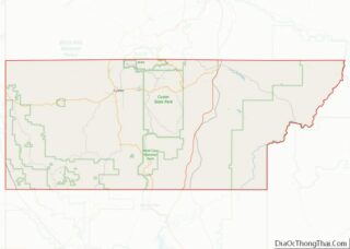
| County: | Custer County |
| Elevation: | 4,882 ft (1,488 m) |
| Total Area: | 0.24 sq mi (0.63 km²) |
| Land Area: | 0.24 sq mi (0.63 km²) |
| Water Area: | 0.00 sq mi (0.00 km²) |
| Total Population: | 109 |
| Population Density: | 450.41/sq mi (173.56/km²) |
| Area code: | 605 |
| FIPS code: | 4651940 |
| GNISfeature ID: | 1265329 |
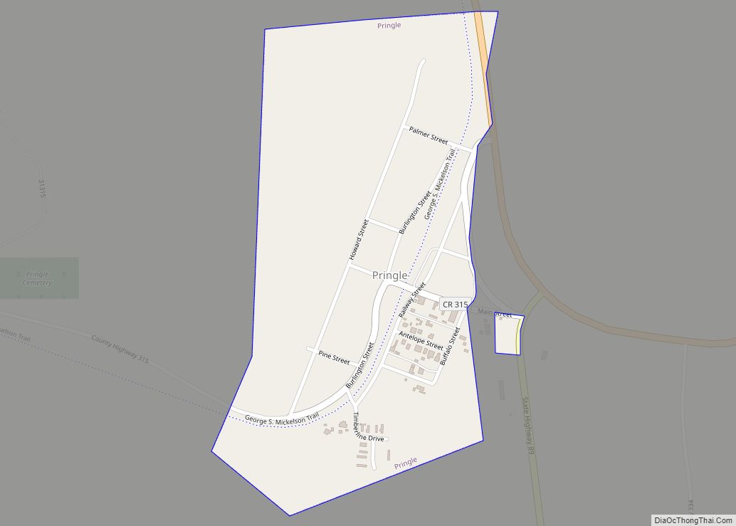
Online Interactive Map
Click on ![]() to view map in "full screen" mode.
to view map in "full screen" mode.
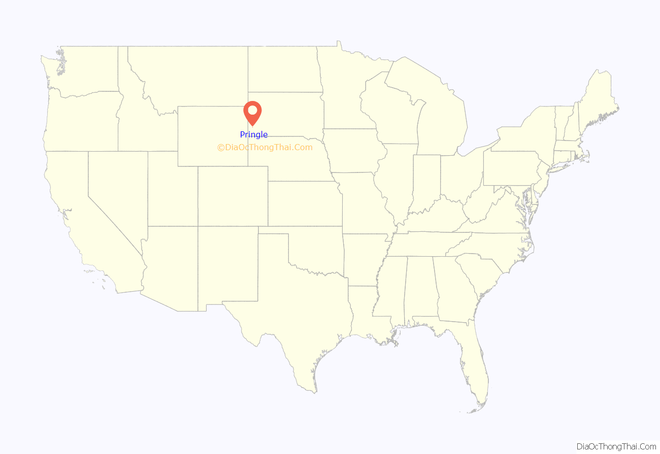
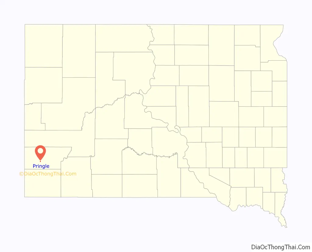
Pringle location map. Where is Pringle town?
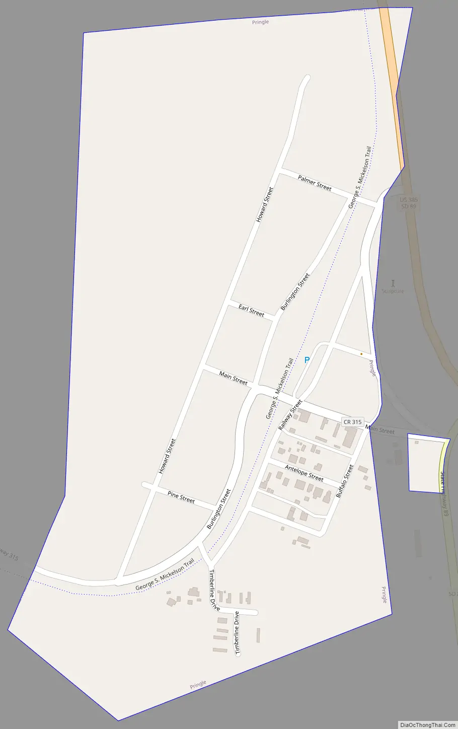
Pringle Road Map
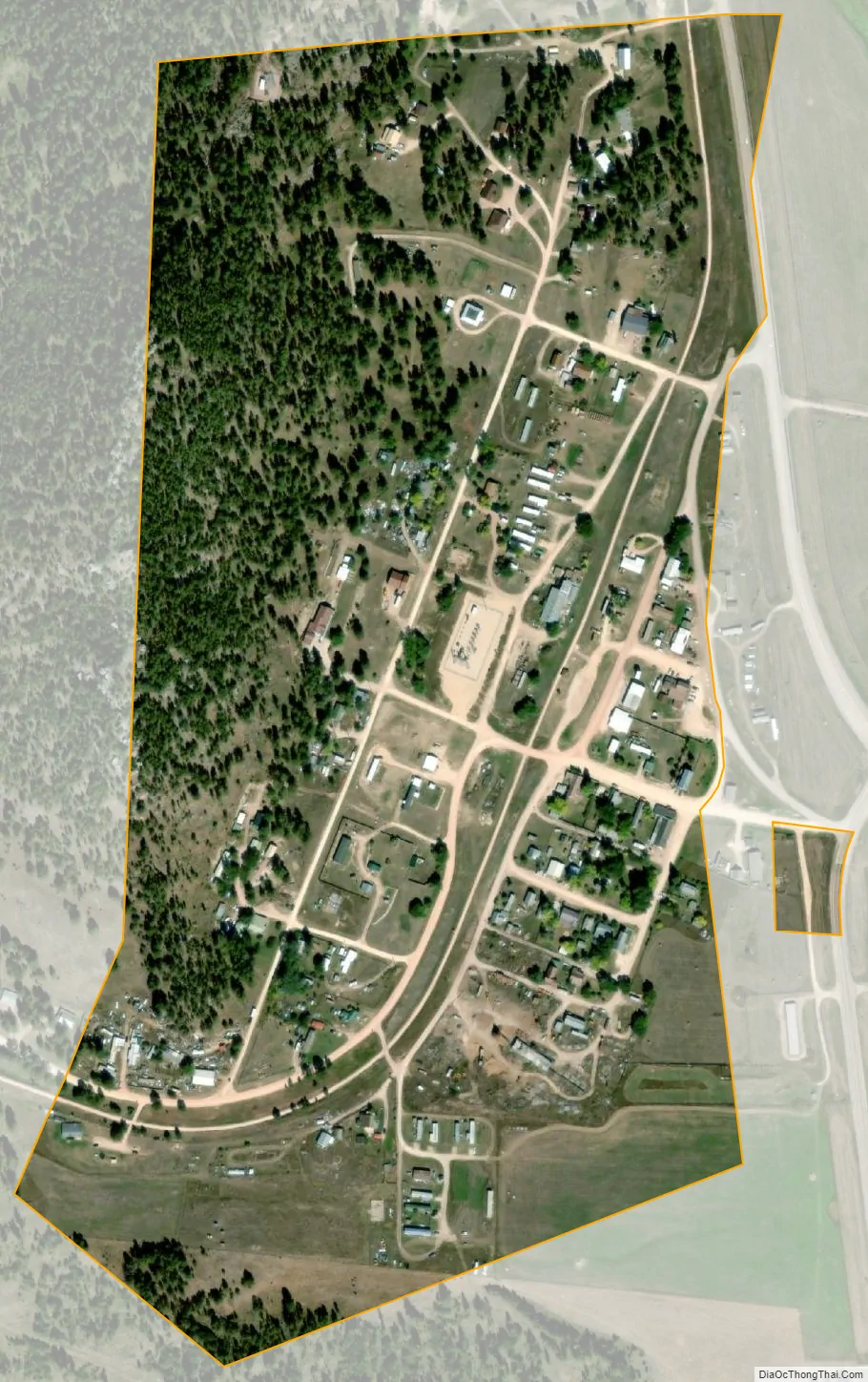
Pringle city Satellite Map
Geography
Pringle is located at 43°36′33″N 103°35′39″W / 43.60917°N 103.59417°W / 43.60917; -103.59417 (43.609253, -103.594124).
Pringle got its start as a stage stop on the Sidney-Custer Trail. Operated by Henry Pringle, it was called the Point of Rocks Stage Station, named after a prominent and distinct granite outcropping located due east of the current town.
The Sidney-Custer Trail was an important route into the southern Black Hills from Nebraska, and The Point of Rocks Station also served traffic between Cheyenne, Wyoming and Custer.
A small settlement, also called Point of Rocks, soon developed around the stage station. In 1890, the Chicago, Burlington, and Quincy Railroad track reached the settlement, at which time the town’s name was changed to Pringle, named after Anna Carr Pringle, who provided hospitality to the railroad crews when they came through town. The settlement soon boasted a railroad depot and two stores.
Pringle is most famous as the home of a housing complex devoted to the Fundamentalist Church of Jesus Christ of Latter Day Saints. The development continues to grow and spark controversy in the area.
According to the United States Census Bureau, the town has a total area of 0.24 square miles (0.62 km), all land.
Pringle has been assigned the ZIP code 57773 and the FIPS place code 51940.
See also
Map of South Dakota State and its subdivision:- Aurora
- Beadle
- Bennett
- Bon Homme
- Brookings
- Brown
- Brule
- Buffalo
- Butte
- Campbell
- Charles Mix
- Clark
- Clay
- Codington
- Corson
- Custer
- Davison
- Day
- Deuel
- Dewey
- Douglas
- Edmunds
- Fall River
- Faulk
- Grant
- Gregory
- Haakon
- Hamlin
- Hand
- Hanson
- Harding
- Hughes
- Hutchinson
- Hyde
- Jackson
- Jerauld
- Jones
- Kingsbury
- Lake
- Lawrence
- Lincoln
- Lyman
- Marshall
- McCook
- McPherson
- Meade
- Mellette
- Miner
- Minnehaha
- Moody
- Pennington
- Perkins
- Potter
- Roberts
- Sanborn
- Shannon
- Spink
- Stanley
- Sully
- Todd
- Tripp
- Turner
- Union
- Walworth
- Yankton
- Ziebach
- Alabama
- Alaska
- Arizona
- Arkansas
- California
- Colorado
- Connecticut
- Delaware
- District of Columbia
- Florida
- Georgia
- Hawaii
- Idaho
- Illinois
- Indiana
- Iowa
- Kansas
- Kentucky
- Louisiana
- Maine
- Maryland
- Massachusetts
- Michigan
- Minnesota
- Mississippi
- Missouri
- Montana
- Nebraska
- Nevada
- New Hampshire
- New Jersey
- New Mexico
- New York
- North Carolina
- North Dakota
- Ohio
- Oklahoma
- Oregon
- Pennsylvania
- Rhode Island
- South Carolina
- South Dakota
- Tennessee
- Texas
- Utah
- Vermont
- Virginia
- Washington
- West Virginia
- Wisconsin
- Wyoming