Curtiss is a village in Clark County in the U.S. state of Wisconsin. The population was 216 at the 2010 census.
| Name: | Curtiss village |
|---|---|
| LSAD Code: | 47 |
| LSAD Description: | village (suffix) |
| State: | Wisconsin |
| County: | Clark County |
| Elevation: | 1,365 ft (416 m) |
| Total Area: | 0.69 sq mi (1.78 km²) |
| Land Area: | 0.69 sq mi (1.78 km²) |
| Water Area: | 0.00 sq mi (0.00 km²) |
| Total Population: | 216 |
| Population Density: | 309.04/sq mi (119.36/km²) |
| Area code: | 715 |
| FIPS code: | 5518125 |
| GNISfeature ID: | 1563636 |
| Website: | http://www.villageofcurtiss.org/ |
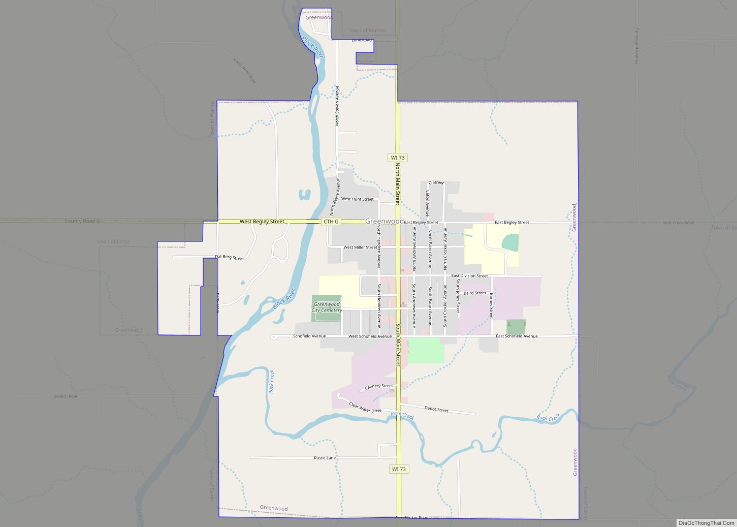
Online Interactive Map
Click on ![]() to view map in "full screen" mode.
to view map in "full screen" mode.
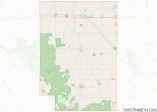
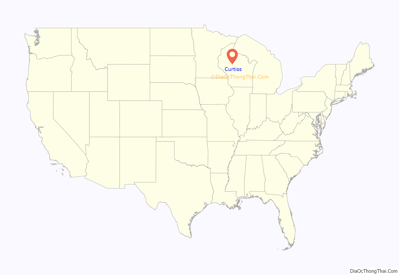
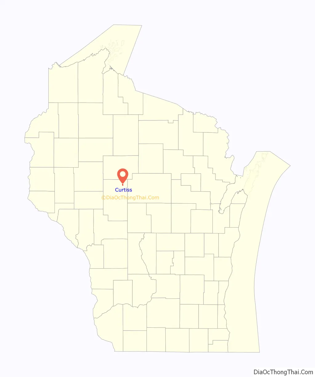
Curtiss location map. Where is Curtiss village?
History
Curtiss was established as a rural railroad station in 1882 and is named after the chief engineer who built the railroad. The village of Curtiss was platted November 17, 1882, having been surveyed by Edwin Parks. The surrounding area was occupied primarily by Norwegian and German emigrants. The primary industries were dairy farming and lumber. By the 1890s, several cheese factories were established in the surrounding townships of Mayville, Hoard and Colby. Additionally, A. D. Bass operated a large sawmill in the southern part of the village. An application for incorporation of the village was made to the State of Wisconsin on October 14, 1914: however, actual incorporation was not granted until March 30, 1917 (Curtiss Centennial Booklet). A two-room school served elementary grades until 1966 when the school was consolidated with the nearby Abbotsford Public Schools.
Perhaps the most famous person to come out of the Village of Curtiss was Army Colonel Franklin Matthias, who oversaw the construction and early operation of the Hanford Site during World War II. The young Colonel Matthias was so proud of his work that he accompanied the first plutonium produced at Hanford to Los Alamos.
On June 8, 1905, a hail storm damaged nearly every building in the village.
On October 15, 1974, Curtiss was the site of a protest by the National Farmers Organization (NFO). NFO farmers slaughtered and buried in a trench 638 calves, mostly less than two weeks old. The protest was in response to the low price of veal. At the time, veal calves were selling for $0.17 per pound, resulting in a net loss to the farmer due to high feed costs. Public backlash against the NFO and the protest was great, with President Ford weighing in to call it “shocking and senseless.”
In 1976, the US EPA aided the village with a grant to establish a municipal sewer and water system. The system was expanded in the 1990s and again in the 2000s to account for industrial growth related to the meat packing industry.
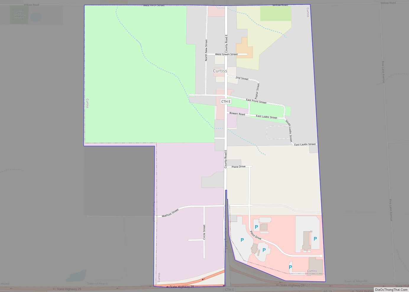
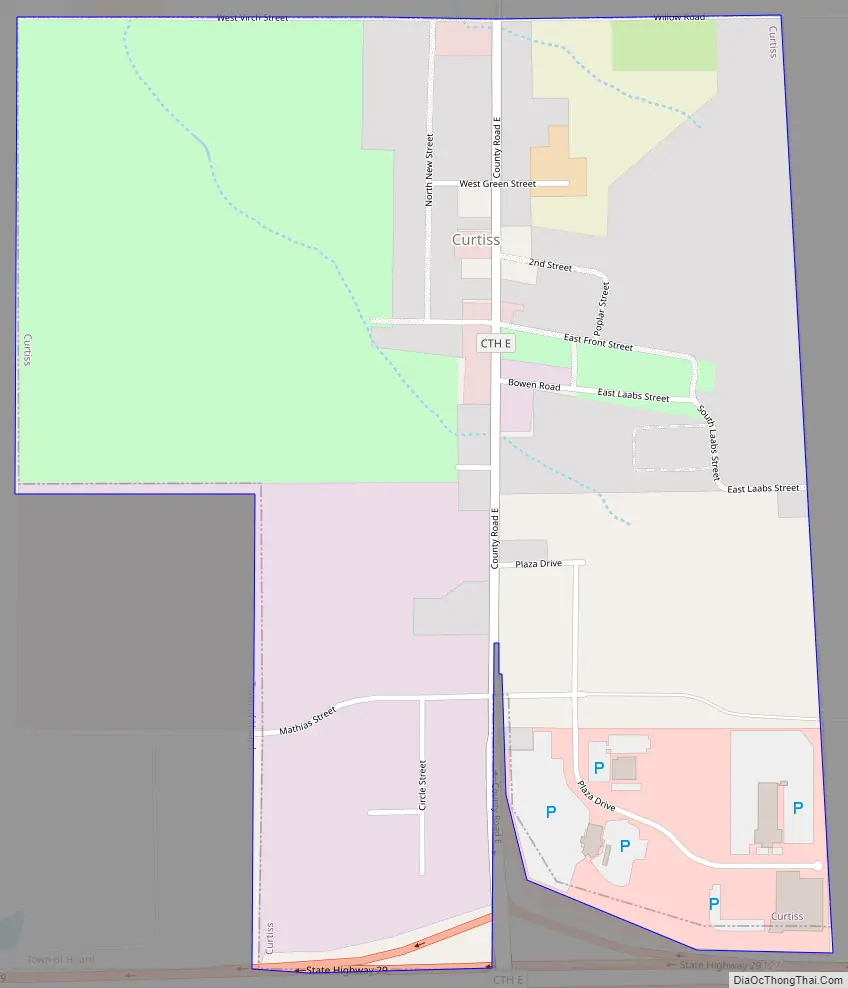
Curtiss Road Map
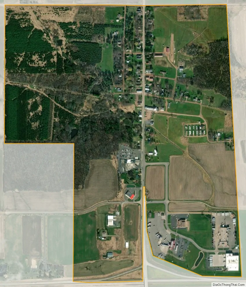
Curtiss city Satellite Map
Geography
Curtiss is located at 44°57′13″N 90°26′0″W / 44.95361°N 90.43333°W / 44.95361; -90.43333 (44.953574, -90.433228).
According to the United States Census Bureau, the village has a total area of 0.68 square miles (1.76 km), all of it land.
See also
Map of Wisconsin State and its subdivision:- Adams
- Ashland
- Barron
- Bayfield
- Brown
- Buffalo
- Burnett
- Calumet
- Chippewa
- Clark
- Columbia
- Crawford
- Dane
- Dodge
- Door
- Douglas
- Dunn
- Eau Claire
- Florence
- Fond du Lac
- Forest
- Grant
- Green
- Green Lake
- Iowa
- Iron
- Jackson
- Jefferson
- Juneau
- Kenosha
- Kewaunee
- La Crosse
- Lafayette
- Lake Michigan
- Lake Superior
- Langlade
- Lincoln
- Manitowoc
- Marathon
- Marinette
- Marquette
- Menominee
- Milwaukee
- Monroe
- Oconto
- Oneida
- Outagamie
- Ozaukee
- Pepin
- Pierce
- Polk
- Portage
- Price
- Racine
- Richland
- Rock
- Rusk
- Saint Croix
- Sauk
- Sawyer
- Shawano
- Sheboygan
- Taylor
- Trempealeau
- Vernon
- Vilas
- Walworth
- Washburn
- Washington
- Waukesha
- Waupaca
- Waushara
- Winnebago
- Wood
- Alabama
- Alaska
- Arizona
- Arkansas
- California
- Colorado
- Connecticut
- Delaware
- District of Columbia
- Florida
- Georgia
- Hawaii
- Idaho
- Illinois
- Indiana
- Iowa
- Kansas
- Kentucky
- Louisiana
- Maine
- Maryland
- Massachusetts
- Michigan
- Minnesota
- Mississippi
- Missouri
- Montana
- Nebraska
- Nevada
- New Hampshire
- New Jersey
- New Mexico
- New York
- North Carolina
- North Dakota
- Ohio
- Oklahoma
- Oregon
- Pennsylvania
- Rhode Island
- South Carolina
- South Dakota
- Tennessee
- Texas
- Utah
- Vermont
- Virginia
- Washington
- West Virginia
- Wisconsin
- Wyoming