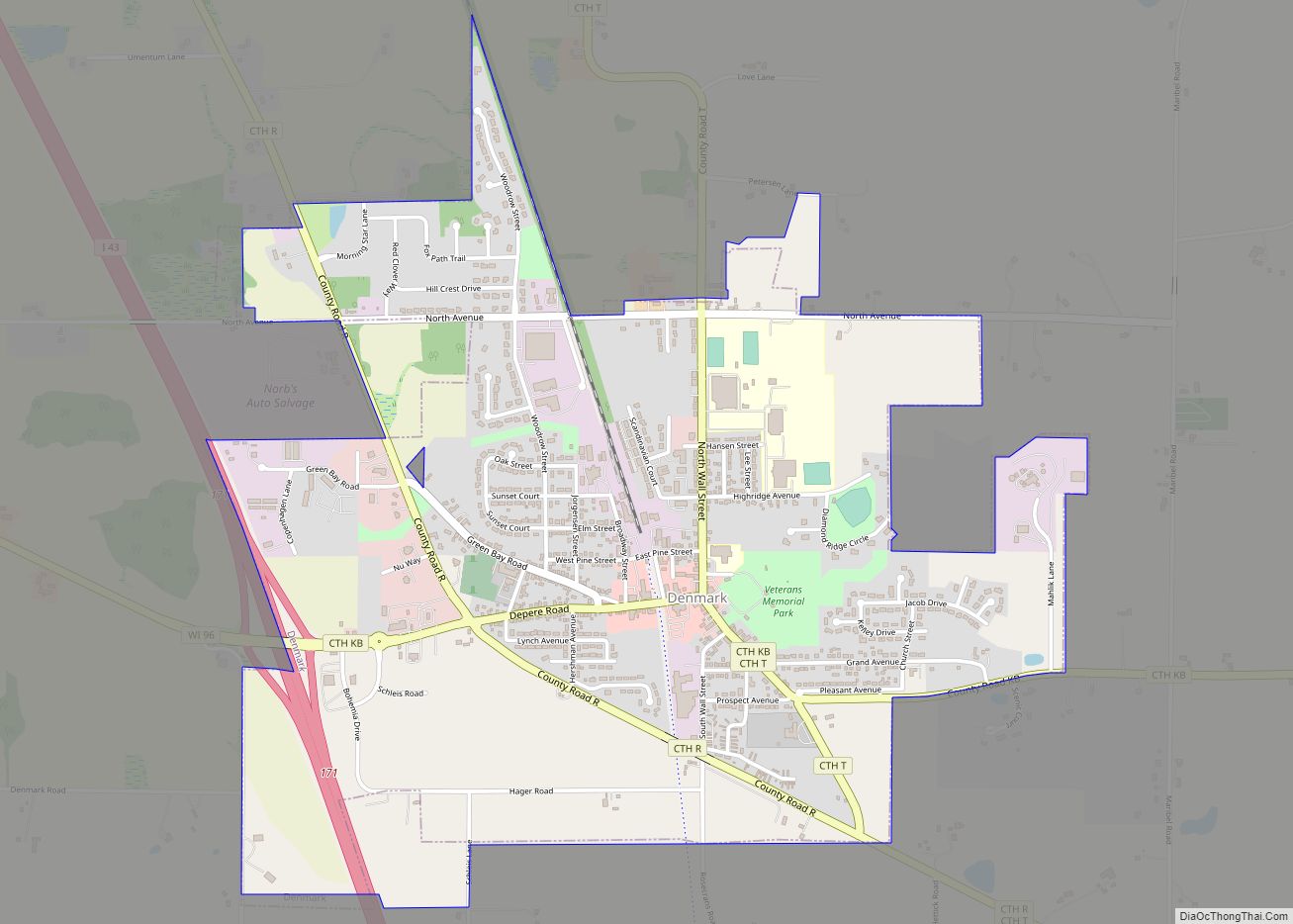
Denmark is a village in Brown County in the U.S. state of Wisconsin. The population was 2,408 at the 2020 census. It is part of the Green Bay Metropolitan Statistical Area. The village is located within the town of New Denmark.
Denmark began to be settled by Danish immigrants in 1848, and has been referred to, along with Hartland, Wisconsin, as the “nuclei of what developed into one of the most important regions of Danish immigration in the United States.”
| Name: | Denmark village |
|---|---|
| LSAD Code: | 47 |
| LSAD Description: | village (suffix) |
| State: | Wisconsin |
| County: | Brown County |
| Elevation: | 873 ft (266 m) |
| Total Area: | 1.97 sq mi (5.10 km²) |
| Land Area: | 1.97 sq mi (5.10 km²) |
| Water Area: | 0.00 sq mi (0.00 km²) |
| Total Population: | 2,408 |
| Population Density: | 1,155.84/sq mi (446.25/km²) |
| ZIP code: | 54208 |
| Area code: | 920 |
| FIPS code: | 5519700 |
| GNISfeature ID: | 1563900 |
| Website: | www.denmark-wi.org |
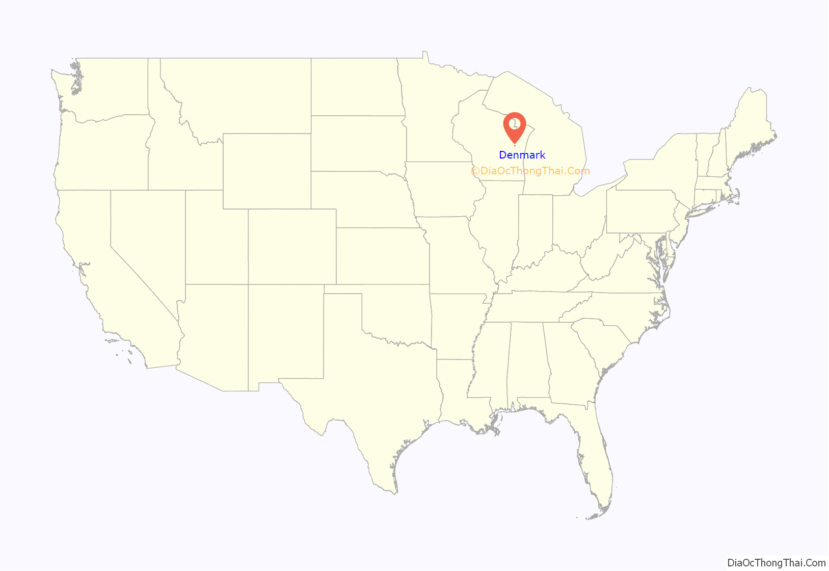
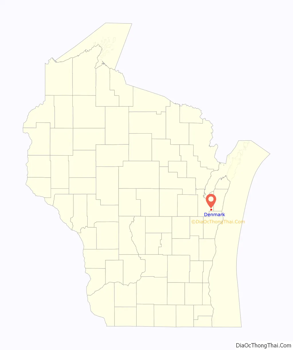
Online Interactive Map
Click on ![]() to view map in "full screen" mode.
to view map in "full screen" mode.
Denmark location map. Where is Denmark village?
History
Early settlement
In 1846, a Prussian immigrant, John Bartlme, purchased 40 acres of land in the area of what is now Denmark.
In 1848, the second settler, and the first Danish immigrant, a man named Niels Gotfredsen, bought 160 acres in the area. He and his wife were referred to as the ‘King and Queen of Denmark’, because they were the first Danish settlers of the town of Denmark.
In 1854, the residents of Brown County, Wisconsin voted on whether Green Bay or De Pere would be the county seat. This was also the year that the residents of Denmark wanted to build a church, but they did not have any money. A man from De Pere came to the town, and offered to pay two dollars for every vote the people of Denmark would cast in favor of De Pere.
On election day, 15 men and boys from Denmark turned out to cast their votes for De Pere, and the town was given $30. But instead of building a church, as was originally intended, the town built a school.
In 1871, Hans Beyer immigrated from old Denmark to New York City, from which he traveled to Green Bay. From Green Bay, Beyer traveled seven hours by ox team to get to Denmark. In 1875, Beyer opened a store in Denmark, which was the first business in the new town, using a loan of $200. In 1896, Beyer built a new store and cheese factory next to the old store.
Turn of the 20th century
In 1906, the Chicago & Northwestern railroad was built through the village. The depot was built in the downtown area. The railroad was originally planned to travel through Cooperstown, Wisconsin, rather than Denmark, but railroad officials decided against this plan.
On June 15, 1915, the town of Denmark held a special election of the issue of incorporation. The official vote tally was 109 in favor, and 26 against. Later that year, the Denmark was officially incorporated into a village.
In 1915, the Kriwanek Brothers established a Ford dealership in the village, which was second oldest Ford dealership in the state of Wisconsin.
On March 3, 1949, Denmark State Bank was robbed of $38,000 at gunpoint. This was the first bank robbery in Brown County, Wisconsin. The Federal Bureau of Investigation became involved, and the perpetrators were caught over the next few weeks.
Later history
The last passenger train to come through the village was on April 30, 1971.
In 1981, Interstate 43 opened just west of the village.
On September 7, 1988, a Chicago & Northwestern train derailed as it was passing the Lake to Lake cheese plant. 20 of the 144 train cars derailed, including several that were carrying sulfuric acid and fuel oil. The train also had cars that were carrying chlorine, however, the engineer did not know which cars contained the chemical, and the wind was blowing towards a residential district. This information led the village and county officials to evacuate a large portion of the village. It was soon found that none of the chemicals had leaked, and residents were allowed to return to their homes.
In 1996, Wisconsin Central Ltd., which had bought the train line from Chicago & Northwestern, abandoned the tracks between Denmark and Rockwood, Wisconsin The abandoned rail line was converted into the Devil’s River State Trail, which was completed in 2013.
Denmark Road Map
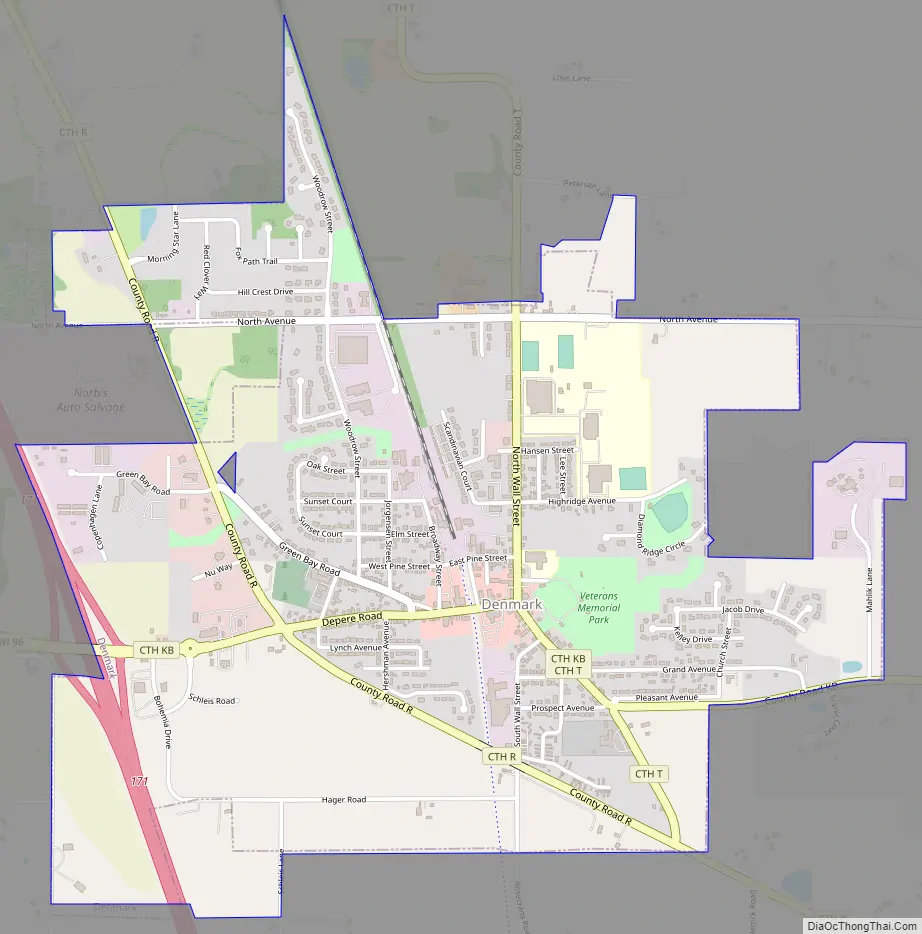
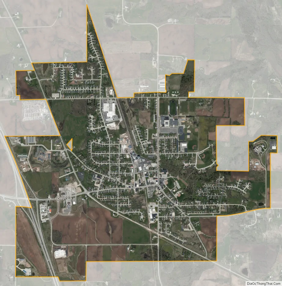
Denmark city Satellite Map
Geography
Denmark is located at 44°20′54″N 87°49′47″W / 44.34833°N 87.82972°W / 44.34833; -87.82972 (44.348295, -87.829697).
According to the United States Census Bureau, the village has a total area of 1.93 square miles (5.00 km), all of it land.
Climate
Denmark has a humid continental climate (Köppen climate classification Dfb), with some moderation due to the village’s proximity to Lake Michigan.
See also
Map of Wisconsin State and its subdivision:- Adams
- Ashland
- Barron
- Bayfield
- Brown
- Buffalo
- Burnett
- Calumet
- Chippewa
- Clark
- Columbia
- Crawford
- Dane
- Dodge
- Door
- Douglas
- Dunn
- Eau Claire
- Florence
- Fond du Lac
- Forest
- Grant
- Green
- Green Lake
- Iowa
- Iron
- Jackson
- Jefferson
- Juneau
- Kenosha
- Kewaunee
- La Crosse
- Lafayette
- Lake Michigan
- Lake Superior
- Langlade
- Lincoln
- Manitowoc
- Marathon
- Marinette
- Marquette
- Menominee
- Milwaukee
- Monroe
- Oconto
- Oneida
- Outagamie
- Ozaukee
- Pepin
- Pierce
- Polk
- Portage
- Price
- Racine
- Richland
- Rock
- Rusk
- Saint Croix
- Sauk
- Sawyer
- Shawano
- Sheboygan
- Taylor
- Trempealeau
- Vernon
- Vilas
- Walworth
- Washburn
- Washington
- Waukesha
- Waupaca
- Waushara
- Winnebago
- Wood
- Alabama
- Alaska
- Arizona
- Arkansas
- California
- Colorado
- Connecticut
- Delaware
- District of Columbia
- Florida
- Georgia
- Hawaii
- Idaho
- Illinois
- Indiana
- Iowa
- Kansas
- Kentucky
- Louisiana
- Maine
- Maryland
- Massachusetts
- Michigan
- Minnesota
- Mississippi
- Missouri
- Montana
- Nebraska
- Nevada
- New Hampshire
- New Jersey
- New Mexico
- New York
- North Carolina
- North Dakota
- Ohio
- Oklahoma
- Oregon
- Pennsylvania
- Rhode Island
- South Carolina
- South Dakota
- Tennessee
- Texas
- Utah
- Vermont
- Virginia
- Washington
- West Virginia
- Wisconsin
- Wyoming