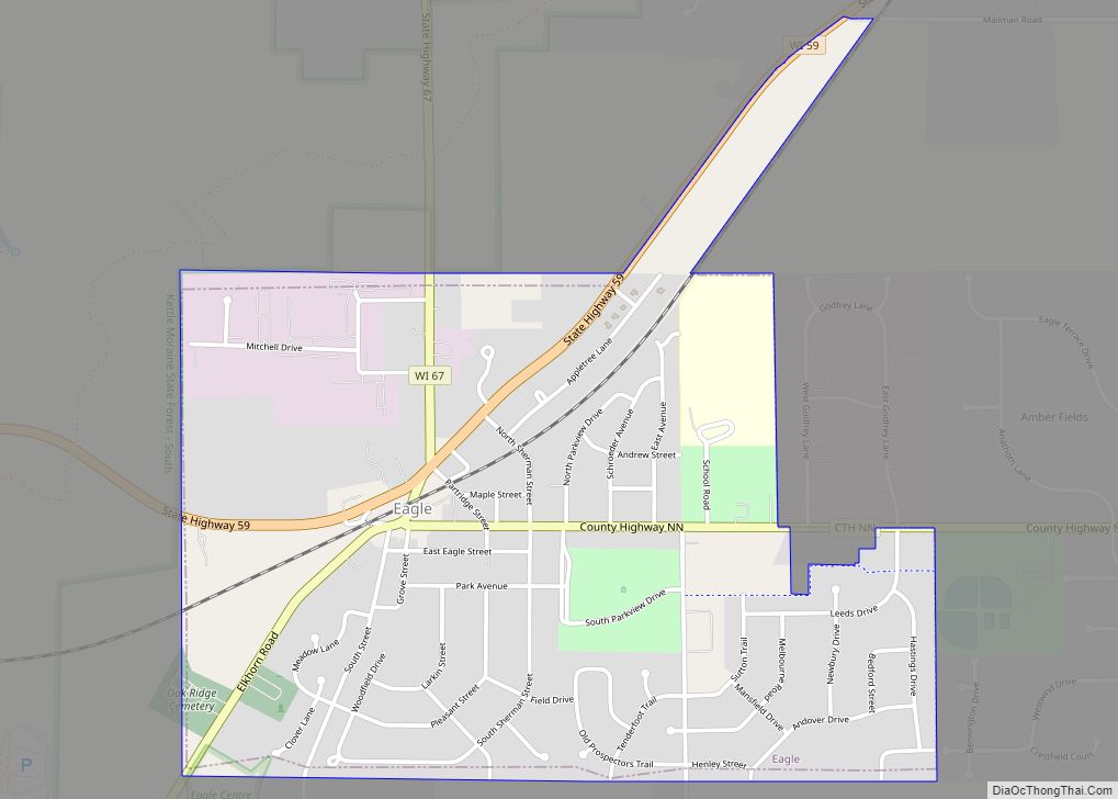
Eagle is a town in Waukesha County, Wisconsin, United States. The population was 3,478 at the 2020 census. The Village of Eagle is located within the town. The unincorporated community of Eagleville is also located in the town.
| Name: | Eagle village |
|---|---|
| LSAD Code: | 47 |
| LSAD Description: | village (suffix) |
| State: | Wisconsin |
| County: | Waukesha County |
| Elevation: | 902 ft (275 m) |
| Total Area: | 35.1 sq mi (90.8 km²) |
| Land Area: | 34.6 sq mi (89.7 km²) |
| Water Area: | 0.4 sq mi (1.1 km²) |
| Total Population: | 3,478 |
| Population Density: | 90/sq mi (34.8/km²) |
| ZIP code: | 53119 |
| Area code: | 262 |
| FIPS code: | 5521425 |
| GNISfeature ID: | 1583112 |
Online Interactive Map
Click on ![]() to view map in "full screen" mode.
to view map in "full screen" mode.
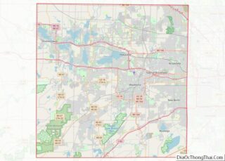
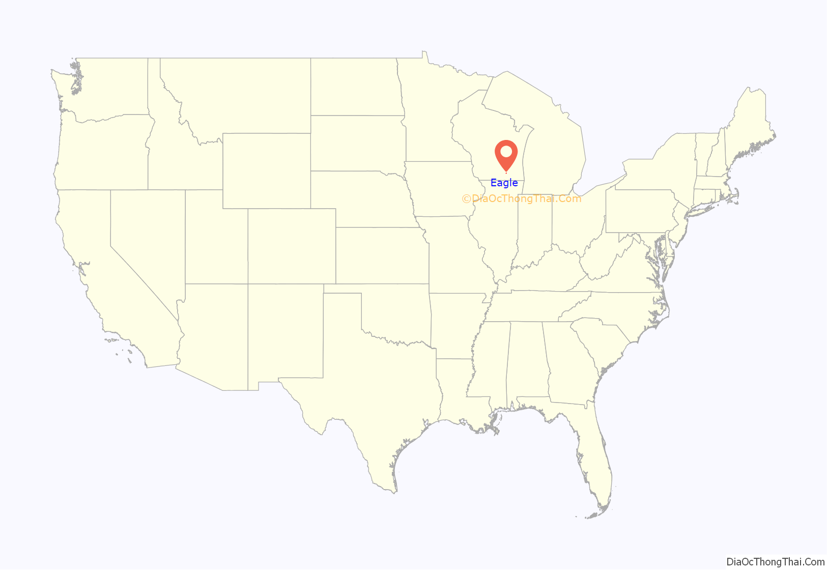
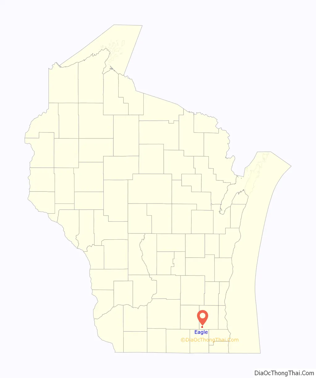
Eagle location map. Where is Eagle village?
History
The town’s name comes from an 1836 incident when pioneer Thomas Sugden and two companions, exploring the area, spotted what was described as “a monster bald-headed eagle… hovering and curving over a large mound” in the midst of the prairie.
On June 21, 2010, a tornado wreaking major damage passed through the town, and the storm that prompted the tornado then prompted warnings for Racine and Milwaukee counties.
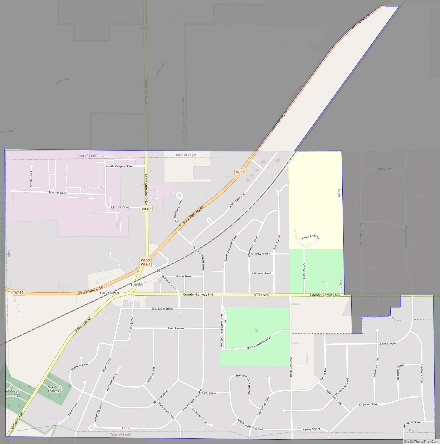
Eagle Road Map
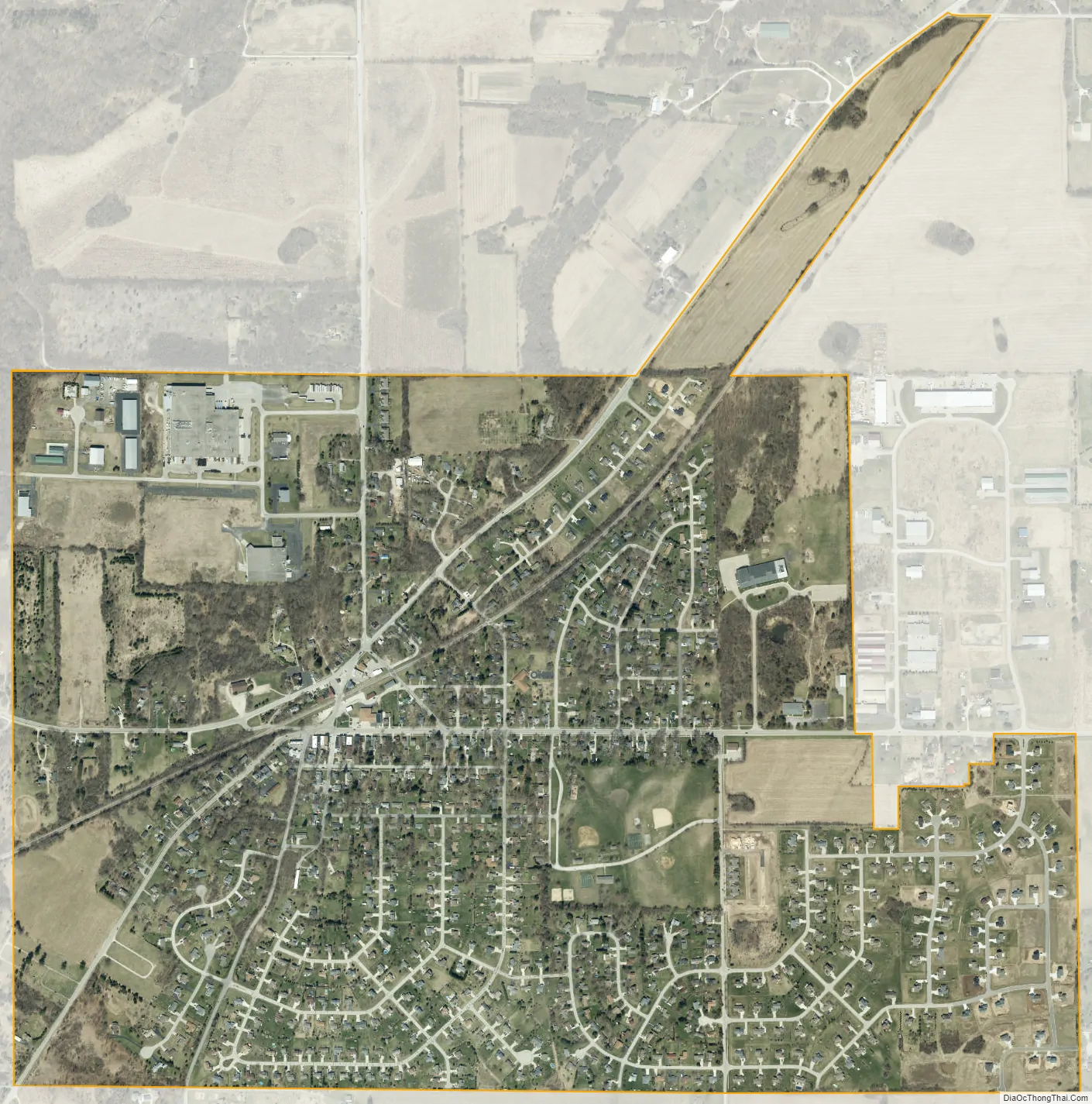
Eagle city Satellite Map
Geography
According to the United States Census Bureau, the town has a total area of 35.1 square miles (90.8 km), of which, 34.6 square miles (89.7 km) of it is land and 0.4 square miles (1.1 km) of it (1.23%) is water.
See also
Map of Wisconsin State and its subdivision:- Adams
- Ashland
- Barron
- Bayfield
- Brown
- Buffalo
- Burnett
- Calumet
- Chippewa
- Clark
- Columbia
- Crawford
- Dane
- Dodge
- Door
- Douglas
- Dunn
- Eau Claire
- Florence
- Fond du Lac
- Forest
- Grant
- Green
- Green Lake
- Iowa
- Iron
- Jackson
- Jefferson
- Juneau
- Kenosha
- Kewaunee
- La Crosse
- Lafayette
- Lake Michigan
- Lake Superior
- Langlade
- Lincoln
- Manitowoc
- Marathon
- Marinette
- Marquette
- Menominee
- Milwaukee
- Monroe
- Oconto
- Oneida
- Outagamie
- Ozaukee
- Pepin
- Pierce
- Polk
- Portage
- Price
- Racine
- Richland
- Rock
- Rusk
- Saint Croix
- Sauk
- Sawyer
- Shawano
- Sheboygan
- Taylor
- Trempealeau
- Vernon
- Vilas
- Walworth
- Washburn
- Washington
- Waukesha
- Waupaca
- Waushara
- Winnebago
- Wood
- Alabama
- Alaska
- Arizona
- Arkansas
- California
- Colorado
- Connecticut
- Delaware
- District of Columbia
- Florida
- Georgia
- Hawaii
- Idaho
- Illinois
- Indiana
- Iowa
- Kansas
- Kentucky
- Louisiana
- Maine
- Maryland
- Massachusetts
- Michigan
- Minnesota
- Mississippi
- Missouri
- Montana
- Nebraska
- Nevada
- New Hampshire
- New Jersey
- New Mexico
- New York
- North Carolina
- North Dakota
- Ohio
- Oklahoma
- Oregon
- Pennsylvania
- Rhode Island
- South Carolina
- South Dakota
- Tennessee
- Texas
- Utah
- Vermont
- Virginia
- Washington
- West Virginia
- Wisconsin
- Wyoming