Fenwood is a village in Marathon County, Wisconsin, United States. It is part of the Wausau, Wisconsin Metropolitan Statistical Area. The population was 152 at the 2010 census.
| Name: | Fenwood village |
|---|---|
| LSAD Code: | 47 |
| LSAD Description: | village (suffix) |
| State: | Wisconsin |
| County: | Marathon County |
| Elevation: | 1,296 ft (395 m) |
| Total Area: | 0.98 sq mi (2.55 km²) |
| Land Area: | 0.98 sq mi (2.55 km²) |
| Water Area: | 0.00 sq mi (0.00 km²) |
| Total Population: | 152 |
| Population Density: | 157.36/sq mi (60.78/km²) |
| Area code: | 715 & 534 |
| FIPS code: | 5525650 |
| GNISfeature ID: | 1564913 |
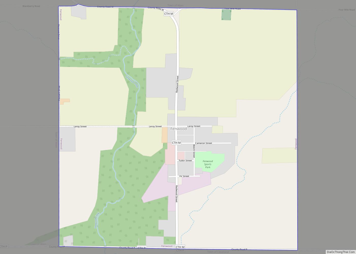
Online Interactive Map
Click on ![]() to view map in "full screen" mode.
to view map in "full screen" mode.
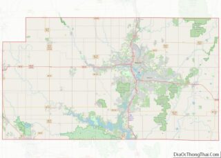
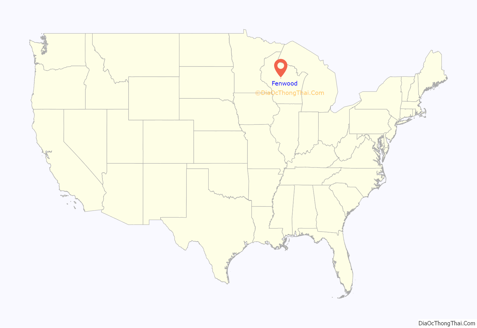
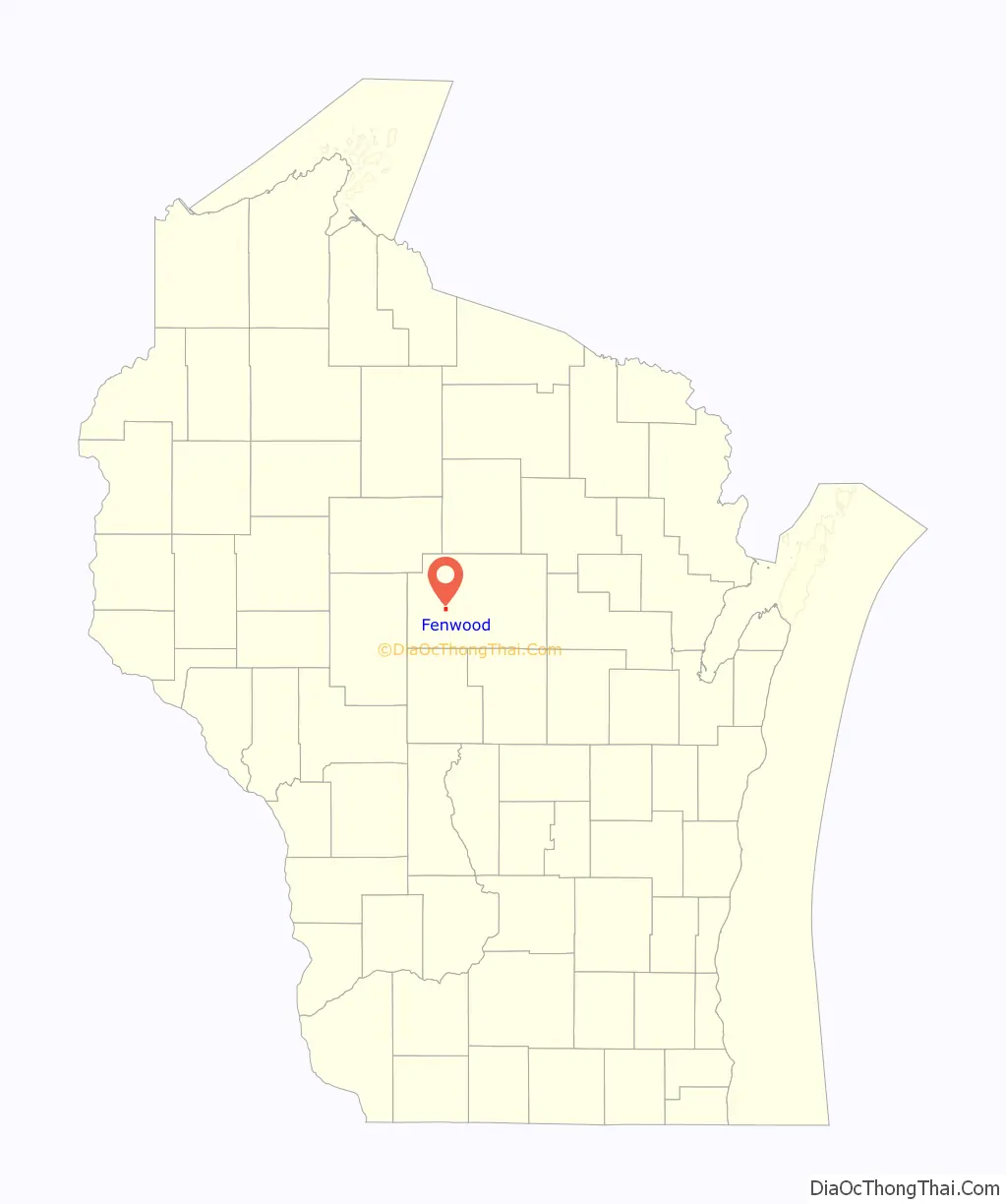
Fenwood location map. Where is Fenwood village?
History
Fenwood was platted by the railroad in 1891. It was named from woods near the townsite at a fen, or marshy area. A post office was established at Fenwood in 1892, and remained in operation until it was discontinued in 1984.
The village of Fenwood, Marathon Co., Wisconsin was platted by Alfred L. Carey, the attorney for the Milwaukee, Lake Shore & Western Railroad, November 18, 1891, about the time when that railroad struck the place; it was incorporated as a village from part of the town of Wien, April 16, 1904, and its first representative in the county board of Marathon county was W. A. Somers. At the time the railroad struck the place, C. S. Curtis of Wausau erected a large saw mill, which was in operation until 1910, when it ceased sawing. At that time there was a large profitable cheese factory in the village, owned and supplied by farmers in the towns of Wien and Cleveland. John Brinkmann and Emil Szebsdat, under firm name of Brinkmann & Szeljsdat owned a general store, and George Wetterau kept the tavern or hotel in the village. Emil Szebsdat was also the village postmaster.
There was a nice state-graded frame schoolhouse with two “departments”: principal, Vallborg Hermanson, and assistant principal, Miss Gertrude Kurtzweil – an average attendance of forty-five pupils in both departments. There were two German Evangelical Lutheran congregations, holding their services in the schoolhouse and attended by the resident ministers of the town of Wien. https://wiclarkcountyhistory.org/neighbors/marathon/history/1913FenwoodHistory.htm
In 1911, the R. Connor Company of Marshfield, with its Marathon County mill located at Stratford, set to work clear- ing two sections of land four miles southeast of the village. This project, no doubt, had much to do in checking the out- ward flow of workmen and gave fresh energy to the entire community. A spur track extending from the mainline to Connor’s woods provided an easy and rapid means of trans- porting logs from camp to the mill. The cut of 1913 climaxed the Connor harvest at this location and that season, two million feet of logs were decked at one time at their rollway. For several years more timbers were hauled into Fenwood from a 500-acre tract. This work was contracted by John Wetterau and was finished in 1928. These intermittent and spasmodic shipments marked the ex- piration of the industry which had given birth to the village. At one time the Chrouser Saw and Tie Mill was also in operation in Fenwood. This mill was operated by George Chrouser from 1908 until the late 1920s. The Fenwood mill was a branch of the Chrouser mill in Stratford. It consisted mainly in making ties for the railroad and custom sawing for area people. In the early 1900s, Fenwood was a booming lumber town. Proof of Fenwood’s past prominence as a lumbering center is mutely evidenced today by unused and unusable logging roads. These keep an endless vigil against a time, never to come, when again one can hear the droning music of a saw punctuated by staccato notes as steel meets steel, in the rhythmic swings of lumberjacks, the dying symphony of the north woods. (This history of Fenwood was compiled by Lillian Bau- man using many histories and newspaper articles from area newspapers.) Early Fenwood. Photograph on loan from Delbert Wetterau. https://digicoll.library.wisc.edu/cgi-bin/WI/WI-idx?type=turn&id=WI.Fenwood&entity=WI.Fenwood.p0012&isize=text
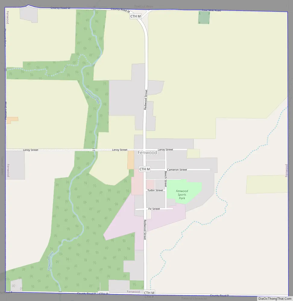
Fenwood Road Map
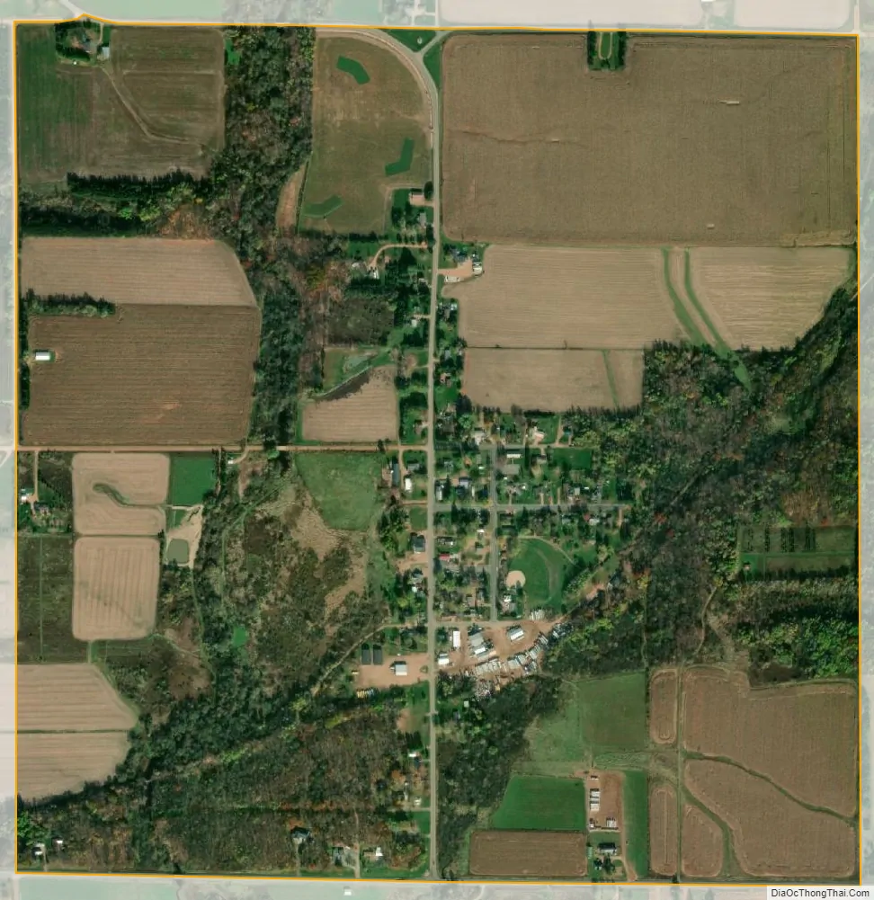
Fenwood city Satellite Map
Geography
Fenwood is located at 44°51′56″N 90°0′50″W / 44.86556°N 90.01389°W / 44.86556; -90.01389 (44.865483, -90.013757).
According to the United States Census Bureau, the village has a total area of 0.99 square miles (2.56 km), all of it land.
See also
Map of Wisconsin State and its subdivision:- Adams
- Ashland
- Barron
- Bayfield
- Brown
- Buffalo
- Burnett
- Calumet
- Chippewa
- Clark
- Columbia
- Crawford
- Dane
- Dodge
- Door
- Douglas
- Dunn
- Eau Claire
- Florence
- Fond du Lac
- Forest
- Grant
- Green
- Green Lake
- Iowa
- Iron
- Jackson
- Jefferson
- Juneau
- Kenosha
- Kewaunee
- La Crosse
- Lafayette
- Lake Michigan
- Lake Superior
- Langlade
- Lincoln
- Manitowoc
- Marathon
- Marinette
- Marquette
- Menominee
- Milwaukee
- Monroe
- Oconto
- Oneida
- Outagamie
- Ozaukee
- Pepin
- Pierce
- Polk
- Portage
- Price
- Racine
- Richland
- Rock
- Rusk
- Saint Croix
- Sauk
- Sawyer
- Shawano
- Sheboygan
- Taylor
- Trempealeau
- Vernon
- Vilas
- Walworth
- Washburn
- Washington
- Waukesha
- Waupaca
- Waushara
- Winnebago
- Wood
- Alabama
- Alaska
- Arizona
- Arkansas
- California
- Colorado
- Connecticut
- Delaware
- District of Columbia
- Florida
- Georgia
- Hawaii
- Idaho
- Illinois
- Indiana
- Iowa
- Kansas
- Kentucky
- Louisiana
- Maine
- Maryland
- Massachusetts
- Michigan
- Minnesota
- Mississippi
- Missouri
- Montana
- Nebraska
- Nevada
- New Hampshire
- New Jersey
- New Mexico
- New York
- North Carolina
- North Dakota
- Ohio
- Oklahoma
- Oregon
- Pennsylvania
- Rhode Island
- South Carolina
- South Dakota
- Tennessee
- Texas
- Utah
- Vermont
- Virginia
- Washington
- West Virginia
- Wisconsin
- Wyoming