Milton is a city in Rock County, Wisconsin, United States. The population was 5,716 at the 2020 census.
| Name: | Milton city |
|---|---|
| LSAD Code: | 25 |
| LSAD Description: | city (suffix) |
| State: | Wisconsin |
| County: | Rock County |
| Elevation: | 889 ft (271 m) |
| Total Area: | 4.28 sq mi (11.08 km²) |
| Land Area: | 4.26 sq mi (11.03 km²) |
| Water Area: | 0.02 sq mi (0.04 km²) |
| Total Population: | 5,716 |
| Population Density: | 1,341.8/sq mi (518.1/km²) |
| ZIP code: | 53563 |
| Area code: | 608 |
| FIPS code: | 5552200 |
| GNISfeature ID: | 1569532 |
| Website: | www.ci.milton.wi.us |
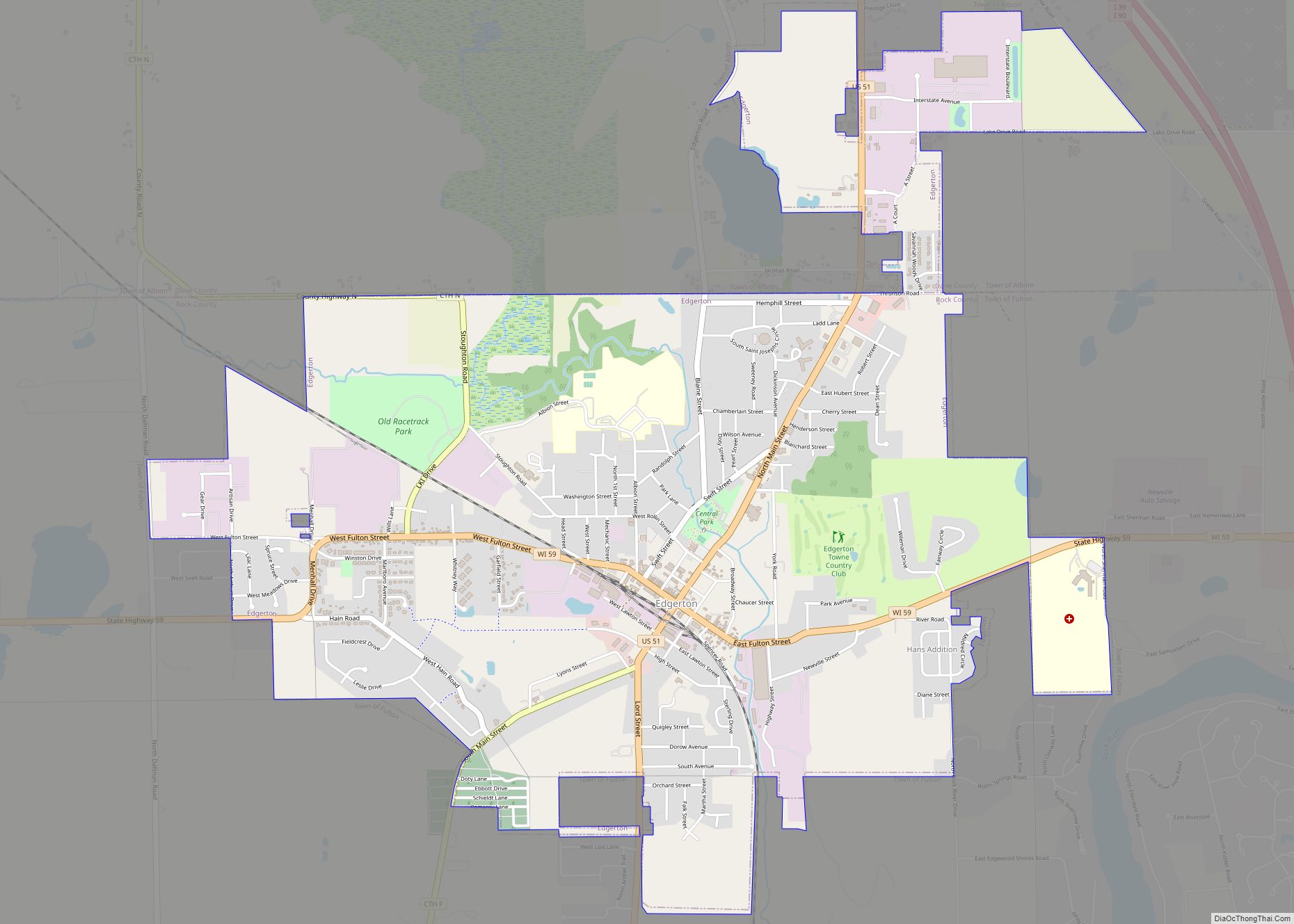
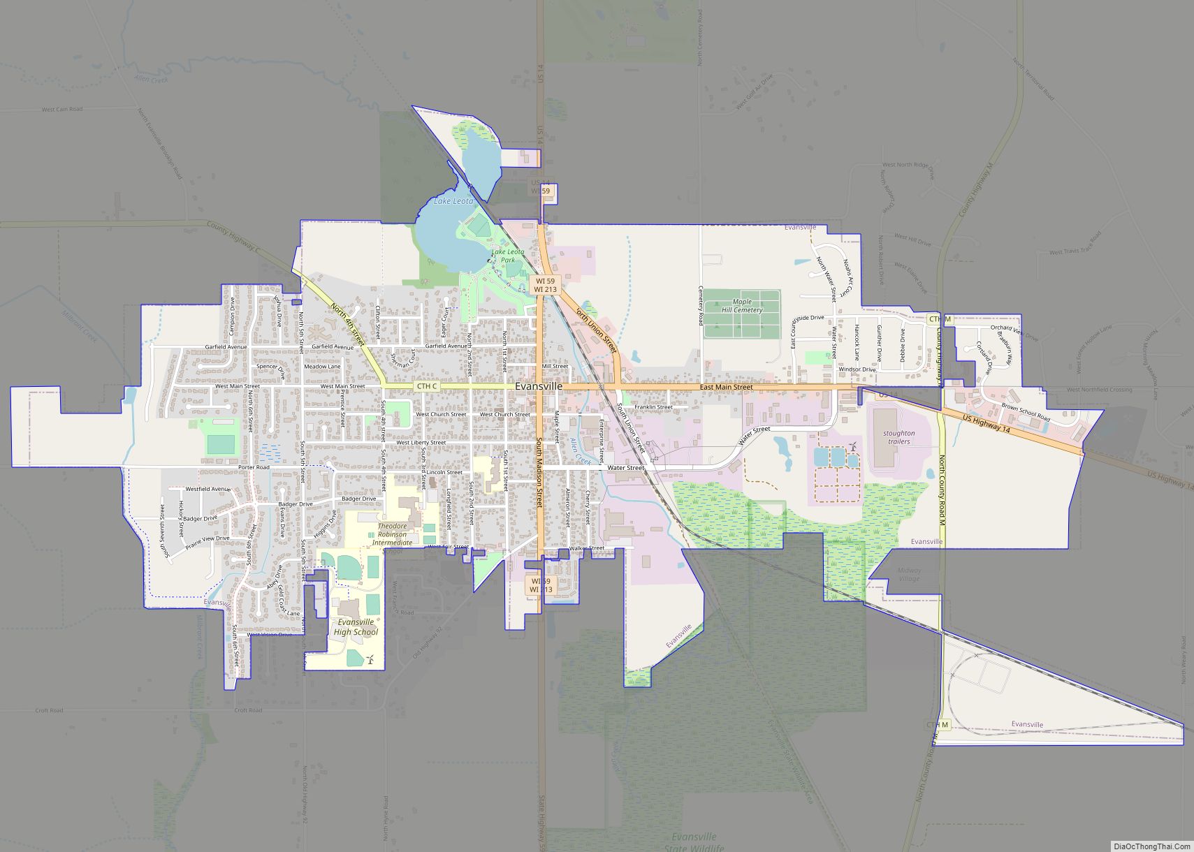
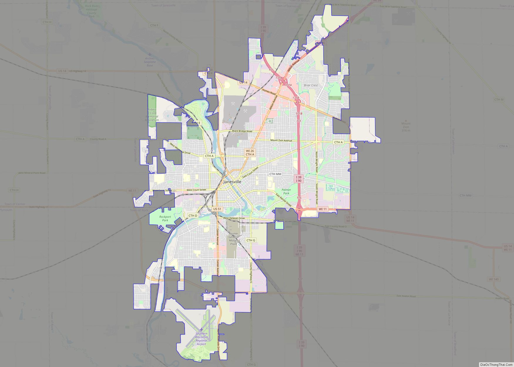
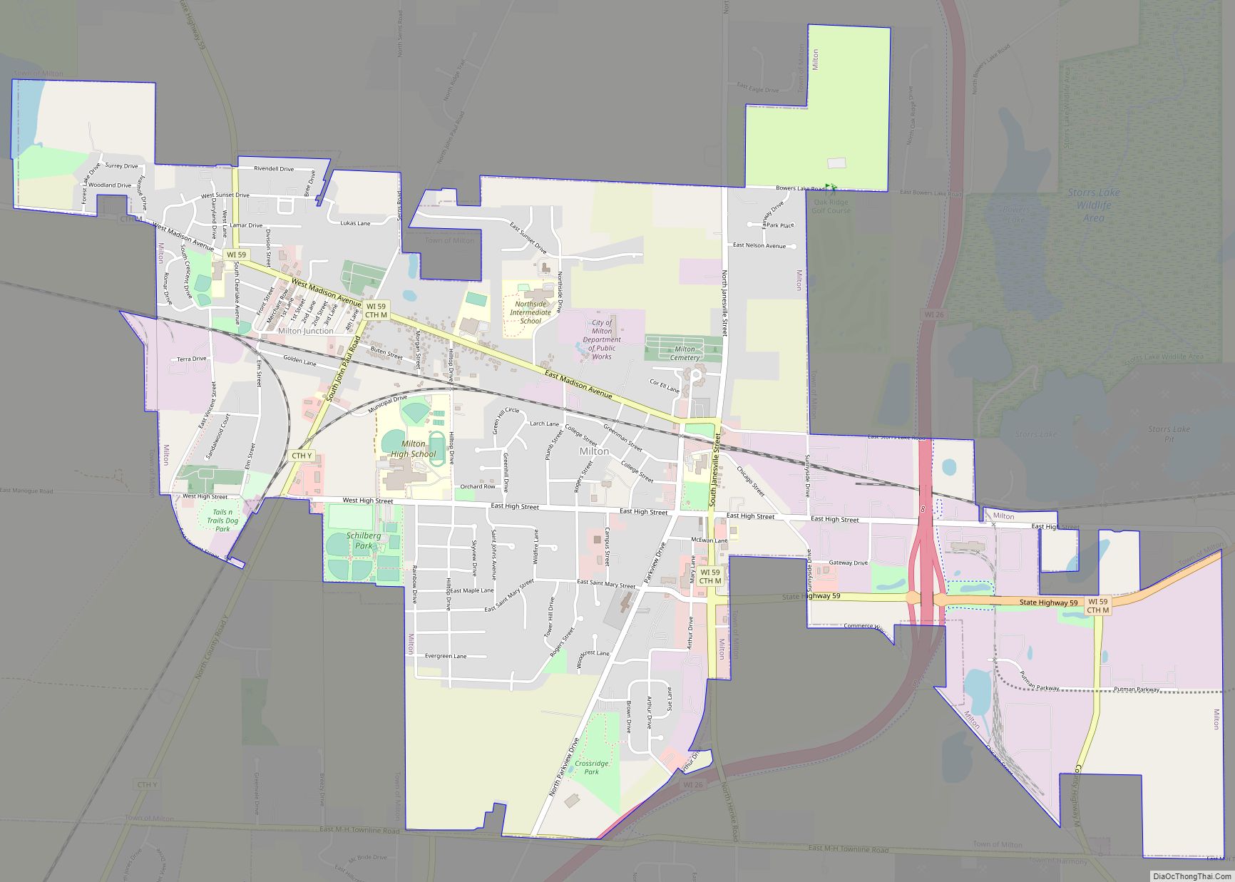
Online Interactive Map
Click on ![]() to view map in "full screen" mode.
to view map in "full screen" mode.
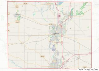
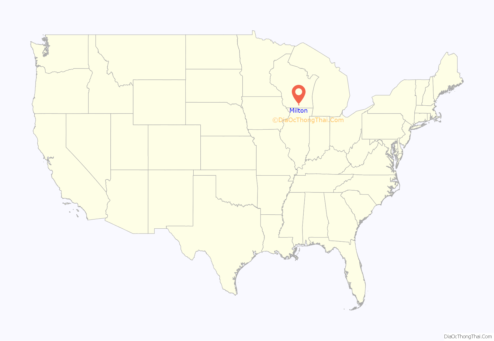
Milton location map. Where is Milton city?
History
The city was formed as a result of the 1967 merger of the villages of Milton and Milton Junction. In November of that year, ballots were cast by 1,093 voters from both villages (Milton: 515 to 47 in favor of the merge; Milton Junction: 322 to 201 in favor of the merge), and the referendum to merge the two was approved by 77%.
Originally named Prairie du Lac, Milton was settled in 1838 by Joseph Goodrich, who from Alfred, New York came with his family to the locality for religious and educational reasons. As soon as he moved he organized a Seventh Day Baptist Church in November 1840 and in 1844 a school that would later become a college, and he also built an inn, a Milton House, without crossing two trade routes.
The Milton House is today one of the oldest poured grout structures in the United States. A noted abolitionist, Goodrich is known to have aided fugitive slaves escape to freedom via the Underground Railroad.
It is believed that Milton is named after poet John Milton, author of “Paradise Lost,” after a settler remarked that the town was his “Paradise Regained” after leaving his previous home, which he thought of as a paradise lost.
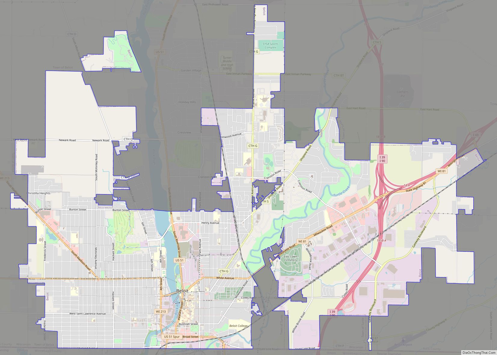
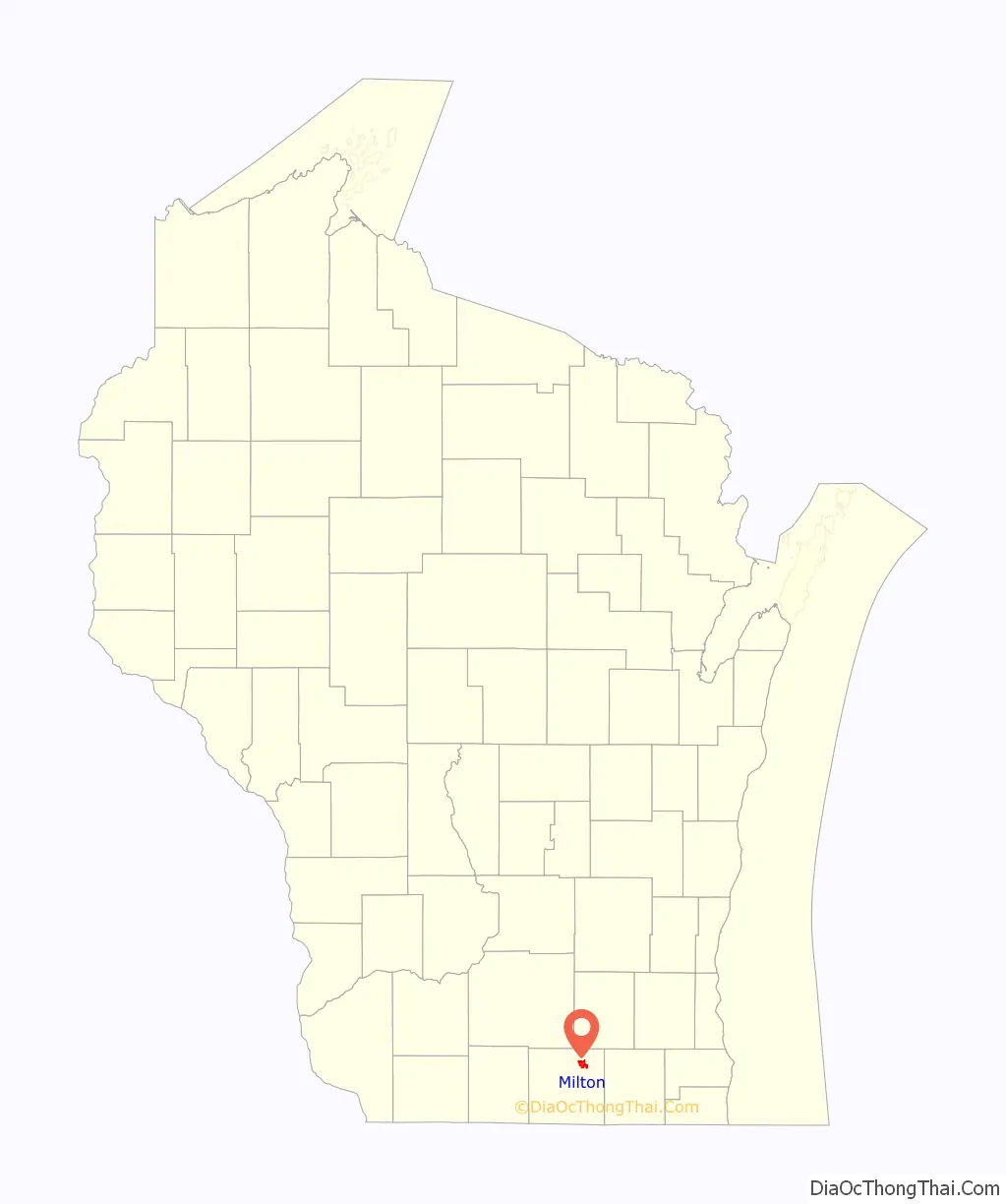
Milton Road Map
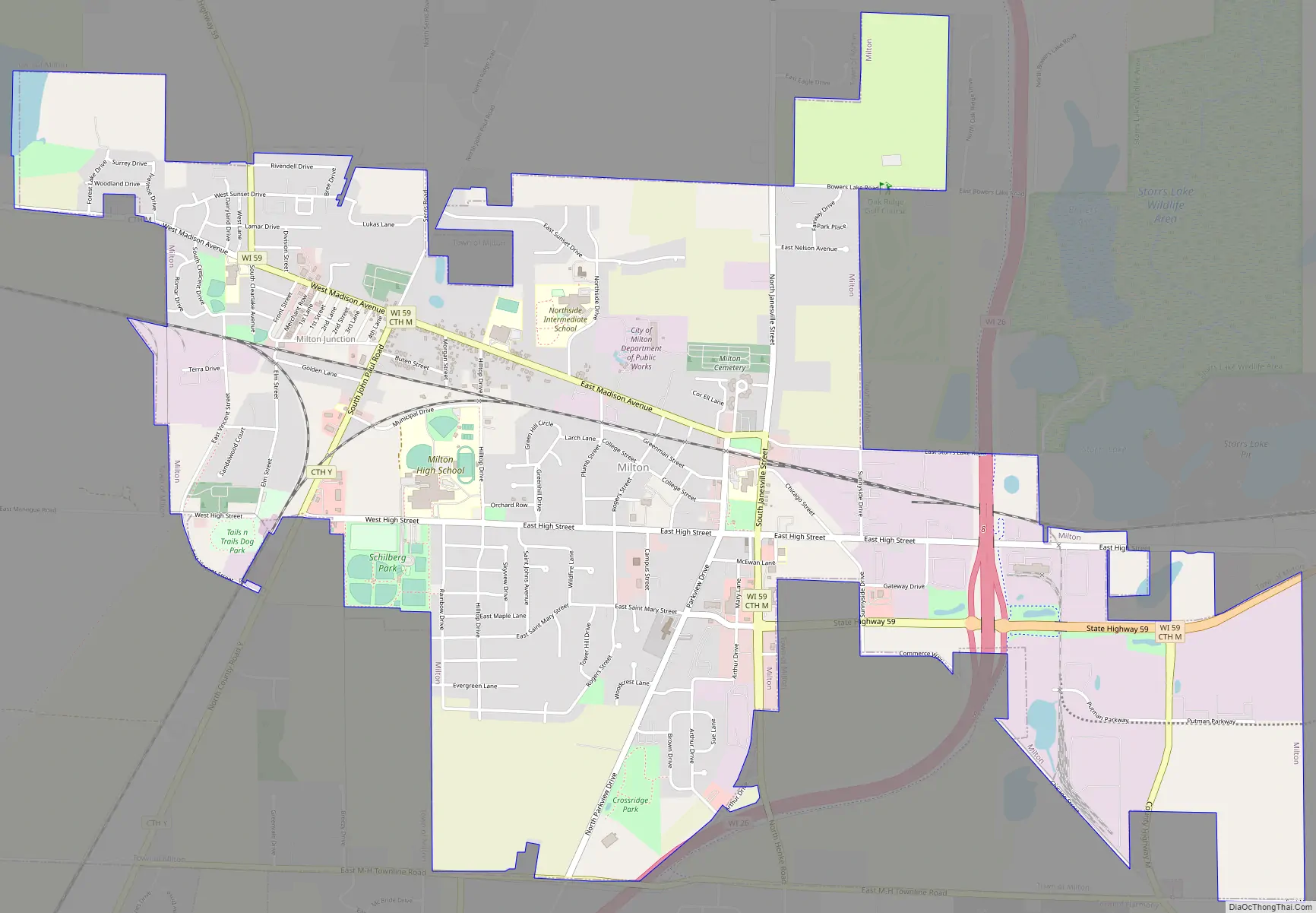
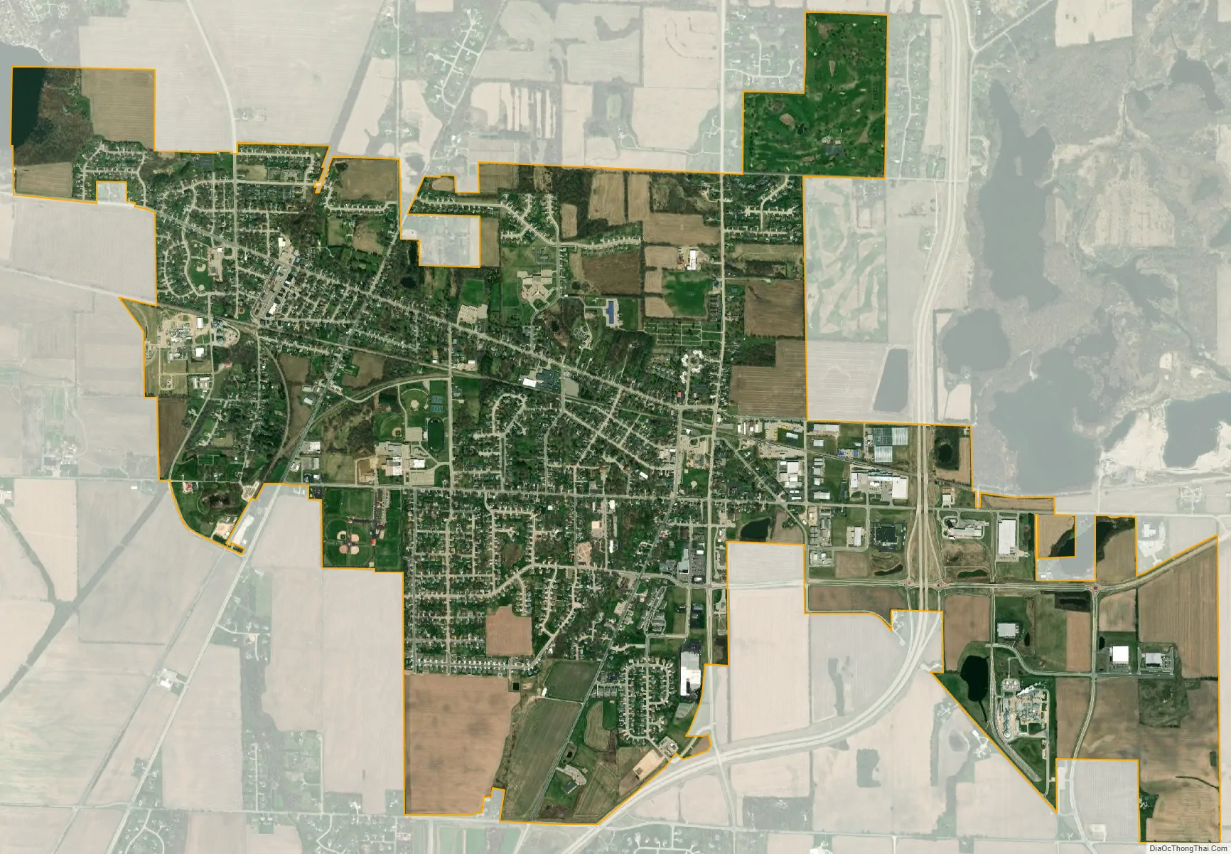
Milton city Satellite Map
Geography
Milton is located at 42°46′40″N 88°57′18″W / 42.77778°N 88.95500°W / 42.77778; -88.95500 (42.777795, -88.955133).
According to the United States Census Bureau, the city has a total area of 3.54 square miles (9.17 km), of which, 3.53 square miles (9.14 km) is land and 0.01 square miles (0.03 km) is water.
See also
Map of Wisconsin State and its subdivision:- Adams
- Ashland
- Barron
- Bayfield
- Brown
- Buffalo
- Burnett
- Calumet
- Chippewa
- Clark
- Columbia
- Crawford
- Dane
- Dodge
- Door
- Douglas
- Dunn
- Eau Claire
- Florence
- Fond du Lac
- Forest
- Grant
- Green
- Green Lake
- Iowa
- Iron
- Jackson
- Jefferson
- Juneau
- Kenosha
- Kewaunee
- La Crosse
- Lafayette
- Lake Michigan
- Lake Superior
- Langlade
- Lincoln
- Manitowoc
- Marathon
- Marinette
- Marquette
- Menominee
- Milwaukee
- Monroe
- Oconto
- Oneida
- Outagamie
- Ozaukee
- Pepin
- Pierce
- Polk
- Portage
- Price
- Racine
- Richland
- Rock
- Rusk
- Saint Croix
- Sauk
- Sawyer
- Shawano
- Sheboygan
- Taylor
- Trempealeau
- Vernon
- Vilas
- Walworth
- Washburn
- Washington
- Waukesha
- Waupaca
- Waushara
- Winnebago
- Wood
- Alabama
- Alaska
- Arizona
- Arkansas
- California
- Colorado
- Connecticut
- Delaware
- District of Columbia
- Florida
- Georgia
- Hawaii
- Idaho
- Illinois
- Indiana
- Iowa
- Kansas
- Kentucky
- Louisiana
- Maine
- Maryland
- Massachusetts
- Michigan
- Minnesota
- Mississippi
- Missouri
- Montana
- Nebraska
- Nevada
- New Hampshire
- New Jersey
- New Mexico
- New York
- North Carolina
- North Dakota
- Ohio
- Oklahoma
- Oregon
- Pennsylvania
- Rhode Island
- South Carolina
- South Dakota
- Tennessee
- Texas
- Utah
- Vermont
- Virginia
- Washington
- West Virginia
- Wisconsin
- Wyoming