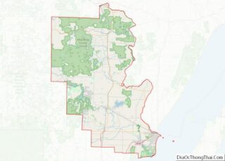
Peshtigo (/ˈpɛʃtɪɡoʊ/ PESH-ti-go) is a city in Marinette County, Wisconsin, United States. The population was 3,420 at the 2020 census The city is surrounded by the Town of Peshtigo. It is part of the Marinette, WI–MI Micropolitan Statistical Area. Peshtigo is known for being the site of the Peshtigo fire of 1871, in which more than 1,200 people perished.
| Name: | Peshtigo city |
|---|---|
| LSAD Code: | 25 |
| LSAD Description: | city (suffix) |
| State: | Wisconsin |
| County: | Marinette County |
| Total Area: | 3.08 sq mi (7.99 km²) |
| Land Area: | 2.91 sq mi (7.54 km²) |
| Water Area: | 0.17 sq mi (0.44 km²) |
| Total Population: | 3,420 |
| Population Density: | 1,148.30/sq mi (443.43/km²) |
| Area code: | 715 & 534 |
| FIPS code: | 5562175 |
| Website: | ci.peshtigo.wi.us |
Online Interactive Map
Click on ![]() to view map in "full screen" mode.
to view map in "full screen" mode.
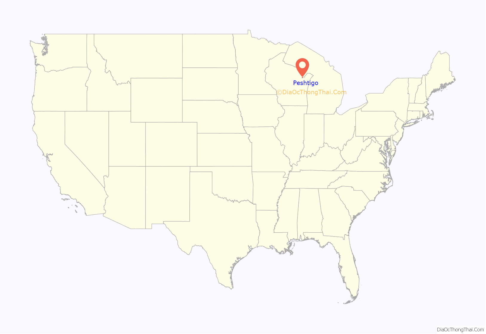
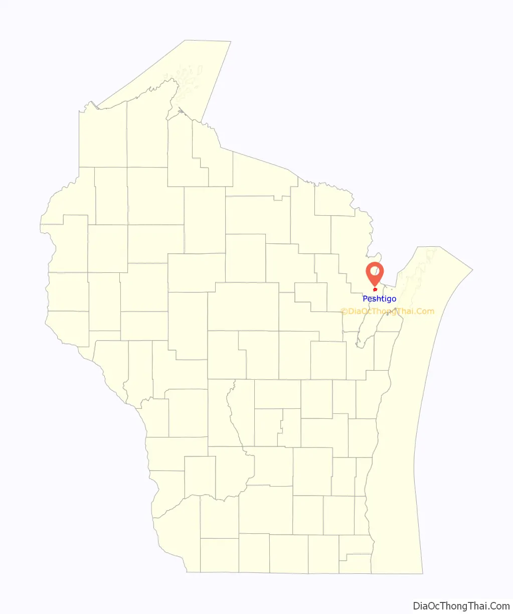
Peshtigo location map. Where is Peshtigo city?
History
Name
Peshtigo took its name from the nearby Peshtigo River. The etymology of Peshtigo is uncertain. Explanations include an Ojibwe word meaning ‘river of the wild goose’, a Menominee word for ‘snapping turtle’, a word meaning ‘passing through a marsh’, or a reference to a local Menominee band known as Pesh-tiko.
Peshtigo fire
On October 8, 1871, a forest fire driven by strong winds totally consumed Peshtigo and a dozen other villages, killing between 1,200 and 2,500 people and engulfing approximately 1.5 million acres (6,000 km). This fire, known as the Peshtigo fire, was the deadliest in American history. Unidentifiable remains of hundreds of residents were buried in a mass grave at the Peshtigo Fire Cemetery. The Peshtigo Fire Museum features several items that survived the fire, plus other artifacts from the area’s history.
This fire started the same day as the Great Chicago fire, the Holland, Michigan fire, the Port Huron Fire of 1871, and the Great Michigan Fire (in Manistee, Michigan).
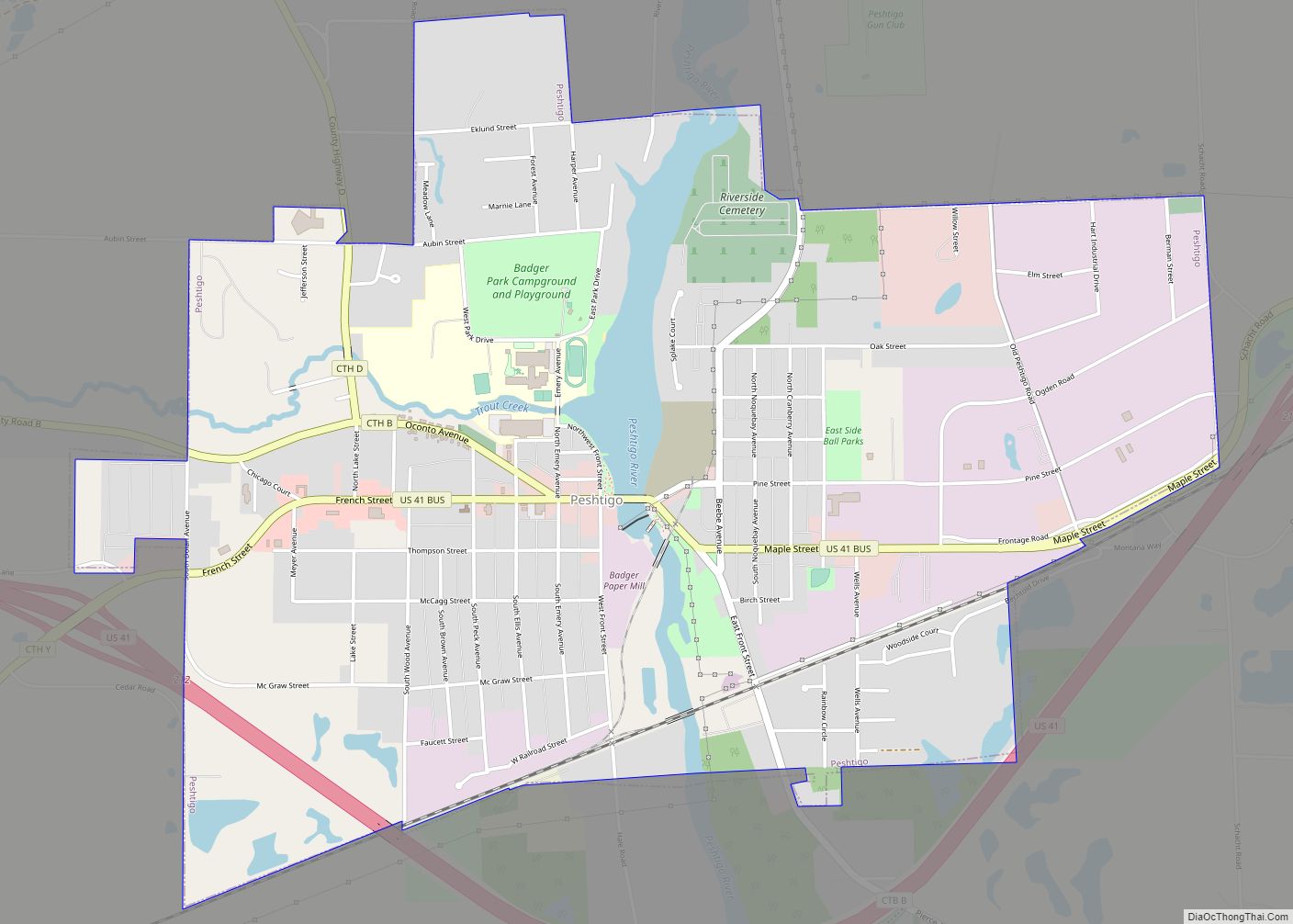
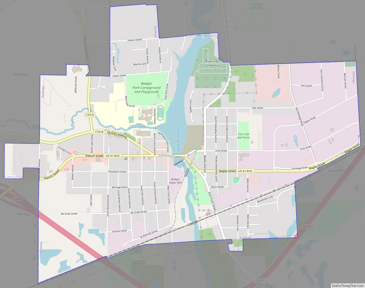
Peshtigo Road Map
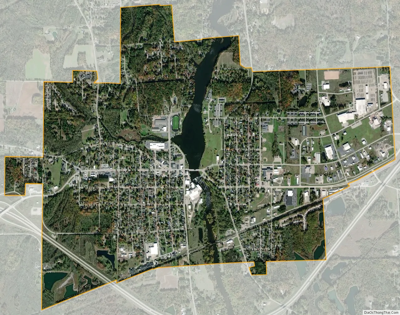
Peshtigo city Satellite Map
Geography
Peshtigo is located at 45°3′13″N 87°44′45″W / 45.05361°N 87.74583°W / 45.05361; -87.74583 (45.053759, −87.746028).
According to the United States Census Bureau, the city has a total area of 3.20 square miles (8.29 km), of which, 3.03 square miles (7.85 km) is land and 0.17 square miles (0.44 km) is water.
See also
Map of Wisconsin State and its subdivision:- Adams
- Ashland
- Barron
- Bayfield
- Brown
- Buffalo
- Burnett
- Calumet
- Chippewa
- Clark
- Columbia
- Crawford
- Dane
- Dodge
- Door
- Douglas
- Dunn
- Eau Claire
- Florence
- Fond du Lac
- Forest
- Grant
- Green
- Green Lake
- Iowa
- Iron
- Jackson
- Jefferson
- Juneau
- Kenosha
- Kewaunee
- La Crosse
- Lafayette
- Lake Michigan
- Lake Superior
- Langlade
- Lincoln
- Manitowoc
- Marathon
- Marinette
- Marquette
- Menominee
- Milwaukee
- Monroe
- Oconto
- Oneida
- Outagamie
- Ozaukee
- Pepin
- Pierce
- Polk
- Portage
- Price
- Racine
- Richland
- Rock
- Rusk
- Saint Croix
- Sauk
- Sawyer
- Shawano
- Sheboygan
- Taylor
- Trempealeau
- Vernon
- Vilas
- Walworth
- Washburn
- Washington
- Waukesha
- Waupaca
- Waushara
- Winnebago
- Wood
- Alabama
- Alaska
- Arizona
- Arkansas
- California
- Colorado
- Connecticut
- Delaware
- District of Columbia
- Florida
- Georgia
- Hawaii
- Idaho
- Illinois
- Indiana
- Iowa
- Kansas
- Kentucky
- Louisiana
- Maine
- Maryland
- Massachusetts
- Michigan
- Minnesota
- Mississippi
- Missouri
- Montana
- Nebraska
- Nevada
- New Hampshire
- New Jersey
- New Mexico
- New York
- North Carolina
- North Dakota
- Ohio
- Oklahoma
- Oregon
- Pennsylvania
- Rhode Island
- South Carolina
- South Dakota
- Tennessee
- Texas
- Utah
- Vermont
- Virginia
- Washington
- West Virginia
- Wisconsin
- Wyoming