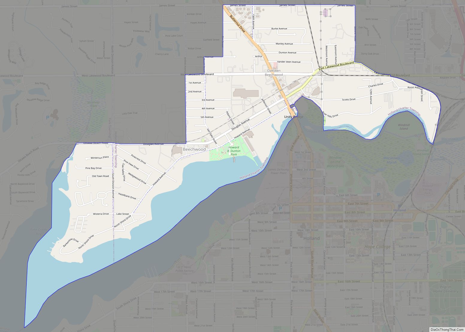
Holland is a city in the western region of the Lower Peninsula of the U.S. state of Michigan. It is situated near the eastern shore of Lake Michigan on Lake Macatawa, which is fed by the Macatawa River (formerly known locally as the Black River). Today, Holland is a thriving city with a diverse economy that includes manufacturing, agriculture, tourism, and higher education. It is home to a number of prominent companies, including Herman Miller, Haworth, and Johnson Controls. The city also attracts thousands of visitors each year for its annual Tulip Time Festival, which celebrates the area’s Dutch heritage and vibrant tulip fields.
The city spans the Ottawa/Allegan county line, with 9.08 sq mi (23.52 km) in Ottawa and the remaining 8.13 sq mi (21.06 km) in Allegan. As of the 2010 census, the population was 33,051, with an urbanized area population of 113,164, as of 2015.
Holland is the largest city in both Ottawa and Allegan counties. The Ottawa County portion is part of the Grand Rapids–Kentwood Metropolitan Statistical Area, while the Allegan County portion is part of the Holland Micropolitan Statistical Area, which is coextensive with Allegan County. As of 2013, both areas are part of the Grand Rapids–Kentwood–Muskegon Combined Statistical Area. Holland was founded by Dutch Americans, and is in an area that has a large percentage of citizens of Dutch American heritage. It is home to Hope College and Western Theological Seminary, institutions of the Reformed Church in America.
| Name: | Holland city |
|---|---|
| LSAD Code: | 25 |
| LSAD Description: | city (suffix) |
| State: | Michigan |
| County: | Allegan County, Ottawa County |
| Elevation: | 662 ft (202 m) |
| Land Area: | 16.68 sq mi (43.21 km²) |
| Water Area: | 0.77 sq mi (1.99 km²) |
| Population Density: | 2,060.66/sq mi (795.62/km²) |
| ZIP code: | 49422-49424 |
| Area code: | 616,269 |
| FIPS code: | 2638640 |
| GNISfeature ID: | 0628421 |
| Website: | www.cityofholland.com#&www.enjoyhollandmichigan.com |
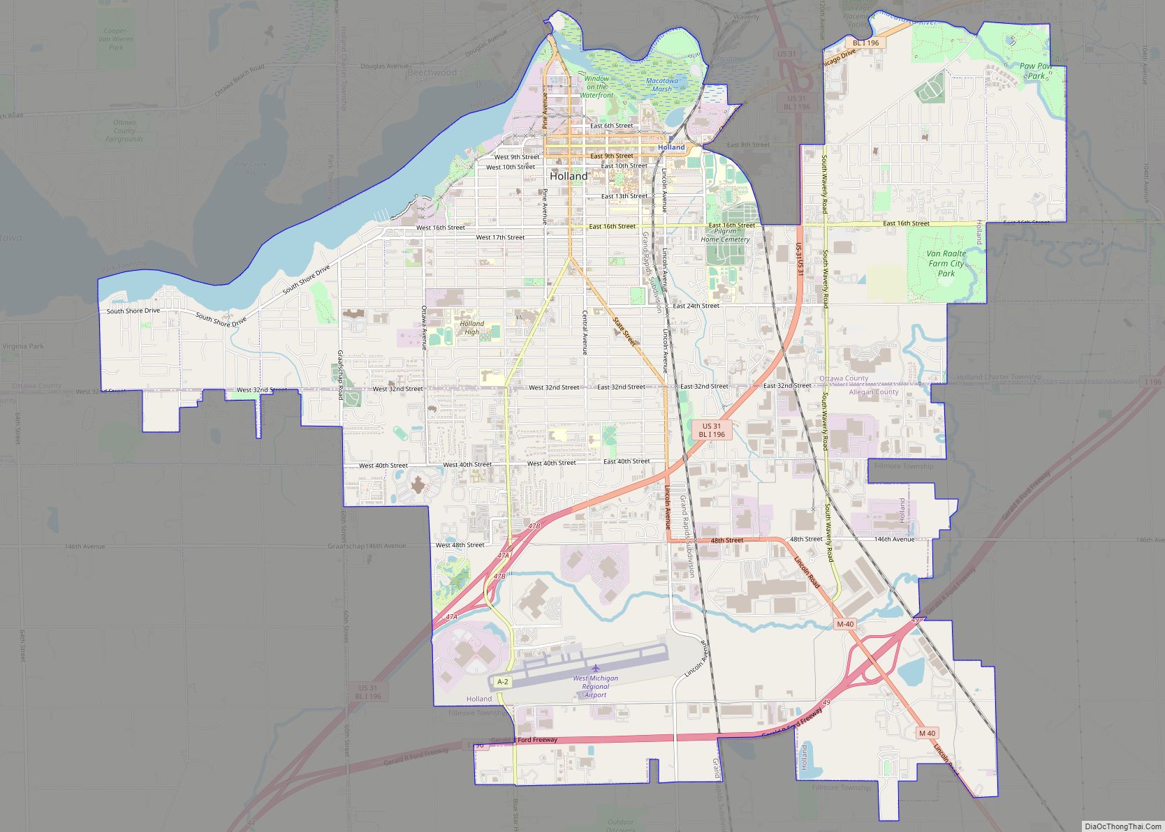
Online Interactive Map
Click on ![]() to view map in "full screen" mode.
to view map in "full screen" mode.
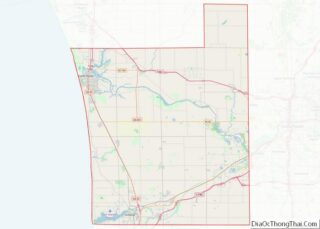
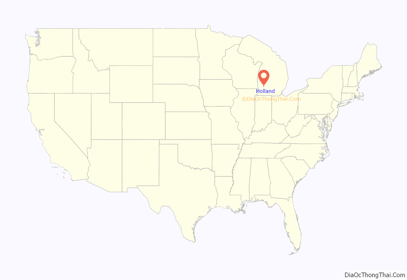
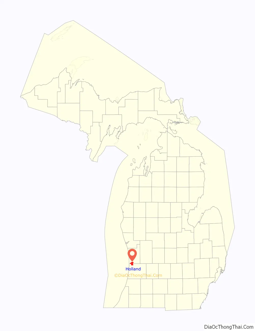
Holland location map. Where is Holland city?
History
Ottawa County was originally populated by Ottawa Indians. In 1846, Reverend George Smith established the Old Wing Mission as an outreach to the native population. The Ottawa living here were primarily practicing Catholics, but Smith tried converting them to Protestantism. While generally unsuccessful in converting the Native population, the two groups worked together relatively closely for a short time. This attempt to work and live together was not valued by the next group who arrived.
Holland was settled in 1847 by Dutch Calvinist separatists, under the leadership of Dr. Albertus van Raalte. Dire economic conditions in the Netherlands compelled them to emigrate, while their desire for religious freedom led them to unite and settle together as a group.
Van Raalte and his colony settled on land in the midst of the Ottawa (Odawa) people’s Old Wing Mission Colony near the Black River where it streamed to Black Lake (now Lake Macatawa) which, in turn, led to Lake Michigan. The Dutch settlers and the Ottawa people never got along. Dutch settlers began stealing sugar and venison from the Ottawa. The Dutch were unwilling to accept the Ottawa people’s mix of Catholic and Native culture. Soon, Dutch leaders tried to force the natives into wooded land in Allegan County. Eventually, the natives moved north to preserve their way of life and culture. Chief Peter Waukazoo and Reverend George Smith decided to move the community and the Ottawa Mission from Holland up to Northport (on the Leelanau Peninsula), voyaging on boats and canoes.
In Holland’s early history, Van Raalte was a spiritual leader, as well as overseeing political, educational and financial matters. In 1847, Van Raalte established a congregation of the Reformed Church in America, which would later be called the First Reformed Church of Holland. On March 25, 1867, Holland was incorporated as a city with Isaac Cappon being the city’s first mayor. The city suffered a major fire on October 8-9, 1871, at the same time as the Great Chicago Fire in Illinois and the very deadly Peshtigo Fire in Wisconsin. Due to the Great Michigan Fire (which included the Port Huron Fire of 1871), Manistee and Port Huron, Michigan, also burned at the same time.
In 1987, a 23-year-old City Council member, Phil Tanis, was elected mayor of Holland while he was still a Hope College student, becoming its youngest mayor.
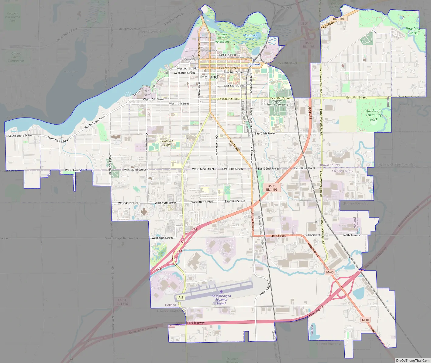
Holland Road Map
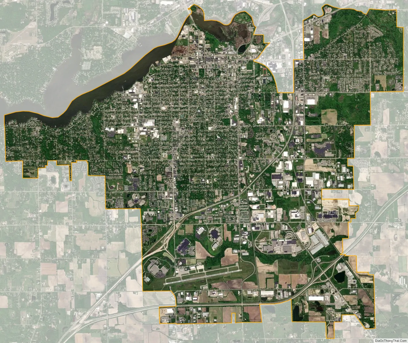
Holland city Satellite Map
Geography
According to the United States Census Bureau, the city has a total area of 17.35 sq mi (44.94 km), of which 16.59 sq mi (42.97 km) is land and 0.76 sq mi (1.97 km) is water.
Neighborhoods
- Holland Heights
Climate
See also
Map of Michigan State and its subdivision:- Alcona
- Alger
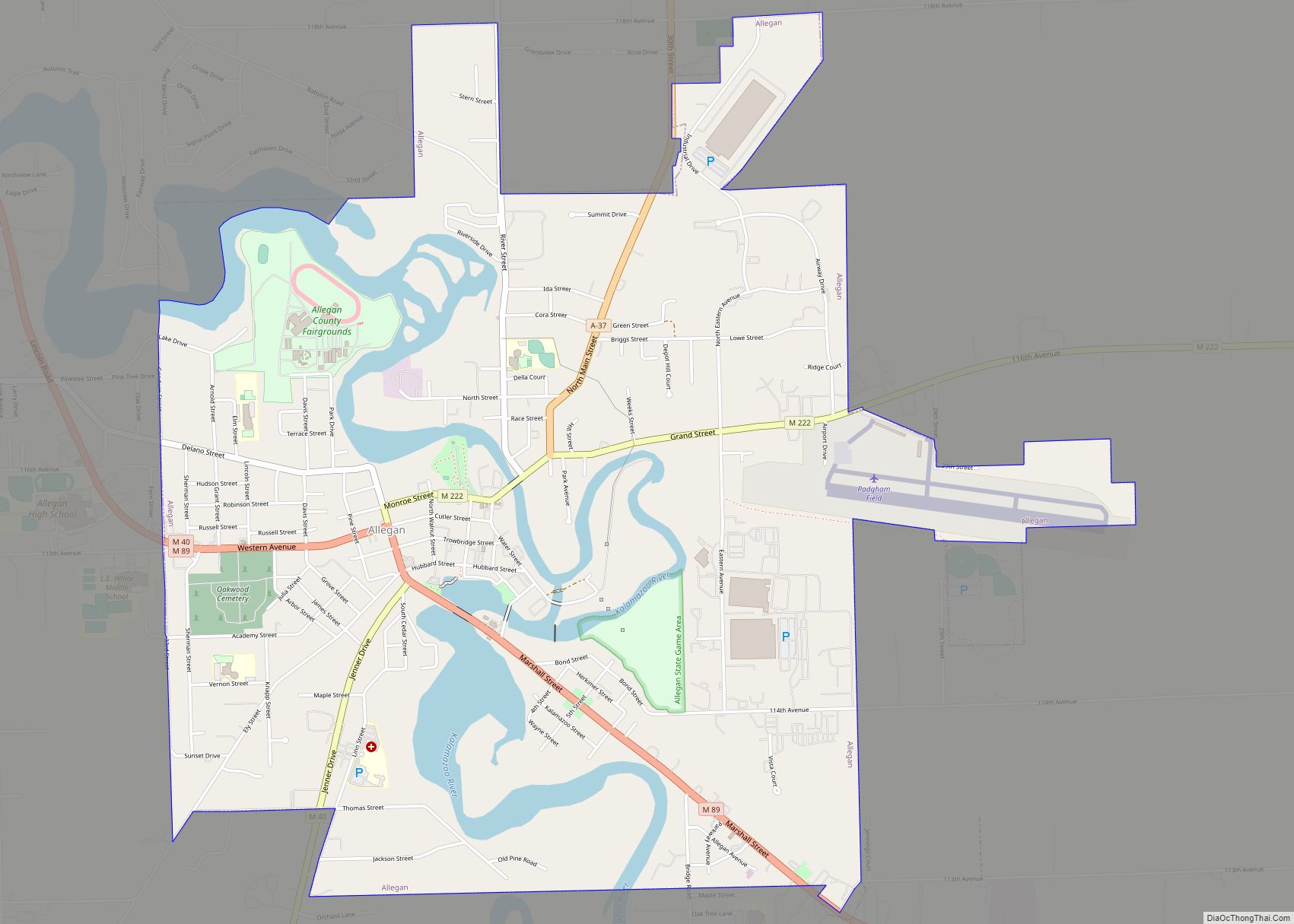
- Allegan
- Alpena
- Antrim
- Arenac
- Baraga
- Barry
- Bay
- Benzie
- Berrien
- Branch
- Calhoun
- Cass
- Charlevoix
- Cheboygan
- Chippewa
- Clare
- Clinton
- Crawford
- Delta
- Dickinson
- Eaton
- Emmet
- Genesee
- Gladwin
- Gogebic
- Grand Traverse
- Gratiot
- Hillsdale
- Houghton
- Huron
- Ingham
- Ionia
- Iosco
- Iron
- Isabella
- Jackson
- Kalamazoo
- Kalkaska
- Kent
- Keweenaw
- Lake
- Lake Hurron
- Lake Michigan
- Lake St. Clair
- Lake Superior
- Lapeer
- Leelanau
- Lenawee
- Livingston
- Luce
- Mackinac
- Macomb
- Manistee
- Marquette
- Mason
- Mecosta
- Menominee
- Midland
- Missaukee
- Monroe
- Montcalm
- Montmorency
- Muskegon
- Newaygo
- Oakland
- Oceana
- Ogemaw
- Ontonagon
- Osceola
- Oscoda
- Otsego
- Ottawa
- Presque Isle
- Roscommon
- Saginaw
- Saint Clair
- Saint Joseph
- Sanilac
- Schoolcraft
- Shiawassee
- Tuscola
- Van Buren
- Washtenaw
- Wayne
- Wexford
- Alabama
- Alaska
- Arizona
- Arkansas
- California
- Colorado
- Connecticut
- Delaware
- District of Columbia
- Florida
- Georgia
- Hawaii
- Idaho
- Illinois
- Indiana
- Iowa
- Kansas
- Kentucky
- Louisiana
- Maine
- Maryland
- Massachusetts
- Michigan
- Minnesota
- Mississippi
- Missouri
- Montana
- Nebraska
- Nevada
- New Hampshire
- New Jersey
- New Mexico
- New York
- North Carolina
- North Dakota
- Ohio
- Oklahoma
- Oregon
- Pennsylvania
- Rhode Island
- South Carolina
- South Dakota
- Tennessee
- Texas
- Utah
- Vermont
- Virginia
- Washington
- West Virginia
- Wisconsin
- Wyoming