Pewaukee is a village in Waukesha County, Wisconsin, United States. The population was 8,238 at the 2020 census. The village is nearly surrounded by the City of Pewaukee. The village was incorporated from what was formerly the Town of Pewaukee, and the remainder of the town later incorporated as a city.
| Name: | Pewaukee village |
|---|---|
| LSAD Code: | 47 |
| LSAD Description: | village (suffix) |
| State: | Wisconsin |
| County: | Waukesha County |
| Elevation: | 873 ft (266 m) |
| Total Area: | 4.58 sq mi (11.85 km²) |
| Land Area: | 4.16 sq mi (10.77 km²) |
| Water Area: | 0.42 sq mi (1.08 km²) |
| Total Population: | 8,238 |
| Population Density: | 1,950.71/sq mi (753.21/km²) |
| Area code: | 262 |
| FIPS code: | 5562250 |
| GNISfeature ID: | 1583915 |
| Website: | villageofpewaukeewi.cbo2.com |
Online Interactive Map
Click on ![]() to view map in "full screen" mode.
to view map in "full screen" mode.
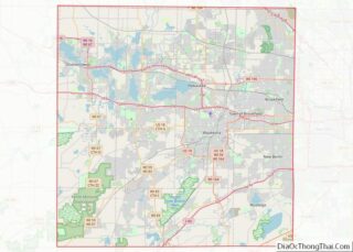
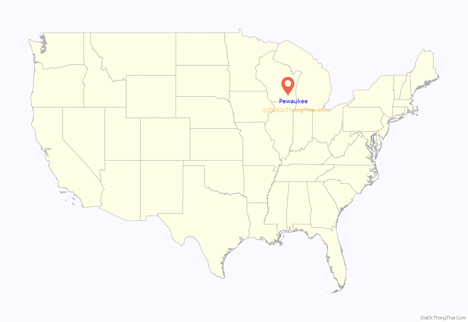
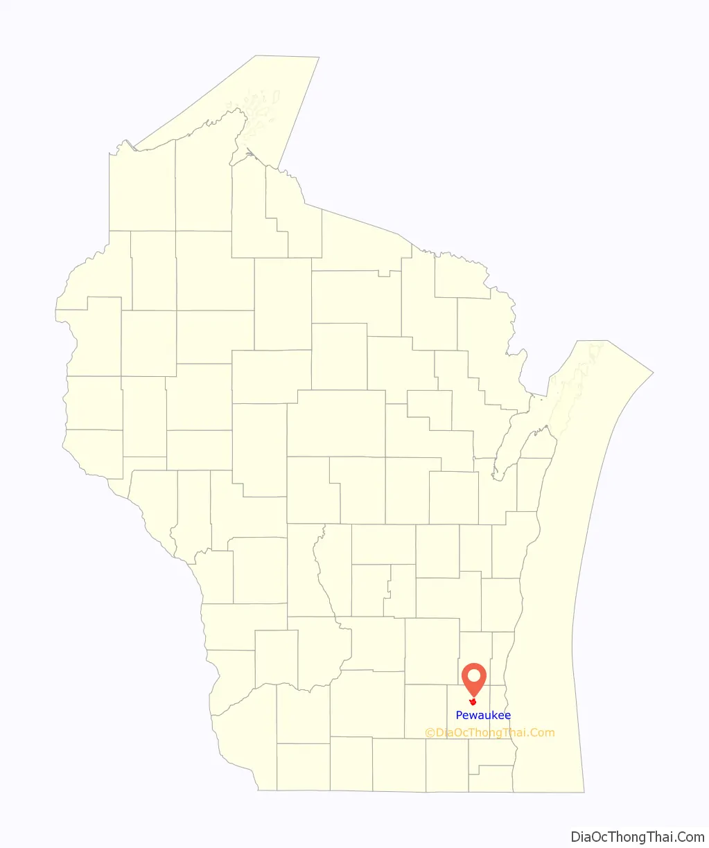
Pewaukee location map. Where is Pewaukee village?
History
The present-day village of Pewaukee was settled in about 1837 by the Deacon Asa Clark of Lunenburg, Vermont, when he erected a hotel, sawmill, and church in this location. Pewaukee became a town in the year 1840, and then a village later in 1876.
Pewaukee is constructed upon aki or (w)aukee, which means “land” or “location” in several Algonquian languages. The significance and outright etymology of the initial syllable of the name is uncertain. Sources in Ojibwe nibiwaki “watery (i.e., swampy) place”, Potawatomi pee-wauk-ee-wee-nick “the dusty water” or “lake of shells”, and Menominee pee-wau-nau-kee “place of flint” have been suggested, as well as rather less unclear attributed meanings such as “snail lake,” “flinty place,” and “clean land”.
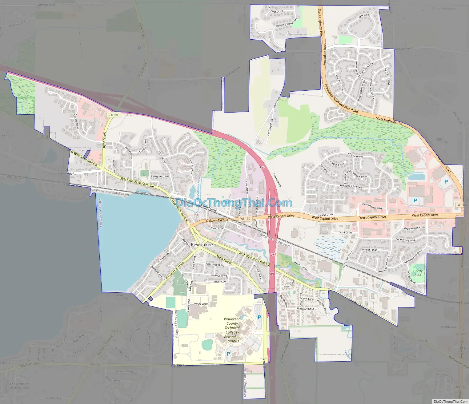
Pewaukee Road Map
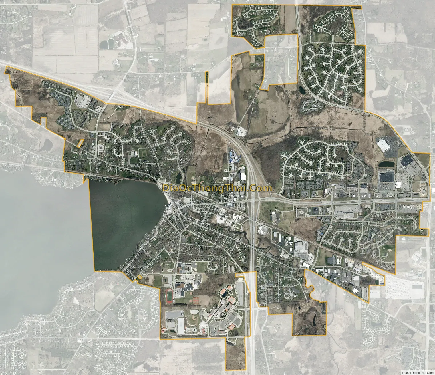
Pewaukee city Satellite Map
Geography
Pewaukee is located at 43°4′57″N 88°15′10″W / 43.08250°N 88.25278°W / 43.08250; -88.25278 (43.082659, -88.252842).
According to the United States Census Bureau, the village has a total area of 4.53 square miles (11.73 km), of which, 4.13 square miles (10.70 km) of it is land and 0.40 square miles (1.04 km) is water.
See also
Map of Wisconsin State and its subdivision:- Adams
- Ashland
- Barron
- Bayfield
- Brown
- Buffalo
- Burnett
- Calumet
- Chippewa
- Clark
- Columbia
- Crawford
- Dane
- Dodge
- Door
- Douglas
- Dunn
- Eau Claire
- Florence
- Fond du Lac
- Forest
- Grant
- Green
- Green Lake
- Iowa
- Iron
- Jackson
- Jefferson
- Juneau
- Kenosha
- Kewaunee
- La Crosse
- Lafayette
- Lake Michigan
- Lake Superior
- Langlade
- Lincoln
- Manitowoc
- Marathon
- Marinette
- Marquette
- Menominee
- Milwaukee
- Monroe
- Oconto
- Oneida
- Outagamie
- Ozaukee
- Pepin
- Pierce
- Polk
- Portage
- Price
- Racine
- Richland
- Rock
- Rusk
- Saint Croix
- Sauk
- Sawyer
- Shawano
- Sheboygan
- Taylor
- Trempealeau
- Vernon
- Vilas
- Walworth
- Washburn
- Washington
- Waukesha
- Waupaca
- Waushara
- Winnebago
- Wood
- Alabama
- Alaska
- Arizona
- Arkansas
- California
- Colorado
- Connecticut
- Delaware
- District of Columbia
- Florida
- Georgia
- Hawaii
- Idaho
- Illinois
- Indiana
- Iowa
- Kansas
- Kentucky
- Louisiana
- Maine
- Maryland
- Massachusetts
- Michigan
- Minnesota
- Mississippi
- Missouri
- Montana
- Nebraska
- Nevada
- New Hampshire
- New Jersey
- New Mexico
- New York
- North Carolina
- North Dakota
- Ohio
- Oklahoma
- Oregon
- Pennsylvania
- Rhode Island
- South Carolina
- South Dakota
- Tennessee
- Texas
- Utah
- Vermont
- Virginia
- Washington
- West Virginia
- Wisconsin
- Wyoming