Plymouth is a city in Sheboygan County, Wisconsin, along the Mullet River. It is included in the Sheboygan, Wisconsin Metropolitan Statistical Area. The city is located in the Town of Plymouth, but is politically independent. Plymouth is known as “Hub City” for its former role as a center of wooden wheelwrighting. The population was 8,932 at the 2020 census. Mayor Don Pohlman was last re-elected in April 2018.
| Name: | Plymouth city |
|---|---|
| LSAD Code: | 25 |
| LSAD Description: | city (suffix) |
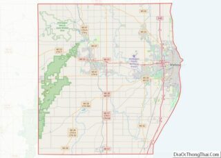
| State: | Wisconsin |
| County: | Sheboygan County |
| Elevation: | 843 ft (257 m) |
| Total Area: | 5.43 sq mi (14.06 km²) |
| Land Area: | 5.35 sq mi (13.85 km²) |
| Water Area: | 0.08 sq mi (0.20 km²) |
| Total Population: | 8,932 |
| Population Density: | 1,600/sq mi (640/km²) |
| Area code: | 920 |
| FIPS code: | 5563700 |
| GNISfeature ID: | 1571709 |
| Website: | www.plymouthgov.com |
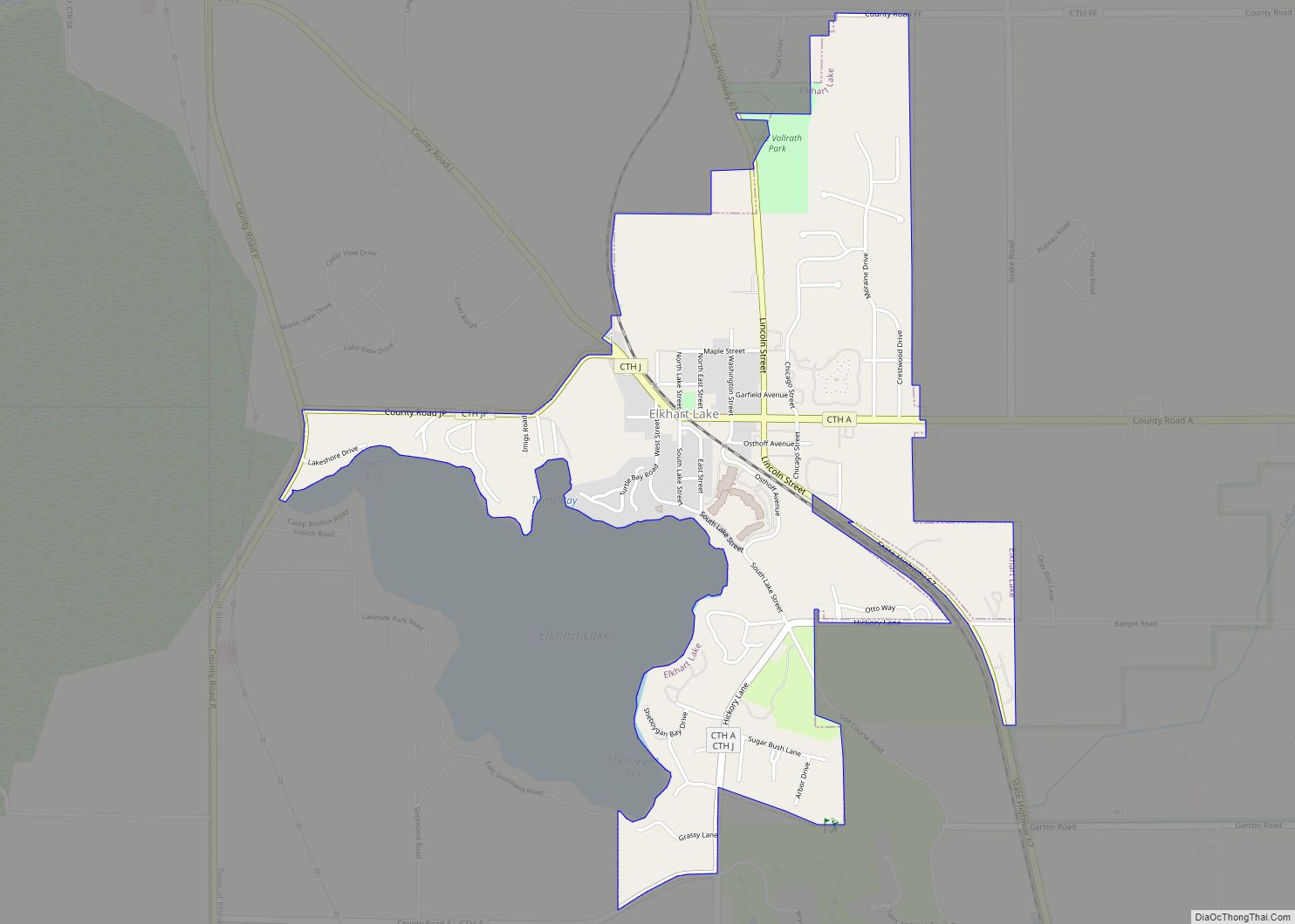
Online Interactive Map
Click on ![]() to view map in "full screen" mode.
to view map in "full screen" mode.
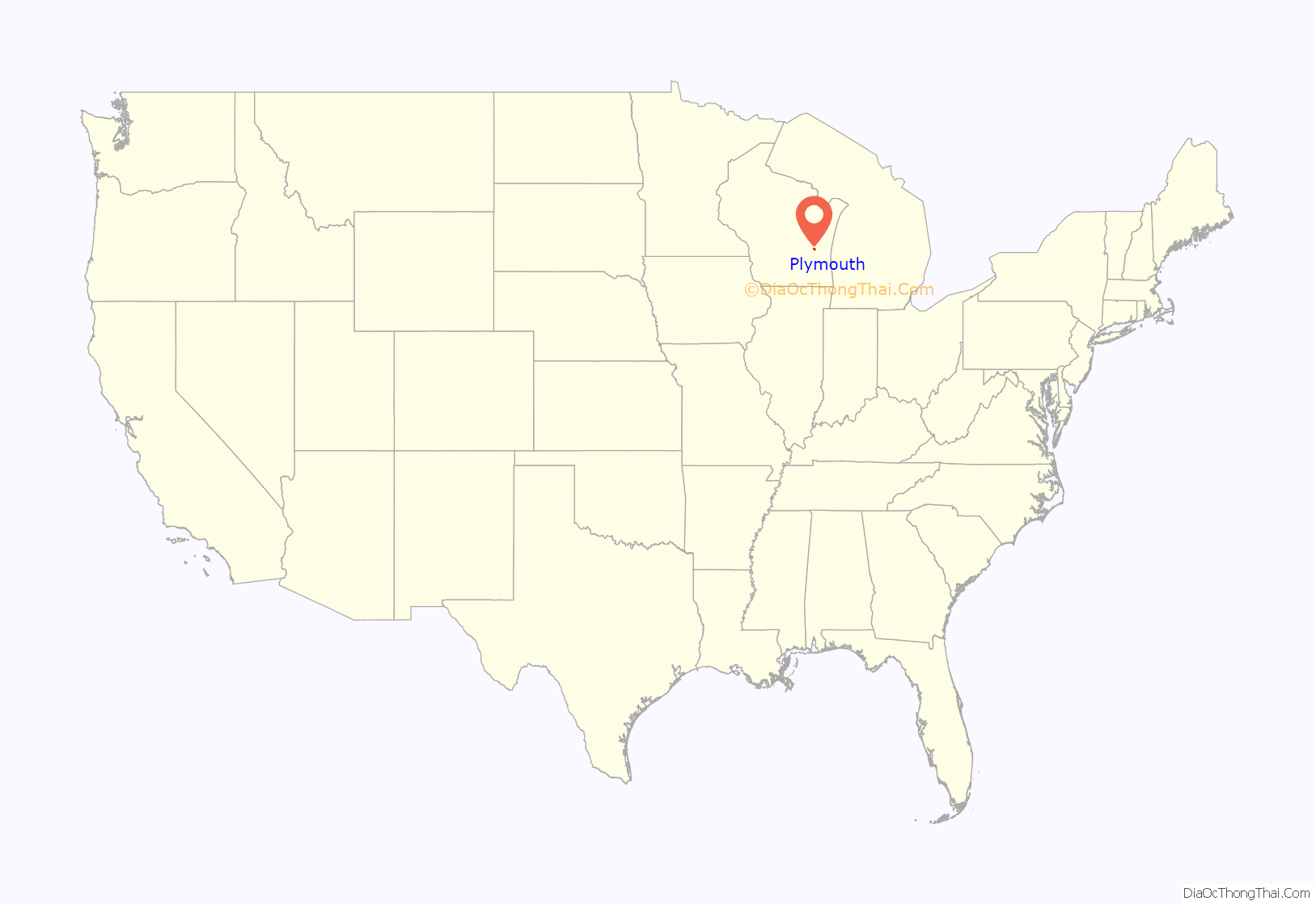
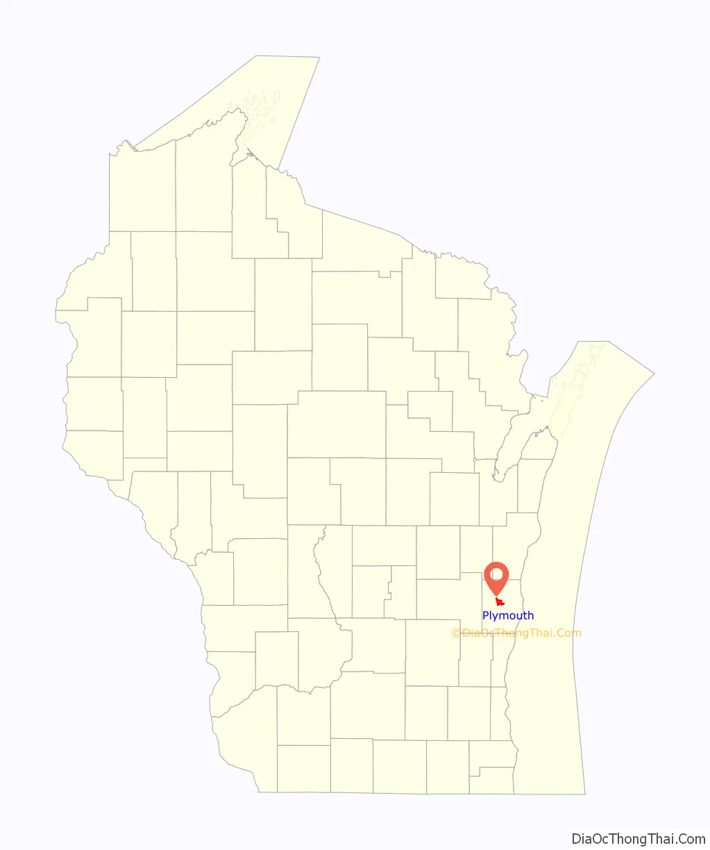
Plymouth location map. Where is Plymouth city?
History
Plymouth was surveyed in 1835 by United States engineers, one of whom was named Mullet, and the Mullet river was subsequently named after him. The first land sold to a private party was sold to an Englishman named John Law who had emigrated from London. It was sold to Law on August 13, 1836. The next sale was to another Englishman, also from London, named Thomas Margrave. Settlers continued trickling in and the town was organized on April 3, 1849. In the 1840s a group of migrants arrived from Tioga County, Pennsylvania. Their ancestors had moved to that area from New England shortly after the American Revolution. The Thorpe family arrived from Hartford, Connecticut. They were of old New England ancestry. These migrants being the original pool of settlers in Plymouth gave the region cultural continuity with New England. The town was named Plymouth, after Plymouth, Massachusetts, where the Pilgrims had landed in 1620.
Originally known by early Native Americans as Quit Qui Oc, or Crooked River, Plymouth was settled in 1845 by Isaac Thorp and incorporated in 1877. The city is often called “Hub City” because of its central location within Sheboygan County, but the nickname “Hub City” began in the 1860s when the Schwartz brothers had a wagon shop where they made wagons, hubs and spokes.
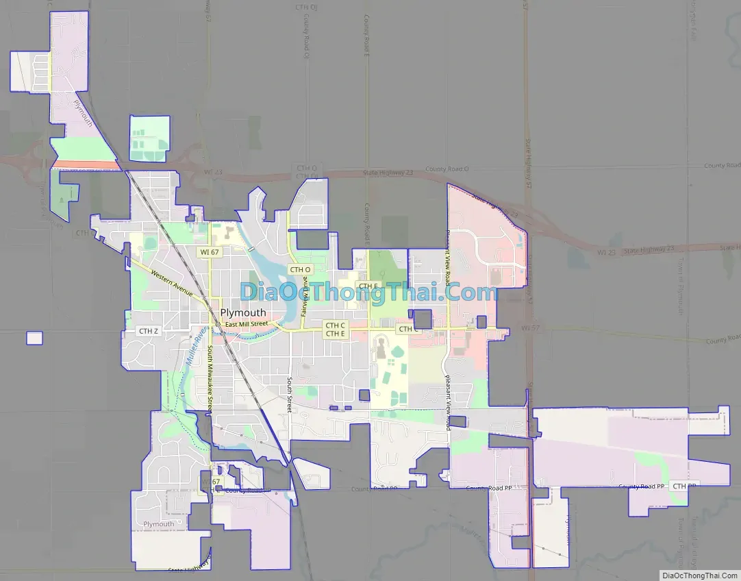
Plymouth Road Map
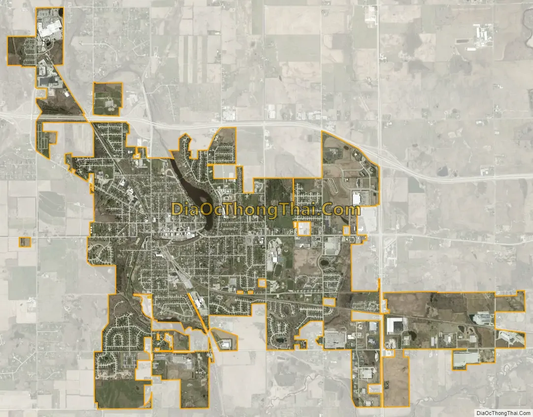
Plymouth city Satellite Map
Geography
Plymouth is located at 43°44′57″N 87°58′36″W / 43.74917°N 87.97667°W / 43.74917; -87.97667 (43.749277, -87.976799).
According to the United States Census Bureau, the city has a total area of 5.34 square miles (13.83 km), of which, 5.26 square miles (13.62 km) is land and 0.08 square miles (0.21 km) is water.
See also
Map of Wisconsin State and its subdivision:- Adams
- Ashland
- Barron
- Bayfield
- Brown
- Buffalo
- Burnett
- Calumet
- Chippewa
- Clark
- Columbia
- Crawford
- Dane
- Dodge
- Door
- Douglas
- Dunn
- Eau Claire
- Florence
- Fond du Lac
- Forest
- Grant
- Green
- Green Lake
- Iowa
- Iron
- Jackson
- Jefferson
- Juneau
- Kenosha
- Kewaunee
- La Crosse
- Lafayette
- Lake Michigan
- Lake Superior
- Langlade
- Lincoln
- Manitowoc
- Marathon
- Marinette
- Marquette
- Menominee
- Milwaukee
- Monroe
- Oconto
- Oneida
- Outagamie
- Ozaukee
- Pepin
- Pierce
- Polk
- Portage
- Price
- Racine
- Richland
- Rock
- Rusk
- Saint Croix
- Sauk
- Sawyer
- Shawano
- Sheboygan
- Taylor
- Trempealeau
- Vernon
- Vilas
- Walworth
- Washburn
- Washington
- Waukesha
- Waupaca
- Waushara
- Winnebago
- Wood
- Alabama
- Alaska
- Arizona
- Arkansas
- California
- Colorado
- Connecticut
- Delaware
- District of Columbia
- Florida
- Georgia
- Hawaii
- Idaho
- Illinois
- Indiana
- Iowa
- Kansas
- Kentucky
- Louisiana
- Maine
- Maryland
- Massachusetts
- Michigan
- Minnesota
- Mississippi
- Missouri
- Montana
- Nebraska
- Nevada
- New Hampshire
- New Jersey
- New Mexico
- New York
- North Carolina
- North Dakota
- Ohio
- Oklahoma
- Oregon
- Pennsylvania
- Rhode Island
- South Carolina
- South Dakota
- Tennessee
- Texas
- Utah
- Vermont
- Virginia
- Washington
- West Virginia
- Wisconsin
- Wyoming