Schofield is a city in Marathon County, Wisconsin, United States. It is part of the Wausau, Wisconsin Metropolitan Statistical Area. The population was 2,157 at the 2020 census. The city was named for William Scholfield, who came to the area in the 1851 to open a sawmill. The city has since dropped the “L” from its name.
| Name: | Schofield city |
|---|---|
| LSAD Code: | 25 |
| LSAD Description: | city (suffix) |
| State: | Wisconsin |
| County: | Marathon County |
| Elevation: | 1,201 ft (366 m) |
| Total Area: | 2.99 sq mi (7.74 km²) |
| Land Area: | 2.12 sq mi (5.48 km²) |
| Water Area: | 0.87 sq mi (2.26 km²) |
| Total Population: | 2,157 |
| Population Density: | 1,024.11/sq mi (395.35/km²) |
| Area code: | 715 & 534 |
| FIPS code: | 5572150 |
| GNISfeature ID: | 1573796 |
| Website: | cityofschofield.org |
Online Interactive Map
Click on ![]() to view map in "full screen" mode.
to view map in "full screen" mode.
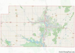
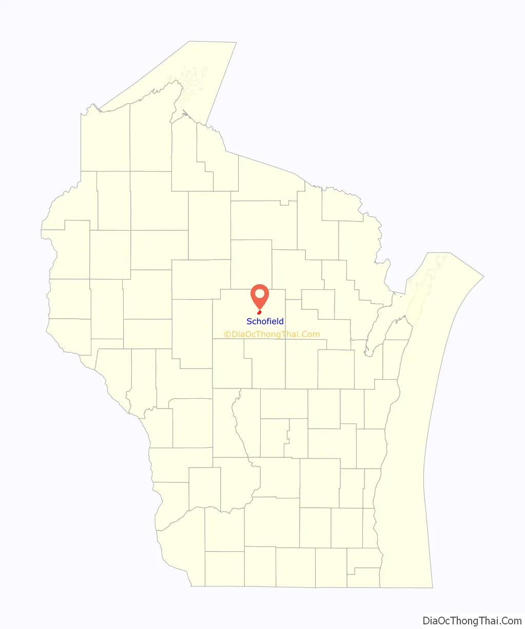
Schofield location map. Where is Schofield city?

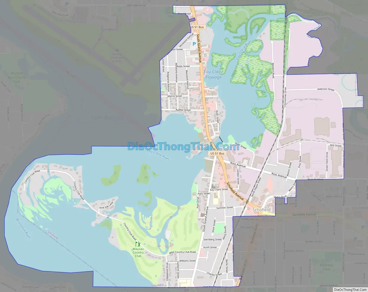
Schofield Road Map
Schofield city Satellite Map

Geography
Schofield is located along the eastern shore of Lake Wausau, an impoundment of the Wisconsin River. Schofield also contains the Eau Claire Flowage and Eau Claire River (not to be confused with the Eau Claire River of Eau Claire, WI), which flows into Lake Wausau at Schofield. Schofield is directly south of Wausau, and is generally separated from the city by the Wausau Downtown Airport. An inner suburb of Wausau, Schofield is bordered by Rothschild, Weston, and the Town of Weston. Lake Wausau and Wausau serve as its western and northern borders. Schofield is located at 44°54′55″N 89°36′43″W / 44.91528°N 89.61194°W / 44.91528; -89.61194 (44.915201, -89.612004).
According to the United States Census Bureau, the city has a total area of 2.83 square miles (7.33 km), of which, 1.76 square miles (4.56 km) is land and 1.07 square miles (2.77 km) is water.
See also
Map of Wisconsin State and its subdivision:- Adams
- Ashland
- Barron
- Bayfield
- Brown
- Buffalo
- Burnett
- Calumet
- Chippewa
- Clark
- Columbia
- Crawford
- Dane
- Dodge
- Door
- Douglas
- Dunn
- Eau Claire
- Florence
- Fond du Lac
- Forest
- Grant
- Green
- Green Lake
- Iowa
- Iron
- Jackson
- Jefferson
- Juneau
- Kenosha
- Kewaunee
- La Crosse
- Lafayette
- Lake Michigan
- Lake Superior
- Langlade
- Lincoln
- Manitowoc
- Marathon
- Marinette
- Marquette
- Menominee
- Milwaukee
- Monroe
- Oconto
- Oneida
- Outagamie
- Ozaukee
- Pepin
- Pierce
- Polk
- Portage
- Price
- Racine
- Richland
- Rock
- Rusk
- Saint Croix
- Sauk
- Sawyer
- Shawano
- Sheboygan
- Taylor
- Trempealeau
- Vernon
- Vilas
- Walworth
- Washburn
- Washington
- Waukesha
- Waupaca
- Waushara
- Winnebago
- Wood
- Alabama
- Alaska
- Arizona
- Arkansas
- California
- Colorado
- Connecticut
- Delaware
- District of Columbia
- Florida
- Georgia
- Hawaii
- Idaho
- Illinois
- Indiana
- Iowa
- Kansas
- Kentucky
- Louisiana
- Maine
- Maryland
- Massachusetts
- Michigan
- Minnesota
- Mississippi
- Missouri
- Montana
- Nebraska
- Nevada
- New Hampshire
- New Jersey
- New Mexico
- New York
- North Carolina
- North Dakota
- Ohio
- Oklahoma
- Oregon
- Pennsylvania
- Rhode Island
- South Carolina
- South Dakota
- Tennessee
- Texas
- Utah
- Vermont
- Virginia
- Washington
- West Virginia
- Wisconsin
- Wyoming