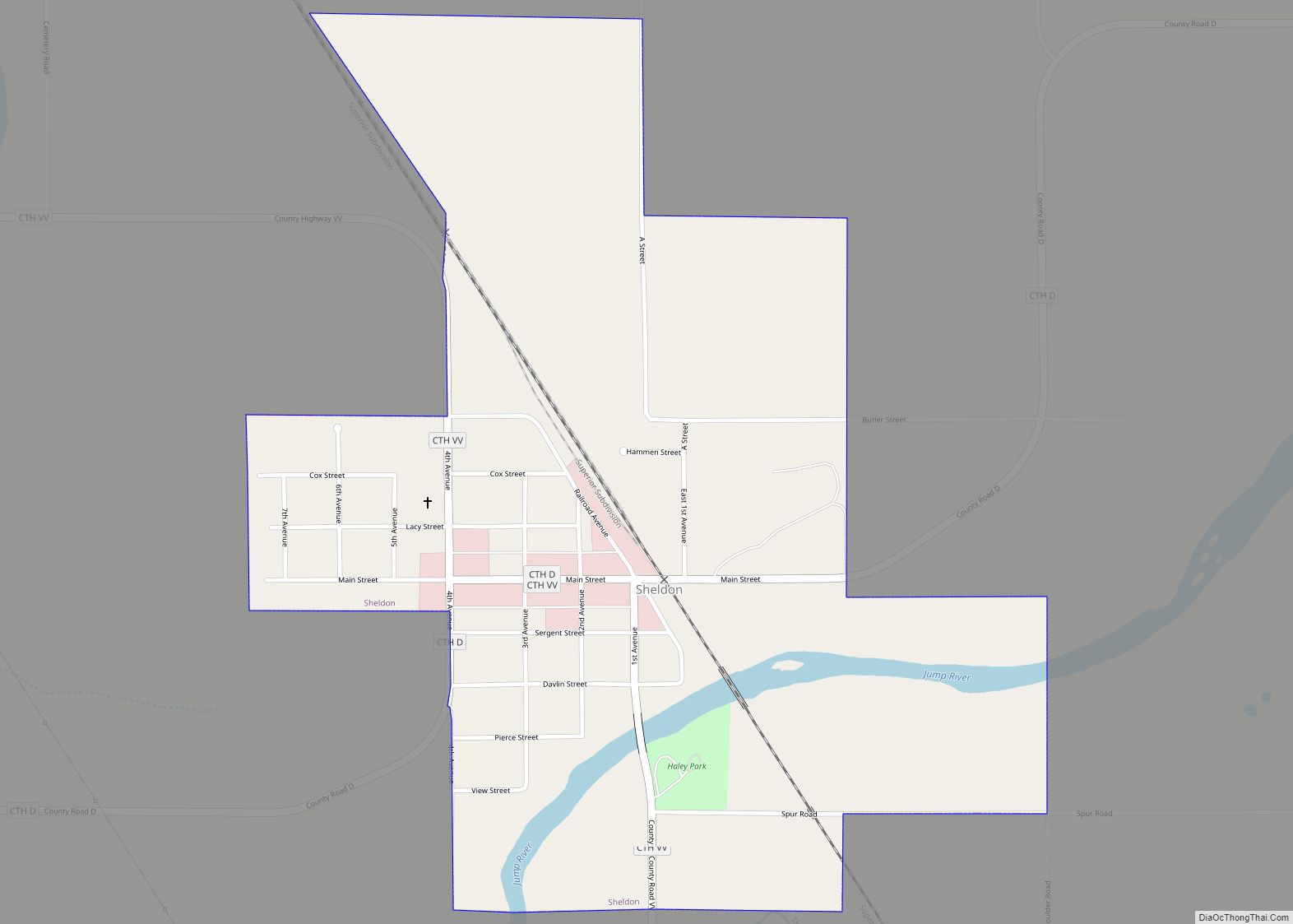
Sheldon is a village in Rusk County, Wisconsin, United States. The population was 237 at the 2010 census.
| Name: | Sheldon village |
|---|---|
| LSAD Code: | 47 |
| LSAD Description: | village (suffix) |
| State: | Wisconsin |
| County: | Rusk County |
| Elevation: | 1,122 ft (342 m) |
| Total Area: | 0.66 sq mi (1.72 km²) |
| Land Area: | 0.66 sq mi (1.72 km²) |
| Water Area: | 0.00 sq mi (0.00 km²) |
| Total Population: | 237 |
| Population Density: | 323.26/sq mi (124.77/km²) |
| Area code: | 715 & 534 |
| FIPS code: | 5573175 |
| GNISfeature ID: | 1574003 |
Online Interactive Map
Click on ![]() to view map in "full screen" mode.
to view map in "full screen" mode.
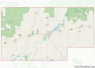
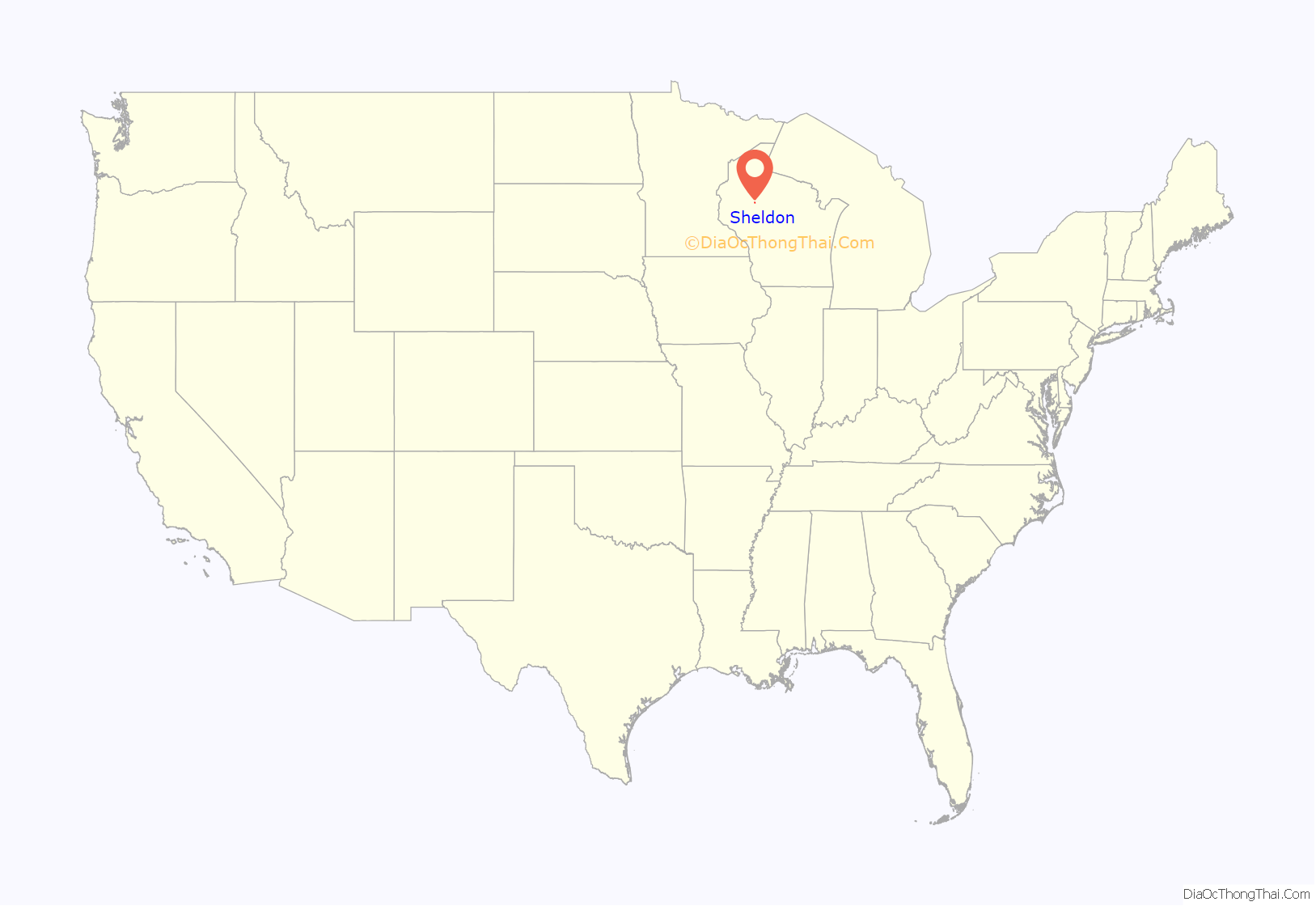
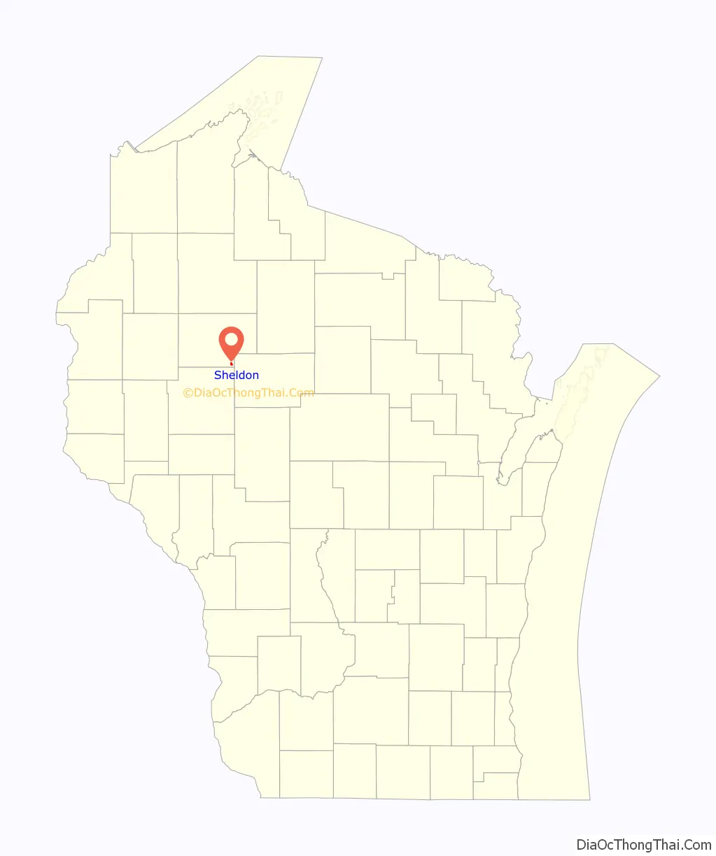
Sheldon location map. Where is Sheldon village?
History
Around 1885 a few pioneer families named Marshal, Sergeant and Carman settled in the brush a mile west of Sheldon’s current location, in a hamlet they called “Fern.” Anton Corbine carried mail in to them from Flambeau by foot or by horse. Other settlers followed. Woodlawn Cemetery was started in 1903 with the burial of Mrs. Alice Elmendorf (aged 65 years). A little log school stood just south of it, and a Rev. Willam would sometimes follow the trails up from Huron to lead worship in the school. In 1905 Max Dietze from Hawkins built a general store east of the cemetery, supplied by driving a wagon with horses across the Jump and along logging roads to Holcombe or Chippewa. In 1906 D. L. Pickering built a sawmill on the bank of Little Jump River.
Sheldon itself began to take form in 1906 when the Wisconsin Central Railroad built its line a mile east of Fern, over the Jump and through the woods on its way to Superior. (That rail line still exists as the modern Canadian National line.) Just north of the river, the Wisconsin Central built a depot, a section house, and a water tank for its trains, and named the station “Sheldon,” after one of its officials. That same year Ed Lacy built a general store across from the depot, later known as Brown’s store, then Mau’s. In 1907 Bill Huggins moved his saloon from Fern into Sheldon. Max Dietz also moved his general store from near the cemetery in to town. Eventually all businesses and schools moved, until now all that remains out by Fern is farms, homes, and the cemetery.
In 1908 Sheldon was platted, and that year a land office opened. By 1910 a new 8-grade school was built in town. The town had a barber shop and two saloons – one with a dance hall upstairs. It had two hotels: the Hotel Walter and the Sheldon House. They mainly housed lumber workers. Logging was the big business then, with the John S. Owen Company logging north of town. In town, several mills sawed boards, including the Jump River Lumber Company’s mill, which employed more than forty men until it burned in 1912. These mills produced boards mostly for local use, but Pickering’s lath mill shipped out its product on the railroad. A train stopped once a day, heading north one day and south the next, and carrying passengers of course, since the roads were terrible. Herb Duel, Sr. installed the first telephones in 1910, with a switchboard in the Hotel Walter. Lacy brought the first car, a 1909 Ford, to town in 1910. In 1917 the village of Sheldon was incorporated, with population 123.
By 1923 Sheldon’s industry included the lath mill, a creamery supplied by local farmers, and a factory that made hoops for butter tubs from local ash wood. The town had a bank, a predecessor of the Dairyland State Bank. And sidewalks were built along Main Street. Electricity came to town in 1930. In 1938 the WPA helped build sidewalks alongside streets.
The town had its setbacks. Logging gradually waned, but dairy grew. Prohibition in 1915 shut down the saloons for a while. In 1920 a pool hall and other buildings burned. In 1923 the school burned, but classes shifted to Tupper’s Hotel, the bank, the Lutheran church, and a lumber company warehouse, and a new school was ready in 1925. The Sheldon Woman’s Club established a library in 1933, which burned in the early 1940s, but was reestablished. In the Labor Day flood of 1941 the Jump River wrecked the road bridge on the south side of town, damaged the railroad bridge, and destroyed buildings. The bridges were rebuilt, but not all buildings. Pickering’s lath mill burned in 1947, but was reconstructed for sawing and planing.
By 1959 the Soo Line was stopping twice a day, providing passenger, freight and mail service, and Sheldon’s population was 300. The town had two or three grocery stores, a few garages, the creamery, two feed mills, some implement dealers, and a lumber yard, but no sawmill. Sheldon had made the transition from lumber-processing to providing services for the surrounding dairy farms.
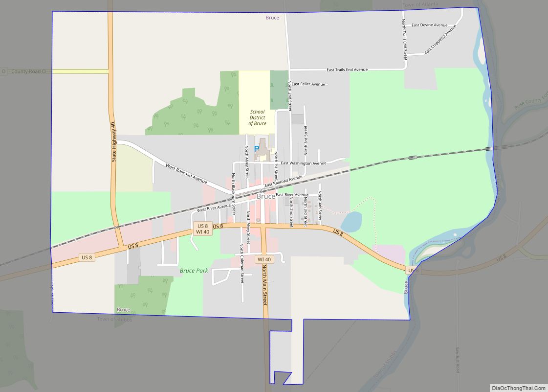
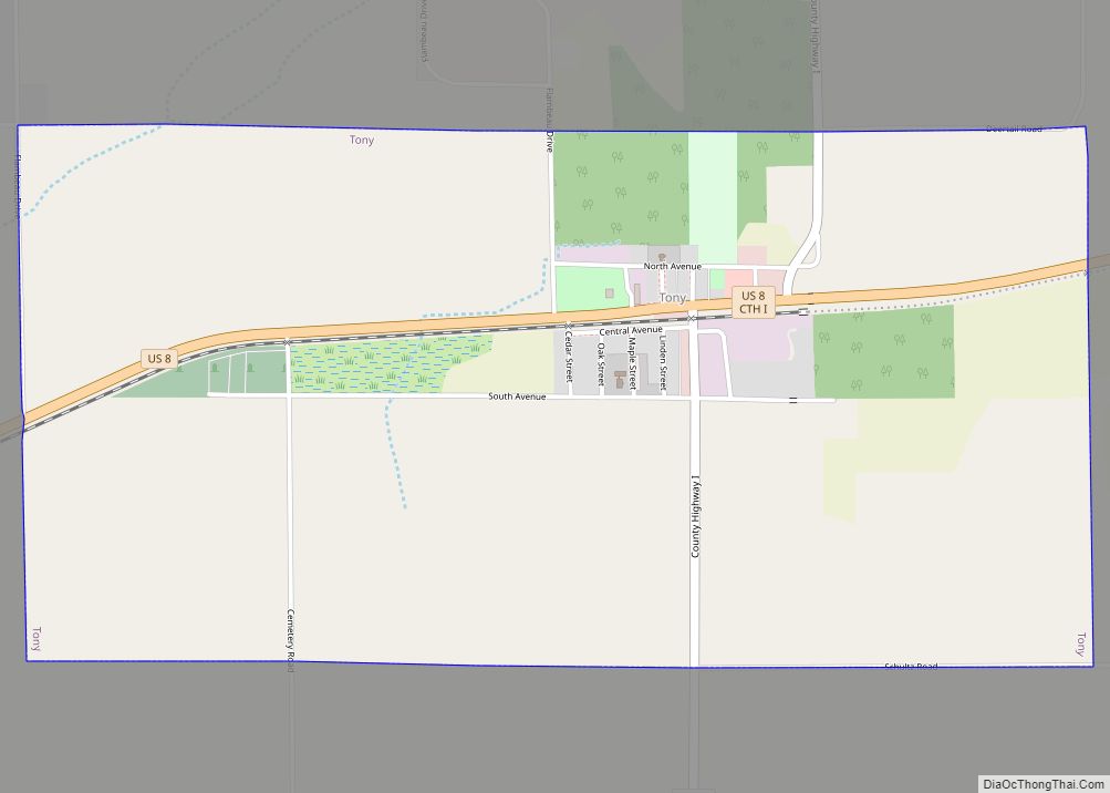
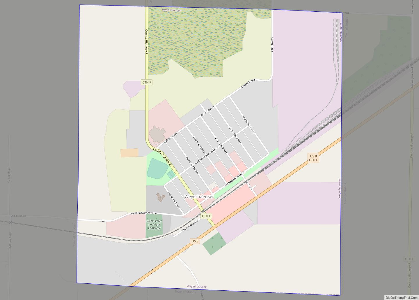
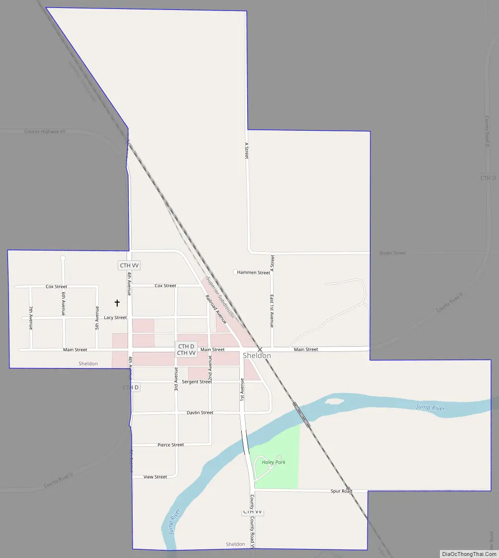
Sheldon Road Map
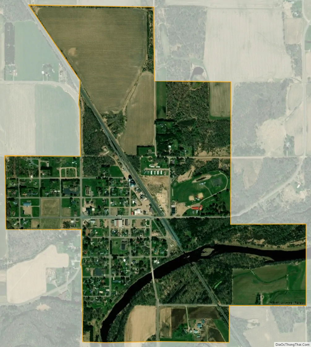
Sheldon city Satellite Map
Geography
Sheldon is located at 45°18′37″N 90°57′32″W / 45.31028°N 90.95889°W / 45.31028; -90.95889 (45.310258, -90.958820).
According to the United States Census Bureau, the village has a total area of 0.66 square miles (1.71 km), all land. The village is located on the north bank of the Jump River.
See also
Map of Wisconsin State and its subdivision:- Adams
- Ashland
- Barron
- Bayfield
- Brown
- Buffalo
- Burnett
- Calumet
- Chippewa
- Clark
- Columbia
- Crawford
- Dane
- Dodge
- Door
- Douglas
- Dunn
- Eau Claire
- Florence
- Fond du Lac
- Forest
- Grant
- Green
- Green Lake
- Iowa
- Iron
- Jackson
- Jefferson
- Juneau
- Kenosha
- Kewaunee
- La Crosse
- Lafayette
- Lake Michigan
- Lake Superior
- Langlade
- Lincoln
- Manitowoc
- Marathon
- Marinette
- Marquette
- Menominee
- Milwaukee
- Monroe
- Oconto
- Oneida
- Outagamie
- Ozaukee
- Pepin
- Pierce
- Polk
- Portage
- Price
- Racine
- Richland
- Rock
- Rusk
- Saint Croix
- Sauk
- Sawyer
- Shawano
- Sheboygan
- Taylor
- Trempealeau
- Vernon
- Vilas
- Walworth
- Washburn
- Washington
- Waukesha
- Waupaca
- Waushara
- Winnebago
- Wood
- Alabama
- Alaska
- Arizona
- Arkansas
- California
- Colorado
- Connecticut
- Delaware
- District of Columbia
- Florida
- Georgia
- Hawaii
- Idaho
- Illinois
- Indiana
- Iowa
- Kansas
- Kentucky
- Louisiana
- Maine
- Maryland
- Massachusetts
- Michigan
- Minnesota
- Mississippi
- Missouri
- Montana
- Nebraska
- Nevada
- New Hampshire
- New Jersey
- New Mexico
- New York
- North Carolina
- North Dakota
- Ohio
- Oklahoma
- Oregon
- Pennsylvania
- Rhode Island
- South Carolina
- South Dakota
- Tennessee
- Texas
- Utah
- Vermont
- Virginia
- Washington
- West Virginia
- Wisconsin
- Wyoming