Wisconsin Dells is a city in Wisconsin, straddling four counties: Adams, Columbia, Juneau, and Sauk. A popular Midwestern tourist destination, the city forms an area known as “The Dells” with the nearby village of Lake Delton. The Dells is home to several water parks and tourist attractions. The city takes its name from the Dells of the Wisconsin River, a scenic, glacial-formed gorge that features sandstone formations along the banks of the Wisconsin River. The Columbia County portion of Wisconsin Dells is located in the Madison Metropolitan Statistical area, the Sauk County portion is a part of the Baraboo Micropolitan Statistical area, both of which are a part of the larger Madison CSA.
It is about 42 miles (68 km) northwest of Madison, Wisconsin, the state’s capital city. Wisconsin Dells has a population of 2,942 people as of the 2020 census.
| Name: | Wisconsin Dells city |
|---|---|
| LSAD Code: | 25 |
| LSAD Description: | city (suffix) |
| State: | Wisconsin |
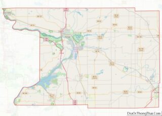
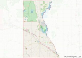
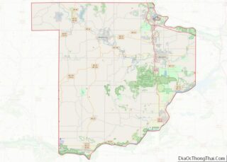
| County: | Adams County, Columbia County, Juneau County, Sauk County |
| Founded: | 1857 |
| Elevation: | 909 ft (277 m) |
| Total Area: | 8.18 sq mi (21.19 km²) |
| Land Area: | 7.84 sq mi (20.30 km²) |
| Water Area: | 0.34 sq mi (0.89 km²) |
| Total Population: | 2,942 |
| Population Density: | 375.3/sq mi (144.9/km²) |
| ZIP code: | 53965 |
| Area code: | 608 |
| FIPS code: | 5588150 |
| GNISfeature ID: | 1576900 |
| Website: | www.citywd.org |
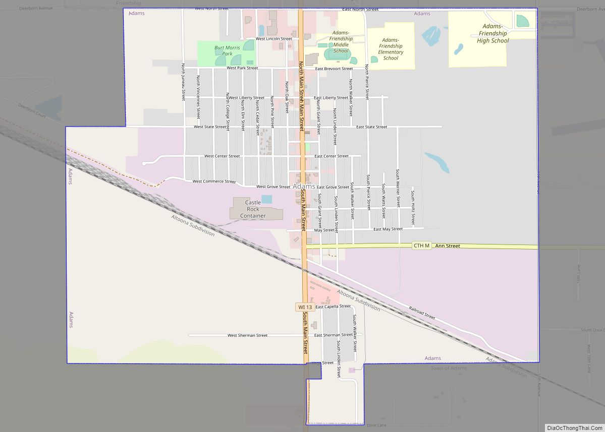
Online Interactive Map
Click on ![]() to view map in "full screen" mode.
to view map in "full screen" mode.
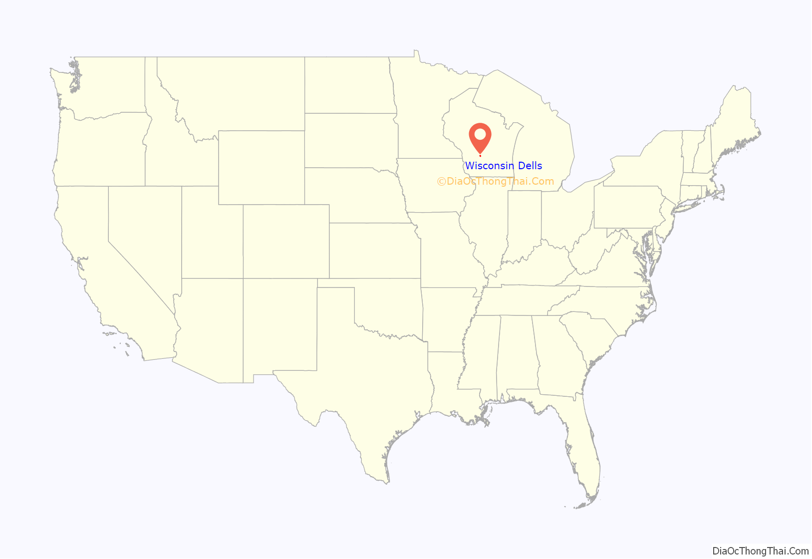
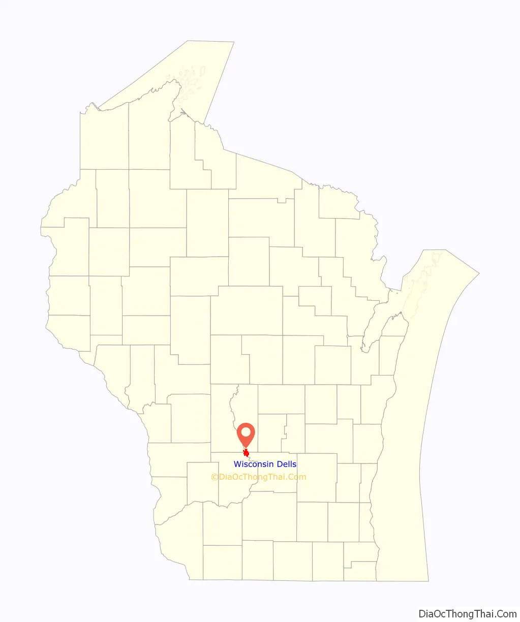
Wisconsin Dells location map. Where is Wisconsin Dells city?
History
The natural formation of the Dells was named by Early French explorers as dalles, a rapids or narrows on a river in voyageur French.
Wisconsin Dells is located on ancestral Ho-Chunk and Menominee land. The Ho-Chunk name for Wisconsin Dells is Nįįš hakiisųc, meaning “rocks close together”. According to Indian agent Joseph Montfort Street, the Sauk leader Black Hawk sought refuge with Ho-Chunks near the Dells of the Wisconsin River at the end of the Black Hawk War of 1832 before surrendering to the United States, but more recent research has argued that this was a mistranslation of the true location. The U.S. acquired the land in treaties with the Ho-Chunk nation in 1837 and with the Menominee in 1848, but Ho-Chunk people who resisted the U.S. policy of Indian removal continued to return to the area and eventually acquired small homesteads.
The city of Wisconsin Dells was founded in 1856 by the Wisconsin Hydraulic Company, a dam-building and real estate investment business. The town was originally named Kilbourn City for Byron Kilbourn, the president of the La Crosse & Milwaukee Railroad Company, which was then preparing to build a railroad across the Wisconsin River to connect Milwaukee and La Crosse, Wisconsin. The railroad’s route caused great local controversy. Boosters and speculators had anticipated the river crossing two miles downriver, where they had established the town of Newport, Wisconsin, and attracted around 1,500 residents by 1855. When the railroad instead completed a slightly more northern route in 1857, Newport rapidly turned into a ghost town as its residents relocated to the site of the railroad bridge, bringing many buildings and even a church from the earlier town to reassemble in Kilbourn City.
In 1859, lumbermen destroyed the Wisconsin Hydraulic Company’s new dam at Kilbourn City because it blocked the flow of timber rafts down the river. This led the company’s main creditor, Byron Kilbourn, to foreclose on its property and take ownership of most of the city’s real estate.
Tourism
Kilbourn City quickly became a popular travel destination in the Midwest due to the scenery of the Dells of the Wisconsin River and the ready railroad access. In 1856, entrepreneur Leroy Gates began taking tourists on boat tours of the Wisconsin Dells and promoting the town to railroad travelers. These tours were given using wooden rowboats until 1873 when two excursion steamers, the Modocawanda and the Dell Queen launched. Gates also established a photography studio in the city, which he sold to photographer H. H. Bennett in 1865. Over the following decades, Bennett took many photos of the sandstone formations in the dells, including stereoscopic views, as well as portraits of local Ho-Chunk people in Indian costume. Prints of Bennett’s photographs were distributed across the United States and played a large role in promoting Kilbourn City as an exotic destination for sightseers. The H. H. Bennett Studio is now a historic site operated by the Wisconsin Historical Society.
In 1909, the Kilbourn Dam was completed across the Wisconsin River to generate hydroelectricity, over the protests of people such as H. H. Bennett, separating the Dells into the Upper and Lower Dells. It is now owned by Alliant Energy.
In 1928 Mr. Clinton Berry established Berry’s Dells airport. It occupied sixty acres and was designated on government maps as beacon No. 19. Berry built the airport to carry visitors to the Dells from the surrounding metropolitan areas.
Kilbourn City shortened its name to Kilbourn in 1895 and then changed its name to Wisconsin Dells in 1931, identifying itself with the famous natural landscape of the Dells of the Wisconsin River.
In 1952, a new traveling performance from Chicago called “Tommy Bartlett’s Thrill Show” came to Lake Delton on its second stop. Following the show’s huge success in the city, its owner, Tommy Bartlett, chose to keep the performance permanently in Wisconsin Dells. To promote the show, Bartlett gave away bumper stickers advertising his thrill show and the city, effectively spreading word about the area across the nation. That tourist attraction closed permanently in 2020.
Soon more attractions followed to serve the ever-increasing tourists, along with many hotels, shops, and restaurants. Today, a large number of water parks are central to the local economy.
Lake Delton, Wisconsin Dells’s sister city to the south, gradually became popular as the Dells attractions spread out. The Wonder Spot was founded in Lake Delton in 1952, and remained open until 2006.
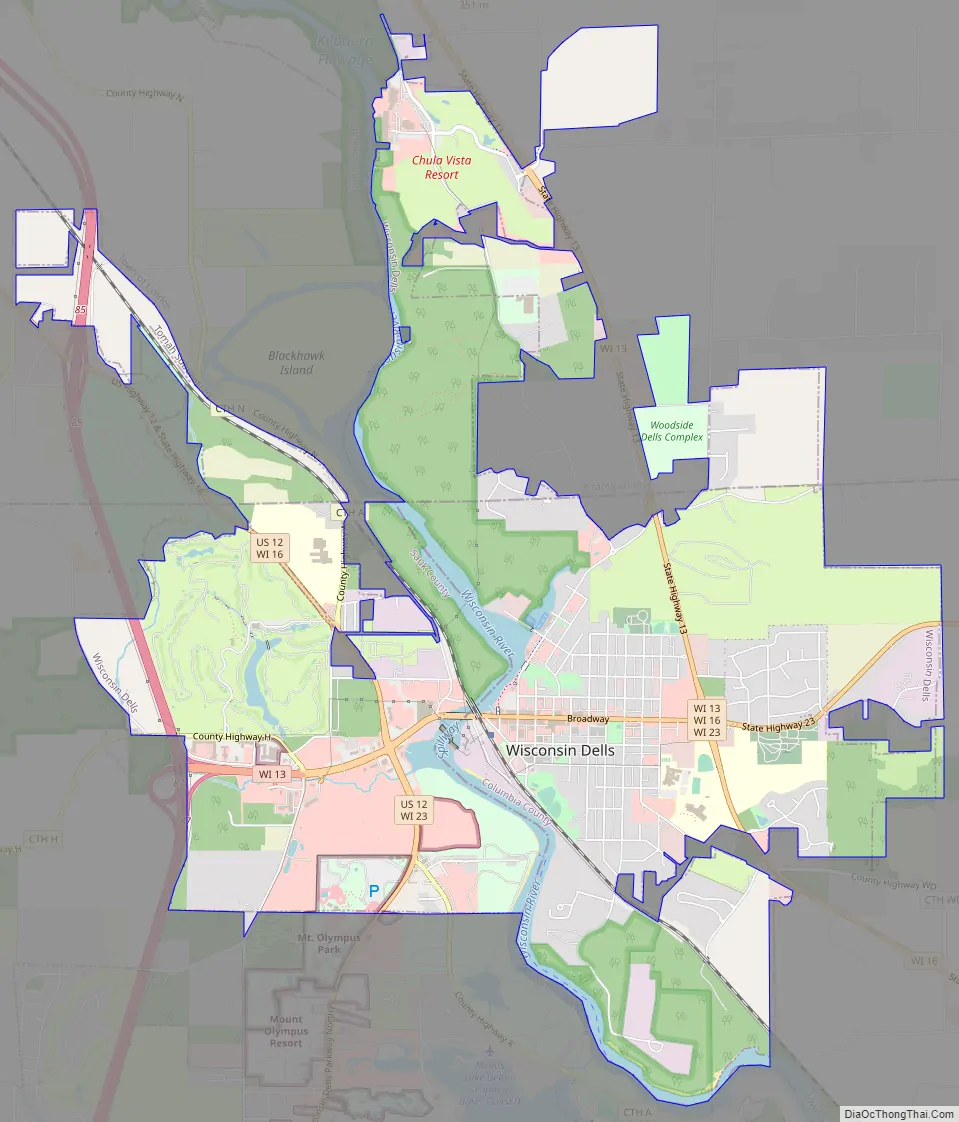
Wisconsin Dells Road Map
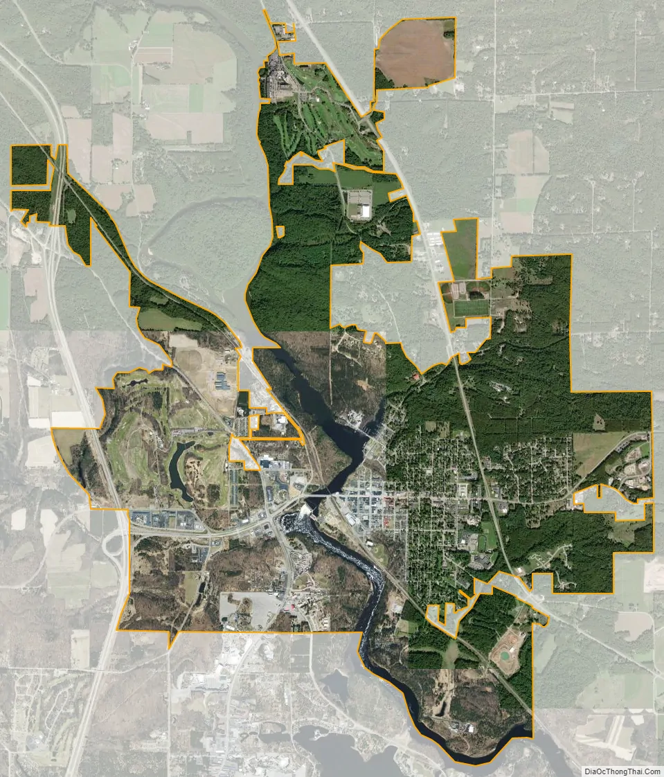
Wisconsin Dells city Satellite Map
Geography
According to the United States Census Bureau, the city has a total area of 8.18 square miles (21.19 km), of which 7.84 square miles (20.31 km) is land and 0.34 square miles (0.88 km) is water. According to the Wisconsin Department of Administration, on January 19, 2004, the city annexed land from the Town of Lyndon in Juneau County, thus expanding the city to include area in four counties. It is mostly located in Columbia County.
Climate
Wisconsin Dells has a humid continental climate.
On July 13, 1936, the temperature in Wisconsin Dells reached 114 °F (46 °C), the highest ever recorded in the state of Wisconsin.
See also
Map of Wisconsin State and its subdivision:- Adams
- Ashland
- Barron
- Bayfield
- Brown
- Buffalo
- Burnett
- Calumet
- Chippewa
- Clark
- Columbia
- Crawford
- Dane
- Dodge
- Door
- Douglas
- Dunn
- Eau Claire
- Florence
- Fond du Lac
- Forest
- Grant
- Green
- Green Lake
- Iowa
- Iron
- Jackson
- Jefferson
- Juneau
- Kenosha
- Kewaunee
- La Crosse
- Lafayette
- Lake Michigan
- Lake Superior
- Langlade
- Lincoln
- Manitowoc
- Marathon
- Marinette
- Marquette
- Menominee
- Milwaukee
- Monroe
- Oconto
- Oneida
- Outagamie
- Ozaukee
- Pepin
- Pierce
- Polk
- Portage
- Price
- Racine
- Richland
- Rock
- Rusk
- Saint Croix
- Sauk
- Sawyer
- Shawano
- Sheboygan
- Taylor
- Trempealeau
- Vernon
- Vilas
- Walworth
- Washburn
- Washington
- Waukesha
- Waupaca
- Waushara
- Winnebago
- Wood
- Alabama
- Alaska
- Arizona
- Arkansas
- California
- Colorado
- Connecticut
- Delaware
- District of Columbia
- Florida
- Georgia
- Hawaii
- Idaho
- Illinois
- Indiana
- Iowa
- Kansas
- Kentucky
- Louisiana
- Maine
- Maryland
- Massachusetts
- Michigan
- Minnesota
- Mississippi
- Missouri
- Montana
- Nebraska
- Nevada
- New Hampshire
- New Jersey
- New Mexico
- New York
- North Carolina
- North Dakota
- Ohio
- Oklahoma
- Oregon
- Pennsylvania
- Rhode Island
- South Carolina
- South Dakota
- Tennessee
- Texas
- Utah
- Vermont
- Virginia
- Washington
- West Virginia
- Wisconsin
- Wyoming