Holden is a census-designated place (CDP) in Logan County, West Virginia, United States. The population was 876 at the 2010 census, down from 1,105 in 2000. The CDP contains the unincorporated communities of Holden, Beebe, Frogtown, Sycamore, Diamond, and Davis, all in the valley of Copperas Mine Fork.
| Name: | Holden CDP |
|---|---|
| LSAD Code: | 57 |
| LSAD Description: | CDP (suffix) |
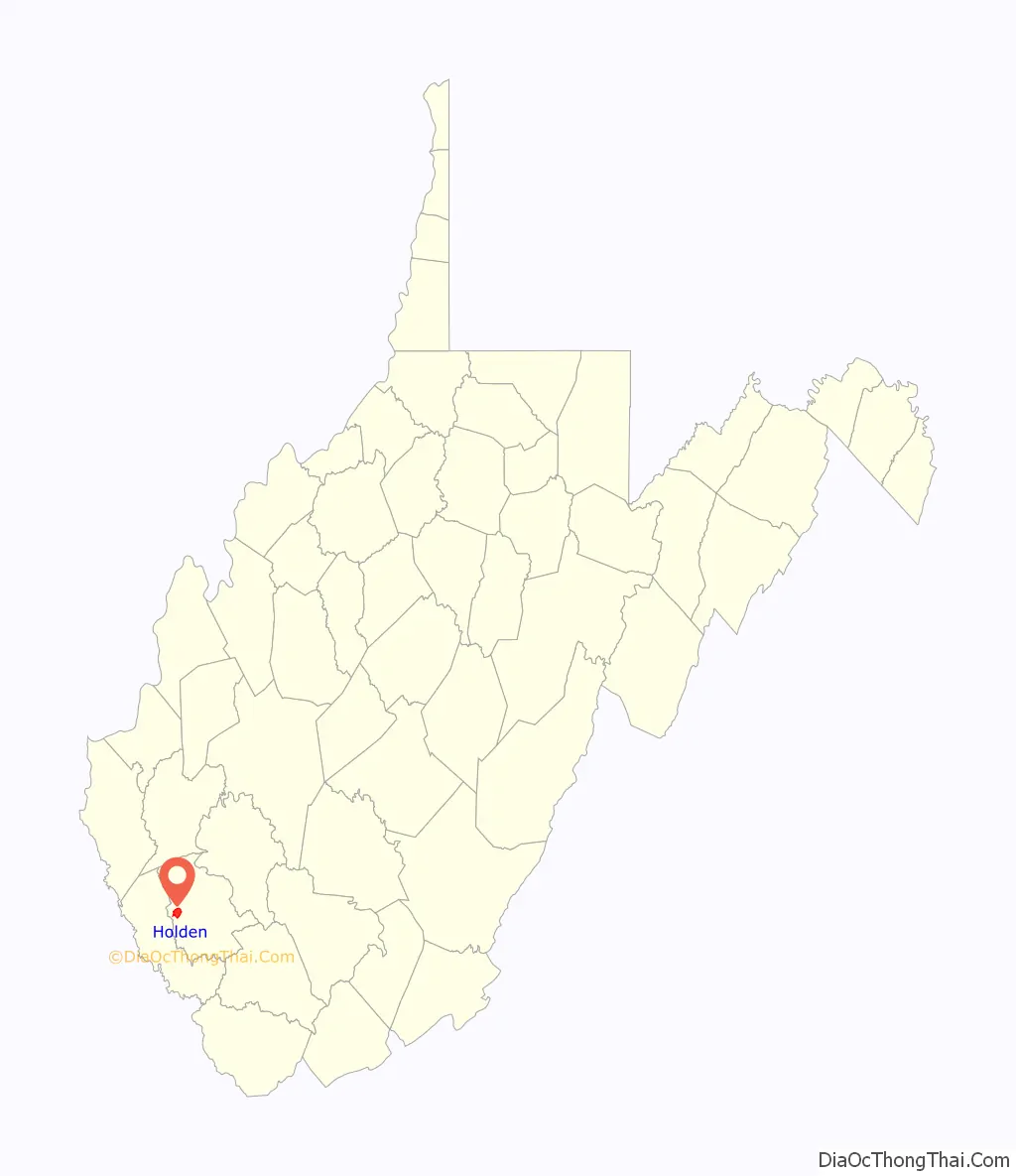
| State: | West Virginia |
| County: | Logan County |
| Elevation: | 735 ft (224 m) |
| Total Area: | 3.73 sq mi (9.67 km²) |
| Land Area: | 3.73 sq mi (9.67 km²) |
| Water Area: | 0.0 sq mi (0.0 km²) |
| Total Population: | 876 |
| Population Density: | 230/sq mi (91/km²) |
| ZIP code: | 25625 |
| Area code: | 304 |
| FIPS code: | 5437948 |
| GNISfeature ID: | 1540381 |
Online Interactive Map
Click on ![]() to view map in "full screen" mode.
to view map in "full screen" mode.
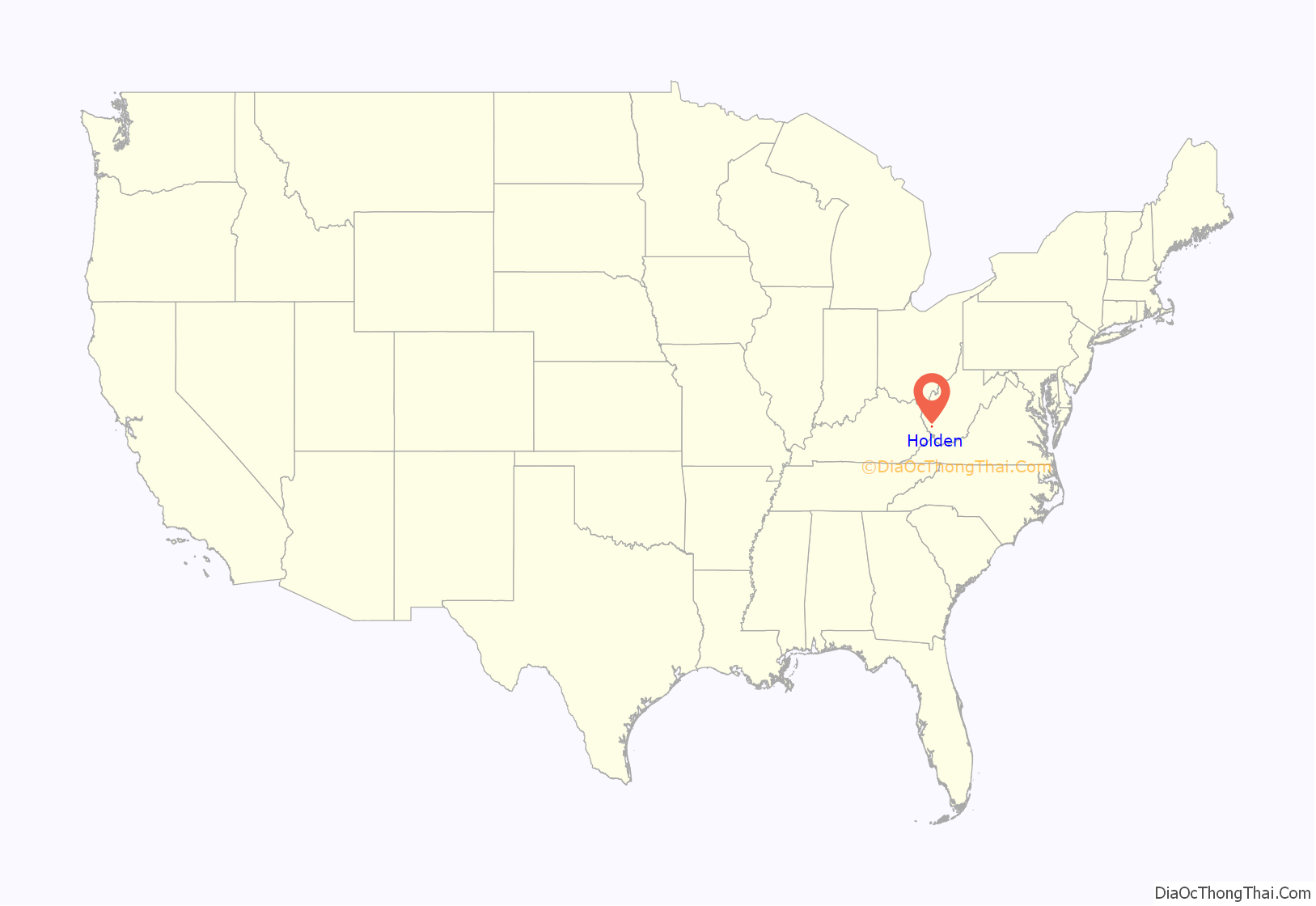
Holden location map. Where is Holden CDP?
History
The settlement was built between 1902 and 1915, by mining engineer Albert F. “Bert” Holden, who wanted to build a model mining town. Located along Copperas Mine Fork, the settlement had a band mill and a brick-making plant to meet the building needs of the community, and all structures were made from local materials including stones from a nearby quarry. In 1907, a mining engineer wrote:
By 1909, 400 buildings had been constructed including houses, stores, barns, a machine shop, a carpenter shop, a blacksmith shop, and a power plant. The center of the community was described as “Main Holden”.
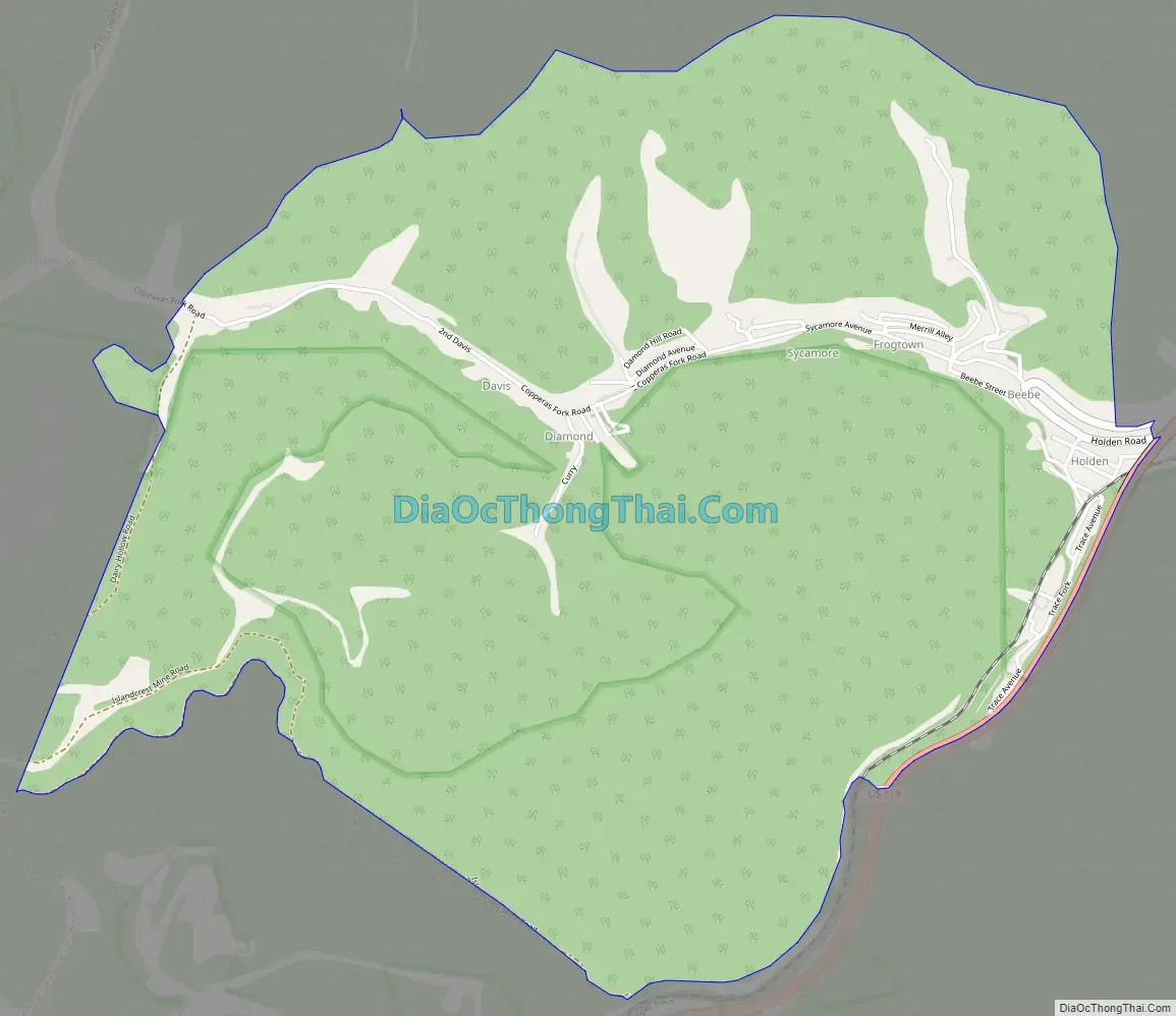
Holden Road Map
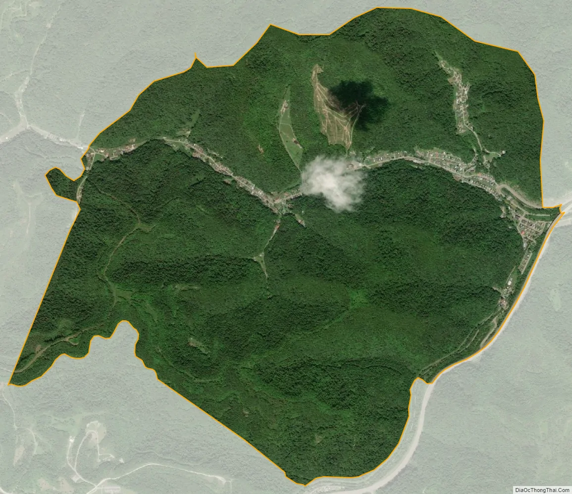
Holden city Satellite Map
Geography
Holden is located in western Logan County along Copperas Mine Fork, a tributary of Island Creek and part of the Guyandotte River watershed. It is 4 miles (6 km) southwest of Logan, the county seat. U.S. Route 119, a four-lane freeway, passes just east of Holden village, leading north 56 miles (90 km) to Charleston, the state capital, and southwest 51 miles (82 km) to Pikeville, Kentucky.
According to the United States Census Bureau, the Holden CDP has a total area of 3.7 square miles (9.7 km), of which 0.1 acres (534 m), or less than 0.01%, are water.
See also
Map of West Virginia State and its subdivision:- Barbour
- Berkeley
- Boone
- Braxton
- Brooke
- Cabell
- Calhoun
- Clay
- Doddridge
- Fayette
- Gilmer
- Grant
- Greenbrier
- Hampshire
- Hancock
- Hardy
- Harrison
- Jackson
- Jefferson
- Kanawha
- Lewis
- Lincoln
- Logan
- Marion
- Marshall
- Mason
- McDowell
- Mercer
- Mineral
- Mingo
- Monongalia
- Monroe
- Morgan
- Nicholas
- Ohio
- Pendleton
- Pleasants
- Pocahontas
- Preston
- Putnam
- Raleigh
- Randolph
- Ritchie
- Roane
- Summers
- Taylor
- Tucker
- Tyler
- Upshur
- Wayne
- Webster
- Wetzel
- Wirt
- Wood
- Wyoming
- Alabama
- Alaska
- Arizona
- Arkansas
- California
- Colorado
- Connecticut
- Delaware
- District of Columbia
- Florida
- Georgia
- Hawaii
- Idaho
- Illinois
- Indiana
- Iowa
- Kansas
- Kentucky
- Louisiana
- Maine
- Maryland
- Massachusetts
- Michigan
- Minnesota
- Mississippi
- Missouri
- Montana
- Nebraska
- Nevada
- New Hampshire
- New Jersey
- New Mexico
- New York
- North Carolina
- North Dakota
- Ohio
- Oklahoma
- Oregon
- Pennsylvania
- Rhode Island
- South Carolina
- South Dakota
- Tennessee
- Texas
- Utah
- Vermont
- Virginia
- Washington
- West Virginia
- Wisconsin
- Wyoming


