Warren County is a county located on the Cumberland Plateau in Middle Tennessee, one of the three Grand Divisions of the U.S. state of Tennessee. As of the 2020 census, the population was 40,953. Its county seat is McMinnville. Warren County comprises the McMinnville, TN Micropolitan Statistical Area.
| Name: | Warren County |
|---|---|
| FIPS code: | 47-177 |
| State: | Tennessee |
| Founded: | 1807 |
| Named for: | Joseph Warren |
| Seat: | McMinnville |
| Largest city: | McMinnville |
| Total Area: | 434 sq mi (1,120 km²) |
| Land Area: | 433 sq mi (1,120 km²) |
| Total Population: | 40,953 |
| Population Density: | 92/sq mi (36/km²) |
| Time zone: | UTC−6 (Central) |
| Summer Time Zone (DST): | UTC−5 (CDT) |
| Website: | www.warrencountytn.gov |
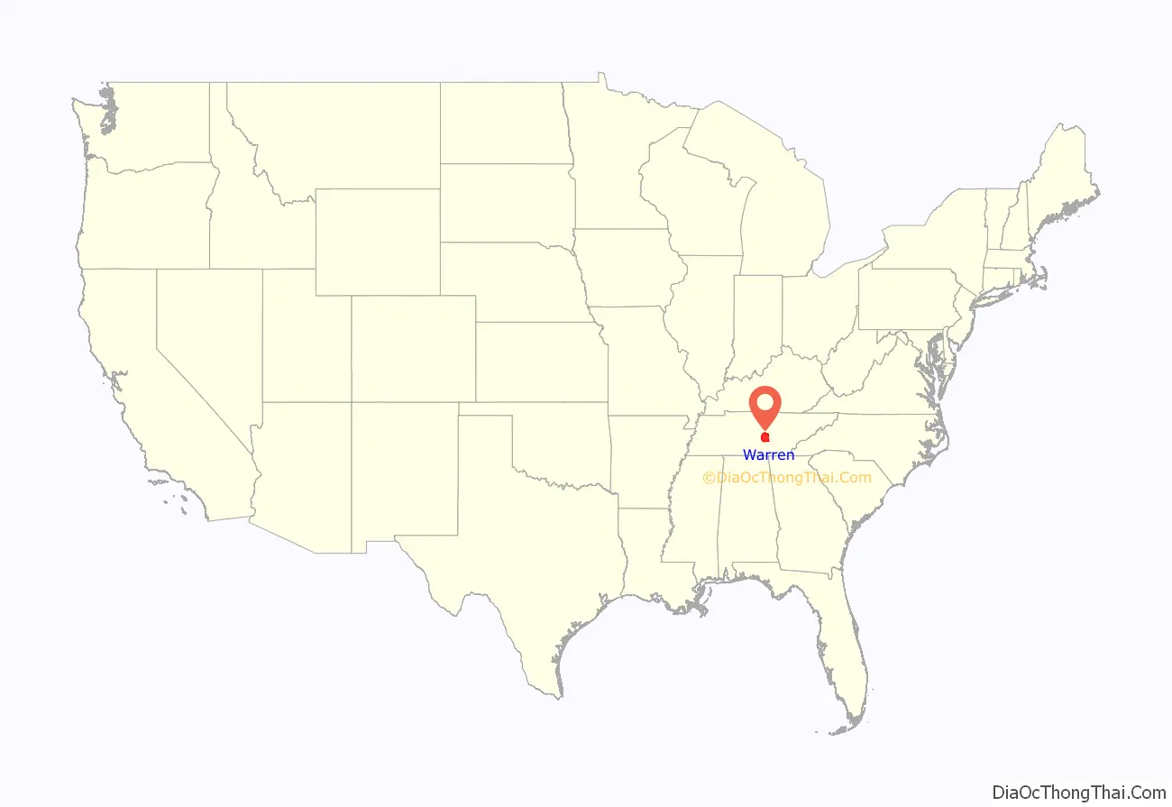
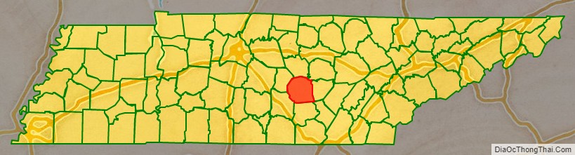
Warren County location map. Where is Warren County?
History
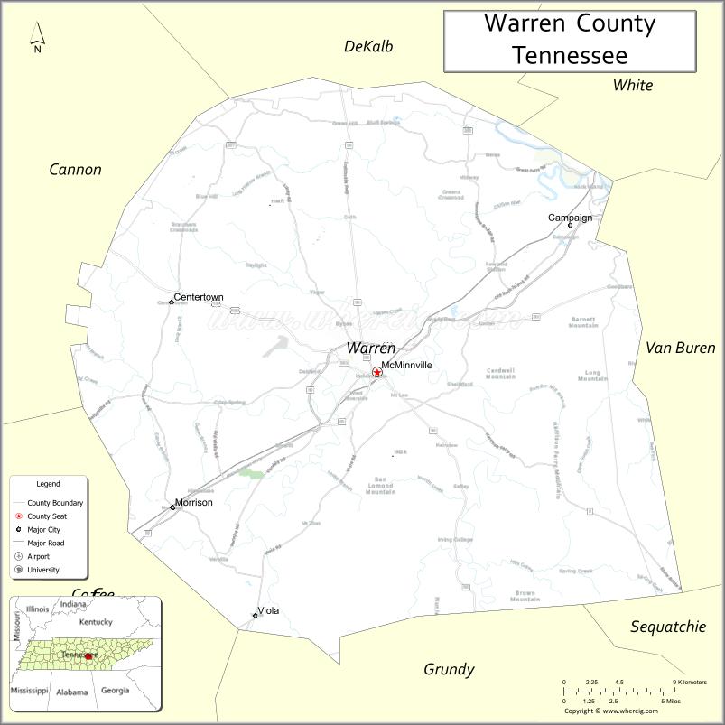
Warren County was created in 1807 from a portion of White County, and named for Joseph Warren (1741–1775), a soldier in the American Revolution. The revised Tennessee State Constitution of 1834 stated that no new county could be within 12 miles (19 km) of the county seat of the county from which it was formed. The boundaries of five counties formed from Warren— Grundy, Van Buren, Cannon, Coffee and DeKalb— were exactly 12 miles from Warren’s county seat, McMinnville, giving the county its distinctive round shape. Warren County was the site of several saltpeter mines. Saltpeter is the main ingredient of gunpowder and was obtained by leaching the earth from several local caves. Hubbards Cave, near Camp Woodlee, was a major operation. Henshaw Cave on Cardwell Mountain (now part of Cumberland Caverns) and Solomon Saltpeter Cave on Ben Lomond Mountain were relatively small mining operations. Most saltpeter mining occurred during the War of 1812 and in the Civil War.
The county was largely developed for farming of such crops as tobacco and hemp. While numerous families held enslaved African Americans as workers, they were a minority of the population. Warren County citizens voted to secede from the Union before the American War Between the States in February 1861 in a state referendum. Voters in Tennessee overall decided to remain in the Union in that time. When President Abraham Lincoln demanded that Tennessee provide troops to fight against the Southern states in April 1861, it was viewed as a violation of Article 3, Section 3 of the U.S. Constitution. At a new referendum in June 1861, Warren County again, along with a majority of Tennessee’s counties, voted for secession. Unlike in some states, slavery was not listed as one of the reasons in Tennessee’s secession proclamation.
Men from Warren County and surrounding upper Cumberland region formed and served in many units in Tennessee’s defense, including the 16th Tennessee Infantry [1] Archived February 14, 2017, at the Wayback Machine led by McMinnville resident Col. John Houston Savage. The Confederate monument [2] next to the county courthouse is dedicated in the memory of the men who served and died in the 16th and lists their names.
Men from Warren County and upper Cumberland area joined the 16th TN Infantry Regiment, among others. Their flag is on display at the Texas ‘Civil War’ Museum in Fort Worth TX.
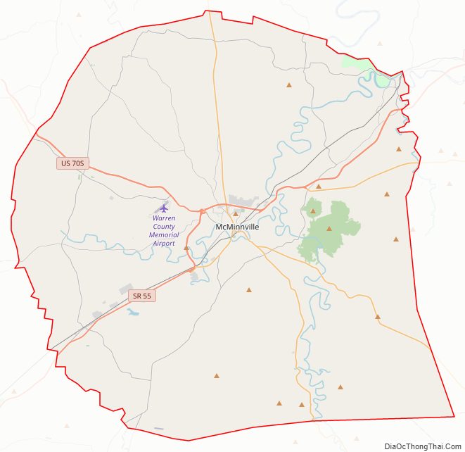
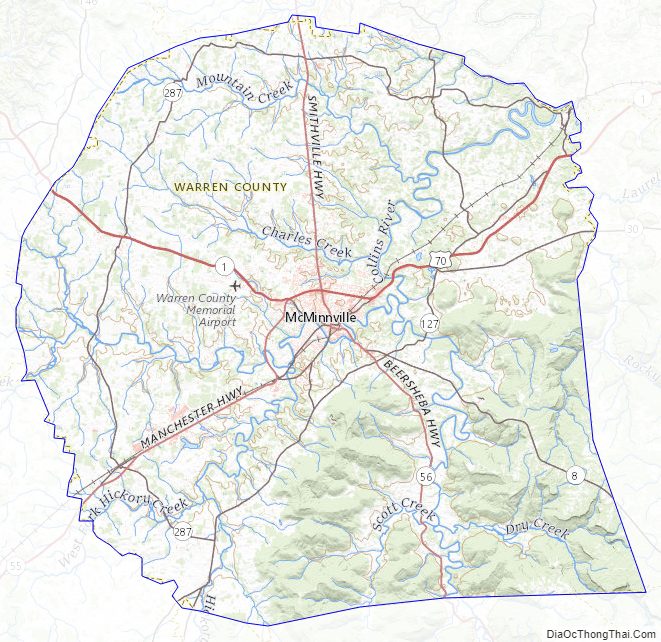
Warren County Road Map
Geography
According to the U.S. Census Bureau, the county has a total area of 434 square miles (1,120 km), of which 433 square miles (1,120 km) is land and 1.4 square miles (3.6 km) (0.3%) is water. The county lies long the Eastern Highland Rim, near the Cumberland Plateau.
The Caney Fork forms part of the county’s borders with White and DeKalb counties to the north. The Rocky River, a tributary of the Caney Fork, forms part of the county’s eastern border with Van Buren County. The Collins River, also a tributary of the Caney Fork, flows through the county, and the Barren Fork, a tributary of the Collins, flows through McMinnville.
Cardwell Mountain is an imposing natural feature located five miles due east of McMinnville. It is an erosional remnant of the nearby Cumberland Plateau. Cardwell Mountain is noted for Cumberland Caverns, an exceptionally long cave which lies underneath the mountain.
Adjacent counties
- DeKalb County (north)
- White County (northeast)
- Van Buren County (east)
- Sequatchie County (southeast)
- Grundy County (south)
- Coffee County (southwest)
- Cannon County (northwest)
Major highways
- U.S. Route 70S
- State Route 8
- State Route 30
- State Route 55
- State Route 56
- State Route 108
- State Route 136
State protected areas
- Hubbard’s Cave State Natural Area
- Morrison Meadow State Natural Area
- Rock Island State Park (part)
Warren County Topographic Map
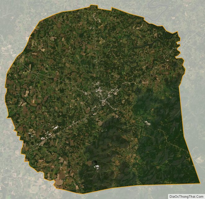
Warren County Satellite Map
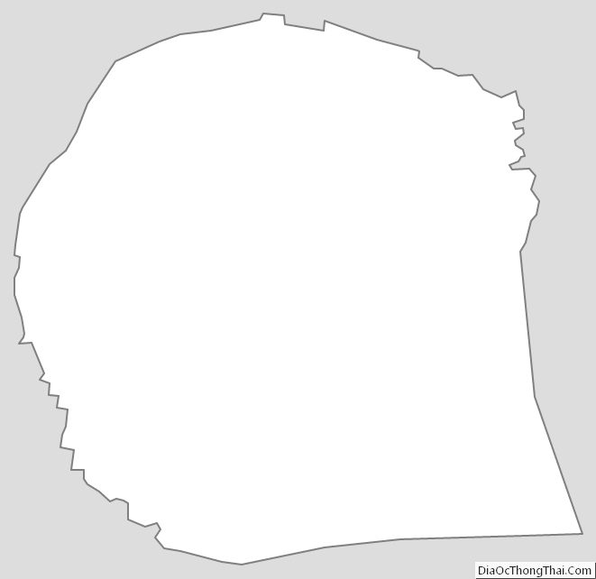
Warren County Outline Map
See also
Map of Tennessee State and its subdivision:- Anderson
- Bedford
- Benton
- Bledsoe
- Blount
- Bradley
- Campbell
- Cannon
- Carroll
- Carter
- Cheatham
- Chester
- Claiborne
- Clay
- Cocke
- Coffee
- Crockett
- Cumberland
- Davidson
- Decatur
- DeKalb
- Dickson
- Dyer
- Fayette
- Fentress
- Franklin
- Gibson
- Giles
- Grainger
- Greene
- Grundy
- Hamblen
- Hamilton
- Hancock
- Hardeman
- Hardin
- Hawkins
- Haywood
- Henderson
- Henry
- Hickman
- Houston
- Humphreys
- Jackson
- Jefferson
- Johnson
- Knox
- Lake
- Lauderdale
- Lawrence
- Lewis
- Lincoln
- Loudon
- Macon
- Madison
- Marion
- Marshall
- Maury
- McMinn
- McNairy
- Meigs
- Monroe
- Montgomery
- Moore
- Morgan
- Obion
- Overton
- Perry
- Pickett
- Polk
- Putnam
- Rhea
- Roane
- Robertson
- Rutherford
- Scott
- Sequatchie
- Sevier
- Shelby
- Smith
- Stewart
- Sullivan
- Sumner
- Tipton
- Trousdale
- Unicoi
- Union
- Van Buren
- Warren
- Washington
- Wayne
- Weakley
- White
- Williamson
- Wilson
- Alabama
- Alaska
- Arizona
- Arkansas
- California
- Colorado
- Connecticut
- Delaware
- District of Columbia
- Florida
- Georgia
- Hawaii
- Idaho
- Illinois
- Indiana
- Iowa
- Kansas
- Kentucky
- Louisiana
- Maine
- Maryland
- Massachusetts
- Michigan
- Minnesota
- Mississippi
- Missouri
- Montana
- Nebraska
- Nevada
- New Hampshire
- New Jersey
- New Mexico
- New York
- North Carolina
- North Dakota
- Ohio
- Oklahoma
- Oregon
- Pennsylvania
- Rhode Island
- South Carolina
- South Dakota
- Tennessee
- Texas
- Utah
- Vermont
- Virginia
- Washington
- West Virginia
- Wisconsin
- Wyoming