Brundidge is the second-largest city in Pike County, Alabama, United States. The population was 2,076 at the 2010 census, down from 2,341 in 2000.
The city was once a major producer of peanut butter. Brundidge holds a Peanut Butter Festival during the last Saturday of each October, which includes live music, a recipe contest, and a parade.
The city has a large number of antique stores in its historic downtown.
| Name: | Brundidge city |
|---|---|
| LSAD Code: | 25 |
| LSAD Description: | city (suffix) |
| State: | Alabama |
| County: | Pike County |
| Elevation: | 472 ft (144 m) |
| Total Area: | 9.78 sq mi (25.32 km²) |
| Land Area: | 9.75 sq mi (25.24 km²) |
| Water Area: | 0.03 sq mi (0.08 km²) |
| Total Population: | 2,073 |
| Population Density: | 212.70/sq mi (82.13/km²) |
| ZIP code: | 36010 |
| Area code: | 334 |
| FIPS code: | 0110240 |
| GNISfeature ID: | 0115032 |
| Website: | http://www.brundidge.org/ |
Online Interactive Map
Click on ![]() to view map in "full screen" mode.
to view map in "full screen" mode.
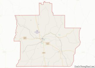
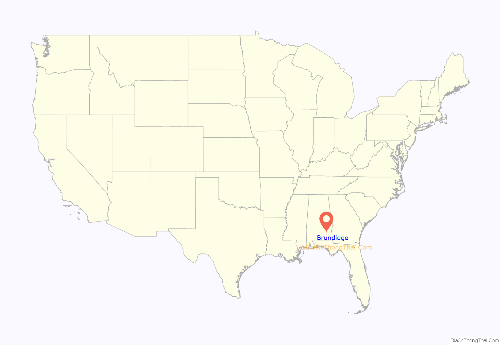
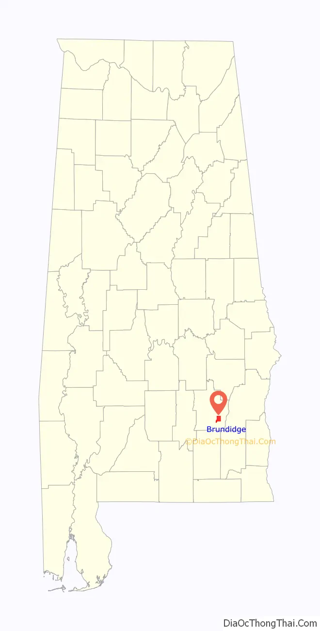
Brundidge location map. Where is Brundidge city?
History
The town was founded prior to the Civil War by George C. Collier, who established a trading post and saloon. First called “Collier’s Store”, the town changed its name around 1854 to honor James M. Brundidge, a prominent citizen and founder of the local Masonic lodge.
During the Civil War, men from Pike County joined “Company F”, the “Brundidge Guards”, of the 15th Regiment Alabama Infantry.
Brundidge grew as an agricultural center after the war. A depot of the newly constructed Alabama Midland Railway was established in Brundidge in 1889. Several hotels and businesses followed. Passenger trains such as the South Wind once passed. The railway line is now the Dothan Subdivision, used for freight operations by CSX Transportation.
Brundidge incorporated in 1893. In 1900, the Brundidge Banking Company opened, followed by the First National Bank in 1904. Brundidge has had three newspapers: the Brundidge News began publication in 1893, the Brundidge Sentinel began in 1926, and the Brundidge Banner in 1962. All have ceased publication.
In the 1920s, Brundidge native Alonza E. Johnston opened a peanut butter mill, and his Johnston Oil Company was soon shipping more than two million jars per year. The company also produced velvet bread and mayonnaise, and operated warehouses, gins, and an ice plant.
The business has ceased operation. The old Johnston Mill and General Store has been adapted as a museum. The mill, as well as the Lightfoot House in Brundidge, are both listed on the Alabama Register of Landmarks and Heritage.
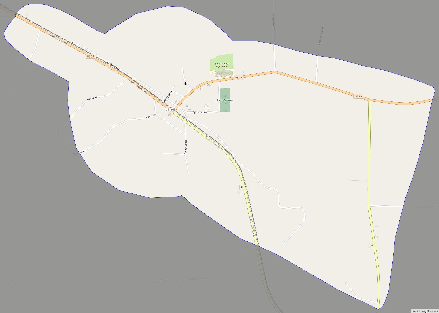
Brundidge Road Map
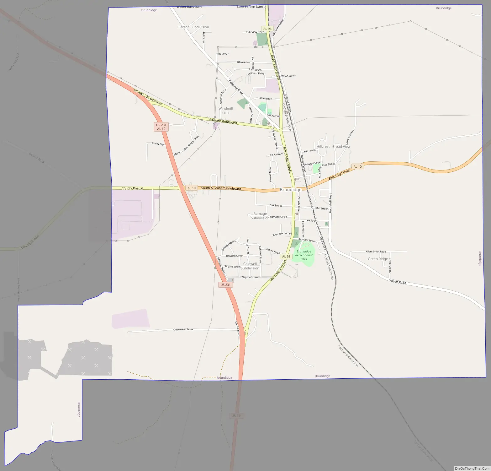
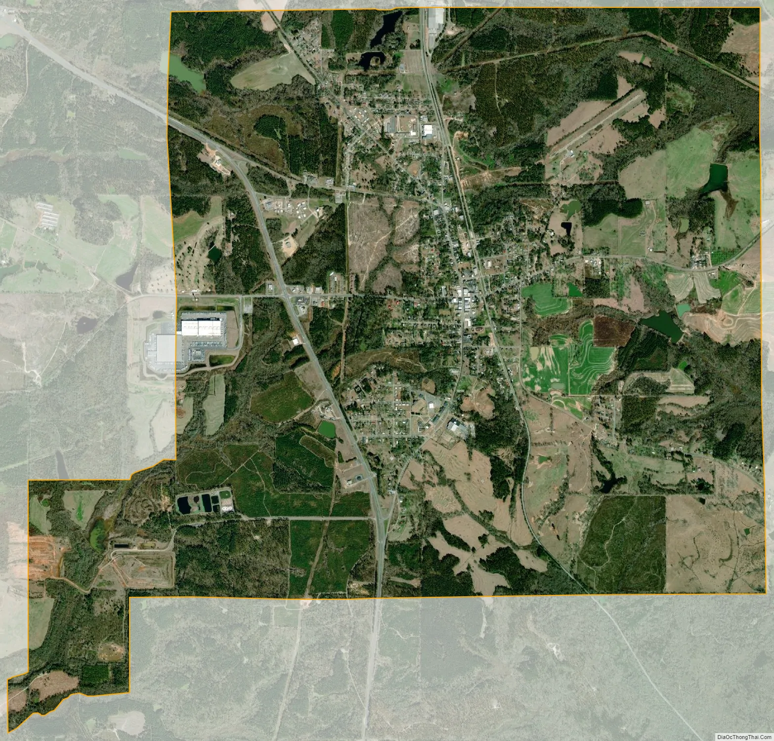
Brundidge city Satellite Map
Geography
Brundidge is located at 31°43′9″N 85°49′5″W / 31.71917°N 85.81806°W / 31.71917; -85.81806 (31.719218, -85.818119).
According to the U.S. Census Bureau, the city has a total area of 9.7 square miles (25 km), of which 9.7 square miles (25 km) is land and 0.04 square miles (0.10 km) (0.31%) is water.
Climate
The climate in this area is characterized by hot, humid summers and generally mild to cool winters. According to the Köppen Climate Classification system, Brundidge has a humid subtropical climate, abbreviated “Cfa” on climate maps.
See also
Map of Alabama State and its subdivision:- Autauga
- Baldwin
- Barbour
- Bibb
- Blount
- Bullock
- Butler
- Calhoun
- Chambers
- Cherokee
- Chilton
- Choctaw
- Clarke
- Clay
- Cleburne
- Coffee
- Colbert
- Conecuh
- Coosa
- Covington
- Crenshaw
- Cullman
- Dale
- Dallas
- De Kalb
- Elmore
- Escambia
- Etowah
- Fayette
- Franklin
- Geneva
- Greene
- Hale
- Henry
- Houston
- Jackson
- Jefferson
- Lamar
- Lauderdale
- Lawrence
- Lee
- Limestone
- Lowndes
- Macon
- Madison
- Marengo
- Marion
- Marshall
- Mobile
- Monroe
- Montgomery
- Morgan
- Perry
- Pickens
- Pike
- Randolph
- Russell
- Saint Clair
- Shelby
- Sumter
- Talladega
- Tallapoosa
- Tuscaloosa
- Walker
- Washington
- Wilcox
- Winston
- Alabama
- Alaska
- Arizona
- Arkansas
- California
- Colorado
- Connecticut
- Delaware
- District of Columbia
- Florida
- Georgia
- Hawaii
- Idaho
- Illinois
- Indiana
- Iowa
- Kansas
- Kentucky
- Louisiana
- Maine
- Maryland
- Massachusetts
- Michigan
- Minnesota
- Mississippi
- Missouri
- Montana
- Nebraska
- Nevada
- New Hampshire
- New Jersey
- New Mexico
- New York
- North Carolina
- North Dakota
- Ohio
- Oklahoma
- Oregon
- Pennsylvania
- Rhode Island
- South Carolina
- South Dakota
- Tennessee
- Texas
- Utah
- Vermont
- Virginia
- Washington
- West Virginia
- Wisconsin
- Wyoming