Troy is a city in and the county seat of Pike County, Alabama, United States. It was formally incorporated on February 4, 1843.
Between 1763 and 1783, the area where Troy sits was part of the colony of British West Florida. After 1783, the region fell under the jurisdiction of the newly created United States of America.
As of the 2010 census, its population was 18,033. The 2019 estimated population was 18,957. The City of Troy is considered one of the fastest-growing cities in Alabama. Troy is home to Troy University, the fourth-largest university in total enrollment in Alabama.
| Name: | Troy city |
|---|---|
| LSAD Code: | 25 |
| LSAD Description: | city (suffix) |
| State: | Alabama |
| County: | Pike County |
| Founded: | 1838 |
| Incorporated: | 1843 |
| Elevation: | 541 ft (165 m) |
| Total Area: | 28.42 sq mi (73.61 km²) |
| Land Area: | 28.34 sq mi (73.41 km²) |
| Water Area: | 0.08 sq mi (0.21 km²) |
| Total Population: | 17,727 |
| Population Density: | 625.45/sq mi (241.49/km²) |
| ZIP code: | 36079, 36081, 36082 |
| Area code: | 334 |
| FIPS code: | 0176920 |
| GNISfeature ID: | 0153725 |
| Website: | www.troyal.gov |
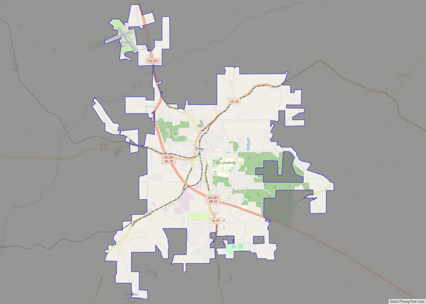
Online Interactive Map
Click on ![]() to view map in "full screen" mode.
to view map in "full screen" mode.
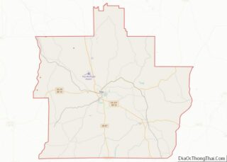
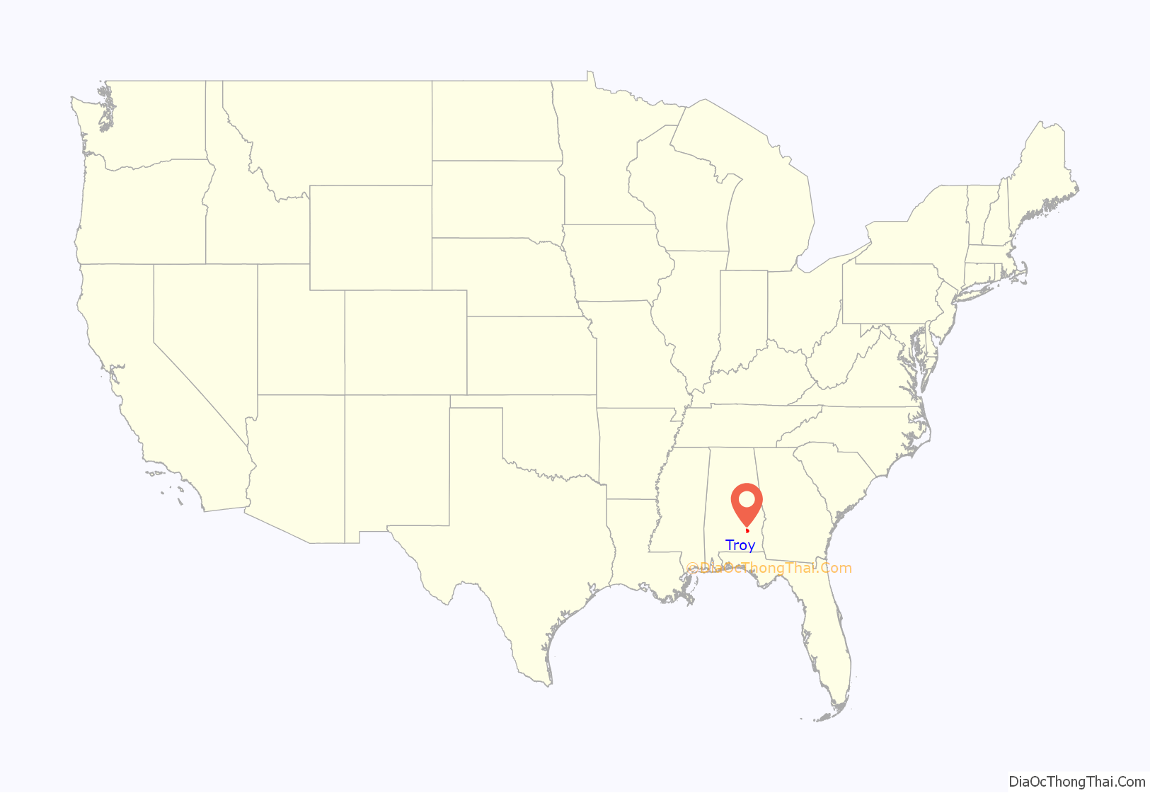
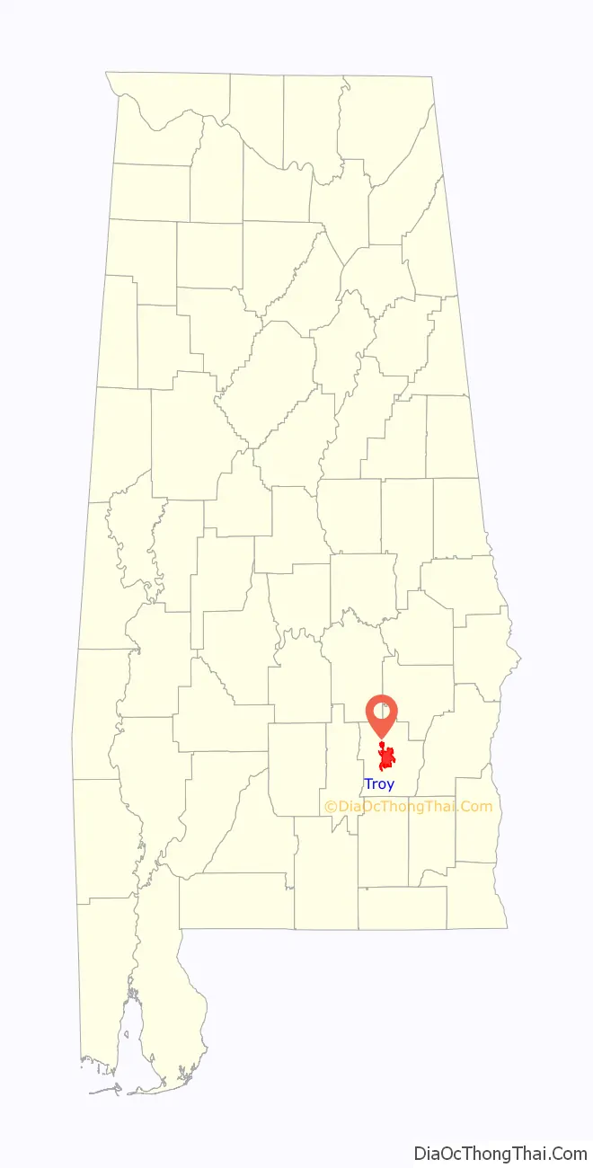
Troy location map. Where is Troy city?
History
Before the Civil War
For many centuries, the area around Troy was settled by different tribes of Native Americans, but became primarily known for its Muskogee Creek presence. Most Creek tribes lived along rivers or streams at that time. Near the Troy area, many Native Americans settled around the Conecuh River and the Pea River.
With the coming of European explorers and colonists, the area of present-day Alabama was claimed by Spain, France, and Great Britain, although very few Europeans settled in the inland parts. After being swapped among those three powers in the course of the 18th century, the United States acquired the region from Spain with the Treaty of Madrid (1795) and created the Mississippi Territory in 1798, including most of the present-day states of Mississippi and Alabama. In 1819, the State of Alabama was admitted to the Union and was soon organized into counties. Pike County, founded in 1821, was one of the first counties established in Alabama. It comprised a large tract of country, so large that it was called the “State of Pike”, which included parts of what are now Crenshaw, Montgomery, Macon, Bullock, and Barbour Counties, and extended to the Chattahoochee River on the east.
After Pike County’s borders were resized, the land that later became Troy was settled in the early 1830s. Originally known as Deer Stand Hill (an Indian hunting ground), which was first settled about 1824, it was later known as Zebulon and then Centreville before being renamed Troy in 1838. Troy became the county seat that same year after a new county courthouse was built in the city, replacing the previous county seat town of Monticello. The court met in local stores until the courthouse was built in 1839. In 1880, this structure was torn down and rebuilt as an opera house, which was also eventually torn down. A brick courthouse was erected in 1880. A hotel and taverns along with small mercantile stores were soon created, quickly making the new town the social center of the county. Unfortunately, the town of Troy completely burned down in 1901 after a devastating fire, and had to be rebuilt. The courthouse, originally in the center of the town square, was demolished because of fire damage and relocated one block away just outside of the town square.
To promote movement of settlers and to speed mail from Washington City to New Orleans, the Federal Road was laid out after 1805. In 1824, a military road was laid out from Fort Barrancas in Pensacola, Florida, and ran on top of the ridges to Fort Mitchell in Russell County, Alabama, and connected to the Federal Road. Captain Daniel E. Burch of the U.S. Army marked the route using three notches on trees for a crew under Lt. Elias Phillips to follow. The route was eventually cleared in 1824 at a cost of $1,130. It follows the ridge dividing the water sheds of the Conecuh River to the northwest, and the Yellow River and Pea River to the southeast. This road became known as the Three Notch Road and ran through Troy and Pike County. While never being highly needed as a military supply road, it became a boon to the settlers who used it to move into south-central and southeast Alabama and into northwest Florida.
During this time, tensions began to rise between the local Creek Indians and the European settlers who were moving into the area. As settlers began to force their way onto Creek lands and push the Indians out, the Creeks began to retaliate, first in small factions, then in larger ones. During this time, the Second Indian War was beginning in the Southeastern United States.
Battle of Hobdy’s Bridge
On February 10, 1837, the Battle of Hobdy’s Bridge occurred after a force of over 100 American militiamen under Captain Jack Cooper intercepted about 75 Creeks making their way to Florida. After locating the site of the Creek camp, the militia divided into two groups to converge on the refugees by surprise.
A brief fight ensued upon their approach, which centered around two fallen trees the Creeks had used as a natural breastwork. The creeks, being extremely low on ammunition, fired nails instead of bullets from the muskets they possessed. The militiamen eventually overran their position and captured the camp, wherein they found items recently plundered from area plantations. Exact casualties are unknown, but it is believed four or five Creeks and perhaps one American were killed. Though stripped of their supplies, the Creeks managed to continue their flight even as they continued to skirmish with other American troops. Near the Florida border, they retaliated by killing two American settlers.
Battle of Pea River
In of the last battles of the Second Creek War, on March 27, 1837, the Battle of Pea River occurred roughly 17 miles to the east of Troy, where the Pea River and Pea Creek converge near Hobdy’s Bridge. A force of over 250 combined Alabama and Georgia militiamen led under General William Wellborn tracked a party of about 400 Creek fugitives that included men, women, and children. The Creeks, angry that the land that had been promised to them was being taken from them by local settlers by violent force, responded by burning local homes and plantations along the Pea River swamp. The Three Notch Trail that traversed through Troy was also considered dangerous at this point, as local Creek Indians around the area were turning violent and burning and looting houses along the stretch. The path of the Creeks had become easy to find due to the several looted and burned plantations they had left behind them as they moved south. After finding their temporary camp in a nearby swamp, General Wellborn divided his command into two wings to encircle the Creeks. He personally commanded one wing, and placed the other under Colonel Jefferson Buford. The Creeks detected the approach, however, and attacked and scattered Buford’s wing.
When Wellborn’s command neared the camp, trudging through waist-high water, gunfire could be heard erupting further down the river. Wellborn ordered his men through the mud and water at a full run. Upon encountering the Creeks downstream, a fierce four-hour battle began on opposite sides of a nearby lagoon. The Creek warriors, many of whom were later found to have been using bullets made of melted pewter plates, made several unsuccessful charges on the militia’s line before being overrun. Records from some of the participants in the battle reported that some of the Creek women and children also took up arms to fight, raining showers of rifle balls and arrows on the militiamen. In one case, two of the Creek women attacked a member of the militia with knives. Unable to defeat the desperate Creeks with gunfire alone, Wellborn finally ordered a direct charge on their lines. The tactic worked, as many of the Creeks fled to their encampment to carry off their children, some even swimming the river to flee. The fighting then devolved into a massacre in which at least 50 Creek men, women and children were killed and an unknown number captured. The Creek survivors continued their flight south in small groups. According to some reports, some of the captured Creeks were enslaved by local planters. Only five Americans were killed, among them General Wellborn’s teenage son, James H. Wellborn.
In winning the Battle of Pea River & Pea Creek, Wellborn had defeated the refugee Creeks but had failed to surround and capture all of them as he had hoped. Instead they fled south down the Pea River to its confluence with the Choctawhatchee and continued across the line into Florida. Furious at their treatment, they continued to battle the Whites for years to come.
During Civil War
At the outbreak of the American Civil War in 1861, the small village of Troy had a population around 600. The 57th Alabama Infantry Regiment of Troy was formed in 1863. The group of soldiers from that regiment fought at the Battle of Peachtree Creek on July 20, 1864.
Troy was mostly spared from the ravages of the war, except that its sons were dying on battlefields throughout the South. On April 26, 1865, a brigade of Union cavalry under the command of General Benjamin Henry Grierson camped outside of Troy. These soldiers moved on to Louisville, Clayton, and Eufaula the next day without incident. However, roughly 20 miles east of Troy at the Pike County border, the Skirmish at Hobdy’s Bridge, what some consider the last battle of the Civil War, took place on May 19, 1865.
Skirmish at Hobdy’s Bridge
A detachment of Union soldiers from the 1st Florida U.S. Cavalry had been sent from Montgomery to Eufaula to escort a mail shipment through the unsettled regions of eastern Alabama. General Robert E. Lee had already surrendered and Wilson’s Raid had just devastated the region, but many former Confederate soldiers were still drifting through the region trying to get home, which presented a threat.
A mail escort, commanded by Lt. Joseph Carroll of the Union Army, left Montgomery on May 11, 1865, and reached Eufaula without difficulty. The total strength of the detachment was only 25 men, but because all seemed quiet, Carroll decided to spend a few days in Eufaula to rest his horses. Since some of his men were natives of the area, he granted them short leaves to go to visit their families. The entire detachment was to reassemble at Hobdy’s Bridge over the Pea River on May 19, 1865.
After many of his men dispersed to their homes, however, Carroll learned that a party of pro-Confederate “guerrillas” had been seen in the area. The identity of this unit, if it had an identity, is unknown, but at about the same time, General Alexander Asboth in Pensacola reported that several companies of cavalry made up of “unrepentant rebels” were still active in the Alabama and Florida borderlands.
Upon receiving this intelligence, Carroll decided to return to Montgomery as quickly as possible and crossed Hobdy’s Bridge with the main body of his detachment two days before the appointed rendezvous. The other men of his command, at home and visiting their families, had no way to know of his decision to leave early or of the danger they faced.
According to military records, the remaining Union soldiers gathered at Hobdy’s Bridge as ordered on the morning of May 19, 1865, only to learn that Carroll and the main body were already gone. Turning their horses onto the long wooden bridge over Pea River, the cavalrymen started off to follow their commander’s route. Unfortunately, they rode straight into a group of Confederate rebel guerillas.
Three Union soldiers were wounded in the fight, and one Confederate soldier was killed, identified as Corporal John W. Skinner of Company C, 1st Florida U.S. Cavalry. He was killed in action six days after Private John J. Williams of the 34th Indiana, who died at Battle of Palmito Ranch, and is generally said to have been the last man killed in the Civil War. That sad distinction actually belongs to Corporal Skinner, who died on the wooden planks of Hobdy’s Bridge in Alabama.
After the war
During the Reconstruction Era after the end of the Civil War, Troy began to have new railroads and roads converging into the city. After the completion of the Mobile & Girard Railroad (later part of the Central of Georgia Railway) in 1870, Troy had a quick spike in population. One of the many to have made the journey to Troy was Jeremiah Augustus “Gus” Henderson. Having owned a large store in nearby Gainers Store (now known as Henderson), he found it difficult to transport and receive shipments by wagon. In 1869, Henry moved his mercantile store to nearby Troy to be closer to the Mobile and Girard Railroad. One of his sons, Charles Henderson, would soon be the governor of Alabama and a large contributor to Troy.
Troy had a quick period of growth in the following years. By 1890, the Alabama Midland Railway (later part of the Atlantic Coast Line Railroad) was completed from Montgomery to Bainbridge, Georgia, via Troy. Rapid growth outside of the Troy downtown square consisted of factories, churches, stores, and Victorian-style houses. Many of the early houses, churches, and cemeteries dating back to this era can still be found in the College Street Historic District, just on the edge of historic downtown Troy. Many of the buildings in the two-block area date from as early as the 1870s. The district was added to the National Register of Historic Places on August 13, 1976.
In 1887, a group of local educators and prominent citizens of Troy joined to acquire a state normal school (teacher training school) for Troy. Thanks mostly to the efforts of Ariosto A. Wiley, a powerful state senator who was born in Troy, the city won the education prize over Lowndesboro, Alabama, which had also wanted a normal school. The school, which was to be known as Troy Normal School, was eventually constructed and completed in 1887 in downtown Troy on a four-acre campus.
This school, which went on to become Troy University, had a stormy early history and was lucky to have survived in its cramped downtown location. Its survival was assured when the third president of the college, Edward Madison Shackelford, led the movement from downtown to its present site starting in 1924. In 1929, the name was changed to Troy State Teacher’s College. The name was again changed in 1957 to Troy State College to reflect the expanded educational offerings of the school. The college underwent yet another name change in 1967, being called Troy State University until reaching its current name, Troy University, in 2005.
During the late 1800s into the early 1900s, Troy experienced steady growth thanks to the railroads, multiple factories, and the college.
Troy Road Map
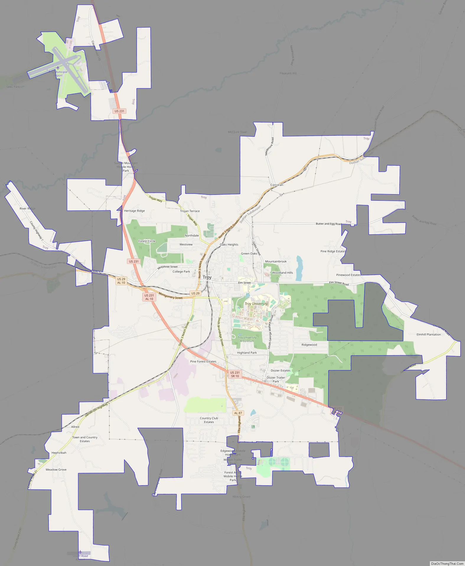
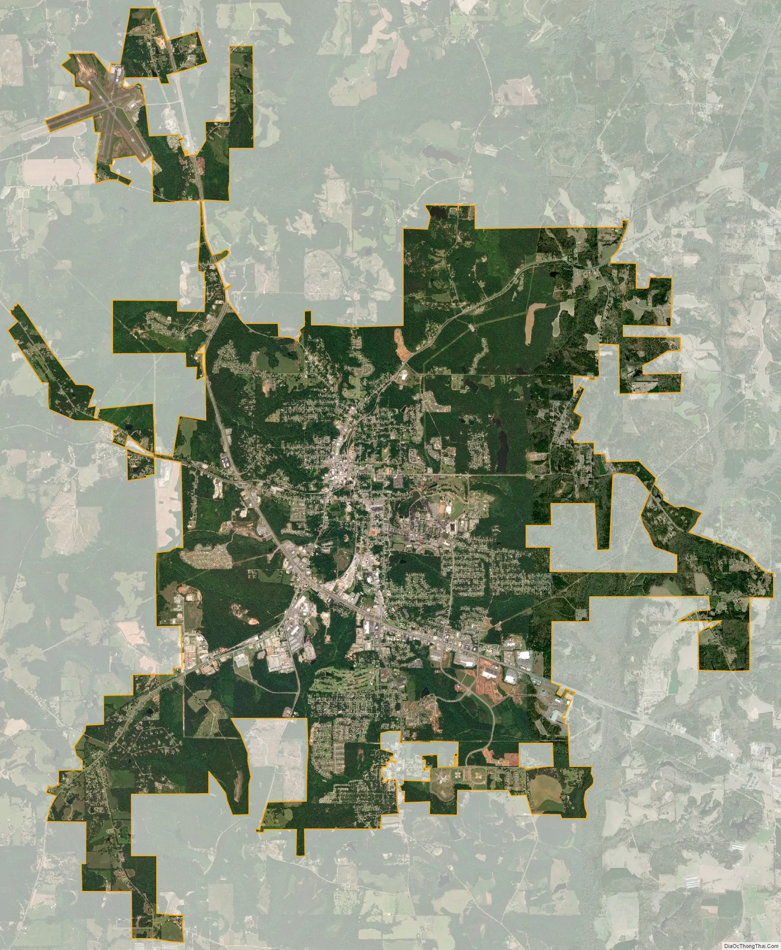
Troy city Satellite Map
Geography
Troy is located at 31°48′32″N 85°58′12″W / 31.80889°N 85.97000°W / 31.80889; -85.97000 (31.808768, −85.969951). It is in the East Gulf Coastal Plains region of Alabama. It is located along the Troy Cuesta ridge, which runs across the state from east to west and is the boundary that separates the Chunnenuggee Hills and Southern Red Hills geographical boundaries. Elevations commonly reach 400 feet (120 m) in these hills and can reach up to 500 feet (150 m) in some areas. About 40 miles (64 km) north of Troy near the Montgomery area, the Chunnenuggee Hills region ends and the flat Black Prairie region begins, commonly known as the Black Belt region. About 60 miles (97 km) south of Troy in the Dothan area, the Southern Red Hills region ends and the Dougherty Plains region begins. Map
Much of the region consists of pine forests. Most tree species found in the area are pine, hickory, oak, pecan, and poplar. The 231-mi-long Conecuh River flows at the northern end of Troy. A 45-acre (18 ha) lake called Pike County Lake is located at the southern end of Troy.
According to the U.S. Census Bureau, the city has a total area of 26.3 square miles (68 km), of which 26.2 square miles (68 km) are land and 0.1 square miles (0.26 km) (0.34%) is covered by water.
See also
Map of Alabama State and its subdivision:- Autauga
- Baldwin
- Barbour
- Bibb
- Blount
- Bullock
- Butler
- Calhoun
- Chambers
- Cherokee
- Chilton
- Choctaw
- Clarke
- Clay
- Cleburne
- Coffee
- Colbert
- Conecuh
- Coosa
- Covington
- Crenshaw
- Cullman
- Dale
- Dallas
- De Kalb
- Elmore
- Escambia
- Etowah
- Fayette
- Franklin
- Geneva
- Greene
- Hale
- Henry
- Houston
- Jackson
- Jefferson
- Lamar
- Lauderdale
- Lawrence
- Lee
- Limestone
- Lowndes
- Macon
- Madison
- Marengo
- Marion
- Marshall
- Mobile
- Monroe
- Montgomery
- Morgan
- Perry
- Pickens
- Pike
- Randolph
- Russell
- Saint Clair
- Shelby
- Sumter
- Talladega
- Tallapoosa
- Tuscaloosa
- Walker
- Washington
- Wilcox
- Winston
- Alabama
- Alaska
- Arizona
- Arkansas
- California
- Colorado
- Connecticut
- Delaware
- District of Columbia
- Florida
- Georgia
- Hawaii
- Idaho
- Illinois
- Indiana
- Iowa
- Kansas
- Kentucky
- Louisiana
- Maine
- Maryland
- Massachusetts
- Michigan
- Minnesota
- Mississippi
- Missouri
- Montana
- Nebraska
- Nevada
- New Hampshire
- New Jersey
- New Mexico
- New York
- North Carolina
- North Dakota
- Ohio
- Oklahoma
- Oregon
- Pennsylvania
- Rhode Island
- South Carolina
- South Dakota
- Tennessee
- Texas
- Utah
- Vermont
- Virginia
- Washington
- West Virginia
- Wisconsin
- Wyoming