Coaling is a town in Tuscaloosa County, Alabama, United States. It incorporated in September 1997. At the 2020 census, the population was 2,035. It is part of the Tuscaloosa, Alabama Metropolitan Statistical Area.
| Name: | Coaling town |
|---|---|
| LSAD Code: | 43 |
| LSAD Description: | town (suffix) |
| State: | Alabama |
| County: | Tuscaloosa County |
| Elevation: | 407 ft (124 m) |
| Total Area: | 5.08 sq mi (13.16 km²) |
| Land Area: | 5.01 sq mi (12.98 km²) |
| Water Area: | 0.07 sq mi (0.18 km²) |
| Total Population: | 2,035 |
| Population Density: | 405.94/sq mi (156.74/km²) |
| ZIP code: | 35449, 35453 |
| Area code: | 205, 659 |
| FIPS code: | 0116000 |
| GNISfeature ID: | 0116314 |
| Website: | coalingalabama.com |
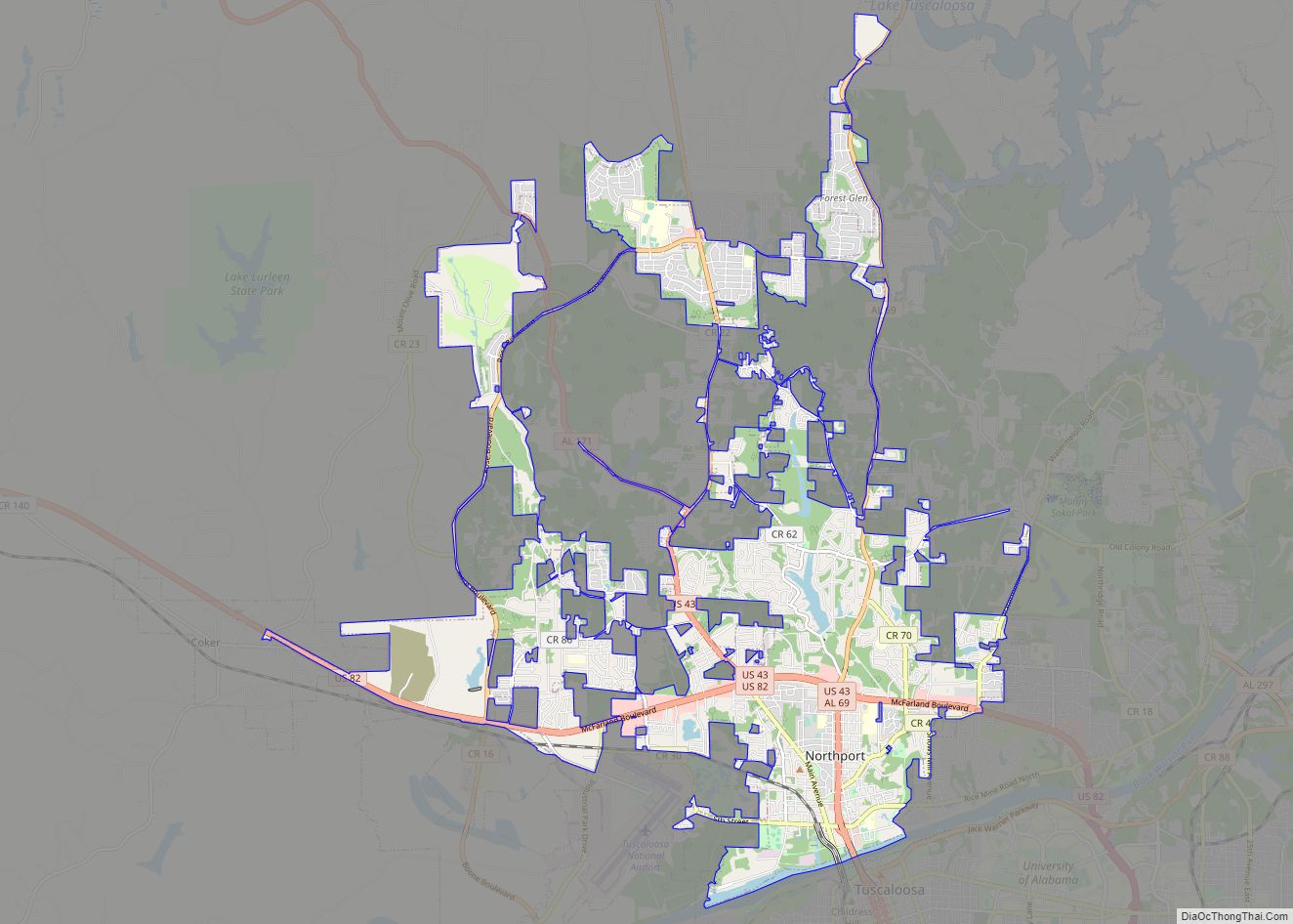
Online Interactive Map
Click on ![]() to view map in "full screen" mode.
to view map in "full screen" mode.
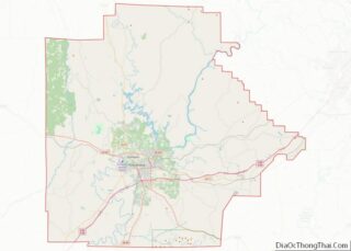
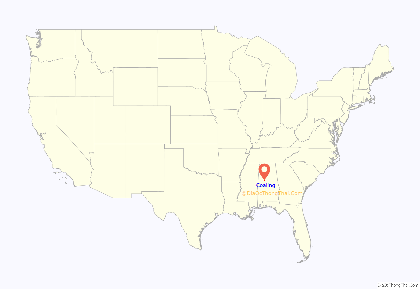
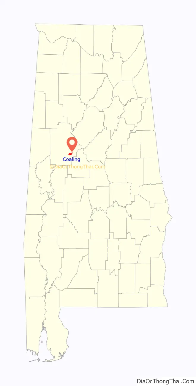
Coaling location map. Where is Coaling town?
History
On April 27, 2011, parts of Coaling were devastated by an EF-3 tornado at approximately 5:15 a.m. Three homes were completely destroyed, at least ten others were severely damaged, and twice as many more sustained light damage. Though there were no fatalities, some residents were hospitalized for injuries.
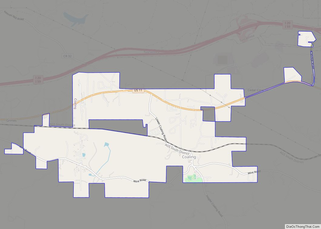
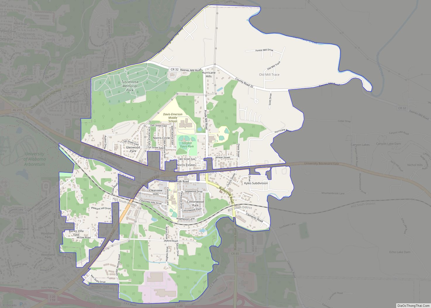
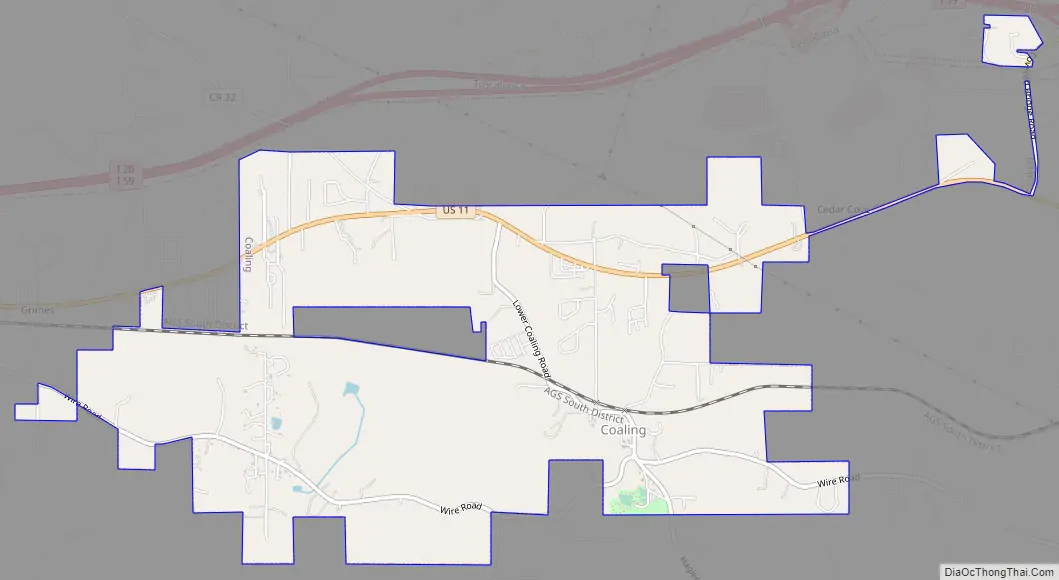
Coaling Road Map
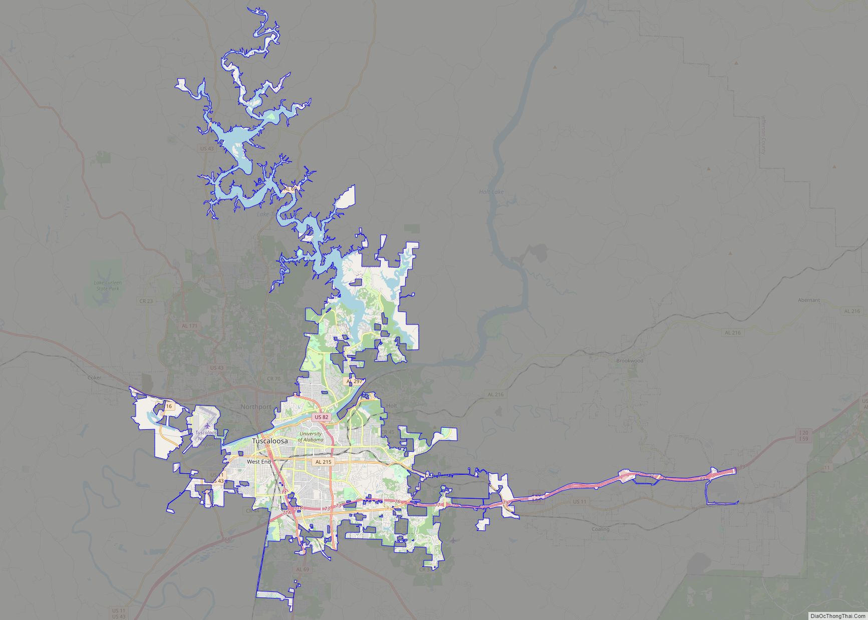
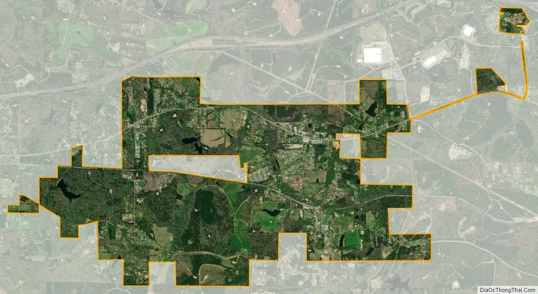
Coaling city Satellite Map
Geography
Coaling is located at 33°10′10″N 87°20′45″W / 33.16944°N 87.34583°W / 33.16944; -87.34583 (33.169442, -87.345859).
According to the U.S. Census Bureau, the city had a total area of 3.7 square miles (9.6 km), of which 3.7 square miles (9.6 km) is land and 0.1 square miles (0.26 km) (1.61%) is water.
See also
Map of Alabama State and its subdivision:- Autauga
- Baldwin
- Barbour
- Bibb
- Blount
- Bullock
- Butler
- Calhoun
- Chambers
- Cherokee
- Chilton
- Choctaw
- Clarke
- Clay
- Cleburne
- Coffee
- Colbert
- Conecuh
- Coosa
- Covington
- Crenshaw
- Cullman
- Dale
- Dallas
- De Kalb
- Elmore
- Escambia
- Etowah
- Fayette
- Franklin
- Geneva
- Greene
- Hale
- Henry
- Houston
- Jackson
- Jefferson
- Lamar
- Lauderdale
- Lawrence
- Lee
- Limestone
- Lowndes
- Macon
- Madison
- Marengo
- Marion
- Marshall
- Mobile
- Monroe
- Montgomery
- Morgan
- Perry
- Pickens
- Pike
- Randolph
- Russell
- Saint Clair
- Shelby
- Sumter
- Talladega
- Tallapoosa
- Tuscaloosa
- Walker
- Washington
- Wilcox
- Winston
- Alabama
- Alaska
- Arizona
- Arkansas
- California
- Colorado
- Connecticut
- Delaware
- District of Columbia
- Florida
- Georgia
- Hawaii
- Idaho
- Illinois
- Indiana
- Iowa
- Kansas
- Kentucky
- Louisiana
- Maine
- Maryland
- Massachusetts
- Michigan
- Minnesota
- Mississippi
- Missouri
- Montana
- Nebraska
- Nevada
- New Hampshire
- New Jersey
- New Mexico
- New York
- North Carolina
- North Dakota
- Ohio
- Oklahoma
- Oregon
- Pennsylvania
- Rhode Island
- South Carolina
- South Dakota
- Tennessee
- Texas
- Utah
- Vermont
- Virginia
- Washington
- West Virginia
- Wisconsin
- Wyoming