Dauphin Island is an island town in Mobile County, Alabama, United States, on a barrier island of the same name, in the Gulf of Mexico. It incorporated in 1988. The population was 1,778 at the 2020 census, up from 1,238 at the 2010 census. The town is part of the Mobile metropolitan area. The island (originally named Massacre Island) was renamed for Louis XIV of France’s great-grandson and heir, the dauphin, the future Louis XV of France. The name of the island is often mistaken as Dolphin Island; the word dauphin is French for dolphin, but historically, the term was used as the title of the heir apparent to the French monarch.
The island is one of the Mississippi–Alabama barrier islands, with the Gulf of Mexico to the south, and the Mississippi Sound and Mobile Bay to the north. The island’s eastern end helps define the mouth of Mobile Bay. The eastern, wider portion of the island is shaded by thick stands of pine trees and saw palmettos, but the narrow, western part of the island features scrub growth and few trees.
Dauphin Island is home to Fort Gaines, Dauphin Island Sea Lab, the Estuarium public aquarium, the Dauphin Island Airport, boat ramps, a large public pier that sits on dry land, historic sites, several restaurants, new condominium developments, and numerous private homes. Beaches attract tourism, and fishing is a popular activity in the waters around the island. The island is connected to the mainland by the Gordon Persons Bridge.
Although the island has several bird sanctuaries, the main one is the 164-acre (66 ha) Audubon Bird Sanctuary. Because Dauphin Island is the first land encountered by many birds as they migrate north from South America, many species can be found resting there before continuing their journey.
In May 2012, the central public beach began charging for access. This marked the second beach on the island to charge the public following the creation of the privately owned West End Beach.
| Name: | Dauphin Island town |
|---|---|
| LSAD Code: | 43 |
| LSAD Description: | town (suffix) |
| State: | Alabama |
| County: | Mobile County |
| Elevation: | 7 ft (2 m) |
| Total Area: | 165.95 sq mi (429.81 km²) |
| Land Area: | 6.26 sq mi (16.20 km²) |
| Water Area: | 159.69 sq mi (413.61 km²) |
| Total Population: | 1,778 |
| Population Density: | 284.21/sq mi (109.72/km²) |
| ZIP code: | 36528 |
| Area code: | 251 |
| FIPS code: | 0119744 |
| GNISfeature ID: | 0117086 |
| Website: | www.townofdauphinisland.org |
Online Interactive Map
Click on ![]() to view map in "full screen" mode.
to view map in "full screen" mode.
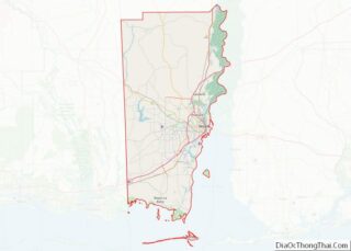
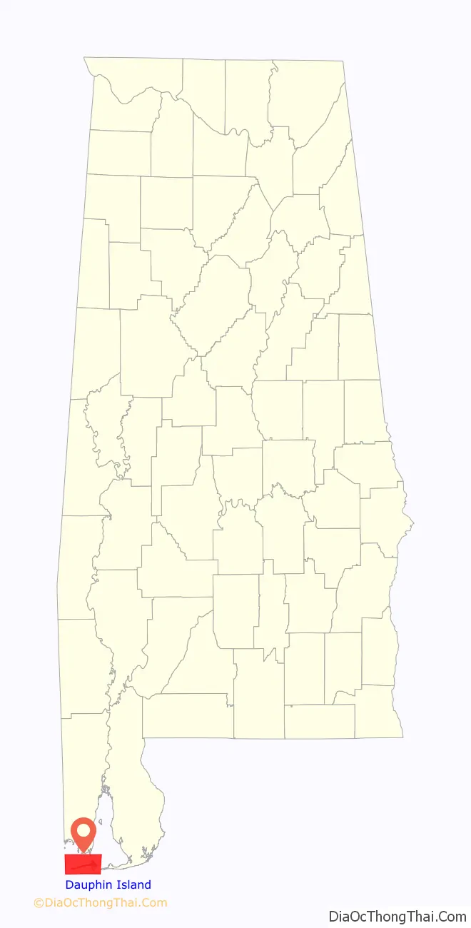
Dauphin Island location map. Where is Dauphin Island town?

History
Serpentine shell middens, perhaps 1,500 years old, attest to at least seasonal occupation by the Native American Mississippian Mound Builder culture. Shell Mound Park, along the island’s northern shore, is administered by the Alabama Marine Resources Division.
In 1519, the Spanish explorer Alonso Álvarez de Pineda was the first documented European to visit, staying long enough to map the island with remarkable accuracy.
The island’s French history began on January 31, 1699, when the explorer Pierre Le Moyne, sieur d’Iberville, one of the founders of French Louisiana, arrived at Mobile Bay and anchored near the island on his way to explore the mouth of the Mississippi River. D’Iberville mistakenly named it Île du Massacre (Massacre Island) because of a large pile of human skeletons discovered there. In reality, the site was a Mississippian burial mound which had been broken open by a hurricane, not a massacre site; however, the dramatic misnomer stuck.
D’Iberville later established a port for Fort Louis de La Louisiane on the island due to its abundant timber, reliable supply of fresh water, and deep-water harbor. The settlement consisted of a fort, a chapel, government-owned warehouses, and residences.
The island served as a major trading depot where goods from Saint-Domingue (Haiti), Mexico, Cuba and France were unloaded and a short-lived fur trade was conducted. Before a channel was dredged, Mobile Bay was too shallow and its sandbars too treacherous for ocean-going vessels to travel up the bay and Mobile River to Fort Louis de La Louisiane. Thus, smaller boats carried the cargo within Mobile Bay to and from Dauphin Island.
In 1719 the first African slaves of Alabama arrived at Dauphin Island. After the French and Indian War (known in Europe as the Seven Years’ War) ended in 1763, the island was ceded to the British. After the American Revolutionary War, the territory again came under Spanish jurisdiction, being part of the Province of West Florida until 1812.
In 1795 after the Treaty of San Lorenzo was signed between Spain and the United States, new settlers began migrating to Alabama from Virginia, North & South Carolina and Georgia.
In 1805, the Chickasaw, Cherokee and Choctaw people were forced to cede their lands to the government. The Creek tribes aggressively fought to hold their lands, but eventually were forced to cede in 1813.
Fort Gaines on the eastern tip of the island was built between 1821 and 1848. It was occupied by Confederate forces in 1861 and captured by the Union Army during the Battle of Mobile Bay. The phrase, “Damn the torpedoes, full speed ahead,” was supposedly spoken by U. S. Admiral David Farragut just a few hundred yards from Dauphin Island’s shore.
The first Sand Island Light, authorized in 1834, was replaced by a structure 150 feet (46 m) high, at a cost of $35,000, that was destroyed by Confederate forces. The present lighthouse (1873; in use until 1970), has been placed on the National Register of Historic Places. Its ownership was recently transferred from the U.S. Department of Interior to the town of Dauphin Island.
In 2023, a large alligator was spotted riding waves and sunbathing on the beach of Dauphin Island. Onlookers posted photos of the crocodile to social media, which subsequently went viral. While alligators traditionally live in freshwater, they are able to tolerate salt water as well according to the Alabama Department of Conservation and Natural Resources.
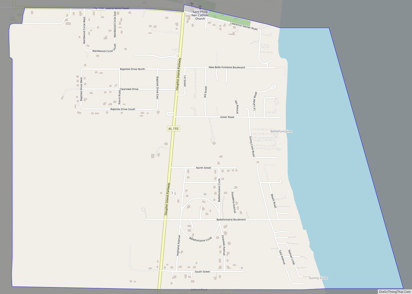
Dauphin Island Road Map
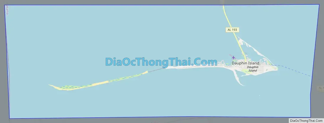
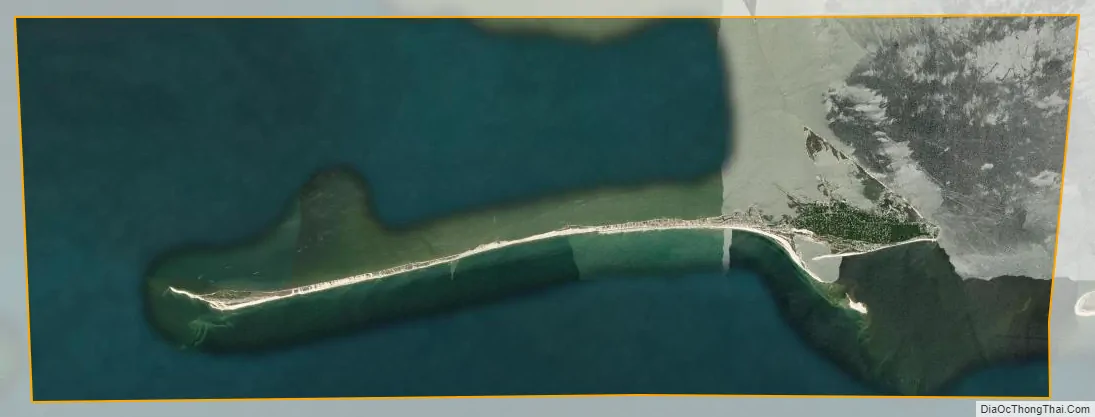
Dauphin Island city Satellite Map
Geography
Dauphin Island is 15 miles (24 km) long from east to west, separating the Gulf of Mexico to the south from the Mississippi Sound and Mobile Bay to the north. The island is less than 0.25 miles (0.40 km) wide for most of its length, except for the eastern quarter of the island, which is over 1 mile (1.6 km) wide. According to the U.S. Census Bureau, the island has a land area of 6.3 square miles (16 km), while the town’s total area is much greater: 166.0 square miles (430 km), with 159.9 square miles (414 km) of it, or 96.2% of the town, in the water of the surrounding Gulf and bays.
The Dauphin Island Bridge, officially the Gordon Persons Bridge, is the island’s sole road connection to the Alabama mainland, carrying State Route 193, which leads north 27 miles (43 km) to Tillmans Corner in the southwest outskirts of Mobile. Downtown Mobile is 37 miles (60 km) north of the island.
Climate
The climate in this area is characterized by hot, humid summers and generally mild to cool winters. According to the Köppen Climate Classification system, Dauphin Island has a humid subtropical climate, abbreviated “Cfa” on climate maps.
See also
Map of Alabama State and its subdivision:- Autauga
- Baldwin
- Barbour
- Bibb
- Blount
- Bullock
- Butler
- Calhoun
- Chambers
- Cherokee
- Chilton
- Choctaw
- Clarke
- Clay
- Cleburne
- Coffee
- Colbert
- Conecuh
- Coosa
- Covington
- Crenshaw
- Cullman
- Dale
- Dallas
- De Kalb
- Elmore
- Escambia
- Etowah
- Fayette
- Franklin
- Geneva
- Greene
- Hale
- Henry
- Houston
- Jackson
- Jefferson
- Lamar
- Lauderdale
- Lawrence
- Lee
- Limestone
- Lowndes
- Macon
- Madison
- Marengo
- Marion
- Marshall
- Mobile
- Monroe
- Montgomery
- Morgan
- Perry
- Pickens
- Pike
- Randolph
- Russell
- Saint Clair
- Shelby
- Sumter
- Talladega
- Tallapoosa
- Tuscaloosa
- Walker
- Washington
- Wilcox
- Winston
- Alabama
- Alaska
- Arizona
- Arkansas
- California
- Colorado
- Connecticut
- Delaware
- District of Columbia
- Florida
- Georgia
- Hawaii
- Idaho
- Illinois
- Indiana
- Iowa
- Kansas
- Kentucky
- Louisiana
- Maine
- Maryland
- Massachusetts
- Michigan
- Minnesota
- Mississippi
- Missouri
- Montana
- Nebraska
- Nevada
- New Hampshire
- New Jersey
- New Mexico
- New York
- North Carolina
- North Dakota
- Ohio
- Oklahoma
- Oregon
- Pennsylvania
- Rhode Island
- South Carolina
- South Dakota
- Tennessee
- Texas
- Utah
- Vermont
- Virginia
- Washington
- West Virginia
- Wisconsin
- Wyoming