Gulfcrest is a census-designated place and unincorporated community in Mobile County, Alabama, United States. Its population was 142 as of the 2020 census.
| Name: | Gulfcrest CDP |
|---|---|
| LSAD Code: | 57 |
| LSAD Description: | CDP (suffix) |
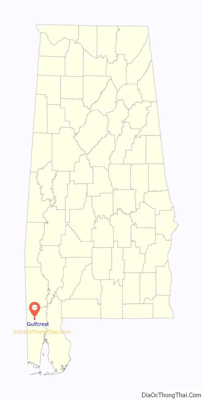
| State: | Alabama |
| County: | Mobile County |
| Elevation: | 148 ft (45 m) |
| Total Area: | 1.52 sq mi (3.93 km²) |
| Land Area: | 1.51 sq mi (3.92 km²) |
| Water Area: | 0.00 sq mi (0.01 km²) |
| Total Population: | 142 |
| Population Density: | 93.79/sq mi (36.21/km²) |
| Area code: | 251 |
| FIPS code: | 0132248 |
| GNISfeature ID: | 143406 |
Online Interactive Map
Click on ![]() to view map in "full screen" mode.
to view map in "full screen" mode.
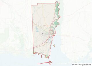
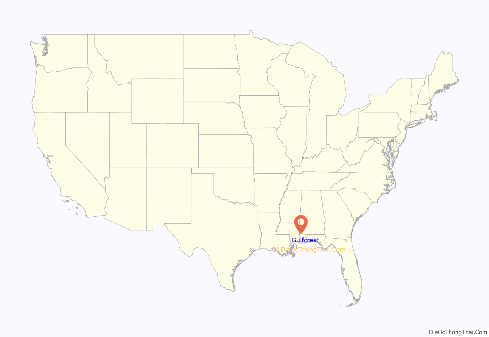
Gulfcrest location map. Where is Gulfcrest CDP?
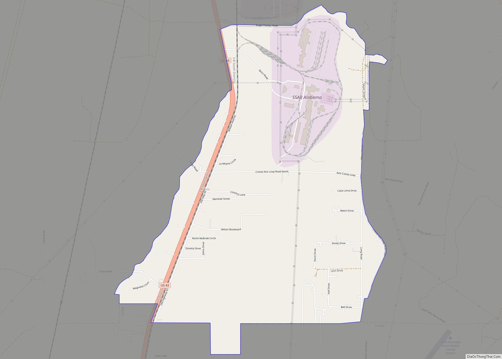
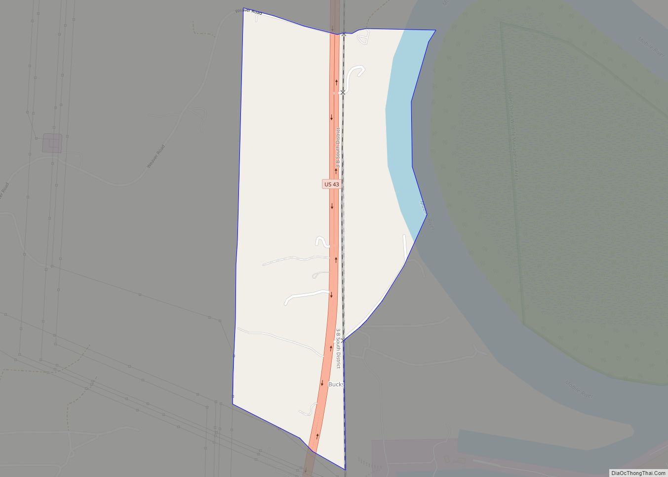
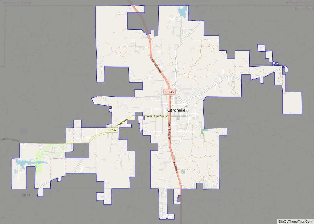
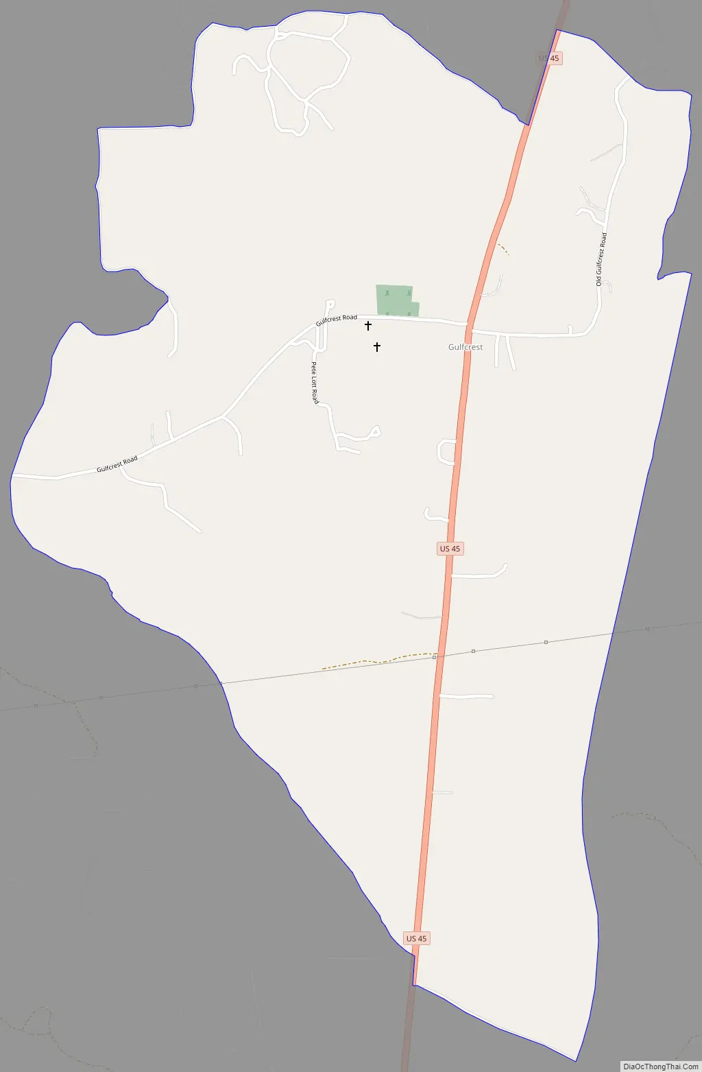
Gulfcrest Road Map
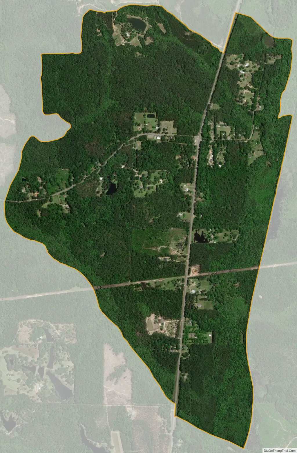
Gulfcrest city Satellite Map
Geography
Gulfcrest is in northern Mobile County, along U.S. Route 45, which leads southeast 26 miles (42 km) to Mobile and north 6 miles (10 km) to Citronelle.
According to the U.S. Census Bureau, Gulfcrest has a total area of 1.5 square miles (3.9 km), of which 0.003 square miles (0.0078 km), or 0.20%, are water. Chickasaw Creek, a south-flowing tributary of the Mobile River, forms the eastern boundary of the Gulfcrest CDP.
See also
Map of Alabama State and its subdivision:- Autauga
- Baldwin
- Barbour
- Bibb
- Blount
- Bullock
- Butler
- Calhoun
- Chambers
- Cherokee
- Chilton
- Choctaw
- Clarke
- Clay
- Cleburne
- Coffee
- Colbert
- Conecuh
- Coosa
- Covington
- Crenshaw
- Cullman
- Dale
- Dallas
- De Kalb
- Elmore
- Escambia
- Etowah
- Fayette
- Franklin
- Geneva
- Greene
- Hale
- Henry
- Houston
- Jackson
- Jefferson
- Lamar
- Lauderdale
- Lawrence
- Lee
- Limestone
- Lowndes
- Macon
- Madison
- Marengo
- Marion
- Marshall
- Mobile
- Monroe
- Montgomery
- Morgan
- Perry
- Pickens
- Pike
- Randolph
- Russell
- Saint Clair
- Shelby
- Sumter
- Talladega
- Tallapoosa
- Tuscaloosa
- Walker
- Washington
- Wilcox
- Winston
- Alabama
- Alaska
- Arizona
- Arkansas
- California
- Colorado
- Connecticut
- Delaware
- District of Columbia
- Florida
- Georgia
- Hawaii
- Idaho
- Illinois
- Indiana
- Iowa
- Kansas
- Kentucky
- Louisiana
- Maine
- Maryland
- Massachusetts
- Michigan
- Minnesota
- Mississippi
- Missouri
- Montana
- Nebraska
- Nevada
- New Hampshire
- New Jersey
- New Mexico
- New York
- North Carolina
- North Dakota
- Ohio
- Oklahoma
- Oregon
- Pennsylvania
- Rhode Island
- South Carolina
- South Dakota
- Tennessee
- Texas
- Utah
- Vermont
- Virginia
- Washington
- West Virginia
- Wisconsin
- Wyoming