Henagar is a city in DeKalb County, Alabama, United States. At the 2020 census, the population was 2,292.
Henagar is located on top of Sand Mountain, a southern extension of the Cumberland Plateau.
| Name: | Henagar city |
|---|---|
| LSAD Code: | 25 |
| LSAD Description: | city (suffix) |
| State: | Alabama |
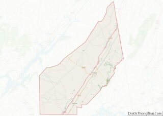
| County: | DeKalb County |
| Elevation: | 1,486 ft (453 m) |
| Total Area: | 22.64 sq mi (58.64 km²) |
| Land Area: | 22.61 sq mi (58.56 km²) |
| Water Area: | 0.03 sq mi (0.09 km²) |
| Total Population: | 2,292 |
| Population Density: | 101.38/sq mi (39.14/km²) |
| ZIP code: | 35978 |
| Area code: | 256 |
| FIPS code: | 0134096 |
| GNISfeature ID: | 2404680 |
| Website: | www.cityofhenagar.com |
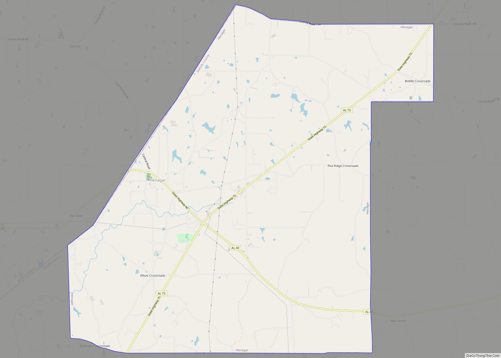
Online Interactive Map
Click on ![]() to view map in "full screen" mode.
to view map in "full screen" mode.
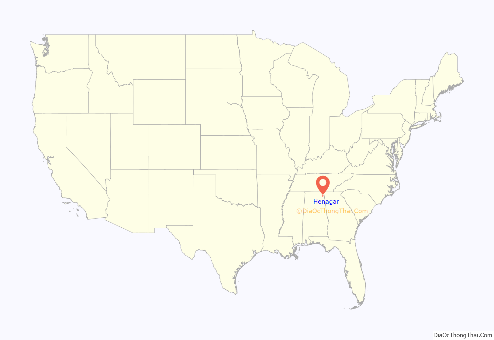
Henagar location map. Where is Henagar city?
History
Henagar was first settled circa 1855. The town is named after an early settler, George Henegar. A post office was established in 1878. It was then that a postal official misspelled the town’s name as “Henagar”. In 1901, a public school was built. At daybreak on November 18, 1906, a Sunday, a tornado struck the town, and all “fifteen stores and houses were reduced to splinters.” They rebuilt, and Henagar incorporated in 1965.
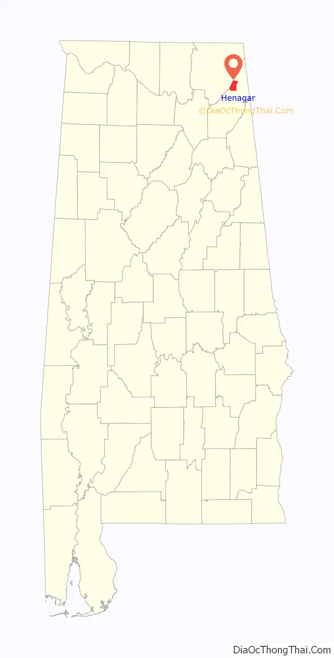
Henagar Road Map
Henagar city Satellite Map

Geography
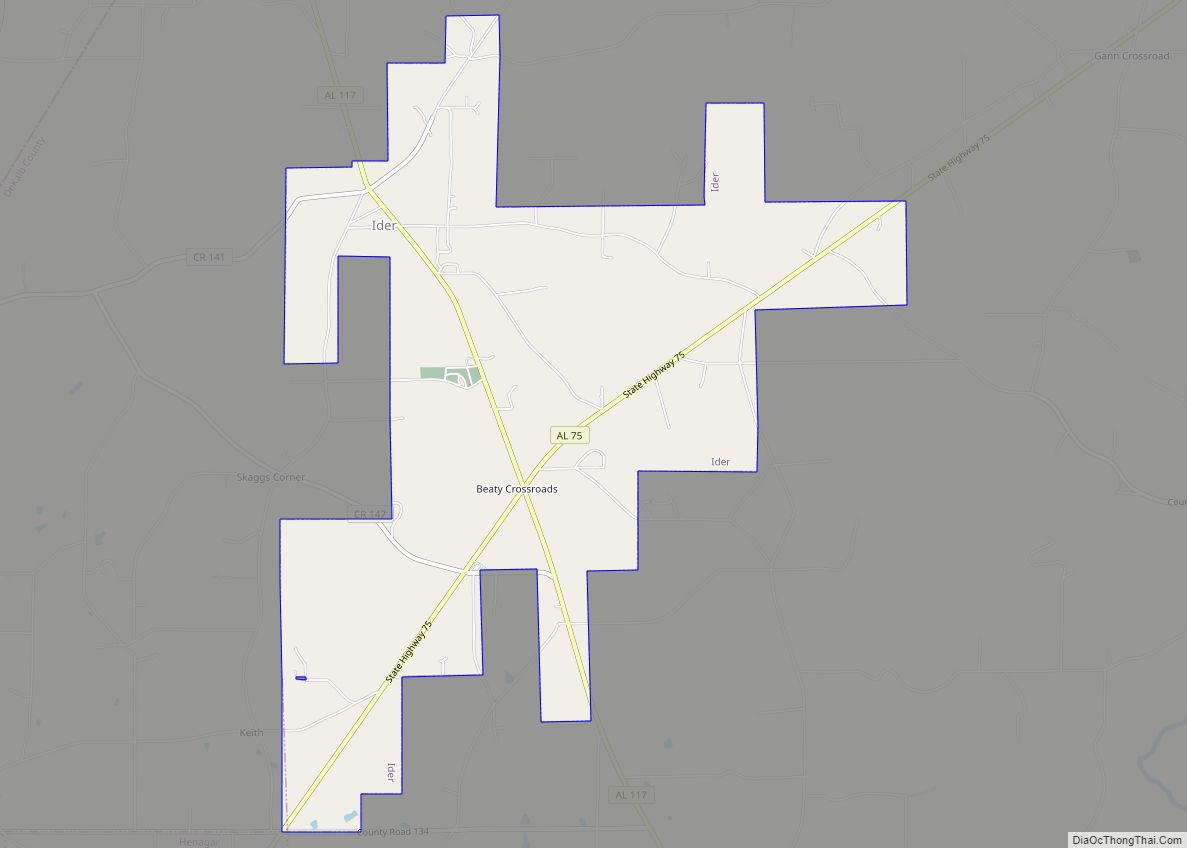
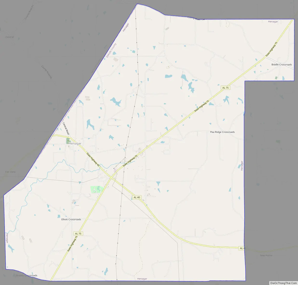
Henagar is located in northern DeKalb County; it borders Jackson County in the northwest.
Alabama State Route 40 passes through the original center of town, leading east 8 miles (13 km) to Interstate 59 in Hammondville and west 19 miles (31 km) to Scottsboro. Alabama State Route 75 crosses AL 40 in the newer commercial part of Henagar and leads northeast 8 miles (13 km) to Ider and southwest 10 miles (16 km) to Rainsville.
According to the U.S. Census Bureau, Henagar has a total area of 22.3 square miles (57.8 km), of which 22.3 square miles (57.7 km) is land and 0.04 square miles (0.1 km), or 0.15%, is water. South Sauty Creek, a tributary of the Tennessee River, flows southwest through the central and southern part of the city.
See also
Map of Alabama State and its subdivision:- Autauga
- Baldwin
- Barbour
- Bibb
- Blount
- Bullock
- Butler
- Calhoun
- Chambers
- Cherokee
- Chilton
- Choctaw
- Clarke
- Clay
- Cleburne
- Coffee
- Colbert
- Conecuh
- Coosa
- Covington
- Crenshaw
- Cullman
- Dale
- Dallas
- De Kalb
- Elmore
- Escambia
- Etowah
- Fayette
- Franklin
- Geneva
- Greene
- Hale
- Henry
- Houston
- Jackson
- Jefferson
- Lamar
- Lauderdale
- Lawrence
- Lee
- Limestone
- Lowndes
- Macon
- Madison
- Marengo
- Marion
- Marshall
- Mobile
- Monroe
- Montgomery
- Morgan
- Perry
- Pickens
- Pike
- Randolph
- Russell
- Saint Clair
- Shelby
- Sumter
- Talladega
- Tallapoosa
- Tuscaloosa
- Walker
- Washington
- Wilcox
- Winston
- Alabama
- Alaska
- Arizona
- Arkansas
- California
- Colorado
- Connecticut
- Delaware
- District of Columbia
- Florida
- Georgia
- Hawaii
- Idaho
- Illinois
- Indiana
- Iowa
- Kansas
- Kentucky
- Louisiana
- Maine
- Maryland
- Massachusetts
- Michigan
- Minnesota
- Mississippi
- Missouri
- Montana
- Nebraska
- Nevada
- New Hampshire
- New Jersey
- New Mexico
- New York
- North Carolina
- North Dakota
- Ohio
- Oklahoma
- Oregon
- Pennsylvania
- Rhode Island
- South Carolina
- South Dakota
- Tennessee
- Texas
- Utah
- Vermont
- Virginia
- Washington
- West Virginia
- Wisconsin
- Wyoming