Mentone is a town in DeKalb County, Alabama, United States. It is located atop Lookout Mountain.
A number of private summer camps are located near Mentone. For a number of years, Mentone has hosted an unusually large number of summer camps. Mentone attracts many visitors and tourists annually, partly due to the summer camps.
| Name: | Mentone town |
|---|---|
| LSAD Code: | 43 |
| LSAD Description: | town (suffix) |
| State: | Alabama |
| County: | DeKalb County |
| Elevation: | 1,686 ft (514 m) |
| Total Area: | 4.30 sq mi (11.13 km²) |
| Land Area: | 4.29 sq mi (11.11 km²) |
| Water Area: | 0.01 sq mi (0.03 km²) |
| Total Population: | 319 |
| Population Density: | 74.38/sq mi (28.72/km²) |
| ZIP code: | 35984 |
| Area code: | 256 |
| FIPS code: | 0148064 |
| GNISfeature ID: | 2406147 |
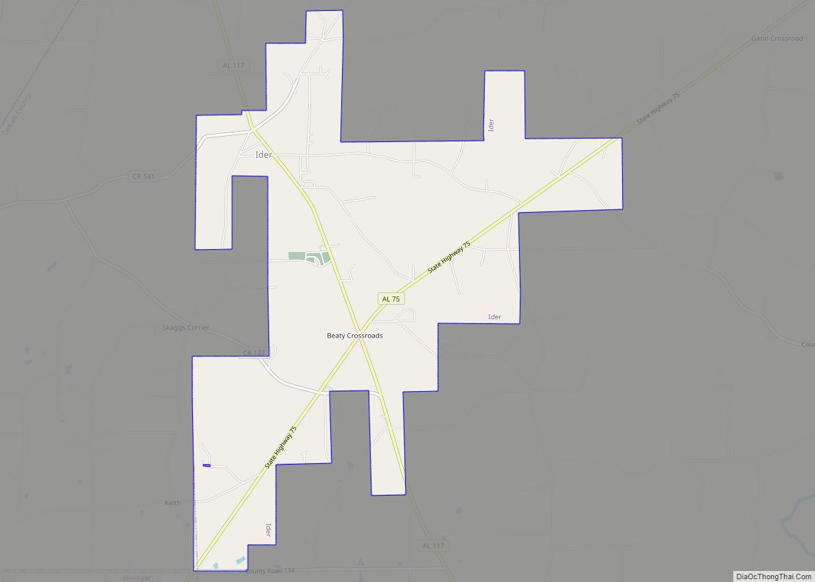
Online Interactive Map
Click on ![]() to view map in "full screen" mode.
to view map in "full screen" mode.
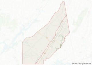
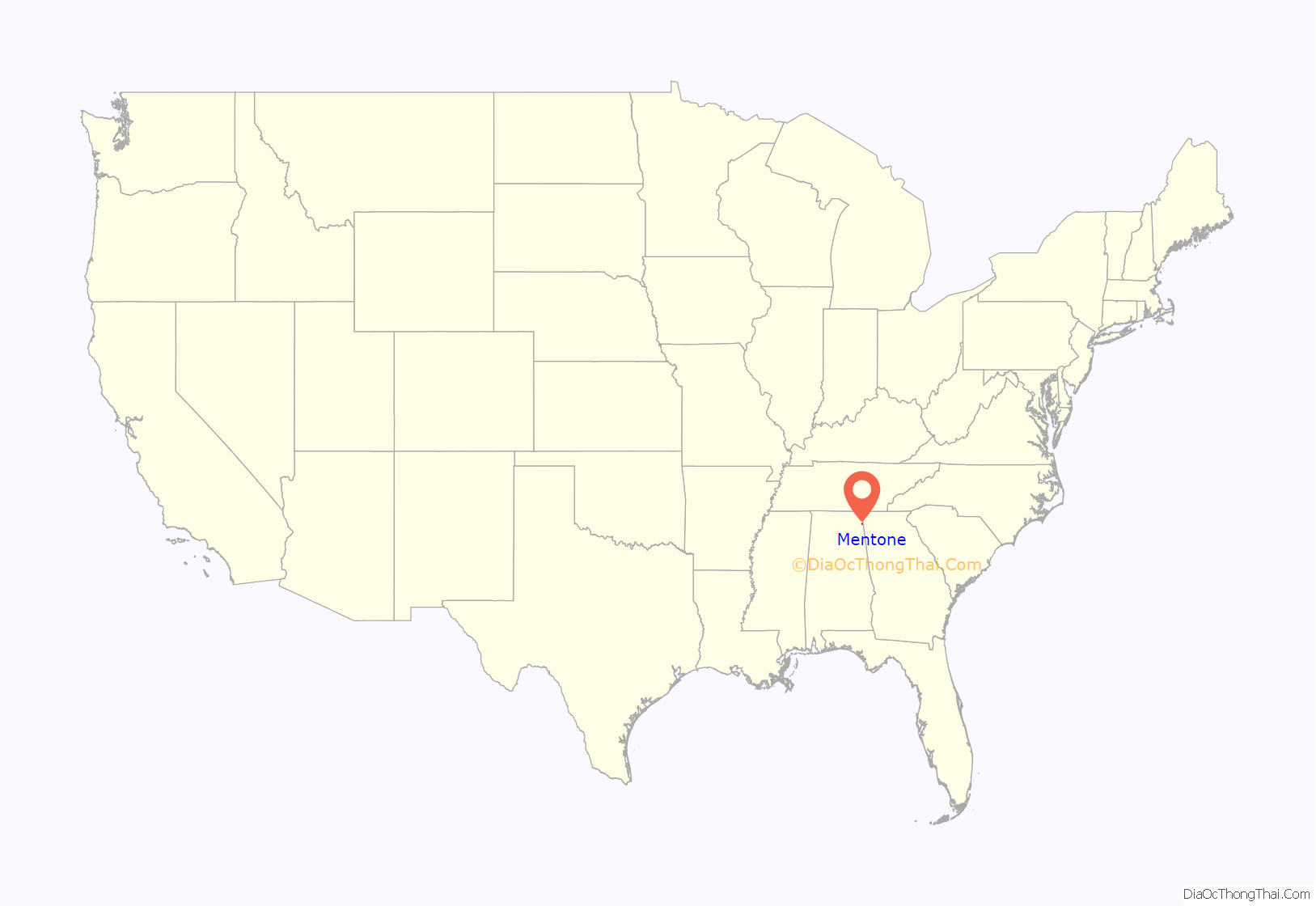
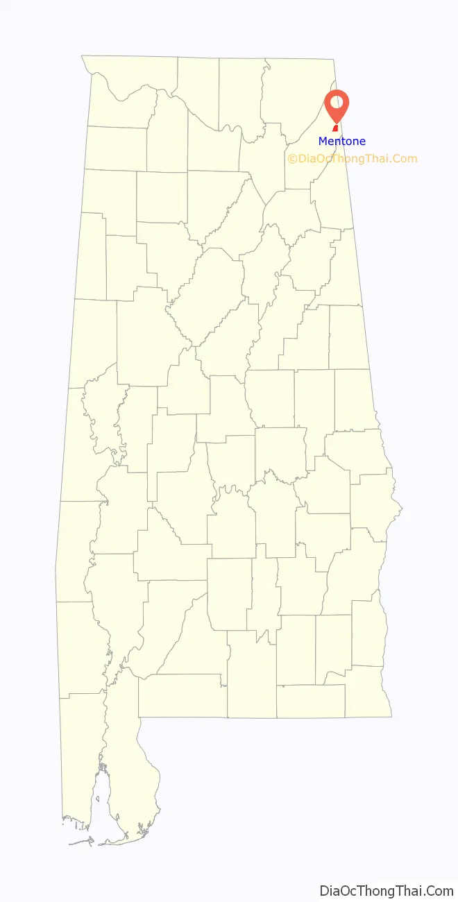
Mentone location map. Where is Mentone town?
History
The community was named after Menton in France and was incorporated in 1935.
In April 2003, it was the town nearest the epicenter of a magnitude 4.6 earthquake. The surprise quake had alarmed residents in the dark hours of the morning and was felt across several states, but it had caused no injuries and only minor damage to the town. Mentone is in the Ridge and Valley region of the southwestern Appalachian Mountains, an area that generally goes several decades between significant earthquakes but has never had a major one in recorded history.
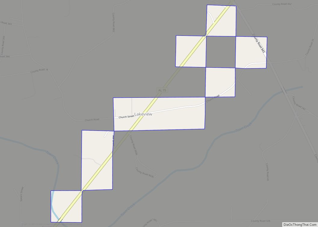
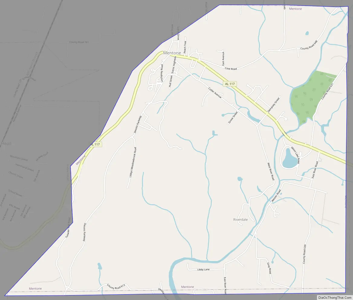
Mentone Road Map
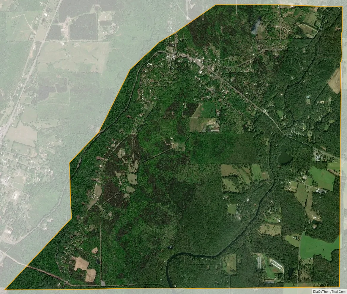
Mentone city Satellite Map
Geography
Mentone is located in eastern DeKalb County at 34°34′20″N 85°34′49″W / 34.57222°N 85.58028°W / 34.57222; -85.58028 (34.572360, -85.580283). It is bordered to the west by the town of Valley Head. The center of town is located on the crest of Lookout Mountain at an elevation of 1,736 feet (529 m). The western border of the town, with Valley Head, follows the western slopes of the mountain. Extending south from the town center is the mountain’s ridgecrest that rises to an elevation of 1,785 feet (544 m) within the town limits. The West Fork of the Little River crosses the eastern portion of the town at an elevation less than 100 feet (30 m) below the ridgecrest.
According to the U.S. Census Bureau, the town has a total area of 4.7 square miles (12.1 km), of which 0.01 square miles (0.03 km), or 0.23%, is water.
See also
Map of Alabama State and its subdivision:- Autauga
- Baldwin
- Barbour
- Bibb
- Blount
- Bullock
- Butler
- Calhoun
- Chambers
- Cherokee
- Chilton
- Choctaw
- Clarke
- Clay
- Cleburne
- Coffee
- Colbert
- Conecuh
- Coosa
- Covington
- Crenshaw
- Cullman
- Dale
- Dallas
- De Kalb
- Elmore
- Escambia
- Etowah
- Fayette
- Franklin
- Geneva
- Greene
- Hale
- Henry
- Houston
- Jackson
- Jefferson
- Lamar
- Lauderdale
- Lawrence
- Lee
- Limestone
- Lowndes
- Macon
- Madison
- Marengo
- Marion
- Marshall
- Mobile
- Monroe
- Montgomery
- Morgan
- Perry
- Pickens
- Pike
- Randolph
- Russell
- Saint Clair
- Shelby
- Sumter
- Talladega
- Tallapoosa
- Tuscaloosa
- Walker
- Washington
- Wilcox
- Winston
- Alabama
- Alaska
- Arizona
- Arkansas
- California
- Colorado
- Connecticut
- Delaware
- District of Columbia
- Florida
- Georgia
- Hawaii
- Idaho
- Illinois
- Indiana
- Iowa
- Kansas
- Kentucky
- Louisiana
- Maine
- Maryland
- Massachusetts
- Michigan
- Minnesota
- Mississippi
- Missouri
- Montana
- Nebraska
- Nevada
- New Hampshire
- New Jersey
- New Mexico
- New York
- North Carolina
- North Dakota
- Ohio
- Oklahoma
- Oregon
- Pennsylvania
- Rhode Island
- South Carolina
- South Dakota
- Tennessee
- Texas
- Utah
- Vermont
- Virginia
- Washington
- West Virginia
- Wisconsin
- Wyoming