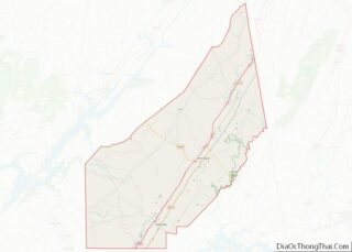
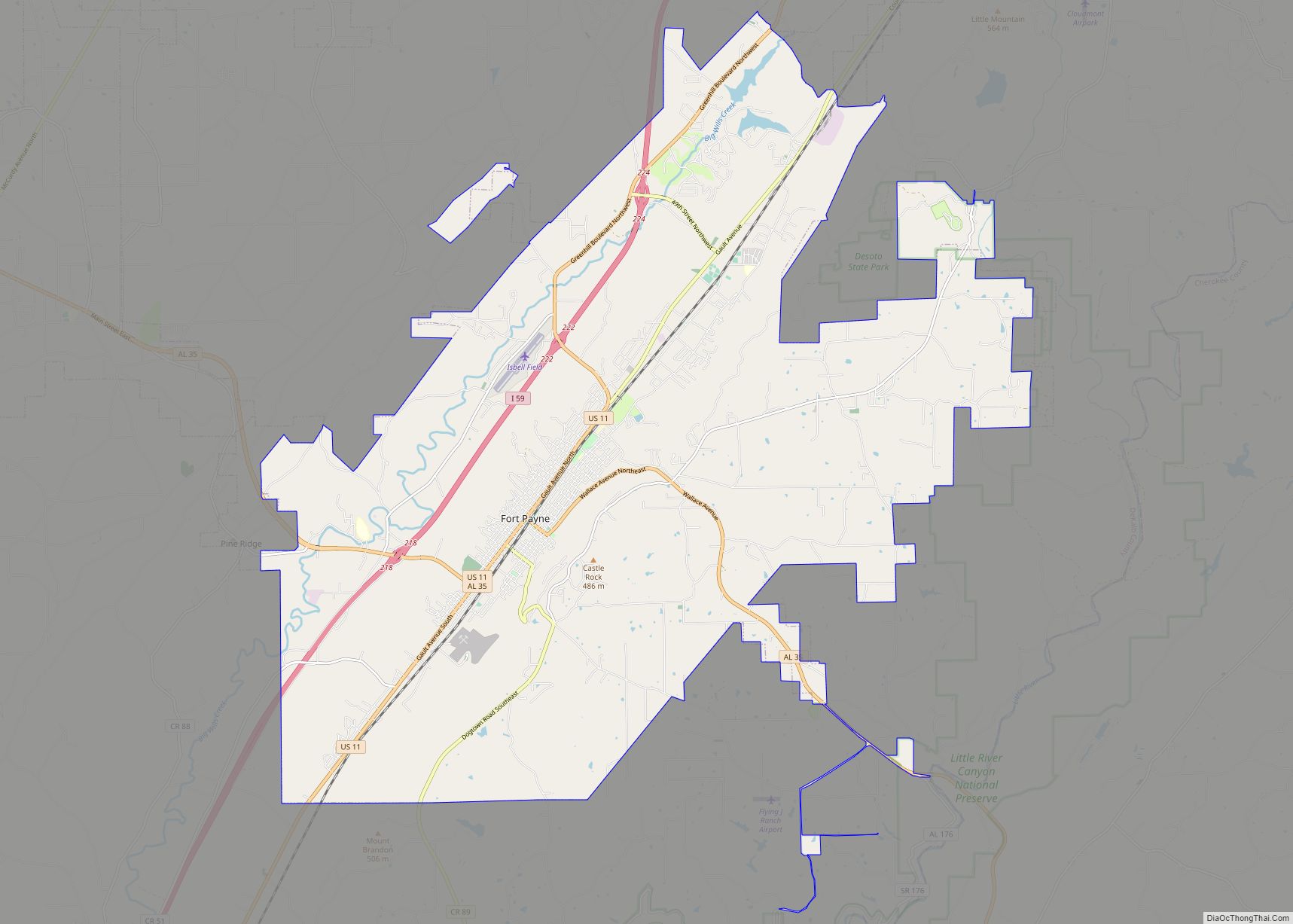
Pine Ridge is a town in DeKalb County, Alabama, United States. It incorporated in 1982. At the 2020 census, the population was 263.
| Name: | Pine Ridge town |
|---|---|
| LSAD Code: | 43 |
| LSAD Description: | town (suffix) |
| State: | Alabama |
| County: | DeKalb County |
| Elevation: | 955 ft (291 m) |
| Total Area: | 1.33 sq mi (3.45 km²) |
| Land Area: | 1.33 sq mi (3.45 km²) |
| Water Area: | 0.00 sq mi (0.00 km²) |
| Total Population: | 263 |
| Population Density: | 197.45/sq mi (76.24/km²) |
| ZIP code: | 35968 |
| Area code: | 256 and 938 |
| FIPS code: | 0160372 |
| GNISfeature ID: | 2407119 |
Online Interactive Map
Click on ![]() to view map in "full screen" mode.
to view map in "full screen" mode.
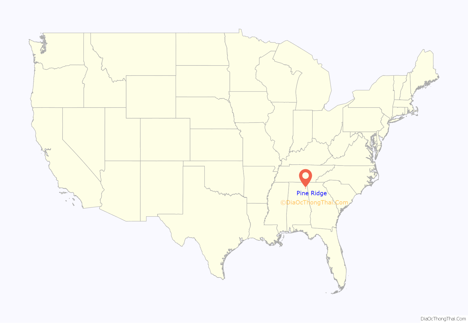
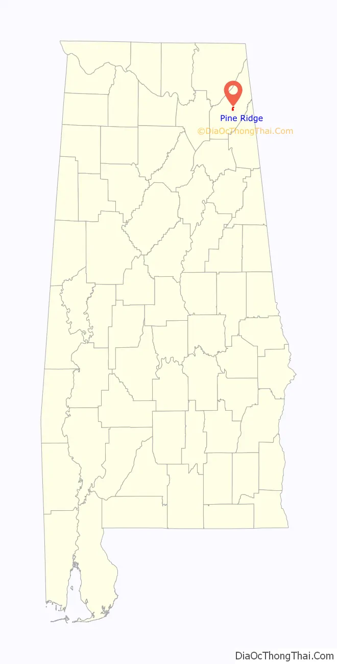
Pine Ridge location map. Where is Pine Ridge town?
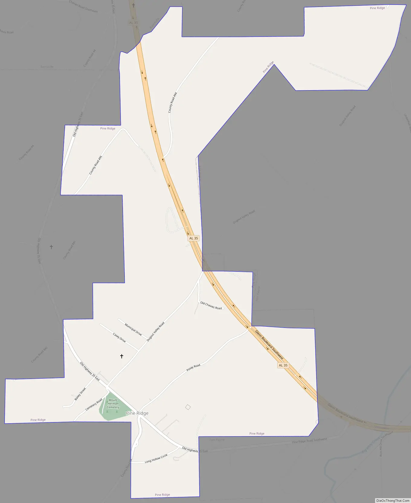
Pine Ridge Road Map
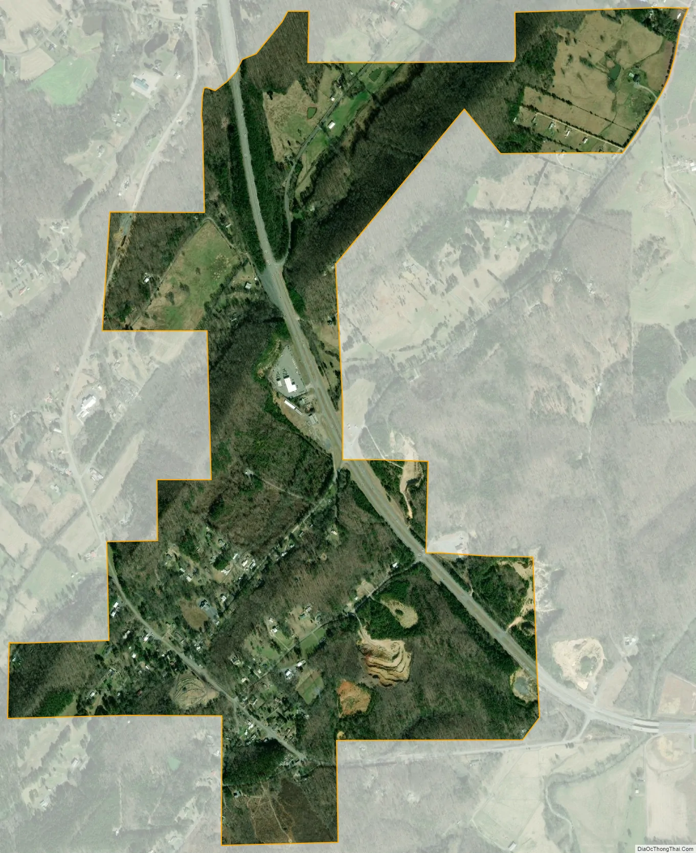
Pine Ridge city Satellite Map
Geography
Pine Ridge is located near the geographic center of DeKalb County at 34°26′45″N 85°46′45″W / 34.44583°N 85.77917°W / 34.44583; -85.77917 (34.445939, -85.779069). It is bordered to the east by the city of Fort Payne, the county seat, and to the northwest by the city of Rainsville.
Pine Ridge is in the Ridge and Valley portion of the Appalachian Mountains and occupies a series of low ridges and valleys. From east to west, they are Middle Ridge, Dugout Valley, Shinbone Ridge, and Sand Valley, with the northwestern part of the town climbing the eastern edge of Sand Mountain, a southern extension of the Cumberland Plateau.
Alabama State Route 35 passes through the town, connecting Fort Payne and Rainsville. Exit 218 on Interstate 59 is 2 miles (3 km) east of Pine Ridge via AL 35.
According to the U.S. Census Bureau, the town has a total area of 1.3 square miles (3.4 km), all land.
See also
Map of Alabama State and its subdivision:- Autauga
- Baldwin
- Barbour
- Bibb
- Blount
- Bullock
- Butler
- Calhoun
- Chambers
- Cherokee
- Chilton
- Choctaw
- Clarke
- Clay
- Cleburne
- Coffee
- Colbert
- Conecuh
- Coosa
- Covington
- Crenshaw
- Cullman
- Dale
- Dallas
- De Kalb
- Elmore
- Escambia
- Etowah
- Fayette
- Franklin
- Geneva
- Greene
- Hale
- Henry
- Houston
- Jackson
- Jefferson
- Lamar
- Lauderdale
- Lawrence
- Lee
- Limestone
- Lowndes
- Macon
- Madison
- Marengo
- Marion
- Marshall
- Mobile
- Monroe
- Montgomery
- Morgan
- Perry
- Pickens
- Pike
- Randolph
- Russell
- Saint Clair
- Shelby
- Sumter
- Talladega
- Tallapoosa
- Tuscaloosa
- Walker
- Washington
- Wilcox
- Winston
- Alabama
- Alaska
- Arizona
- Arkansas
- California
- Colorado
- Connecticut
- Delaware
- District of Columbia
- Florida
- Georgia
- Hawaii
- Idaho
- Illinois
- Indiana
- Iowa
- Kansas
- Kentucky
- Louisiana
- Maine
- Maryland
- Massachusetts
- Michigan
- Minnesota
- Mississippi
- Missouri
- Montana
- Nebraska
- Nevada
- New Hampshire
- New Jersey
- New Mexico
- New York
- North Carolina
- North Dakota
- Ohio
- Oklahoma
- Oregon
- Pennsylvania
- Rhode Island
- South Carolina
- South Dakota
- Tennessee
- Texas
- Utah
- Vermont
- Virginia
- Washington
- West Virginia
- Wisconsin
- Wyoming