Waterloo is a town in Lauderdale County, Alabama, United States. It is part of the Florence–Muscle Shoals metropolitan area, known as “The Shoals”. As of the 2010 census, the population of the town was 203, down from 208 in 2000. The town and surrounding area is served by Waterloo High School and by the Waterloo Volunteer Fire Department.
| Name: | Waterloo town |
|---|---|
| LSAD Code: | 43 |
| LSAD Description: | town (suffix) |
| State: | Alabama |
| County: | Lauderdale County |
| Incorporated: | 1832 |
| Elevation: | 466 ft (142 m) |
| Total Area: | 0.80 sq mi (2.08 km²) |
| Land Area: | 0.75 sq mi (1.94 km²) |
| Water Area: | 0.05 sq mi (0.14 km²) |
| Total Population: | 178 |
| Population Density: | 237.97/sq mi (91.94/km²) |
| ZIP code: | 35677 |
| Area code: | 256 |
| FIPS code: | 0180064 |
| GNISfeature ID: | 128626 |
| Website: | www.waterlooalabama.com |
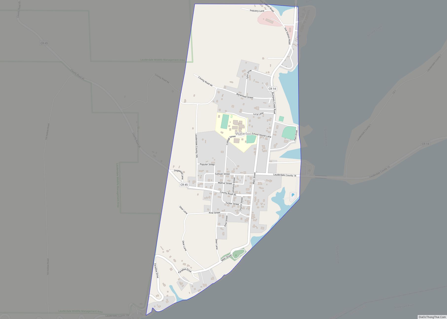
Online Interactive Map
Click on ![]() to view map in "full screen" mode.
to view map in "full screen" mode.
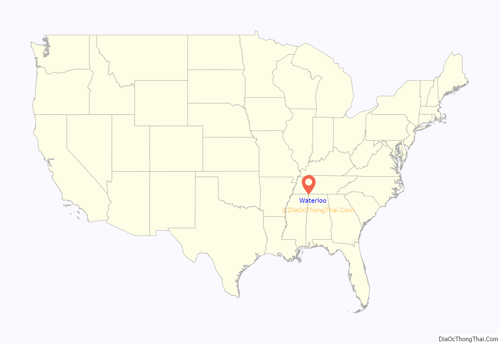
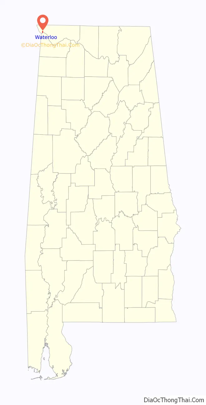
Waterloo location map. Where is Waterloo town?
History
The town was incorporated in 1832 on the banks of the Tennessee River. The name most likely commemorates the Battle of Waterloo. According to the 1910 U.S. Census, Waterloo was reincorporated in 1903.
In the 1930s, the town was moved to its current location when the Tennessee Valley Authority completed the Pickwick Landing Dam, which impounds Pickwick Lake. Waterloo has lost a large area of land to floods and later the construction of Pickwick Landing Dam.
In 1880, when it first appeared on the U.S. Census, and again from 1910 to 1940, it was the second largest community in Lauderdale County after Florence, reaching its zenith of 524 residents in 1940. It has since lost two-thirds of its population and since 1980, and ranks 8th and smallest of Lauderdale County’s incorporated communities with 203 residents.
Waterloo Road Map
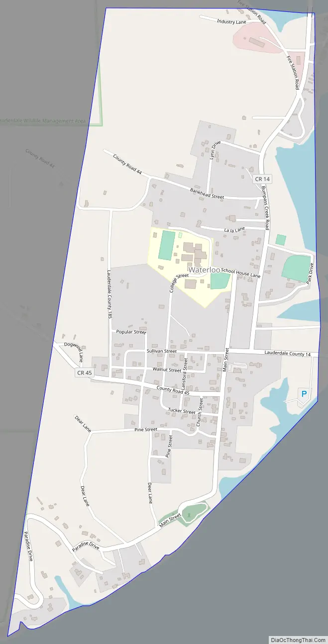
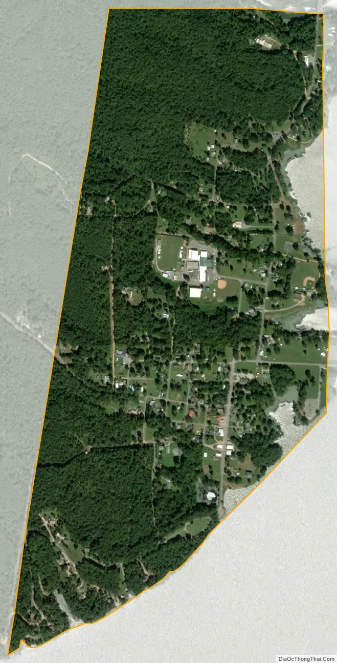
Waterloo city Satellite Map
Geography
Waterloo is located along the north shore of Pickwick Lake, a reservoir along the Tennessee River created by Pickwick Landing Dam approximately 20 miles (32 km) downstream. Second Creek, which flows from the north, empties into Pickwick Lake at Waterloo, creating a small inlet. The point at which the states of Alabama, Mississippi, and Tennessee meet is located several miles northwest of Waterloo. County Road 14 connects Waterloo with Florence to the east.
According to the U.S. Census Bureau, the town has a total area of 0.8 square miles (2.1 km), of which 0.75 square miles (1.9 km) is land and 0.05 square miles (0.13 km) (6.17%) is water.
See also
Map of Alabama State and its subdivision:- Autauga
- Baldwin
- Barbour
- Bibb
- Blount
- Bullock
- Butler
- Calhoun
- Chambers
- Cherokee
- Chilton
- Choctaw
- Clarke
- Clay
- Cleburne
- Coffee
- Colbert
- Conecuh
- Coosa
- Covington
- Crenshaw
- Cullman
- Dale
- Dallas
- De Kalb
- Elmore
- Escambia
- Etowah
- Fayette
- Franklin
- Geneva
- Greene
- Hale
- Henry
- Houston
- Jackson
- Jefferson
- Lamar
- Lauderdale
- Lawrence
- Lee
- Limestone
- Lowndes
- Macon
- Madison
- Marengo
- Marion
- Marshall
- Mobile
- Monroe
- Montgomery
- Morgan
- Perry
- Pickens
- Pike
- Randolph
- Russell
- Saint Clair
- Shelby
- Sumter
- Talladega
- Tallapoosa
- Tuscaloosa
- Walker
- Washington
- Wilcox
- Winston
- Alabama
- Alaska
- Arizona
- Arkansas
- California
- Colorado
- Connecticut
- Delaware
- District of Columbia
- Florida
- Georgia
- Hawaii
- Idaho
- Illinois
- Indiana
- Iowa
- Kansas
- Kentucky
- Louisiana
- Maine
- Maryland
- Massachusetts
- Michigan
- Minnesota
- Mississippi
- Missouri
- Montana
- Nebraska
- Nevada
- New Hampshire
- New Jersey
- New Mexico
- New York
- North Carolina
- North Dakota
- Ohio
- Oklahoma
- Oregon
- Pennsylvania
- Rhode Island
- South Carolina
- South Dakota
- Tennessee
- Texas
- Utah
- Vermont
- Virginia
- Washington
- West Virginia
- Wisconsin
- Wyoming