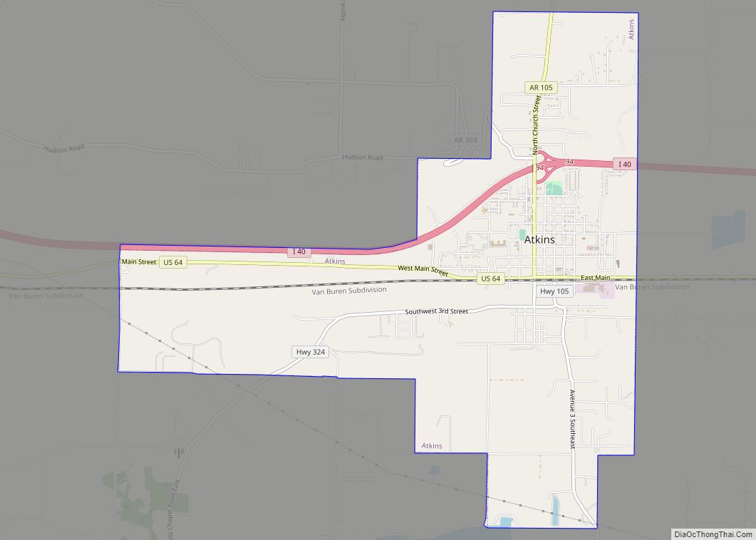
Atkins is a city in Pope County, Arkansas, United States. The population was 3,016 at the 2010 census. It is part of the Russellville Micropolitan Statistical Area.
| Name: | Atkins city |
|---|---|
| LSAD Code: | 25 |
| LSAD Description: | city (suffix) |
| State: | Arkansas |
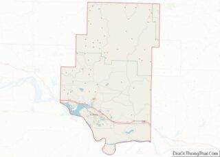
| County: | Pope County |
| Elevation: | 367 ft (112 m) |
| Total Area: | 6.14 sq mi (15.89 km²) |
| Land Area: | 6.13 sq mi (15.88 km²) |
| Water Area: | 0.01 sq mi (0.01 km²) |
| Total Population: | 2,859 |
| Population Density: | 466.39/sq mi (180.09/km²) |
| ZIP code: | 72823 |
| Area code: | 479 |
| FIPS code: | 0502590 |
| GNISfeature ID: | 2403125 |
Online Interactive Map
Click on ![]() to view map in "full screen" mode.
to view map in "full screen" mode.
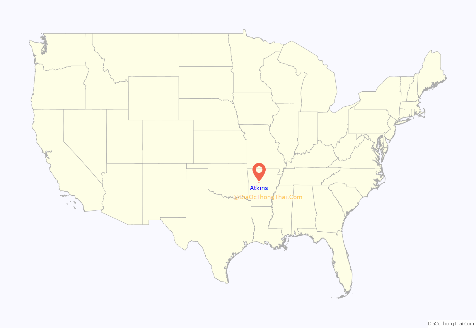
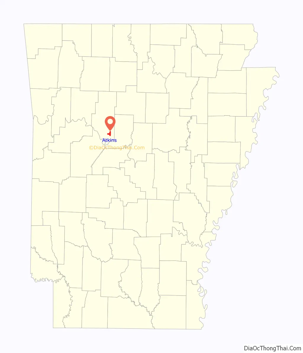
Atkins location map. Where is Atkins city?
History
The town is named after Elisha Atkins, a Boston sugar importer who financed the Little Rock and Fort Smith Railroad which spawned the growth of the town after the Civil War. It was formally platted in 1872. Atkins built its first school in 1875 and boasted its own newspaper, the Atkins Chronicle in 1894. The town served as a local cotton depot with a number of cotton gins operating in town. The 1927 flooding of the Arkansas River damaged the town and subsequent road buildings gradually shifted the town to orient northwards away from the river.
Atkins was the site of the Goldsmith Pickle Company which started producing pickled cucumbers in 1946. The town thus laid claim to be the “Pickle Capital of the World” with some 1200 acres devoted to growing cucumbers. Along the same line Atkins was the original home of the fried dill pickle, created by Bernell “Fatman” Austin. The pickle plant came under owners through the years until 2002 when the plant shuttered but left the town with the two-day “Picklefest” legacy held each May.
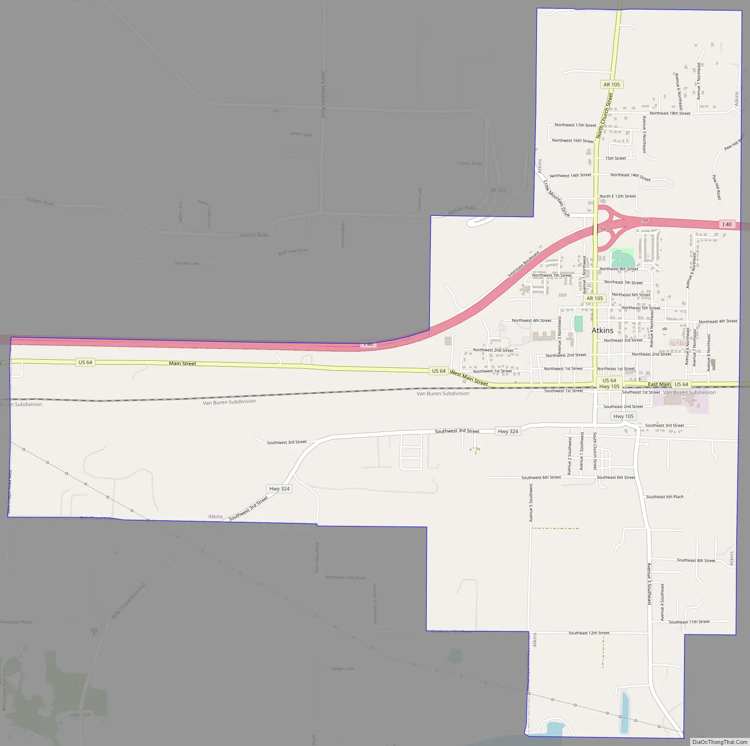
Atkins Road Map
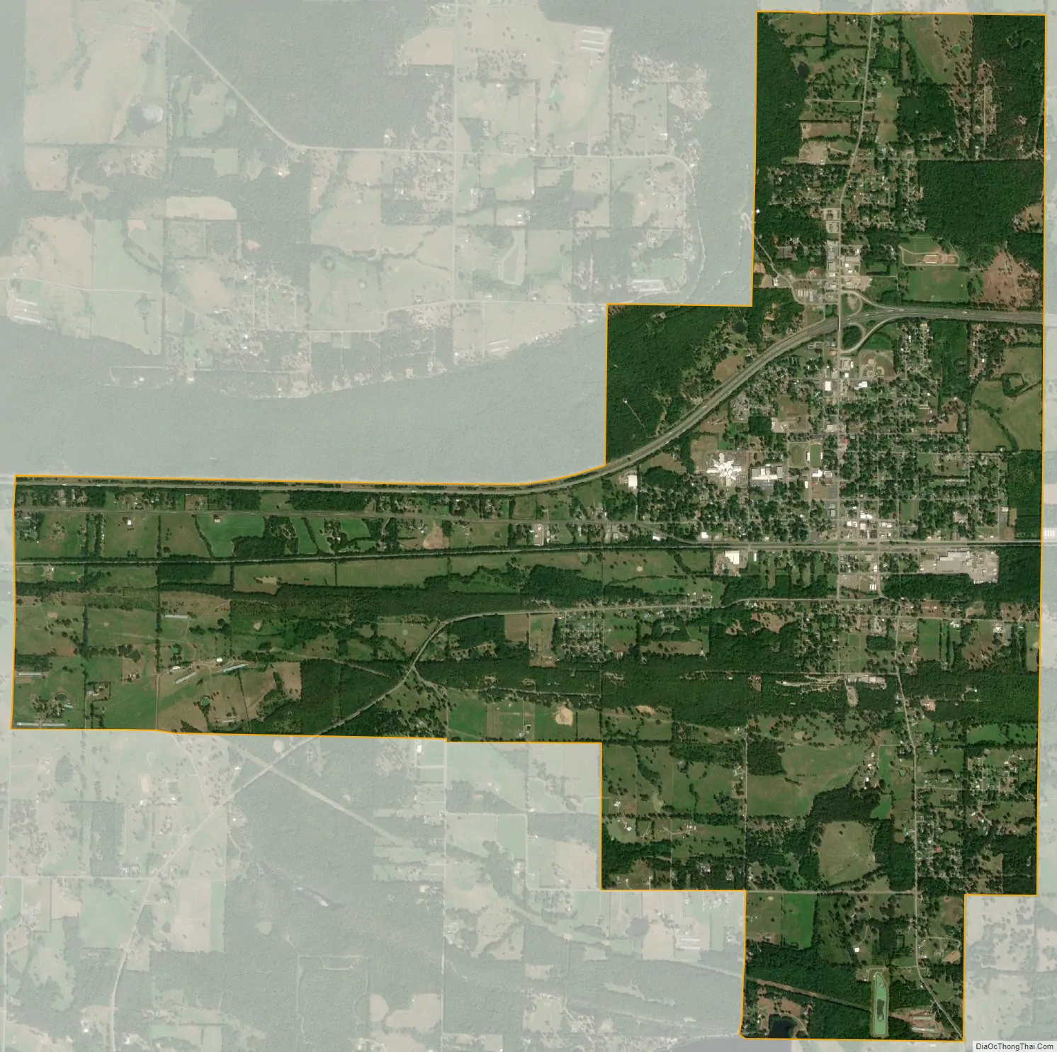
Atkins city Satellite Map
Geography
Atkins is located at 35°14′37″N 92°56′18″W / 35.24361°N 92.93833°W / 35.24361; -92.93833 (35.243485, -92.938212).
According to the United States Census Bureau, the city has a total area of 6.1 square miles (16 km), all land. Many Atkins residents commute to nearby Russellville for work, school, and recreation.
See also
Map of Arkansas State and its subdivision:- Arkansas
- Ashley
- Baxter
- Benton
- Boone
- Bradley
- Calhoun
- Carroll
- Chicot
- Clark
- Clay
- Cleburne
- Cleveland
- Columbia
- Conway
- Craighead
- Crawford
- Crittenden
- Cross
- Dallas
- Desha
- Drew
- Faulkner
- Franklin
- Fulton
- Garland
- Grant
- Greene
- Hempstead
- Hot Spring
- Howard
- Independence
- Izard
- Jackson
- Jefferson
- Johnson
- Lafayette
- Lawrence
- Lee
- Lincoln
- Little River
- Logan
- Lonoke
- Madison
- Marion
- Miller
- Mississippi
- Monroe
- Montgomery
- Nevada
- Newton
- Ouachita
- Perry
- Phillips
- Pike
- Poinsett
- Polk
- Pope
- Prairie
- Pulaski
- Randolph
- Saint Francis
- Saline
- Scott
- Searcy
- Sebastian
- Sevier
- Sharp
- Stone
- Union
- Van Buren
- Washington
- White
- Woodruff
- Yell
- Alabama
- Alaska
- Arizona
- Arkansas
- California
- Colorado
- Connecticut
- Delaware
- District of Columbia
- Florida
- Georgia
- Hawaii
- Idaho
- Illinois
- Indiana
- Iowa
- Kansas
- Kentucky
- Louisiana
- Maine
- Maryland
- Massachusetts
- Michigan
- Minnesota
- Mississippi
- Missouri
- Montana
- Nebraska
- Nevada
- New Hampshire
- New Jersey
- New Mexico
- New York
- North Carolina
- North Dakota
- Ohio
- Oklahoma
- Oregon
- Pennsylvania
- Rhode Island
- South Carolina
- South Dakota
- Tennessee
- Texas
- Utah
- Vermont
- Virginia
- Washington
- West Virginia
- Wisconsin
- Wyoming