Dover is a small town in Pope County, Arkansas, United States. The population was 1,378 at the 2010 census. Dover is located in the Arkansas River Valley, and is part of the Russellville Micropolitan Statistical Area. Seven miles north of the county seat, Russellville, it has several churches, a grocery store, emergency services—a volunteer fire department and a county EMS substation—, a branch library, schools, two discount variety stores, a medical clinic, a bank, a hardware store, several small eating establishments, and other businesses.
| Name: | Dover city |
|---|---|
| LSAD Code: | 25 |
| LSAD Description: | city (suffix) |
| State: | Arkansas |
| County: | Pope County |
| Elevation: | 410 ft (120 m) |
| Total Area: | 2.83 sq mi (7.32 km²) |
| Land Area: | 2.83 sq mi (7.32 km²) |
| Water Area: | 0.00 sq mi (0.00 km²) |
| Total Population: | 1,337 |
| Population Density: | 472.94/sq mi (182.58/km²) |
| ZIP code: | 72837 |
| Area code: | 479 |
| FIPS code: | 0519600 |
| GNISfeature ID: | 2403504 |
| Website: | www.doverar.com |
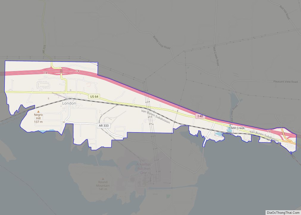
Online Interactive Map
Click on ![]() to view map in "full screen" mode.
to view map in "full screen" mode.
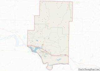
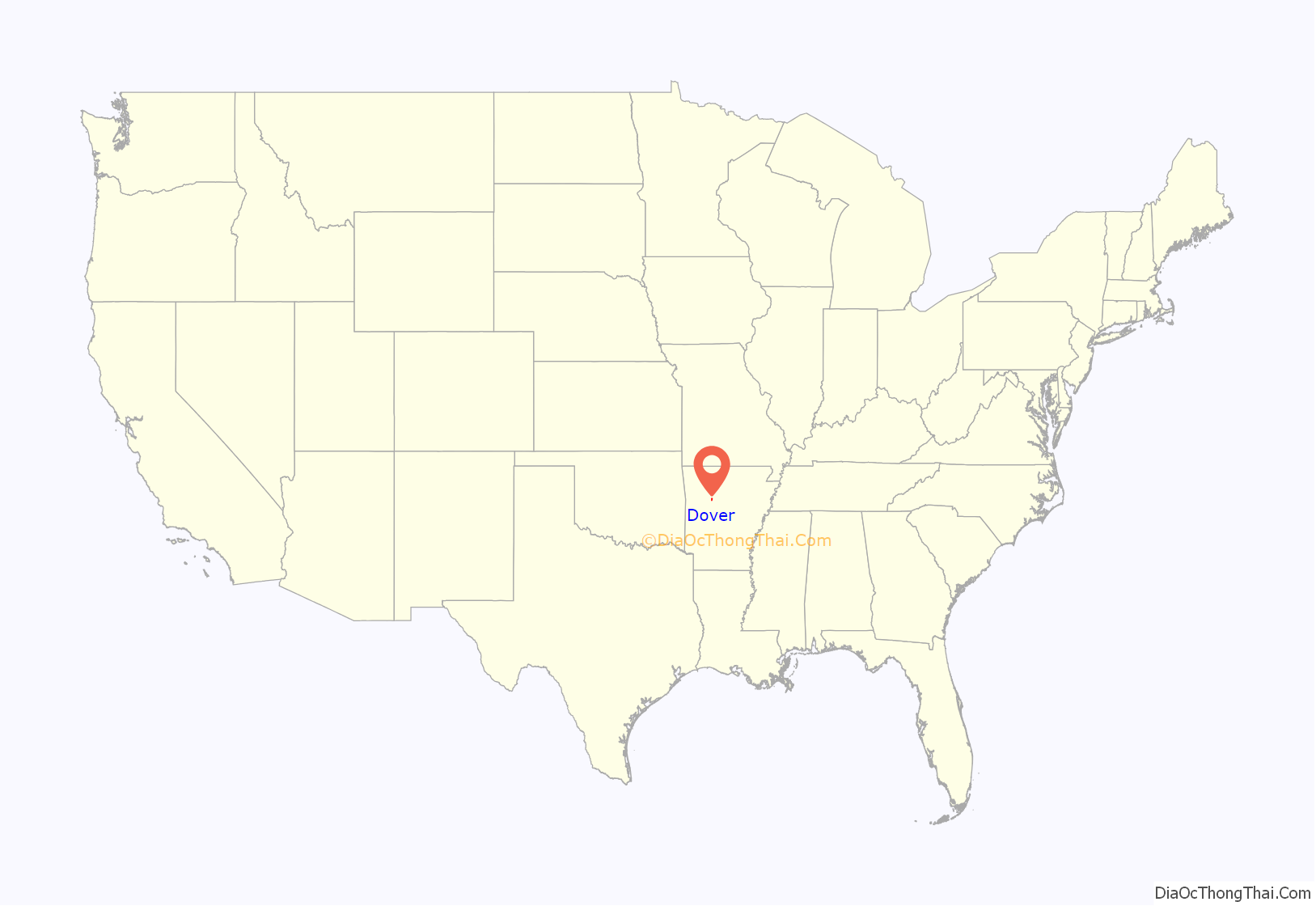
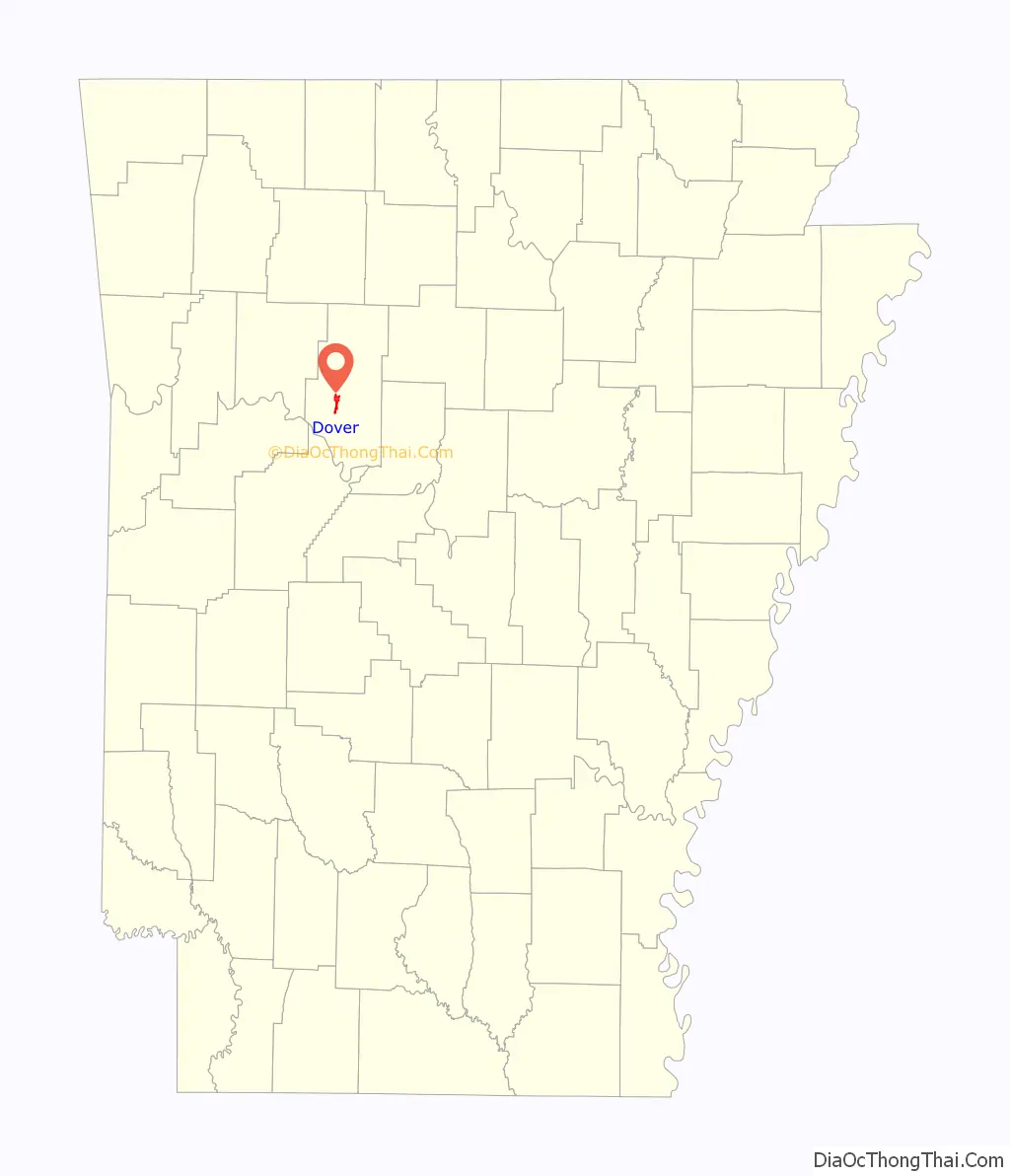
Dover location map. Where is Dover city?
History
Dover was either named by British aristocrats in the 1830s for Dover, Kent, England or by Stephen Rye in 1832 for Dover, Tennessee. Incorporated December 31, 1852, Dover was the county seat for Pope County from 1841 to 1887 with the county’s brick courthouse on the square bounded by present-day Camp, Market, Water, and Elizabeth Streets.
More than half of the businesses in the commercial part of town were lost to fire on February 15, 1930, as were at least 8 homes on two city blocks. At least 11 businesses were lost or badly damaged. A fire truck from neighboring Russellville helped in fighting the fire, but with no municipal fire water system, the truck had to draw water from a large well at a Dover business. Fighting the blaze, thought to have originated as a grass fire, was hampered by the lack of a water supply and high winds. The buildings lost were of wood frame construction.
The Simmons massacre
On December 22 and 26, 1987, Ronald Gene Simmons, of near Dover, killed all fourteen members of his family during a Christmas reunion at the Simmons property 5 miles north of Dover. Two days later, he continued his killing spree in the county seat of Russellville, having targeted previous employers and co-workers, killing two and wounding two more. Simmons was arrested without resistance, was sentenced to death on December 10, 1989, waived mandatory appellate review, and executed on June 25, 1990, the quickest sentence-to-execution time in the United States since the death penalty was reinstated in 1976.
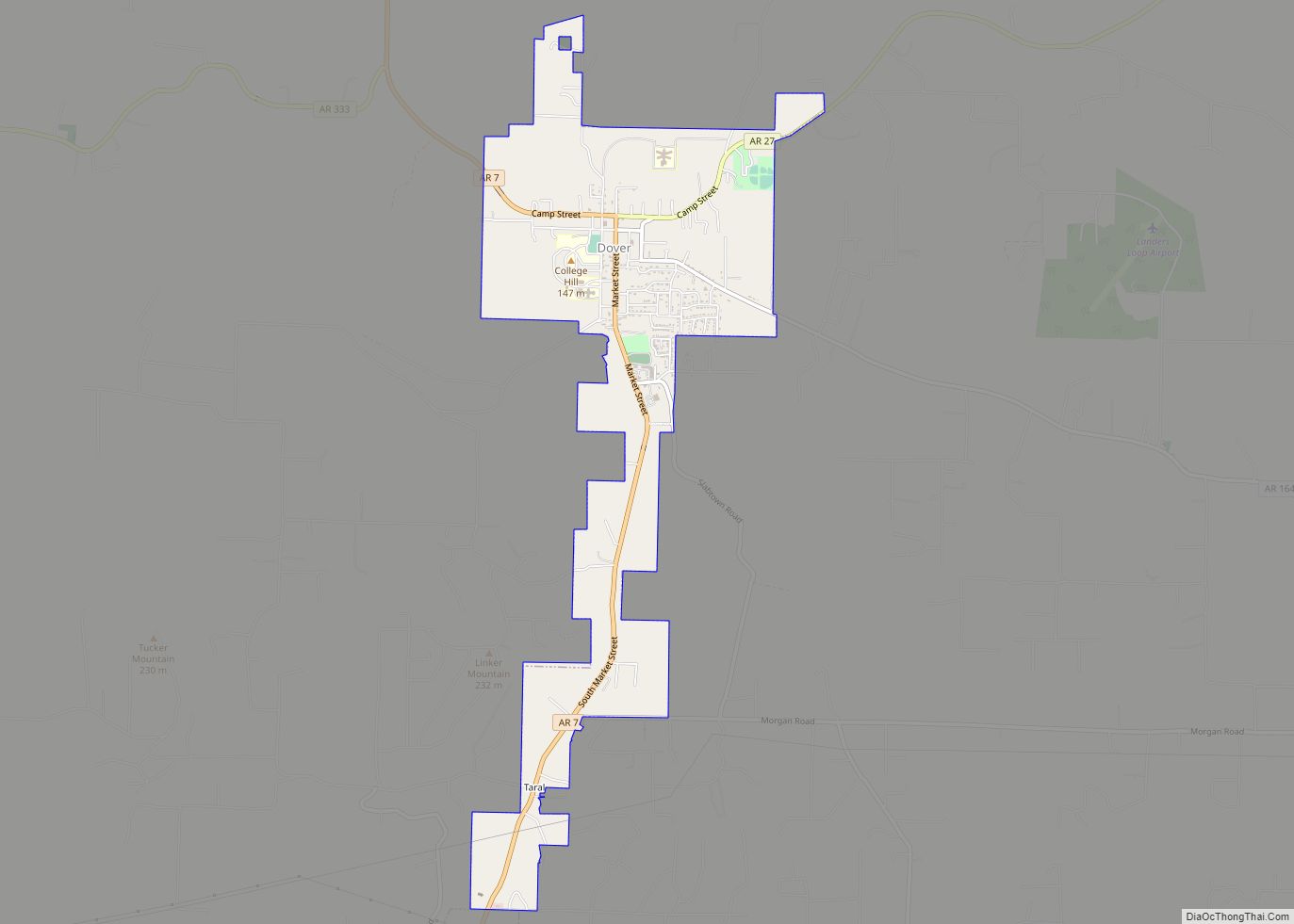
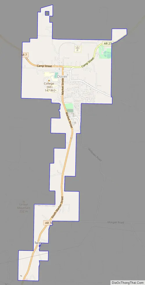
Dover Road Map
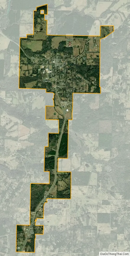
Dover city Satellite Map
Geography
According to the United States Census Bureau, the city has a total area of 1.8 square miles (4.7 km), all land.
Ecologically, Dover is located within the Arkansas Valley Hills subregion within the larger Arkansas Valley ecoregion. The subregion is a thin transition area between the flat and fertile Arkansas Valley Plains to the south along the Arkansas River, and the steep and densely forested lands of the Boston Mountains in northern Pope County.
The mild hills historically supported oak-hickory forest or oak-hickory-pine forest. Elevation changes and soil types make the Arkansas Valley Hills largely unsuitable for row agriculture. Instead, forest has been cleared for pastureland, poultry farming or ranching. Logging remains an important land use where elevation or soil makes livestock farming unsuitable. Many of the smaller streams and watercourses are completely dry in summer.
See also
Map of Arkansas State and its subdivision:- Arkansas
- Ashley
- Baxter
- Benton
- Boone
- Bradley
- Calhoun
- Carroll
- Chicot
- Clark
- Clay
- Cleburne
- Cleveland
- Columbia
- Conway
- Craighead
- Crawford
- Crittenden
- Cross
- Dallas
- Desha
- Drew
- Faulkner
- Franklin
- Fulton
- Garland
- Grant
- Greene
- Hempstead
- Hot Spring
- Howard
- Independence
- Izard
- Jackson
- Jefferson
- Johnson
- Lafayette
- Lawrence
- Lee
- Lincoln
- Little River
- Logan
- Lonoke
- Madison
- Marion
- Miller
- Mississippi
- Monroe
- Montgomery
- Nevada
- Newton
- Ouachita
- Perry
- Phillips
- Pike
- Poinsett
- Polk
- Pope
- Prairie
- Pulaski
- Randolph
- Saint Francis
- Saline
- Scott
- Searcy
- Sebastian
- Sevier
- Sharp
- Stone
- Union
- Van Buren
- Washington
- White
- Woodruff
- Yell
- Alabama
- Alaska
- Arizona
- Arkansas
- California
- Colorado
- Connecticut
- Delaware
- District of Columbia
- Florida
- Georgia
- Hawaii
- Idaho
- Illinois
- Indiana
- Iowa
- Kansas
- Kentucky
- Louisiana
- Maine
- Maryland
- Massachusetts
- Michigan
- Minnesota
- Mississippi
- Missouri
- Montana
- Nebraska
- Nevada
- New Hampshire
- New Jersey
- New Mexico
- New York
- North Carolina
- North Dakota
- Ohio
- Oklahoma
- Oregon
- Pennsylvania
- Rhode Island
- South Carolina
- South Dakota
- Tennessee
- Texas
- Utah
- Vermont
- Virginia
- Washington
- West Virginia
- Wisconsin
- Wyoming