Russellville is the county seat and largest city in Pope County, Arkansas, United States, with a 2021 estimated population of 29,338. It is home to Arkansas Tech University. Arkansas Nuclear One, Arkansas’ only nuclear power plant is nearby. Russellville borders Lake Dardanelle and the Arkansas River.
It is the principal city of the Russellville Micropolitan Statistical Area, which includes all of Pope and Yell counties.
| Name: | Russellville city |
|---|---|
| LSAD Code: | 25 |
| LSAD Description: | city (suffix) |
| State: | Arkansas |
| County: | Pope County |
| Incorporated: | June 7, 1870; 152 years ago (1870-06-07) |
| Elevation: | 367 ft (112 m) |
| Land Area: | 28.30 sq mi (73.30 km²) |
| Water Area: | 0.06 sq mi (0.17 km²) |
| Population Density: | 1,022.54/sq mi (394.80/km²) |
| ZIP code: | 72801, 72802, 72837, 72858 |
| Area code: | 479 |
| FIPS code: | 0561670 |
| GNISfeature ID: | 2404658 |
| Website: | russellvillearkansas.org |
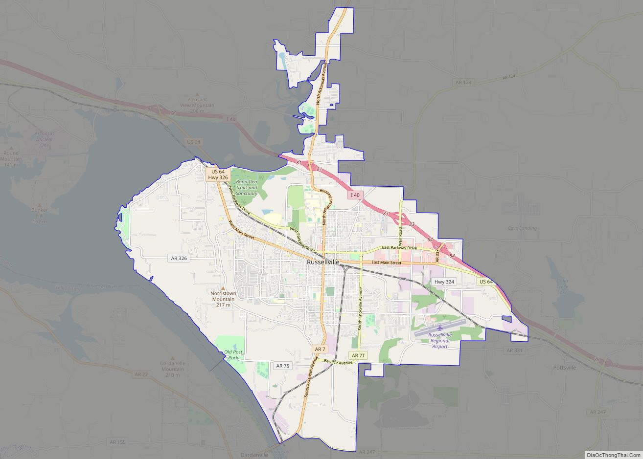
Online Interactive Map
Click on ![]() to view map in "full screen" mode.
to view map in "full screen" mode.
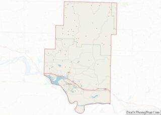
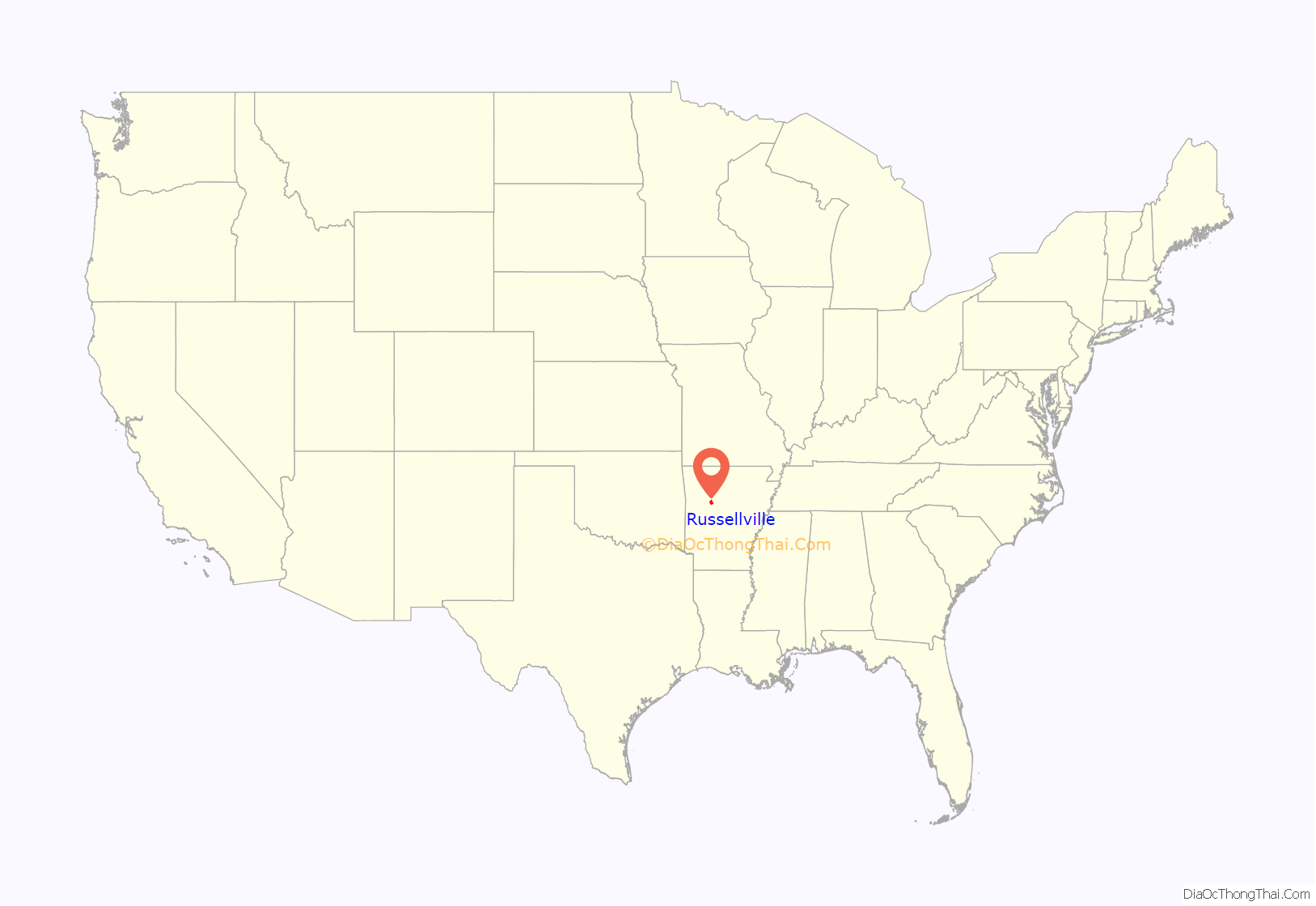
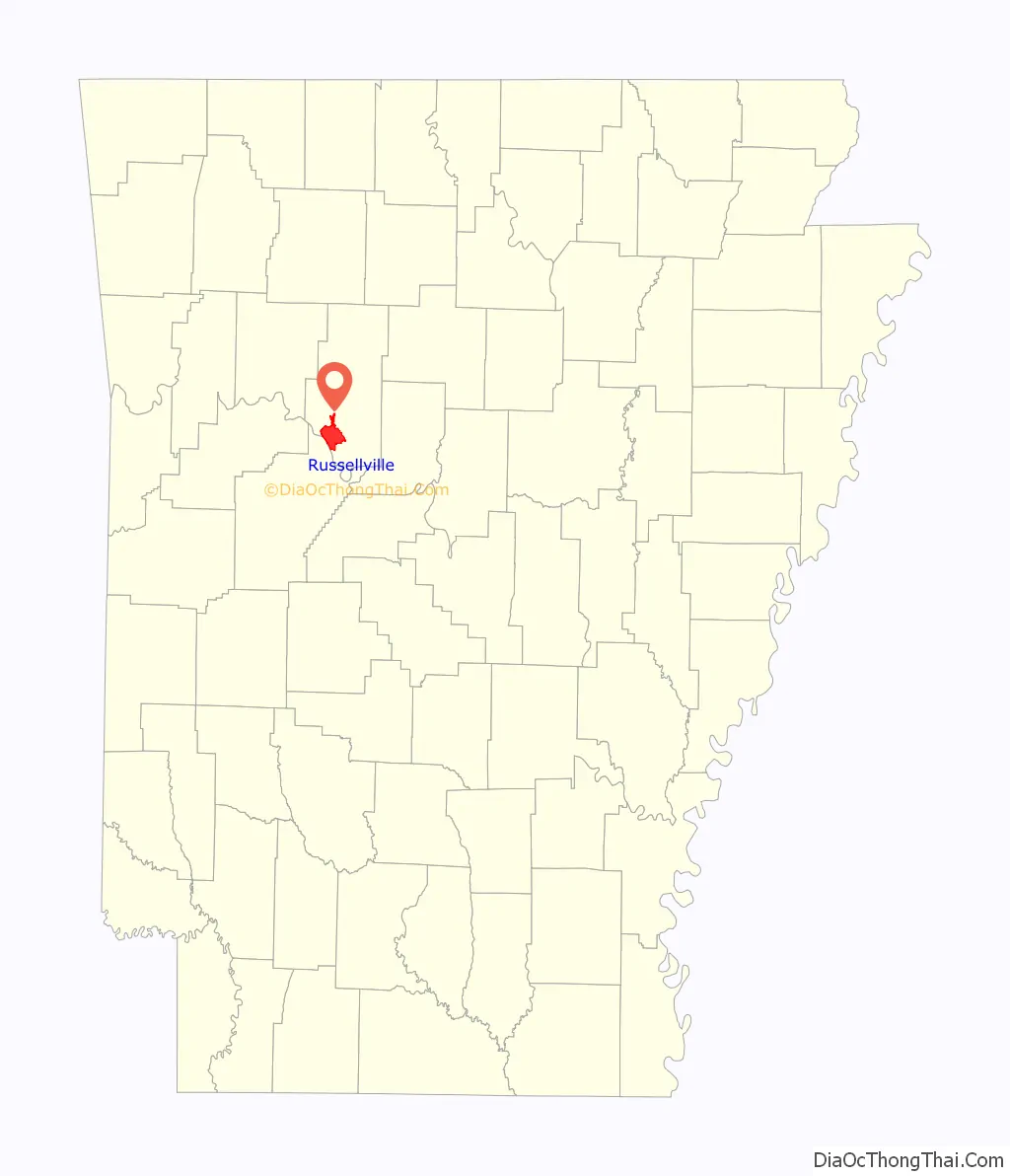
Russellville location map. Where is Russellville city?
History
Settlement
Before the town was named Russellville, its vicinity was known as Chactas Prairie, The Prairie, or Cactus Flats. Located on the southern edge of the Ozark Mountains and north of the Arkansas River, this setting was an ideal settlement area.
In the early 19th century, Osage from Missouri hunted frequently in the valley where Russellville is now located. Between 1818 and 1828, the area was within a Cherokee reservation. Under a new treaty concluded on May 6, 1828, the western boundary of Arkansas was established, with seven million acres west of Arkansas in Indian Territory (present-day Oklahoma) provided to the Cherokees “forever.” The Cherokees agreed to leave the Arkansas lands within 14 months.
The first house in what is now Russellville, a one-and-a-half-story hand-hewn log house, was built by J.C. Holledger in 1834 and purchased the next year by Dr. Thomas Russell. The first business to be established in the town was an 18 ft by 24 ft general retail store started by Jacob Shinn in 1854. Shinn replaced the wood structure store with a masonry structure, a building completed in 1876 and which, still standing today, is known as the Shinn Building. It was built at the junction of an east–west road from Lewisburg to Clarksville and a north–south road between Dover and the military road crossing at Norristown on the Arkansas River. The intersection is now Main Street and Denver (formerly River) Street respectively.
According to tradition, in the 1840s, the choice of a name for the community of five homes and a store was between Russellville—for Thomas Russell, who had the first home in the area and was a doctor—and Shinnville—for Jacob L. Shinn who established the community’s first store. However, Russellville was actually named about 1842 when Jacob was a teen. Russellville is listed on mail routes in requests for proposals for carrying the mail in 1842, when Shinn was 15, and in 1846, when he was 19, so naming the community after Jacob would have been quite unlikely. However, in the 1840s, his uncle, James Madison Shinn, and father, B. D. R. Shinn, operated a store in the small frontier community, so any truth in the naming tradition may apply to them.
A post office was established as early as the early 1840s based on request for mail route proposals and certainly by 1854.
American Civil War
As with the war with Mexico in the 1840s, many men of Russellville served in the state’s military forces during the American Civil War. Local men served in the state forces early in the war, with many transferring to Confederate regiments by 1862. Several local men were also formed into at least two pro-Union companies. No great battles occurred in or near Russellville, though actions did take place late in the war at nearby Dardanelle (Yell County). While the war came to an official end in 1865, peace did not immediately return to the area. Many areas of Pope County were disrupted in the early 1870s by the turmoil of what came to be known as the Pope County Militia War.
Reconstruction era
The town grew slowly, but during the early 1870s the railroad was built and the town exploded commercially and experienced a boom in population. It connected Russellville to other towns in the area, and ran eventually from Ft. Smith to Little Rock, connecting other river valley towns such as Morrilton, Conway, Atkins, London, and facilitating trade among them. Russellville’s first newspaper, the Herald, was founded in 1870. By 1876, the town boasted a population of approximately 800 serviced by fifteen stores, two cotton gins, and six doctors.
Incorporation as a city
On June 7, 1870, Russellville became an incorporated city. Incorporation prompted a debate on moving the county seat, located in Dover since 1841, to one of two growing business centers adjacent to the new tracks. An act to move the county seat passed in the General Assembly in 1873 but was repealed during a special session of the General Assembly in 1874. On March 19, 1887, an election was held on whether to move the county seat to Russellville or to Atkins. Russellville was selected by a margin of 128 votes out of 2,670 total votes cast. The question on moving the county seat had also gone to the voters nearly a decade earlier on September 2, 1878, but the results were overturned in the courts.
While formal education came to the Russellville area early with the founding of nearby Dwight Mission in 1820, most early schools were either private or by subscription. The Russellville Public School District was formed in 1870, the year the city was incorporated. By 1876, it had evolved into a nine-month school. By 1890, approximately 400 students attended in ten grades, and in 1893, the first class to attend through twelve grades graduated.
Most 19th-century residents of the area farmed for a living or, with the coming of the railroad, harvested timber. By the end of the century, Russellville and the surrounding area had become a prosperous coal-mining area, with the Ouita Coal Company being the first established. Other coal companies followed with deep mine shafts sunk north and south of town, which, by the 1950s, had given way to strip mining. Cotton became a profitable crop near Russellville; in the early 20th century, bales were sold from wagons in the middle of Main Street. Today, no coal is mined, and the cotton gins are gone.
20th century
In 1906 the town suffered a massive fire in its central business district. The fire consumed nearly half of the buildings but they were quickly rebuilt, most within six months after the fire.
What today is Arkansas Tech University (ATU) in Russellville was established in 1910 as the Second District Agricultural school—a four-year high school. The school evolved over the years, adding 2 years of college courses in the 1920s and dropping the high school courses at the end of the 1929-1930 academic year with the school’s name changed to Arkansas Polytechnic College in 1925. Its name was changed to Arkansas Tech University in 1976.
With America’s entry into World War II, many Russellville men enlisted or were drafted into the military. Many of the local men served in the 153rd Infantry. Battery D and Battery F of the 206th Coast Artillery Regiment of the Arkansas National Guard were initially stationed at ATU. Many of the men saw service in Alaska in what is known as the Williwaw War.
After the war, the construction of Interstate 40 in 1956 sparked Russelville’s growth. The highway has been a boon to the area’s growth, much like the railroad was in the 1870s. A major economic boost came as a result of the completion of a dam near the Arkansas River crossing between Dardanelle and Russellville in 1965. The dam created a lake, which led to the establishment of Lake Dardanelle State Park, a major tourist attraction in the area. The completion of the lock and power dam, a part of the McClellan-Kerr Arkansas River Navigation System, which brings in between $1 and $2 billion in trade to the state each year, has greatly improved the area’s business prospects. During the 1970s, the town, like so many other small American towns, witnessed the decentralization of its historic downtown area, due to the advent of large retail outlets such as Wal-Mart. Many of the historic buildings were left to decay or were torn down. Also in the 1970s, Arkansas’ only nuclear power plant, Arkansas Nuclear One, was built just outside the city, on Lake Dardanelle. The plant brought more people and jobs to the city.
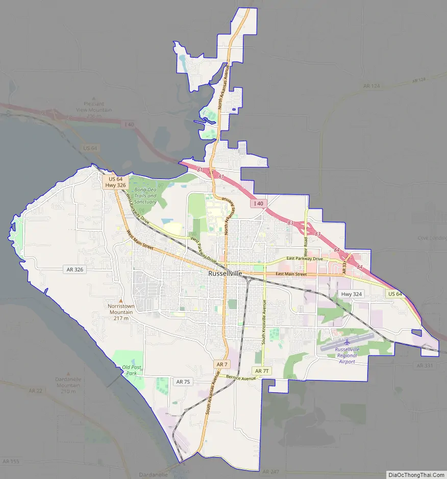
Russellville Road Map
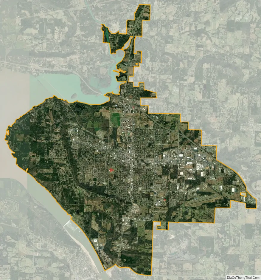
Russellville city Satellite Map
Geography
Russellville is located at 35°16′42″N 93°8′13″W / 35.27833°N 93.13694°W / 35.27833; -93.13694 (35.278429, -93.136820). According to the United States Census Bureau, the city has a total area of 28.3 square miles (73 km), of which 28.2 square miles (73 km) is land and 0.04 square miles (0.10 km) (0.08%) is water. It is located on the Arkansas River.
Climate
The climate in this area is characterized by hot, humid summers and generally mild to cool winters. According to the Köppen Climate Classification system, Russellville has a humid subtropical climate, abbreviated “Cfa” on climate maps.
See also
Map of Arkansas State and its subdivision:- Arkansas
- Ashley
- Baxter
- Benton
- Boone
- Bradley
- Calhoun
- Carroll
- Chicot
- Clark
- Clay
- Cleburne
- Cleveland
- Columbia
- Conway
- Craighead
- Crawford
- Crittenden
- Cross
- Dallas
- Desha
- Drew
- Faulkner
- Franklin
- Fulton
- Garland
- Grant
- Greene
- Hempstead
- Hot Spring
- Howard
- Independence
- Izard
- Jackson
- Jefferson
- Johnson
- Lafayette
- Lawrence
- Lee
- Lincoln
- Little River
- Logan
- Lonoke
- Madison
- Marion
- Miller
- Mississippi
- Monroe
- Montgomery
- Nevada
- Newton
- Ouachita
- Perry
- Phillips
- Pike
- Poinsett
- Polk
- Pope
- Prairie
- Pulaski
- Randolph
- Saint Francis
- Saline
- Scott
- Searcy
- Sebastian
- Sevier
- Sharp
- Stone
- Union
- Van Buren
- Washington
- White
- Woodruff
- Yell
- Alabama
- Alaska
- Arizona
- Arkansas
- California
- Colorado
- Connecticut
- Delaware
- District of Columbia
- Florida
- Georgia
- Hawaii
- Idaho
- Illinois
- Indiana
- Iowa
- Kansas
- Kentucky
- Louisiana
- Maine
- Maryland
- Massachusetts
- Michigan
- Minnesota
- Mississippi
- Missouri
- Montana
- Nebraska
- Nevada
- New Hampshire
- New Jersey
- New Mexico
- New York
- North Carolina
- North Dakota
- Ohio
- Oklahoma
- Oregon
- Pennsylvania
- Rhode Island
- South Carolina
- South Dakota
- Tennessee
- Texas
- Utah
- Vermont
- Virginia
- Washington
- West Virginia
- Wisconsin
- Wyoming