Avoca is a town in Benton County, Arkansas, United States. The population was 487 at the 2020 census. It is part of the Northwest Arkansas region.
It is named after the town of Avoca in Ireland.
| Name: | Avoca town |
|---|---|
| LSAD Code: | 43 |
| LSAD Description: | town (suffix) |
| State: | Arkansas |
| County: | Benton County |
| Elevation: | 1,345 ft (410 m) |
| Total Area: | 1.88 sq mi (4.86 km²) |
| Land Area: | 1.88 sq mi (4.86 km²) |
| Water Area: | 0.00 sq mi (0.00 km²) |
| Total Population: | 487 |
| Population Density: | 259.73/sq mi (100.30/km²) |
| ZIP code: | 72711 |
| Area code: | 479 |
| FIPS code: | 0503040 |
| GNISfeature ID: | 2405190 |
| Website: | www.avocaarkansas.info |
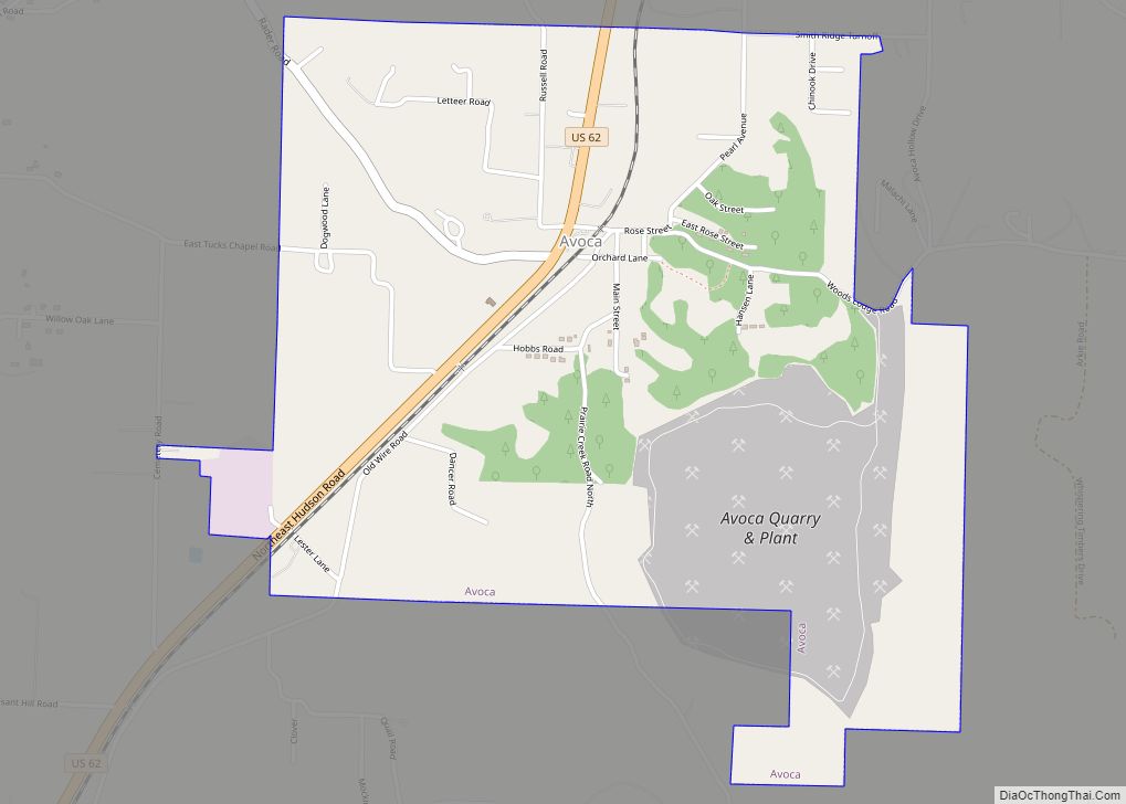
Online Interactive Map
Click on ![]() to view map in "full screen" mode.
to view map in "full screen" mode.
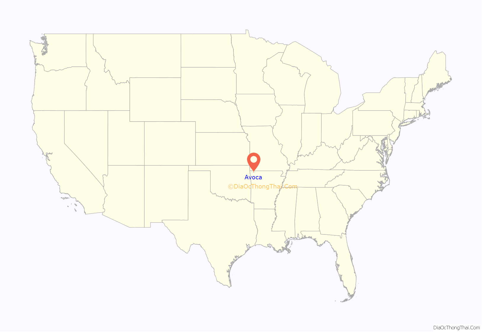
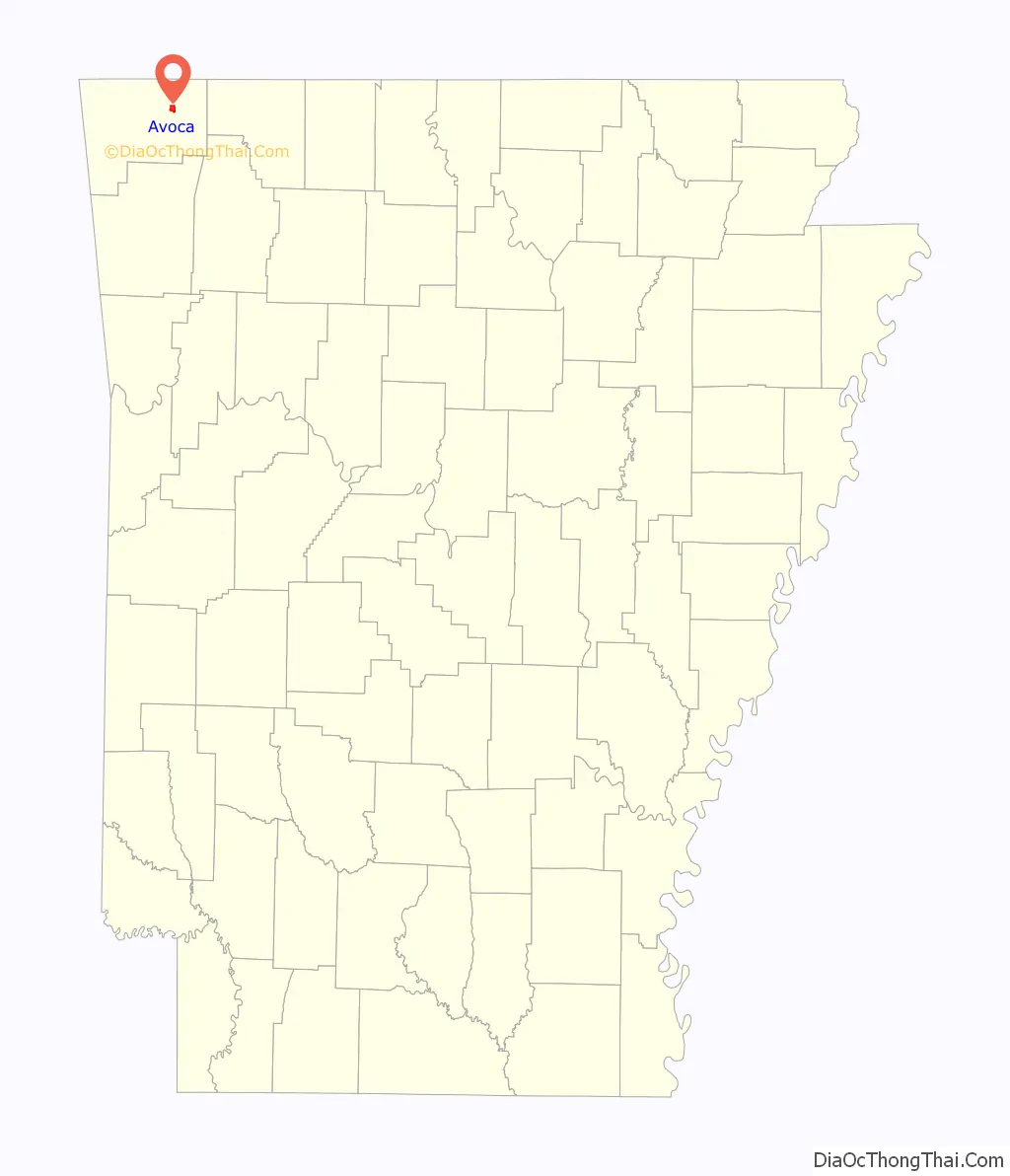
Avoca location map. Where is Avoca town?
History
Avoca was platted in 1881. A post office called Avoca has been in operation since 1872.
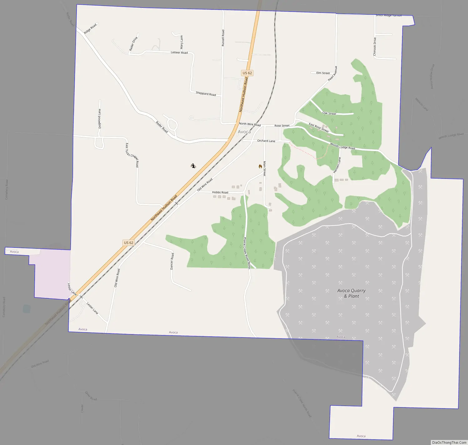
Avoca Road Map
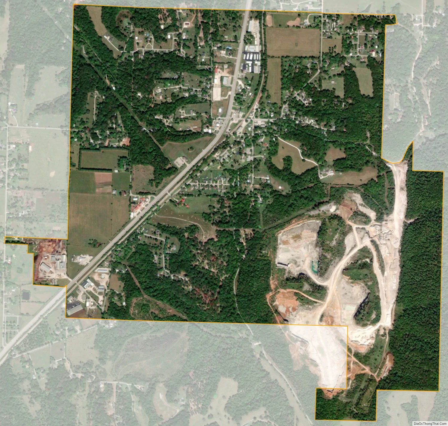
Avoca city Satellite Map
Geography
Avoca is located in east-central Benton County at 36°24′00″N 94°04′24″W / 36.399971°N 94.073239°W / 36.399971; -94.073239, 6 miles (10 km) northeast of the center of Rogers. U.S. Route 62 passes through the town, leading southwest 7 miles (11 km) to Interstate 540 in Bentonville and northeast 11 miles (18 km) to Gateway near the Missouri border.
According to the United States Census Bureau, Avoca has a total area of 1.8 square miles (4.7 km), all land.
See also
Map of Arkansas State and its subdivision:- Arkansas
- Ashley
- Baxter
- Benton
- Boone
- Bradley
- Calhoun
- Carroll
- Chicot
- Clark
- Clay
- Cleburne
- Cleveland
- Columbia
- Conway
- Craighead
- Crawford
- Crittenden
- Cross
- Dallas
- Desha
- Drew
- Faulkner
- Franklin
- Fulton
- Garland
- Grant
- Greene
- Hempstead
- Hot Spring
- Howard
- Independence
- Izard
- Jackson
- Jefferson
- Johnson
- Lafayette
- Lawrence
- Lee
- Lincoln
- Little River
- Logan
- Lonoke
- Madison
- Marion
- Miller
- Mississippi
- Monroe
- Montgomery
- Nevada
- Newton
- Ouachita
- Perry
- Phillips
- Pike
- Poinsett
- Polk
- Pope
- Prairie
- Pulaski
- Randolph
- Saint Francis
- Saline
- Scott
- Searcy
- Sebastian
- Sevier
- Sharp
- Stone
- Union
- Van Buren
- Washington
- White
- Woodruff
- Yell
- Alabama
- Alaska
- Arizona
- Arkansas
- California
- Colorado
- Connecticut
- Delaware
- District of Columbia
- Florida
- Georgia
- Hawaii
- Idaho
- Illinois
- Indiana
- Iowa
- Kansas
- Kentucky
- Louisiana
- Maine
- Maryland
- Massachusetts
- Michigan
- Minnesota
- Mississippi
- Missouri
- Montana
- Nebraska
- Nevada
- New Hampshire
- New Jersey
- New Mexico
- New York
- North Carolina
- North Dakota
- Ohio
- Oklahoma
- Oregon
- Pennsylvania
- Rhode Island
- South Carolina
- South Dakota
- Tennessee
- Texas
- Utah
- Vermont
- Virginia
- Washington
- West Virginia
- Wisconsin
- Wyoming