Rogers is a city in Benton County, Arkansas, United States. Located in the Ozarks, it is part of the Northwest Arkansas region, one of the fastest growing metro areas in the country. Rogers was the location of the first Walmart store, whose corporate headquarters is located in neighboring Bentonville. Daisy Outdoor Products, known for its air rifles, has both its headquarters and its Airgun Museum in Rogers.
As of the 2010 census, the city had a population of 55,964. In 2019, the estimated population was 68,669, making it the sixth-most populous city in the state. Northwest Arkansas is ranked 102nd in terms of population in the United States, with 546,725 inhabitants as of the 2020 U.S. Census.
| Name: | Rogers city |
|---|---|
| LSAD Code: | 25 |
| LSAD Description: | city (suffix) |
| State: | Arkansas |
| County: | Benton County |
| Incorporated: | June 6, 1881 |
| Elevation: | 1,368 ft (417 m) |
| Land Area: | 38.90 sq mi (100.74 km²) |
| Water Area: | 0.17 sq mi (0.44 km²) |
| Population Density: | 1,797.26/sq mi (693.93/km²) |
| ZIP code: | 72756-72757-72758 |
| Area code: | 479 |
| FIPS code: | 0560410 |
| GNISfeature ID: | 0054160 |
| Website: | www.rogersar.gov |
Online Interactive Map
Click on ![]() to view map in "full screen" mode.
to view map in "full screen" mode.
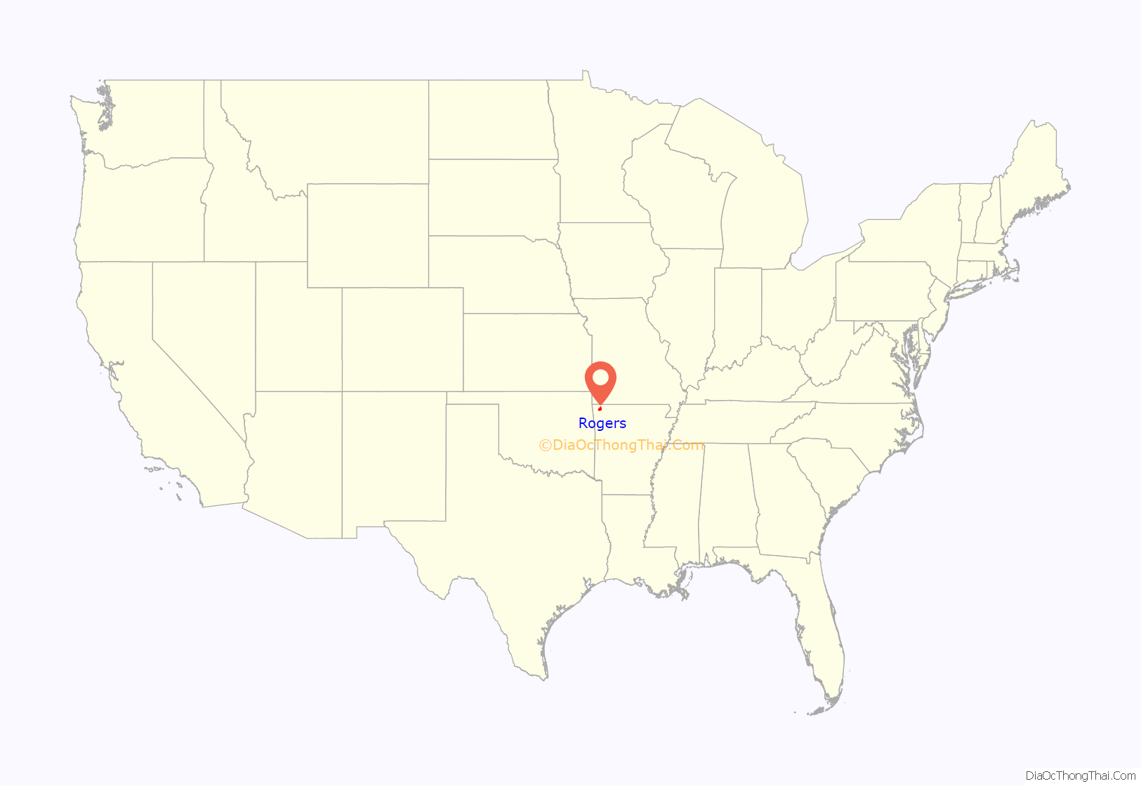
Rogers location map. Where is Rogers city?

History
Rogers was named after Captain Charles W. Rogers, who was vice-president and general manager of the St. Louis and San Francisco Railway, also known as the Frisco. The town was established in 1881, the year the Frisco line arrived; it was at this time the area residents honored Captain Rogers by naming it for him. The community was incorporated on June 6, 1881.
Historic commerce
The first retail business owned by the Stroud family was a store in Pea Ridge, Arkansas, which was co-owned by Allen Bryant Stroud (1831–1914) and his son Harlan Lafayette (H.L.) Stroud (1858–1950). That business was established prior to 1879 and Allen Stroud also served as postmaster at Pea Ridge for a time. In 1884, H.L. Stroud sold his interest in the Stroud store in Pea Ridge and purchased a dry goods store at the corner of First and Walnut Streets in Rogers which he named Stroud’s Mercantile.
In 1887 he brought in his brother Evan Giesen (1868–1952) to serve as manager of his new business. In 1891 H.L. Stroud moved his business into a storefront on the north side of the 100 block of Walnut Street. Stroud’s continued to prosper, and in 1899 H.L. built the brick building at 114–116 West Walnut Street. Stroud’s continued to be the leading retail business in Rogers up into the 1960s, when in 1962 Sam Walton opened the first location of what would become the retail giant Walmart just seven blocks away. Walton’s new store combined with the nationwide movement of retail centers from aged downtowns to malls and shopping centers slowly eroded Stroud’s customer base, leading the locally beloved retailer to permanently close in 1993 after 109 years in business. In 1912 the city council formed a commission of local businessmen to facilitate the paving of downtown Rogers. Despite the constant complaints of dusty and muddy streets, and the enthusiastic support of prominent citizens such as Coin Harvey, bickering over the cost and method of paving delayed the start of the project until July 1924. The downtown area was paved with concrete and overlaid with bricks in rows, changing to a basket weave pattern at the intersections of streets. The work was completed in December 1924, and the brick pavement remains today, with renovations done to the streets in 2010.
Rogers Road Map
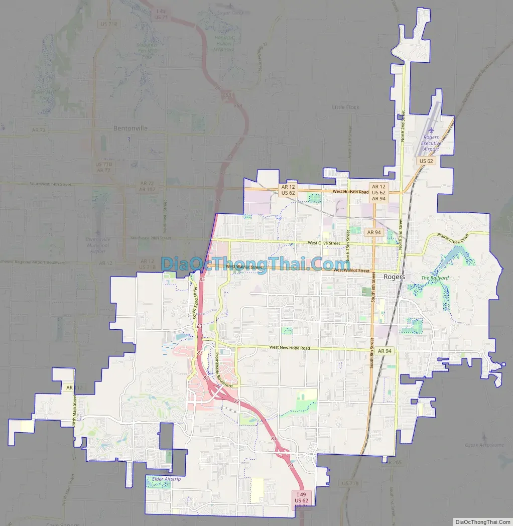
Rogers city Satellite Map

Geography
Rogers is located at 36°19′46″N 94°8′29″W / 36.32944°N 94.14139°W / 36.32944; -94.14139 (36.329388, −94.141372). According to the United States Census Bureau, the city has a total area of 33.6 square miles (87 km), of which 33.5 square miles (87 km) is land and 0.1 square miles (0.26 km) (0.15%) is water.
Climate
The climate in this area is characterized by warm, humid summers and generally mild to cool winters. According to the Köppen Climate Classification system, Rogers has a humid subtropical climate, abbreviated “Cfa” on climate maps.
See also
Map of Arkansas State and its subdivision:- Arkansas
- Ashley
- Baxter
- Benton
- Boone
- Bradley
- Calhoun
- Carroll
- Chicot
- Clark
- Clay
- Cleburne
- Cleveland
- Columbia
- Conway
- Craighead
- Crawford
- Crittenden
- Cross
- Dallas
- Desha
- Drew
- Faulkner
- Franklin
- Fulton
- Garland
- Grant
- Greene
- Hempstead
- Hot Spring
- Howard
- Independence
- Izard
- Jackson
- Jefferson
- Johnson
- Lafayette
- Lawrence
- Lee
- Lincoln
- Little River
- Logan
- Lonoke
- Madison
- Marion
- Miller
- Mississippi
- Monroe
- Montgomery
- Nevada
- Newton
- Ouachita
- Perry
- Phillips
- Pike
- Poinsett
- Polk
- Pope
- Prairie
- Pulaski
- Randolph
- Saint Francis
- Saline
- Scott
- Searcy
- Sebastian
- Sevier
- Sharp
- Stone
- Union
- Van Buren
- Washington
- White
- Woodruff
- Yell
- Alabama
- Alaska
- Arizona
- Arkansas
- California
- Colorado
- Connecticut
- Delaware
- District of Columbia
- Florida
- Georgia
- Hawaii
- Idaho
- Illinois
- Indiana
- Iowa
- Kansas
- Kentucky
- Louisiana
- Maine
- Maryland
- Massachusetts
- Michigan
- Minnesota
- Mississippi
- Missouri
- Montana
- Nebraska
- Nevada
- New Hampshire
- New Jersey
- New Mexico
- New York
- North Carolina
- North Dakota
- Ohio
- Oklahoma
- Oregon
- Pennsylvania
- Rhode Island
- South Carolina
- South Dakota
- Tennessee
- Texas
- Utah
- Vermont
- Virginia
- Washington
- West Virginia
- Wisconsin
- Wyoming