Bella Vista is a city in Benton County, Arkansas, United States. First established in 1917 as a summer resort destination, Bella Vista has evolved and redesigned itself over the succeeding years. Bella Vista became a retirement community in 1965, and, after much contention and a 2006 vote of its property owners, became an incorporated city.
Following its official incorporation on January 1, 2007, the new city government took over the police department, fire department, streets, trash removal and other city functions, while the Property Owners Association (POA) retained control of the many amenities available to members (property owners) and their guests.
Amenities include numerous parks, clubhouses with workout areas, swimming pools, five 18-hole golf courses, two nine-hole golf course, seven lakes with fishing and boat docks (three ski lakes), a marina, swimming beach, putt putt golf courses and tennis courts, dog park, softball field, and extensive hiking and biking trails.
The city of Bella Vista is located on the Springfield Plateau of the Ozark Mountains. Oak/hickory forests, along with valleys, creeks, and steep rises, characterize the city’s topography. Bella Vista is located north of Bentonville and Rogers within the Northwest Arkansas region. The city has been experiencing a population and building boom in recent years, as indicated by a 60% growth in population between the 2000 and 2010 censuses.
| Name: | Bella Vista city |
|---|---|
| LSAD Code: | 25 |
| LSAD Description: | city (suffix) |
| State: | Arkansas |
| County: | Benton County |
| Elevation: | 1,034 ft (315 m) |
| Total Area: | 46.88 sq mi (121.41 km²) |
| Land Area: | 45.30 sq mi (117.34 km²) |
| Water Area: | 1.57 sq mi (4.07 km²) |
| Total Population: | 30,104 |
| Population Density: | 664.47/sq mi (256.55/km²) |
| ZIP code: | 72714, 72715 |
| Area code: | 479 |
| FIPS code: | 0504840 |
| GNISfeature ID: | 0076292 |
| Website: | www.bellavistaar.gov |
Online Interactive Map
Click on ![]() to view map in "full screen" mode.
to view map in "full screen" mode.
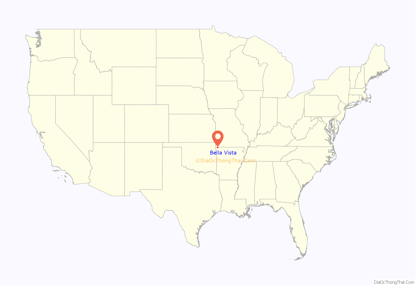
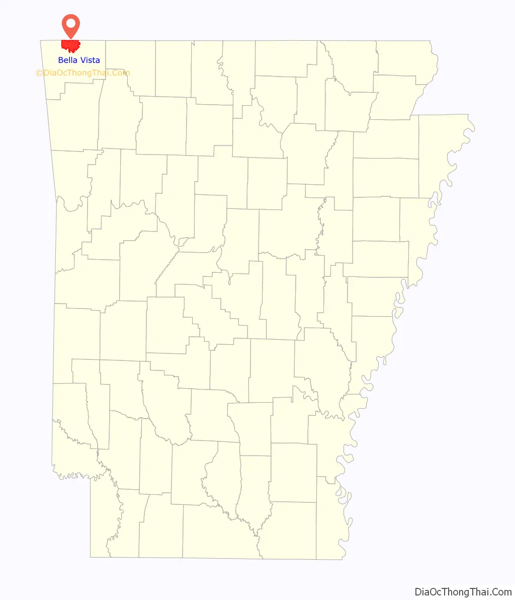
Bella Vista location map. Where is Bella Vista city?
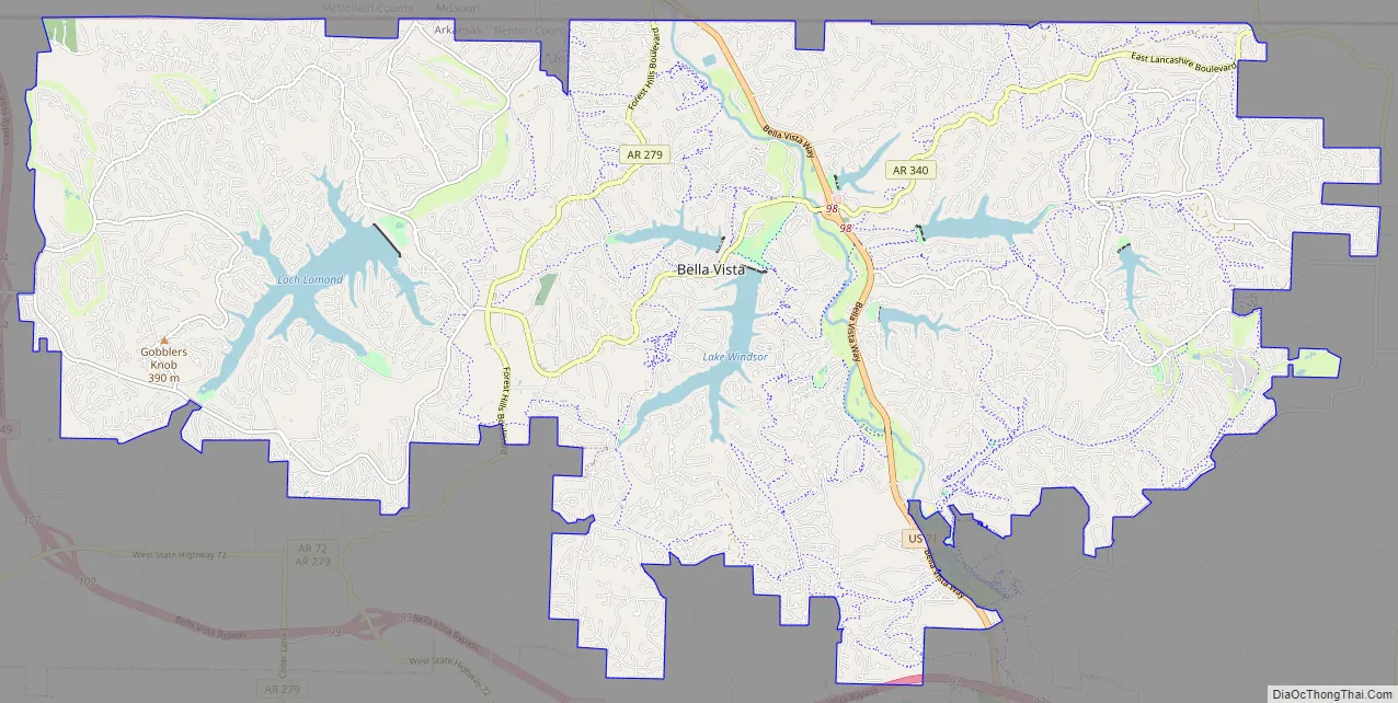
Bella Vista Road Map
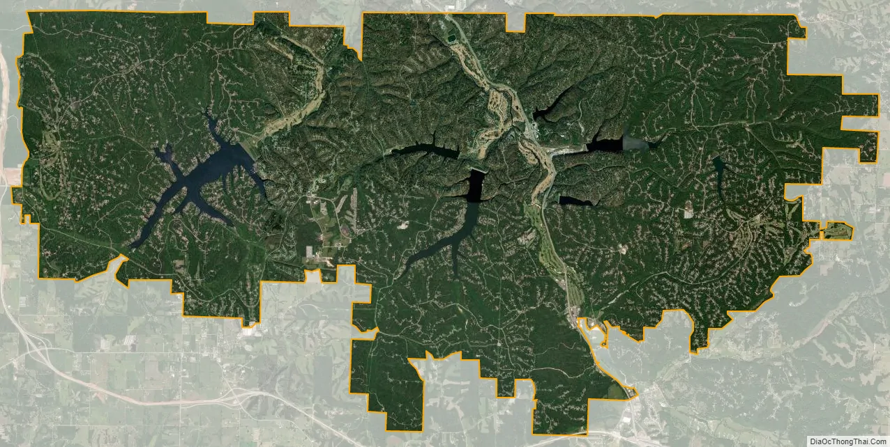
Bella Vista city Satellite Map
Geography
Bella Vista is located in northern Benton County. Its northern border is the Missouri state line. According to the United States Census Bureau, the city has a total area of 45.9 square miles (118.9 km), of which 44.2 square miles (114.6 km) is land and 1.6 square miles (4.2 km) is water, consisting mainly of the several lakes within the city.
See also
Map of Arkansas State and its subdivision:- Arkansas
- Ashley
- Baxter
- Benton
- Boone
- Bradley
- Calhoun
- Carroll
- Chicot
- Clark
- Clay
- Cleburne
- Cleveland
- Columbia
- Conway
- Craighead
- Crawford
- Crittenden
- Cross
- Dallas
- Desha
- Drew
- Faulkner
- Franklin
- Fulton
- Garland
- Grant
- Greene
- Hempstead
- Hot Spring
- Howard
- Independence
- Izard
- Jackson
- Jefferson
- Johnson
- Lafayette
- Lawrence
- Lee
- Lincoln
- Little River
- Logan
- Lonoke
- Madison
- Marion
- Miller
- Mississippi
- Monroe
- Montgomery
- Nevada
- Newton
- Ouachita
- Perry
- Phillips
- Pike
- Poinsett
- Polk
- Pope
- Prairie
- Pulaski
- Randolph
- Saint Francis
- Saline
- Scott
- Searcy
- Sebastian
- Sevier
- Sharp
- Stone
- Union
- Van Buren
- Washington
- White
- Woodruff
- Yell
- Alabama
- Alaska
- Arizona
- Arkansas
- California
- Colorado
- Connecticut
- Delaware
- District of Columbia
- Florida
- Georgia
- Hawaii
- Idaho
- Illinois
- Indiana
- Iowa
- Kansas
- Kentucky
- Louisiana
- Maine
- Maryland
- Massachusetts
- Michigan
- Minnesota
- Mississippi
- Missouri
- Montana
- Nebraska
- Nevada
- New Hampshire
- New Jersey
- New Mexico
- New York
- North Carolina
- North Dakota
- Ohio
- Oklahoma
- Oregon
- Pennsylvania
- Rhode Island
- South Carolina
- South Dakota
- Tennessee
- Texas
- Utah
- Vermont
- Virginia
- Washington
- West Virginia
- Wisconsin
- Wyoming