Bentonville is the tenth-largest city in Arkansas, United States and the county seat of Benton County. The city is centrally located in the county with Rogers adjacent to the east. The city is the birthplace of and world headquarters location of Walmart, the world’s largest retailer. It is one of the four main cities in the three-county Northwest Arkansas Metropolitan Statistical Area, which is ranked 105th in terms of population in the United States with 546,725 residents in 2020, according to the United States Census Bureau. The city itself had a population of 54,164 at the 2020 Census, an increase of 53% from the 2010 Census. Bentonville is considered to be one of the fastest growing cities in the state and consistently ranks amongst the safest cities in Arkansas. It is included in the Fayetteville–Springdale–Rogers Metropolitan Statistical Area.
| Name: | Bentonville city |
|---|---|
| LSAD Code: | 25 |
| LSAD Description: | city (suffix) |
| State: | Arkansas |
| County: | Benton County |
| Incorporated: | April 3, 1873 |
| Elevation: | 1,296 ft (395 m) |
| Total Area: | 34.25 sq mi (88.70 km²) |
| Land Area: | 34.05 sq mi (88.19 km²) |
| Water Area: | 0.20 sq mi (0.52 km²) |
| Total Population: | 56,734 |
| Population Density: | 1,590.72/sq mi (614.19/km²) |
| ZIP code: | 72712, 72713, 72716 |
| Area code: | 479 |
| FIPS code: | 0505320 |
| GNISfeature ID: | 0076305 |
| Website: | bentonvillear.com |
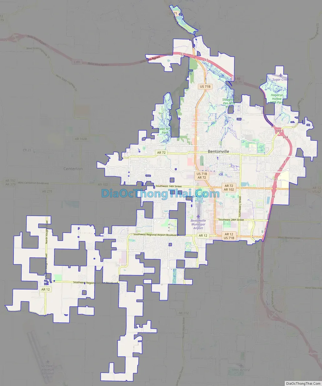
Online Interactive Map
Click on ![]() to view map in "full screen" mode.
to view map in "full screen" mode.
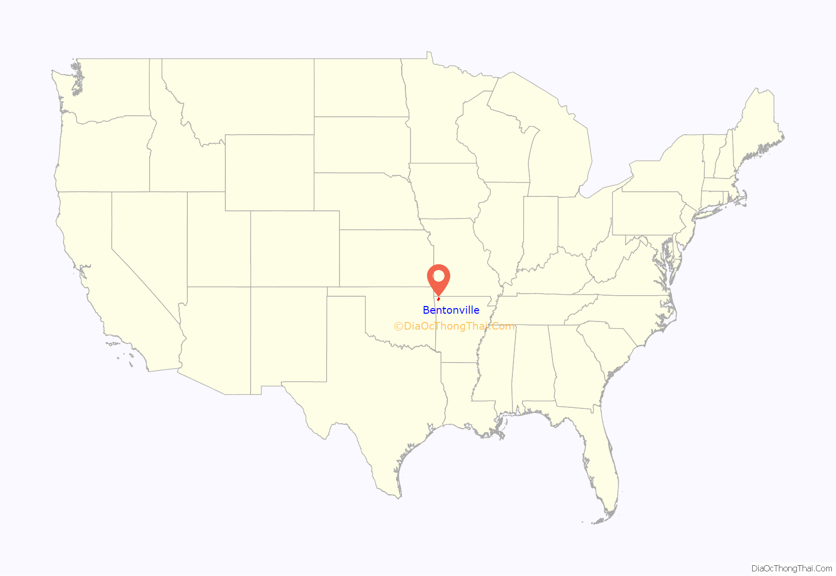
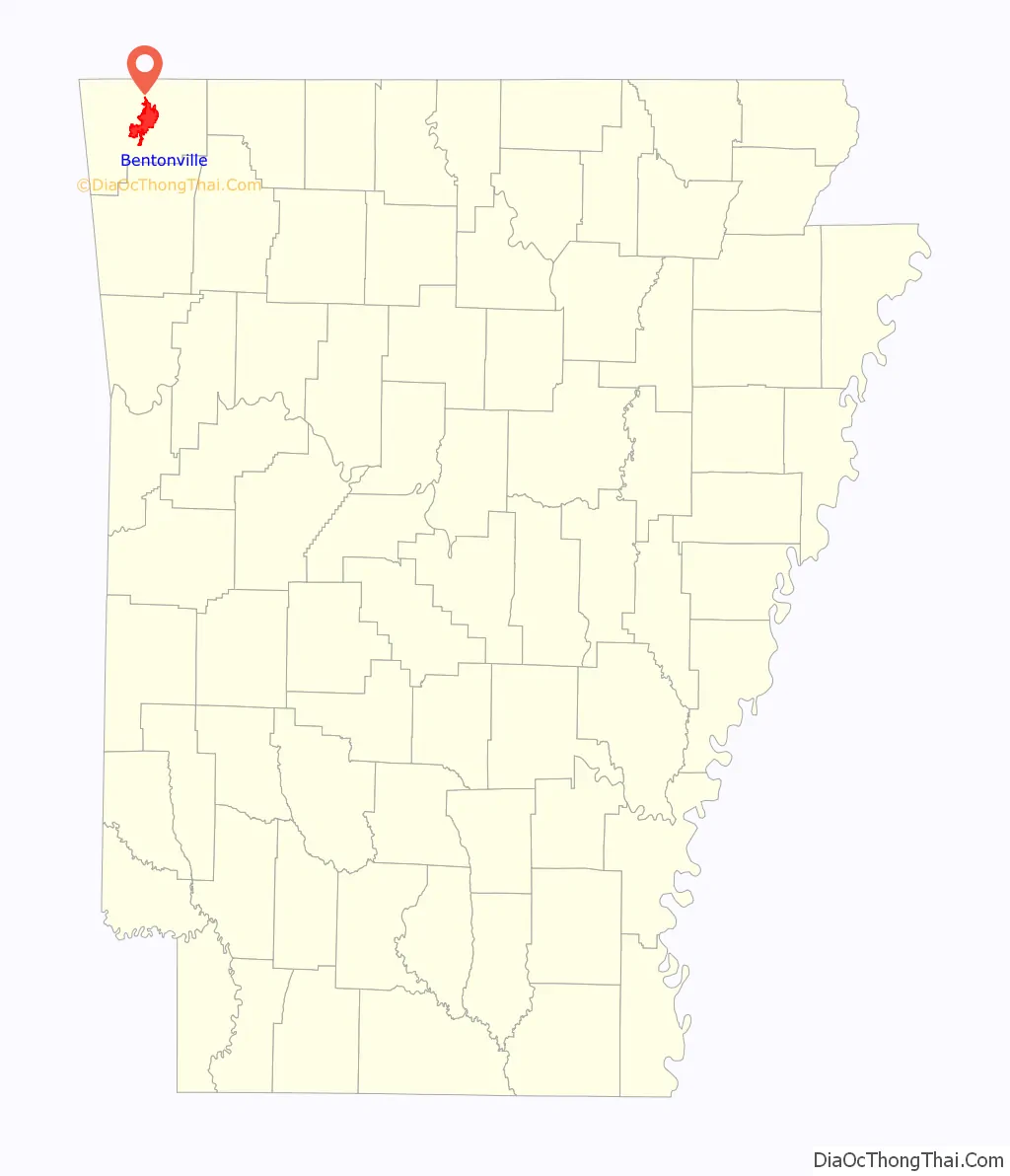
Bentonville location map. Where is Bentonville city?
History
Early history
The area now known as Bentonville’s first known use by humans was as hunting grounds by the Osage Nation who lived in Missouri. The Osage would leave their settlements to hunt in present-day Benton County for months at a time before returning to their families. White settlers first inhabited the area around 1837 and named their settlement “Osage”. By this time, the Osage had ceased using the area for hunting, and the white settlers began to establish farms. Upon establishment of Benton County on September 30, 1836, Osage was deemed a suitable site for the county seat, and the town square was established as the home of county government the following year. Osage was renamed Bentonville in honor of Thomas Hart Benton, a senator from Missouri who strongly supported Arkansas statehood.
Early statehood and Civil War
Two years after Arkansas received statehood in 1836, thousands of Cherokee people from Georgia passed through Benton County as part of the Trail of Tears route to the Indian Territory in what is now Oklahoma. Although no Civil War battles were fought inside Bentonville, the city was occupied by both armies and saw almost all of its buildings burned. Bentonville was a staging point for the Confederate army prior to the Battle of Pea Ridge, fought about 12 miles (19 km) northeast of town, and the town saw a brief skirmish just prior to the battle. The city began to rebuild about a decade after incorporation on April 3, 1873, with many of these Reconstruction Era buildings today serving as the oldest structures in Bentonville.
After the war, the area established a vibrant apple industry, with Benton County becoming the leading apple producing county in the nation in 1901.
Twentieth Century
In the 1920s and 1930s the county developed a reputation as a leader in poultry production that continued into the World War II years, and which the area still maintains today. The post war economy helped Bentonville grow, with many new businesses starting.
In 1950, Sam Walton bought the Harrison Variety Store on the Bentonville town square. He fully remodeled the building and opened “Walton’s 5 and 10 Variety Store” on March 18, 1951. This single store eventually led to the creation of Walmart, the world’s largest retailer, which still strongly influences the community today.
The late twentieth and early twenty-first century has seen a dramatic reduction in the manufacturing sector in Bentonville, corresponding with an increase in tourism and entertainment focused on the natural setting and outdoor opportunities of the area as well as the Crystal Bridges Museum of American Art, which opened in 2011. This has resulted in Bentonville being the fastest growing city in Arkansas, and the larger Northwest Arkansas area one of the fastest growing in the United States.
Bentonville Road Map
Bentonville city Satellite Map

Geography
According to the United States Census Bureau, the city has a total area of 31.5 square miles (81.6 km), of which 31.3 square miles (81.0 km) is land and 0.19 square miles (0.5 km), or 0.67%, is water.
Metropolitan area
The Northwest Arkansas region consists of three Arkansas counties: Benton, Madison, and Washington. The area had a population of 347,045 at the 2000 census which had increased to 463,204 by the 2010 Census (an increase of 33.47 percent). The Metropolitan Statistical Area does not consist of the usual principal-city-with-suburbs morphology; instead Bentonville is bordered to the east by Rogers, the north by Bella Vista, and the west by Centerton. The Northwest Arkansas National Airport is located to the southwest of Bentonville and is used to connect all of the northwest Arkansas region to the rest of the nation. For more than the last decade, Northwest Arkansas has been one of the fastest-growing regions in the United States.
Climate
Bentonville lies in the humid subtropical climate zone (Köppen Cfa) with influence from the humid continental climate type. Bentonville experiences all four seasons and does receive cold air masses from the north, however some of the Arctic masses are blocked by the higher elevations of the Ozarks. July is the hottest month of the year, with an average high of 89 °F (32 °C) and an average low of 66 °F (19 °C). Temperatures above 90 °F (32.2 °C) are common, with a high of 100 °F (37.8 °C) occurring about once per year on average. January is the coldest month with an average high of 46 °F (8 °C) and an average low of 24 °F (−4 °C). The city’s highest temperature was 114 °F (45.6 °C), recorded in 1954. The lowest temperature recorded was −16 °F (−26.7 °C), in 1996.
See also
Map of Arkansas State and its subdivision:- Arkansas
- Ashley
- Baxter
- Benton
- Boone
- Bradley
- Calhoun
- Carroll
- Chicot
- Clark
- Clay
- Cleburne
- Cleveland
- Columbia
- Conway
- Craighead
- Crawford
- Crittenden
- Cross
- Dallas
- Desha
- Drew
- Faulkner
- Franklin
- Fulton
- Garland
- Grant
- Greene
- Hempstead
- Hot Spring
- Howard
- Independence
- Izard
- Jackson
- Jefferson
- Johnson
- Lafayette
- Lawrence
- Lee
- Lincoln
- Little River
- Logan
- Lonoke
- Madison
- Marion
- Miller
- Mississippi
- Monroe
- Montgomery
- Nevada
- Newton
- Ouachita
- Perry
- Phillips
- Pike
- Poinsett
- Polk
- Pope
- Prairie
- Pulaski
- Randolph
- Saint Francis
- Saline
- Scott
- Searcy
- Sebastian
- Sevier
- Sharp
- Stone
- Union
- Van Buren
- Washington
- White
- Woodruff
- Yell
- Alabama
- Alaska
- Arizona
- Arkansas
- California
- Colorado
- Connecticut
- Delaware
- District of Columbia
- Florida
- Georgia
- Hawaii
- Idaho
- Illinois
- Indiana
- Iowa
- Kansas
- Kentucky
- Louisiana
- Maine
- Maryland
- Massachusetts
- Michigan
- Minnesota
- Mississippi
- Missouri
- Montana
- Nebraska
- Nevada
- New Hampshire
- New Jersey
- New Mexico
- New York
- North Carolina
- North Dakota
- Ohio
- Oklahoma
- Oregon
- Pennsylvania
- Rhode Island
- South Carolina
- South Dakota
- Tennessee
- Texas
- Utah
- Vermont
- Virginia
- Washington
- West Virginia
- Wisconsin
- Wyoming