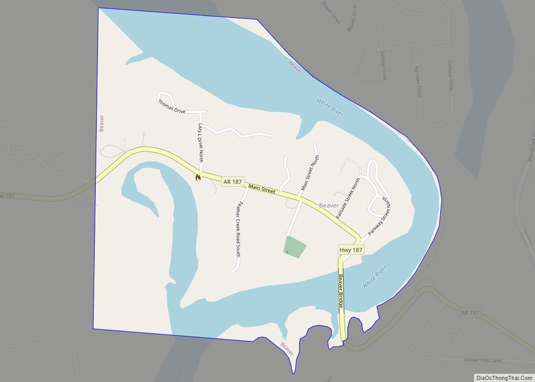
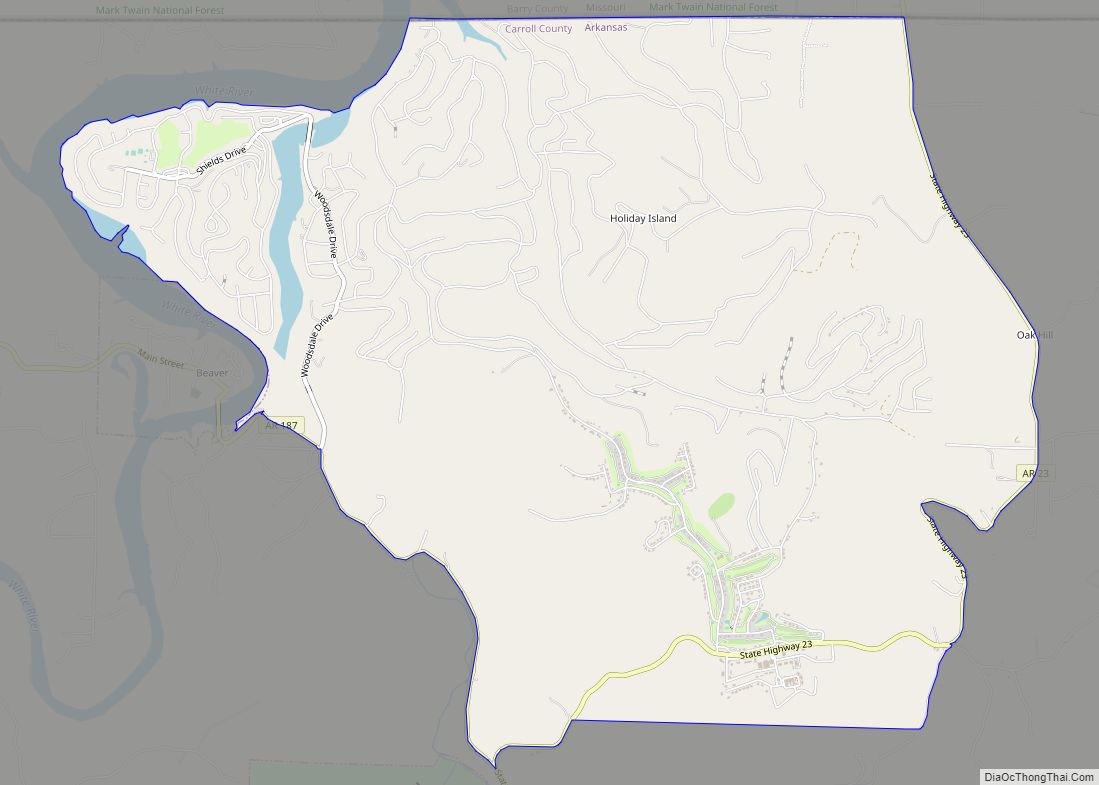
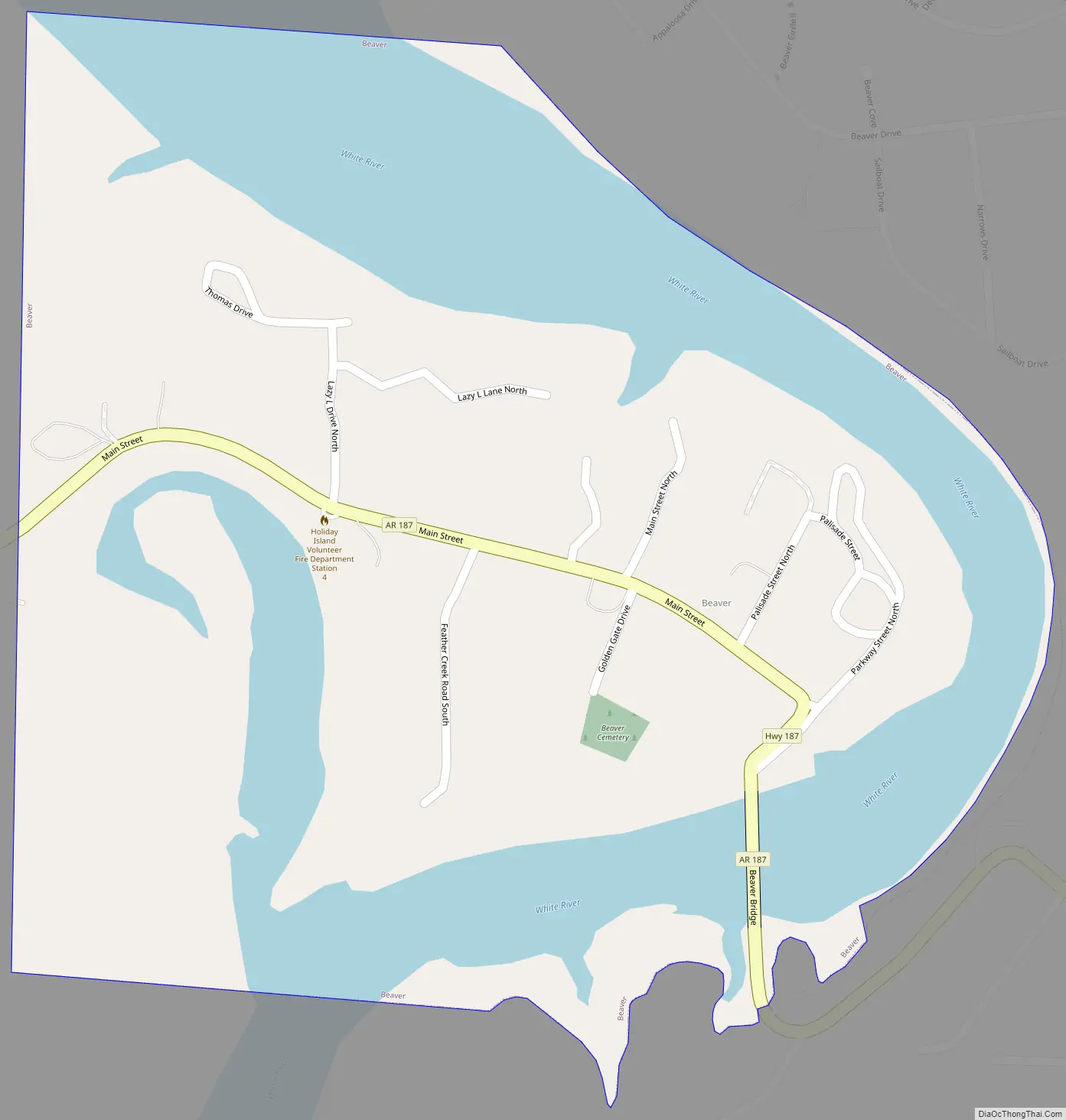
Beaver is a town in Carroll County, Arkansas, United States. As of the 2020 census it had a population of 67. The community is located on the White River at the western limits of Table Rock Lake deep in the Ozark Mountains. Located north of Eureka Springs, the small town has been featured in movies for its picturesque scenery. The town is known for the Beaver Bridge, a two-panel suspension bridge over the White River listed on the National Register of Historic Places.
| Name: | Beaver town |
|---|---|
| LSAD Code: | 43 |
| LSAD Description: | town (suffix) |
| State: | Arkansas |
| County: | Carroll County |
| Elevation: | 932 ft (284 m) |
| Total Area: | 0.50 sq mi (1.29 km²) |
| Land Area: | 0.32 sq mi (0.82 km²) |
| Water Area: | 0.18 sq mi (0.48 km²) |
| Total Population: | 67 |
| Population Density: | 212.70/sq mi (82.14/km²) |
| ZIP code: | 72613 |
| Area code: | 479 |
| FIPS code: | 0504540 |
| GNISfeature ID: | 0057351 |
| Website: | www.beavertownarkansas.com |
Online Interactive Map
Click on ![]() to view map in "full screen" mode.
to view map in "full screen" mode.
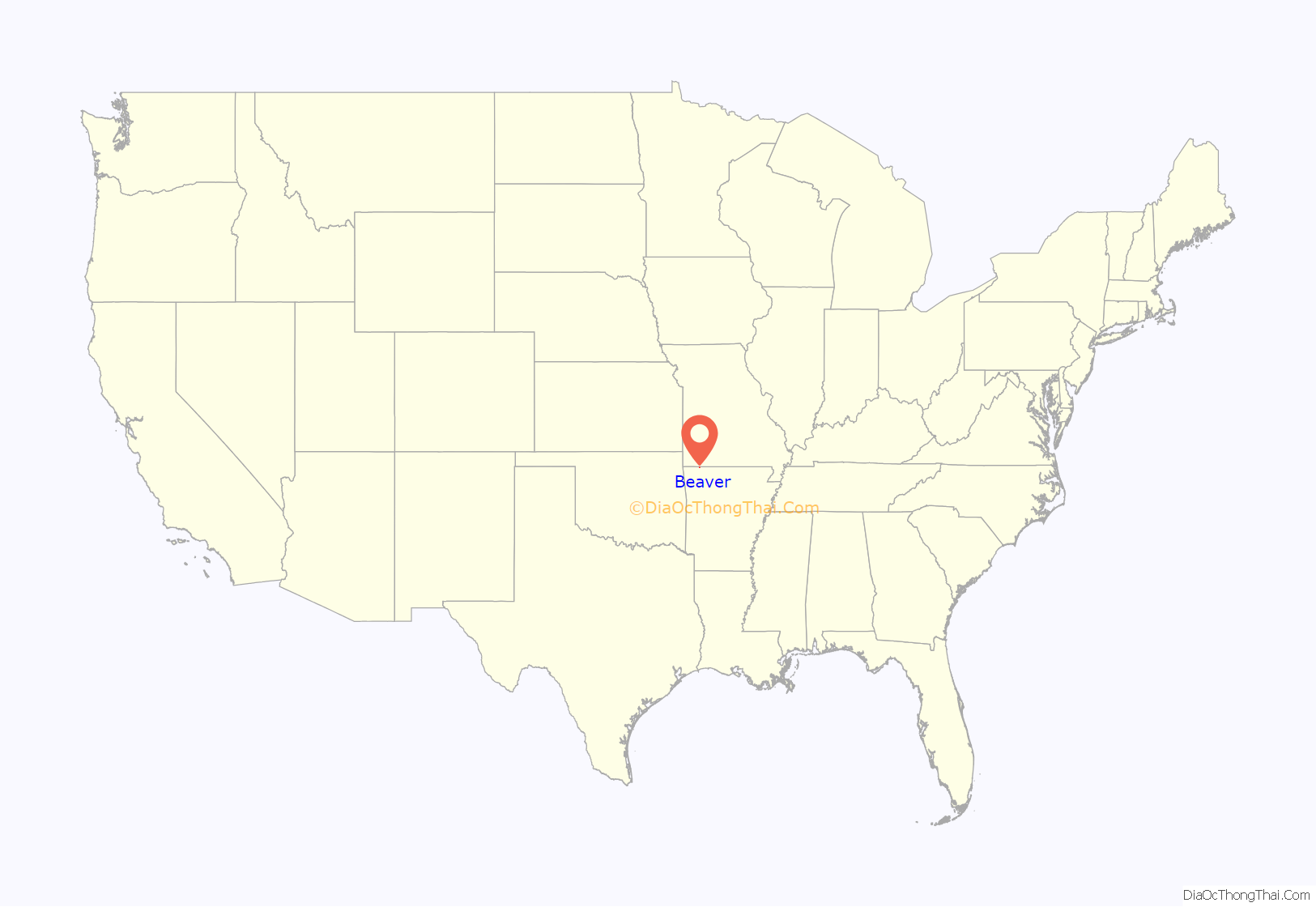
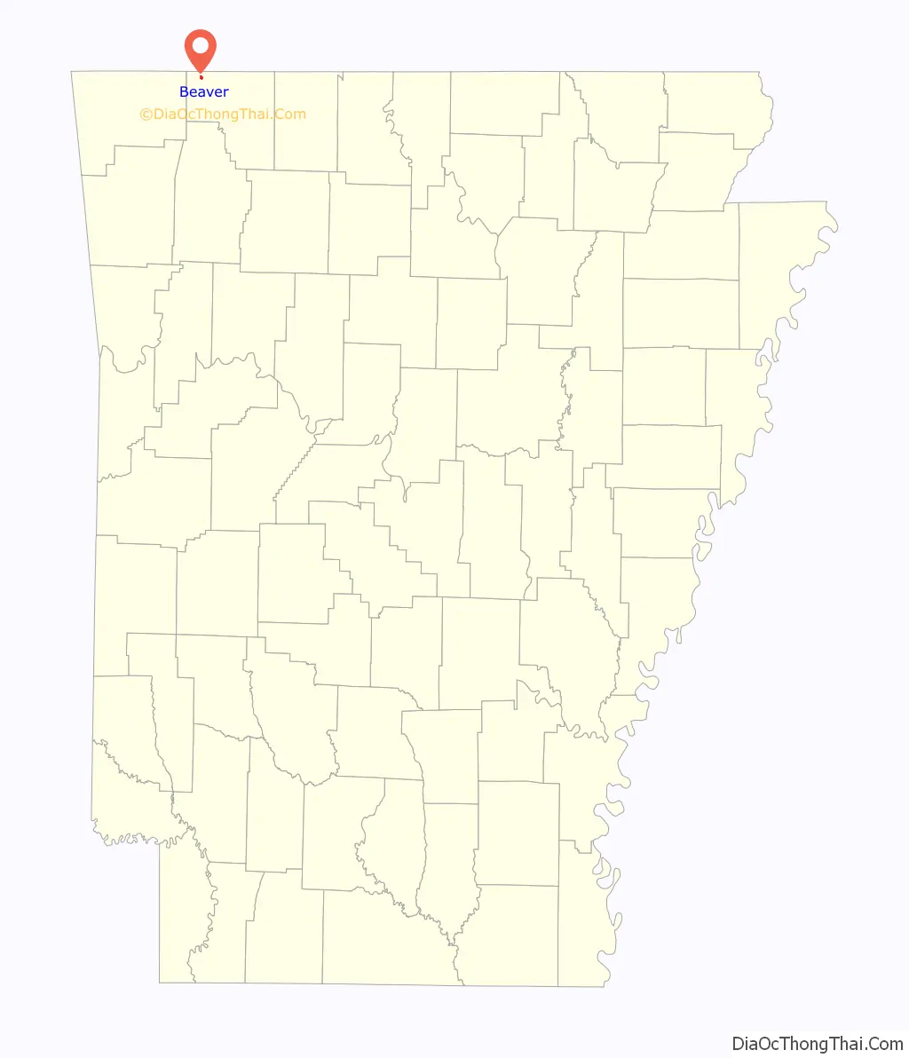
Beaver location map. Where is Beaver town?
Beaver Road Map
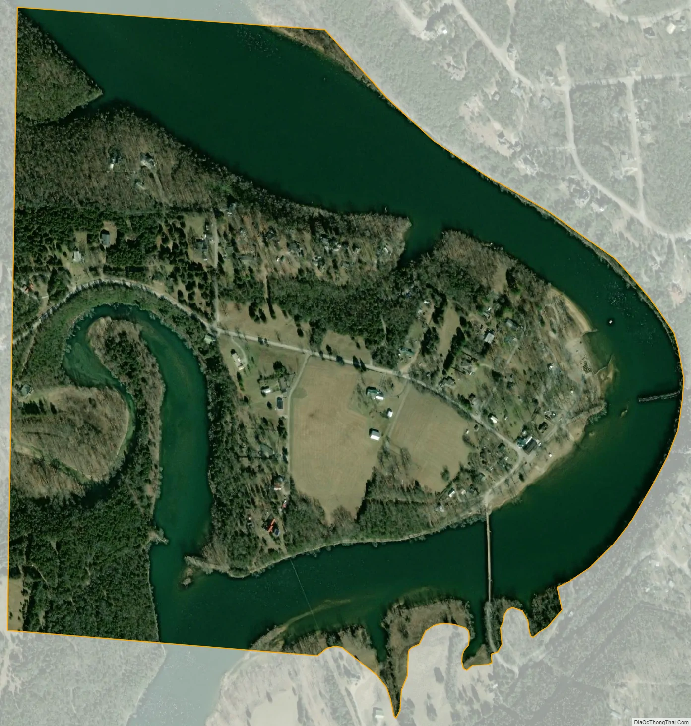
Beaver city Satellite Map
Geography
Beaver is located in northwestern Carroll County at 36°28′32″N 93°46′16″W / 36.47556°N 93.77111°W / 36.47556; -93.77111 (36.475495, -93.771170).
According to the United States Census Bureau, the town has a total area of 0.54 square miles (1.4 km), of which 0.35 square miles (0.9 km) is land and 0.19 square miles (0.5 km), or 33.16%, is water.
Highway 187 is the only member of the Arkansas Highway System that serves Beaver. The route leads west 5 miles (8 km) to US Highway 62, which provides access to Eureka Springs to the southeast and Rogers to the west. The Arkansas Highway 23, the Pig Trail Scenic Byway, runs near the town as well, a popular route with tourists and motorcyclists.
See also
Map of Arkansas State and its subdivision:- Arkansas
- Ashley
- Baxter
- Benton
- Boone
- Bradley
- Calhoun
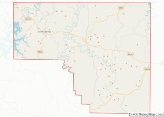
- Carroll
- Chicot
- Clark
- Clay
- Cleburne
- Cleveland
- Columbia
- Conway
- Craighead
- Crawford
- Crittenden
- Cross
- Dallas
- Desha
- Drew
- Faulkner
- Franklin
- Fulton
- Garland
- Grant
- Greene
- Hempstead
- Hot Spring
- Howard
- Independence
- Izard
- Jackson
- Jefferson
- Johnson
- Lafayette
- Lawrence
- Lee
- Lincoln
- Little River
- Logan
- Lonoke
- Madison
- Marion
- Miller
- Mississippi
- Monroe
- Montgomery
- Nevada
- Newton
- Ouachita
- Perry
- Phillips
- Pike
- Poinsett
- Polk
- Pope
- Prairie
- Pulaski
- Randolph
- Saint Francis
- Saline
- Scott
- Searcy
- Sebastian
- Sevier
- Sharp
- Stone
- Union
- Van Buren
- Washington
- White
- Woodruff
- Yell
- Alabama
- Alaska
- Arizona
- Arkansas
- California
- Colorado
- Connecticut
- Delaware
- District of Columbia
- Florida
- Georgia
- Hawaii
- Idaho
- Illinois
- Indiana
- Iowa
- Kansas
- Kentucky
- Louisiana
- Maine
- Maryland
- Massachusetts
- Michigan
- Minnesota
- Mississippi
- Missouri
- Montana
- Nebraska
- Nevada
- New Hampshire
- New Jersey
- New Mexico
- New York
- North Carolina
- North Dakota
- Ohio
- Oklahoma
- Oregon
- Pennsylvania
- Rhode Island
- South Carolina
- South Dakota
- Tennessee
- Texas
- Utah
- Vermont
- Virginia
- Washington
- West Virginia
- Wisconsin
- Wyoming