Bradley is a city in Lafayette County, Arkansas, United States. The population was 628 at the 2010 census.
| Name: | Bradley city |
|---|---|
| LSAD Code: | 25 |
| LSAD Description: | city (suffix) |
| State: | Arkansas |
| County: | Lafayette County |
| Elevation: | 253 ft (77 m) |
| Total Area: | 0.91 sq mi (2.36 km²) |
| Land Area: | 0.91 sq mi (2.36 km²) |
| Water Area: | 0.00 sq mi (0.00 km²) |
| Total Population: | 405 |
| Population Density: | 443.59/sq mi (171.30/km²) |
| ZIP code: | 71826 |
| Area code: | 870 |
| FIPS code: | 0508290 |
| GNISfeature ID: | 0076408 |
Online Interactive Map
Click on ![]() to view map in "full screen" mode.
to view map in "full screen" mode.
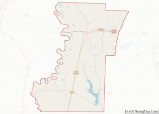
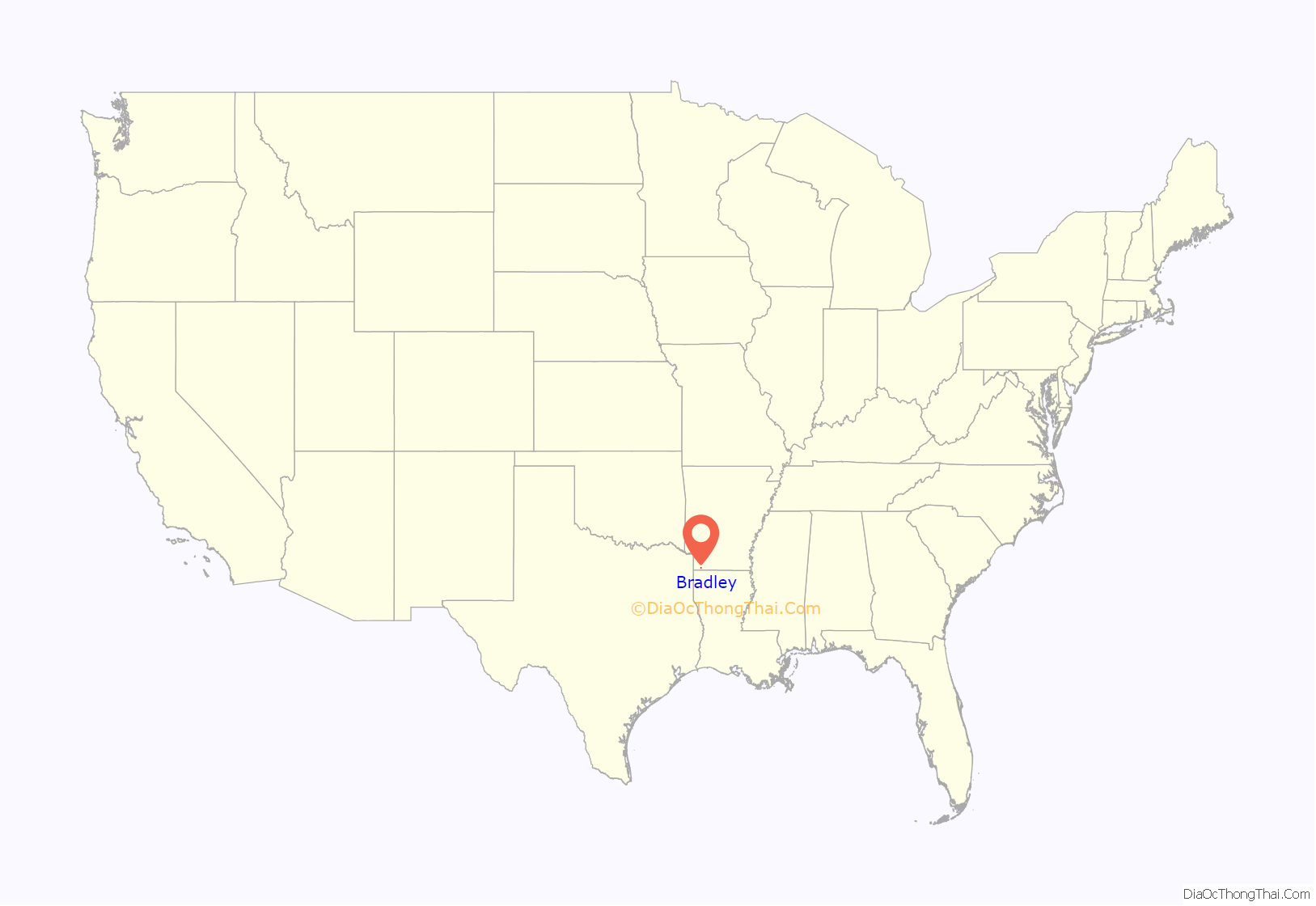
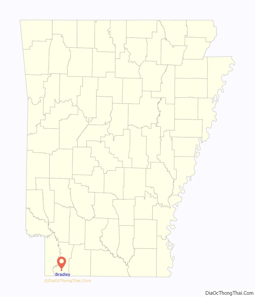
Bradley location map. Where is Bradley city?
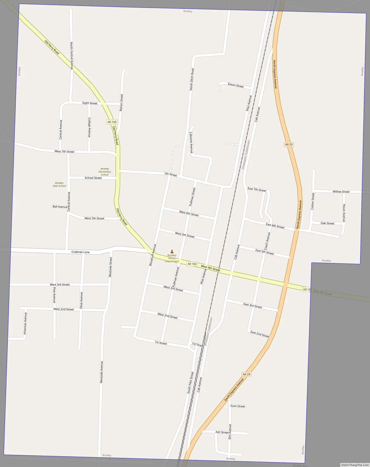
Bradley Road Map
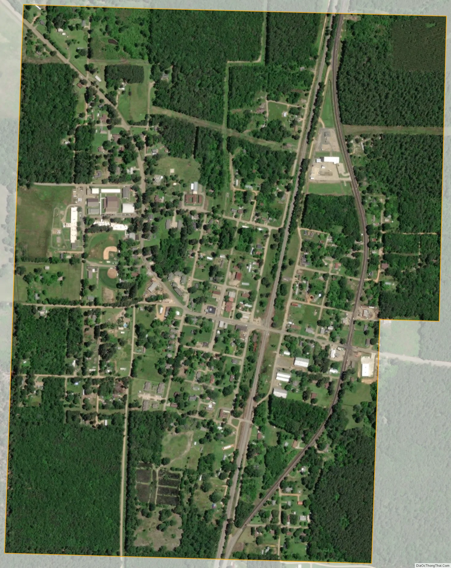
Bradley city Satellite Map
Geography
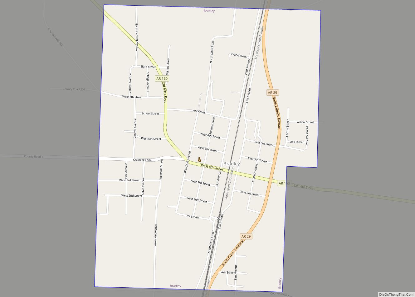
Bradley is located in southern Lafayette County at 33°5′55″N 93°39′27″W / 33.09861°N 93.65750°W / 33.09861; -93.65750 (33.098580, -93.657434). It sits at the intersection of Arkansas Highways 29 and 160. Highway 29 leads north 19 miles (31 km) to Lewisville and south 6 miles (10 km) to the Louisiana border at Arkana. Plain Dealing, Louisiana, is 14 miles (23 km) south of Bradley. Highway 160 leads east from Bradley 7 miles (11 km) to the community of State Line and west 15 miles (24 km) to Interstate 49 near Doddridge.
According to the United States Census Bureau, Bradley has a total area of 0.93 square miles (2.4 km), all land.
See also
Map of Arkansas State and its subdivision:- Arkansas
- Ashley
- Baxter
- Benton
- Boone
- Bradley
- Calhoun
- Carroll
- Chicot
- Clark
- Clay
- Cleburne
- Cleveland
- Columbia
- Conway
- Craighead
- Crawford
- Crittenden
- Cross
- Dallas
- Desha
- Drew
- Faulkner
- Franklin
- Fulton
- Garland
- Grant
- Greene
- Hempstead
- Hot Spring
- Howard
- Independence
- Izard
- Jackson
- Jefferson
- Johnson
- Lafayette
- Lawrence
- Lee
- Lincoln
- Little River
- Logan
- Lonoke
- Madison
- Marion
- Miller
- Mississippi
- Monroe
- Montgomery
- Nevada
- Newton
- Ouachita
- Perry
- Phillips
- Pike
- Poinsett
- Polk
- Pope
- Prairie
- Pulaski
- Randolph
- Saint Francis
- Saline
- Scott
- Searcy
- Sebastian
- Sevier
- Sharp
- Stone
- Union
- Van Buren
- Washington
- White
- Woodruff
- Yell
- Alabama
- Alaska
- Arizona
- Arkansas
- California
- Colorado
- Connecticut
- Delaware
- District of Columbia
- Florida
- Georgia
- Hawaii
- Idaho
- Illinois
- Indiana
- Iowa
- Kansas
- Kentucky
- Louisiana
- Maine
- Maryland
- Massachusetts
- Michigan
- Minnesota
- Mississippi
- Missouri
- Montana
- Nebraska
- Nevada
- New Hampshire
- New Jersey
- New Mexico
- New York
- North Carolina
- North Dakota
- Ohio
- Oklahoma
- Oregon
- Pennsylvania
- Rhode Island
- South Carolina
- South Dakota
- Tennessee
- Texas
- Utah
- Vermont
- Virginia
- Washington
- West Virginia
- Wisconsin
- Wyoming