Bull Shoals is a city in Marion County, Arkansas, United States, founded in 1954. The population was 1,952 at the 2020 census. Primarily a retirement and vacation center, Bull Shoals is bordered in three directions by the clear, deep, man-made Bull Shoals Lake.
| Name: | Bull Shoals city |
|---|---|
| LSAD Code: | 25 |
| LSAD Description: | city (suffix) |
| State: | Arkansas |
| County: | Marion County |
| Elevation: | 558 ft (170 m) |
| Total Area: | 4.97 sq mi (12.87 km²) |
| Land Area: | 4.90 sq mi (12.70 km²) |
| Water Area: | 0.07 sq mi (0.18 km²) |
| Total Population: | 1,952 |
| Population Density: | 398.20/sq mi (153.74/km²) |
| ZIP code: | 72619 |
| Area code: | 870 |
| FIPS code: | 0509790 |
| GNISfeature ID: | 2403951 |
| Website: | www.cityofbullshoals.org |
Online Interactive Map
Click on ![]() to view map in "full screen" mode.
to view map in "full screen" mode.
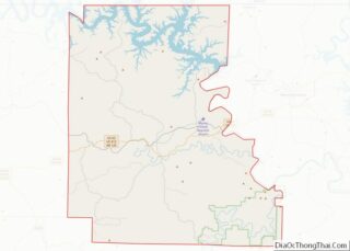
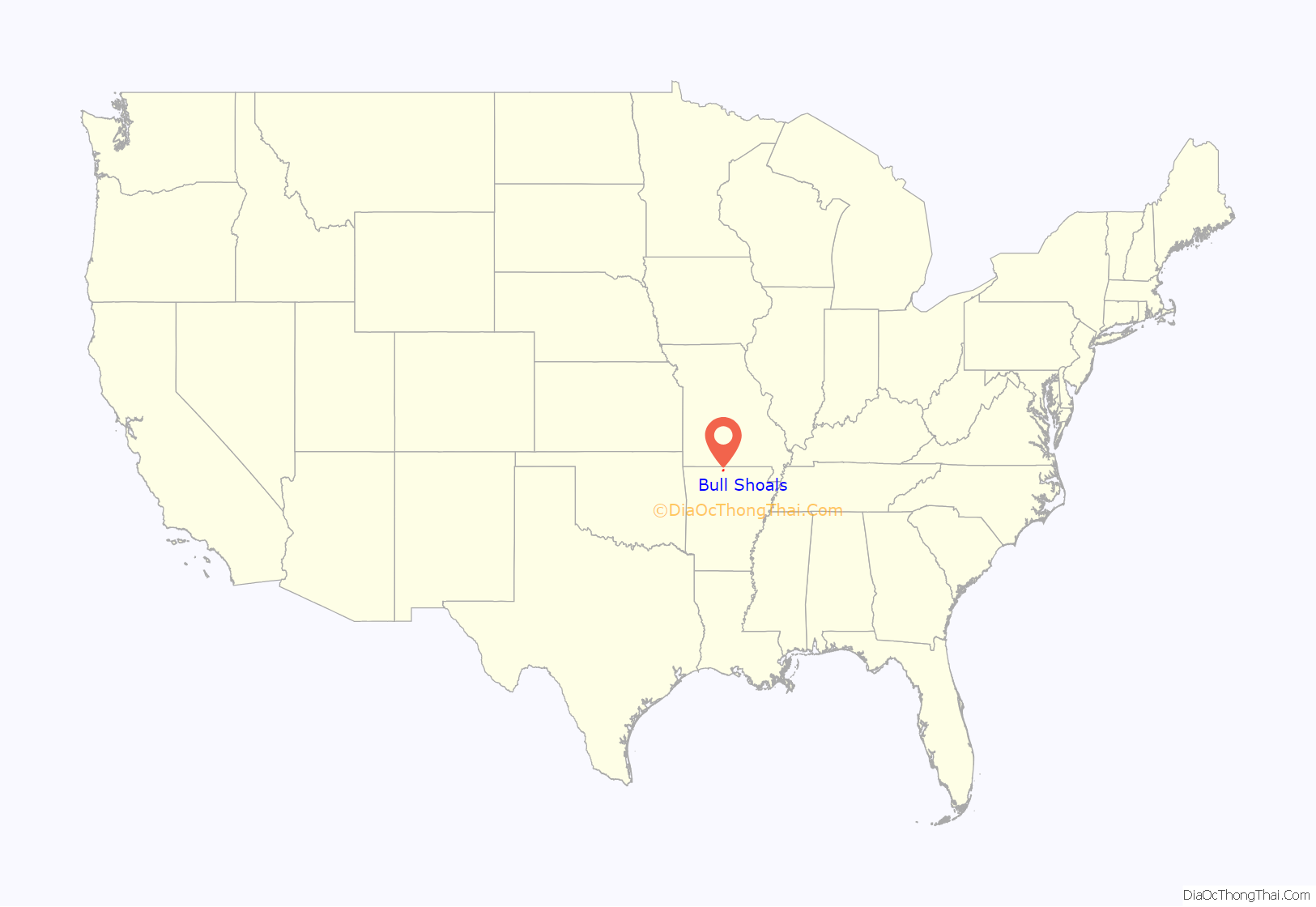
Bull Shoals location map. Where is Bull Shoals city?

History
The town was created by real estate developers C. S. Woods and C. S. Woods Jr. and was officially established in 1954. Bull Shoals Dam is the threshold into the town from the southeast.
Bull Shoals Dam and the town of Bull Shoals developed together. The developers bought several tracts of the former Newton Flat settlement when they learned that the government planned to build a flood-control and power-generating concrete dam at the site. Construction of the dam took four years, from 1947 to 1951, resulting in one of the largest dams built in the nation at that time.
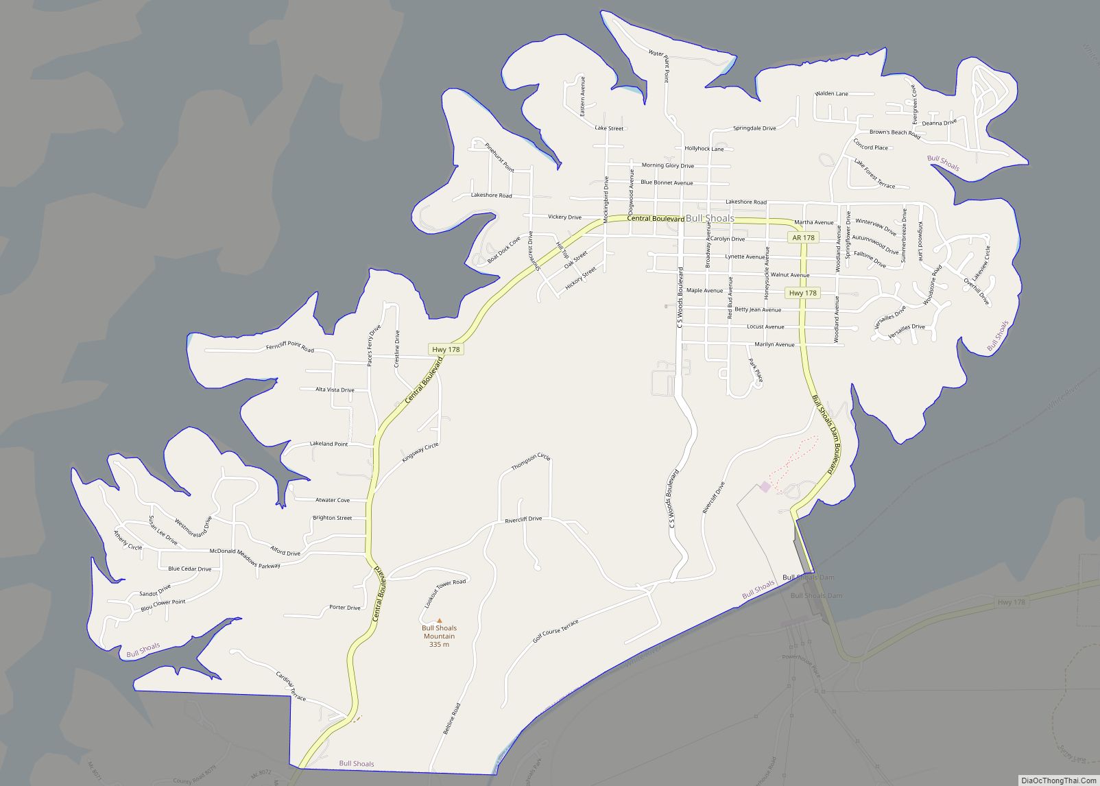
Bull Shoals Road Map
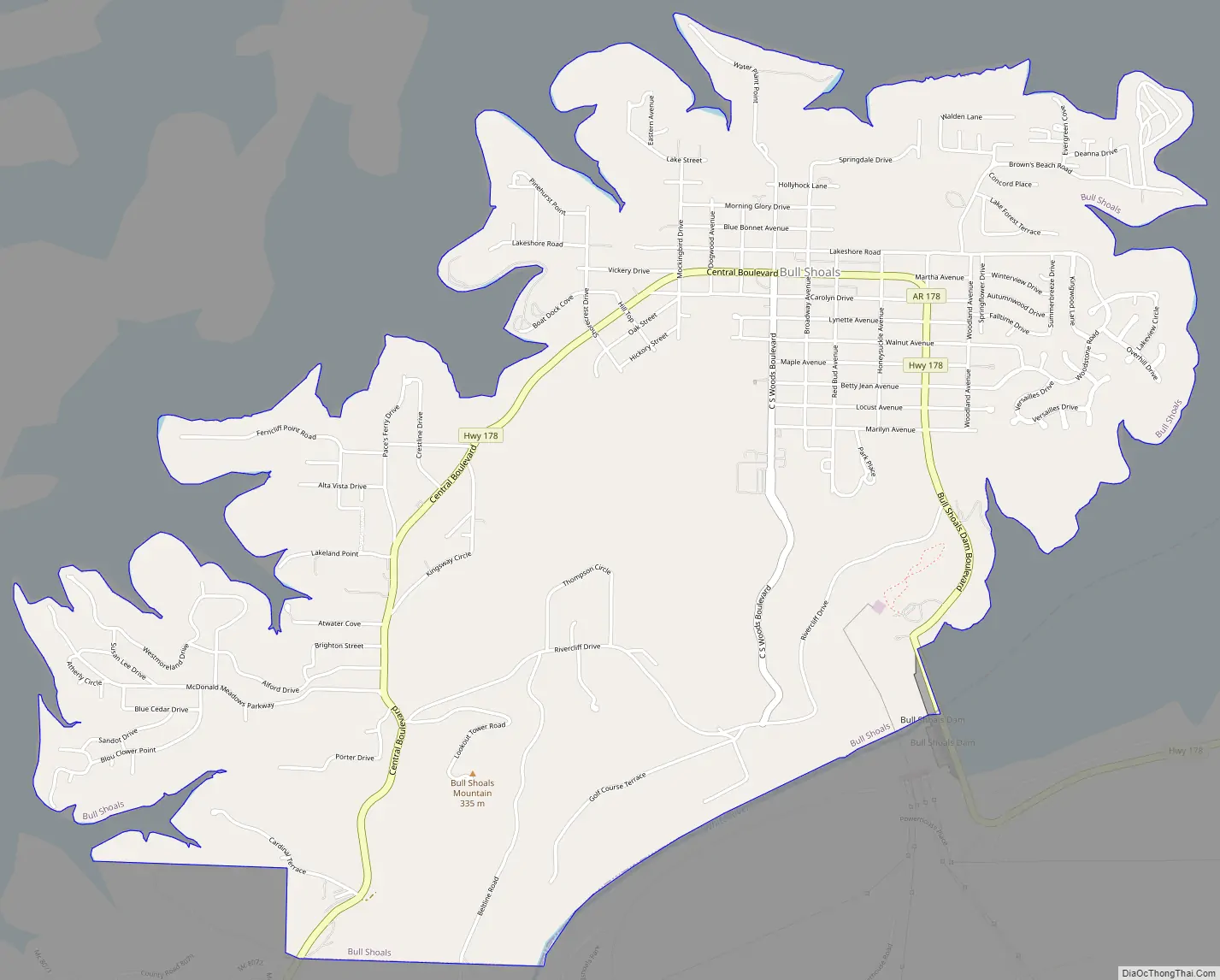
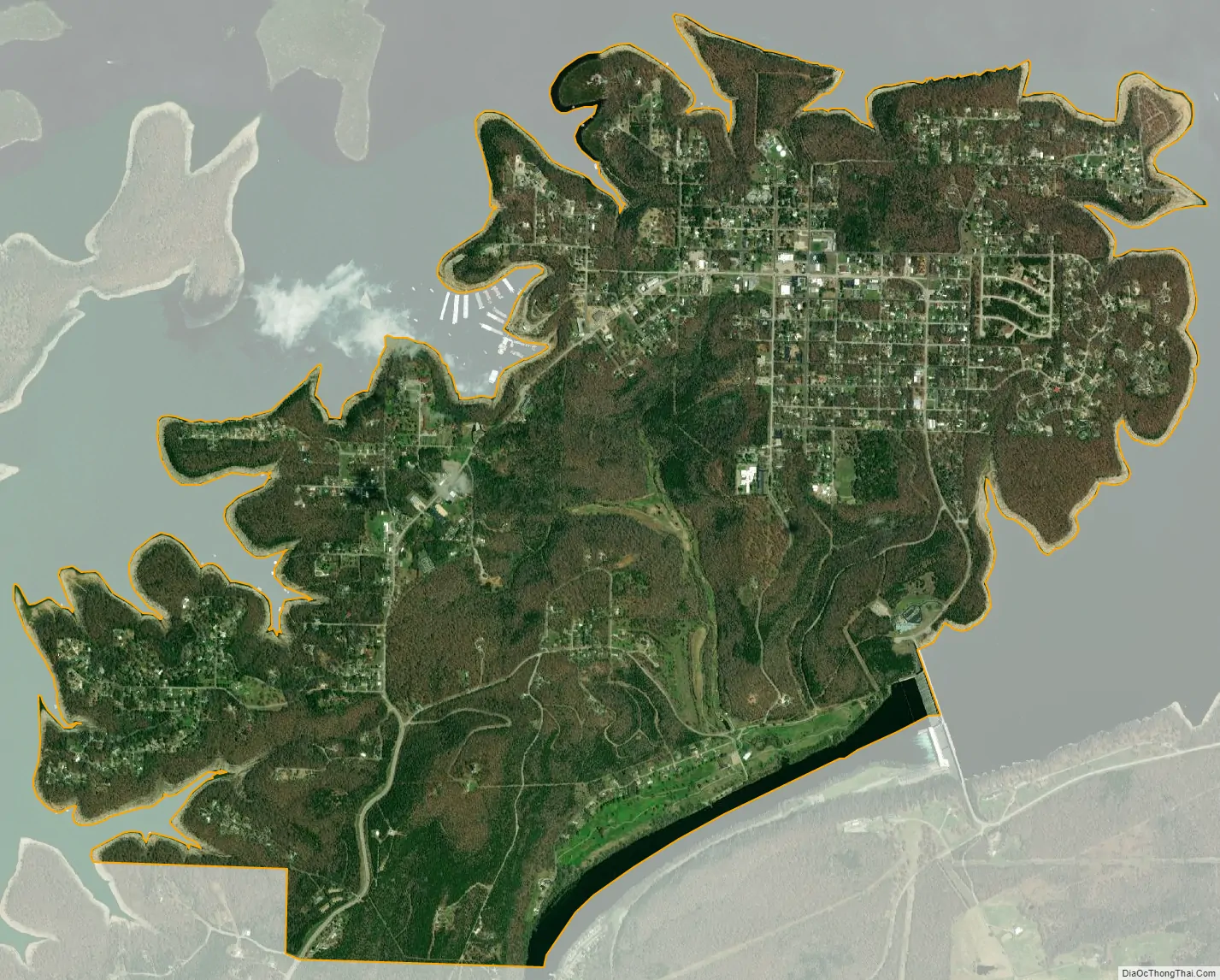
Bull Shoals city Satellite Map
Geography
Bull Shoals is located in northeastern Marion County and is bordered on three sides by Bull Shoals Lake, with the main channel of the lake, on the White River, to the southeast and northeast, and a long arm of the lake formed by the inlets of Jimmie Creek and Moccasin Creek on the northwest side of the city. The southeast border of the city, in the White River, is the Baxter County line.
According to the United States Census Bureau, the city has a total area of 5.0 square miles (13 km), of which 0.07 square miles (0.18 km), or 1.39%, are water.
Highway 178 is the only highway and only major road in and out of Bull Shoals, which the highway enters just off the Bull Shoal Dam, which begins the Bull Shoals Lake from the White River, near the Arkansas-Missouri border. Highway 178 leads east 9 miles (14 km) to Midway and south the same distance to Flippin. Yellville, the Marion county seat, is 15 miles (24 km) to the southwest of Bull Shoals, and Mountain Home is 15 miles to the southeast.
See also
Map of Arkansas State and its subdivision:- Arkansas
- Ashley
- Baxter
- Benton
- Boone
- Bradley
- Calhoun
- Carroll
- Chicot
- Clark
- Clay
- Cleburne
- Cleveland
- Columbia
- Conway
- Craighead
- Crawford
- Crittenden
- Cross
- Dallas
- Desha
- Drew
- Faulkner
- Franklin
- Fulton
- Garland
- Grant
- Greene
- Hempstead
- Hot Spring
- Howard
- Independence
- Izard
- Jackson
- Jefferson
- Johnson
- Lafayette
- Lawrence
- Lee
- Lincoln
- Little River
- Logan
- Lonoke
- Madison
- Marion
- Miller
- Mississippi
- Monroe
- Montgomery
- Nevada
- Newton
- Ouachita
- Perry
- Phillips
- Pike
- Poinsett
- Polk
- Pope
- Prairie
- Pulaski
- Randolph
- Saint Francis
- Saline
- Scott
- Searcy
- Sebastian
- Sevier
- Sharp
- Stone
- Union
- Van Buren
- Washington
- White
- Woodruff
- Yell
- Alabama
- Alaska
- Arizona
- Arkansas
- California
- Colorado
- Connecticut
- Delaware
- District of Columbia
- Florida
- Georgia
- Hawaii
- Idaho
- Illinois
- Indiana
- Iowa
- Kansas
- Kentucky
- Louisiana
- Maine
- Maryland
- Massachusetts
- Michigan
- Minnesota
- Mississippi
- Missouri
- Montana
- Nebraska
- Nevada
- New Hampshire
- New Jersey
- New Mexico
- New York
- North Carolina
- North Dakota
- Ohio
- Oklahoma
- Oregon
- Pennsylvania
- Rhode Island
- South Carolina
- South Dakota
- Tennessee
- Texas
- Utah
- Vermont
- Virginia
- Washington
- West Virginia
- Wisconsin
- Wyoming