Cave Springs is a city in Benton County, Arkansas. The population was 5,495 at the time of the 2020 census, up from 1,729 in 2010 census. It is part of the Northwest Arkansas metropolitan area. In June 2022, Cave Springs was named the 3rd highest average home values in the state of Arkansas.
| Name: | Cave Springs city |
|---|---|
| LSAD Code: | 25 |
| LSAD Description: | city (suffix) |
| State: | Arkansas |
| County: | Benton County |
| Elevation: | 1,158 ft (353 m) |
| Total Area: | 7.81 sq mi (20.24 km²) |
| Land Area: | 7.76 sq mi (20.09 km²) |
| Water Area: | 0.05 sq mi (0.14 km²) |
| Total Population: | 5,495 |
| Population Density: | 708.21/sq mi (273.45/km²) |
| ZIP code: | 72718 |
| Area code: | 479 |
| FIPS code: | 0512340 |
| GNISfeature ID: | 0076553 |
| Website: | cavespringsar.gov |
Online Interactive Map
Click on ![]() to view map in "full screen" mode.
to view map in "full screen" mode.
Cave Springs location map. Where is Cave Springs city?
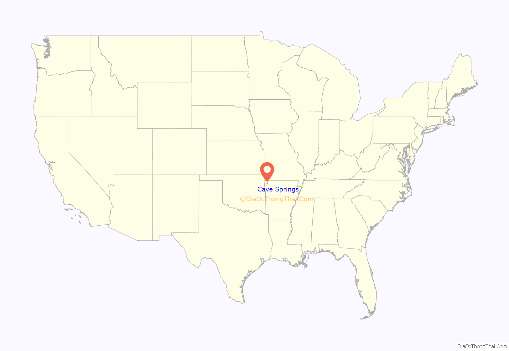
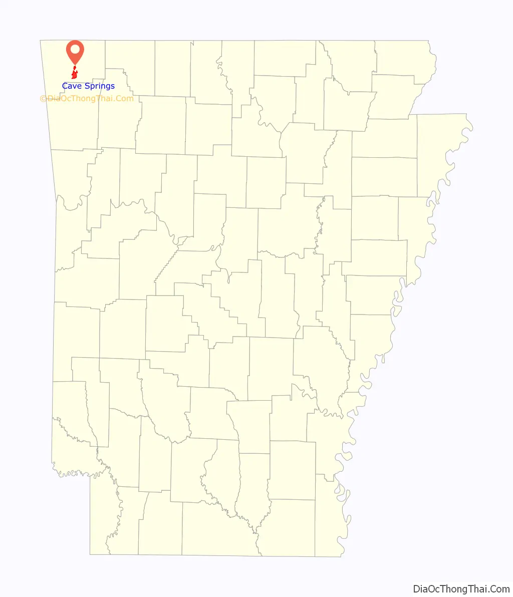
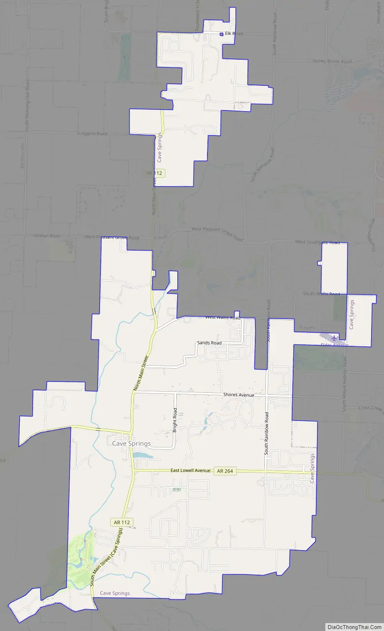
Cave Springs Road Map
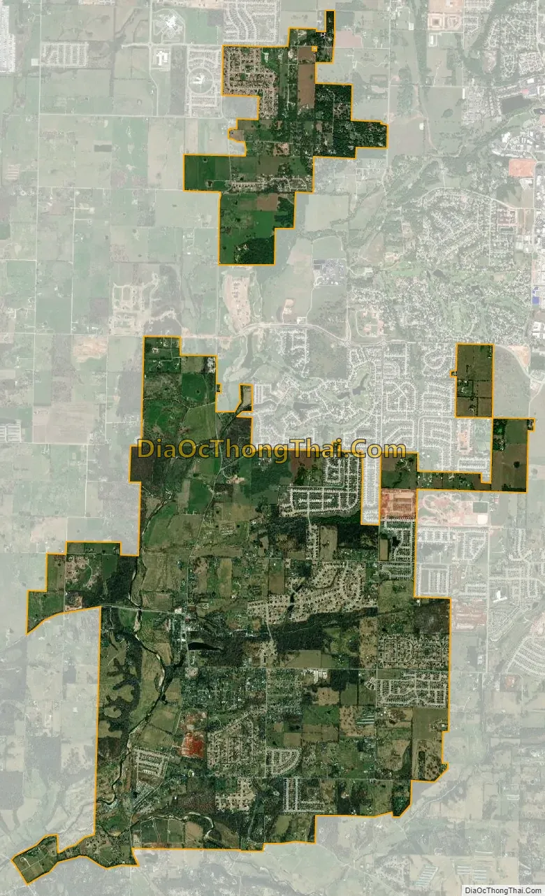
Cave Springs city Satellite Map
Geography
Cave Springs is located in southern central Benton County at 36°16′40″N 94°13′24″W / 36.27778°N 94.22333°W / 36.27778; -94.22333 (36.277729, -94.223226), in the valley of Osage Creek. Arkansas Highway 112 (Main Street) leads north 8 miles (13 km) to Bentonville and south 16 miles (26 km) to Fayetteville. Arkansas Highway 264 (East Lowell Avenue) leads east 6 miles (10 km) to Lowell and west (as Healing Springs Road) 5 miles (8 km) to Northwest Arkansas National Airport.
According to the United States Census Bureau, the city has a total area of 6.9 square miles (18.0 km), of which 6.9 square miles (17.8 km) is land and 0.077 square miles (0.2 km), or 0.84%, is water. Lake Keith, a small water basin in the middle of Cave Springs, harbors the rare Ozark Cavefish (Amblyopsis rosae). In October 2013, Lake Keith was temporarily drained.
Water from Lake Keith feeds into the Osage Creek, a tributary of the Illinois River.
See also
Map of Arkansas State and its subdivision:- Arkansas
- Ashley
- Baxter
- Benton
- Boone
- Bradley
- Calhoun
- Carroll
- Chicot
- Clark
- Clay
- Cleburne
- Cleveland
- Columbia
- Conway
- Craighead
- Crawford
- Crittenden
- Cross
- Dallas
- Desha
- Drew
- Faulkner
- Franklin
- Fulton
- Garland
- Grant
- Greene
- Hempstead
- Hot Spring
- Howard
- Independence
- Izard
- Jackson
- Jefferson
- Johnson
- Lafayette
- Lawrence
- Lee
- Lincoln
- Little River
- Logan
- Lonoke
- Madison
- Marion
- Miller
- Mississippi
- Monroe
- Montgomery
- Nevada
- Newton
- Ouachita
- Perry
- Phillips
- Pike
- Poinsett
- Polk
- Pope
- Prairie
- Pulaski
- Randolph
- Saint Francis
- Saline
- Scott
- Searcy
- Sebastian
- Sevier
- Sharp
- Stone
- Union
- Van Buren
- Washington
- White
- Woodruff
- Yell
- Alabama
- Alaska
- Arizona
- Arkansas
- California
- Colorado
- Connecticut
- Delaware
- District of Columbia
- Florida
- Georgia
- Hawaii
- Idaho
- Illinois
- Indiana
- Iowa
- Kansas
- Kentucky
- Louisiana
- Maine
- Maryland
- Massachusetts
- Michigan
- Minnesota
- Mississippi
- Missouri
- Montana
- Nebraska
- Nevada
- New Hampshire
- New Jersey
- New Mexico
- New York
- North Carolina
- North Dakota
- Ohio
- Oklahoma
- Oregon
- Pennsylvania
- Rhode Island
- South Carolina
- South Dakota
- Tennessee
- Texas
- Utah
- Vermont
- Virginia
- Washington
- West Virginia
- Wisconsin
- Wyoming