Decatur is a city, in Benton County, Arkansas, United States. The population was 1,773 at the 2020 census. It is part of the Northwest Arkansas region. This town is named after Commodore Stephen Decatur, Jr.
| Name: | Decatur city |
|---|---|
| LSAD Code: | 25 |
| LSAD Description: | city (suffix) |
| State: | Arkansas |
| County: | Benton County |
| Elevation: | 1,237 ft (377 m) |
| Total Area: | 4.53 sq mi (11.72 km²) |
| Land Area: | 4.47 sq mi (11.58 km²) |
| Water Area: | 0.06 sq mi (0.14 km²) |
| Total Population: | 1,773 |
| Population Density: | 396.56/sq mi (153.11/km²) |
| ZIP code: | 72722 |
| Area code: | 479 |
| FIPS code: | 0517740 |
| GNISfeature ID: | 0076769 |
| Website: | decaturarkansas.com |
Online Interactive Map
Click on ![]() to view map in "full screen" mode.
to view map in "full screen" mode.
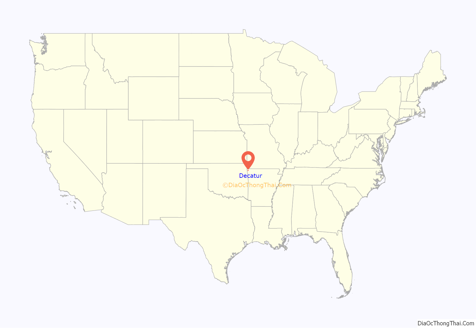
Decatur location map. Where is Decatur city?
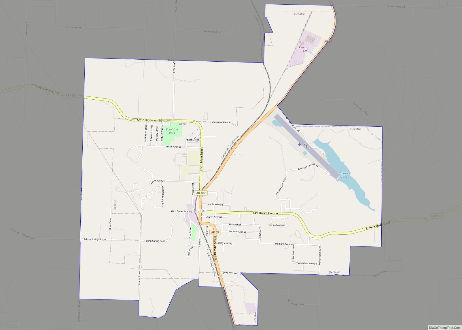
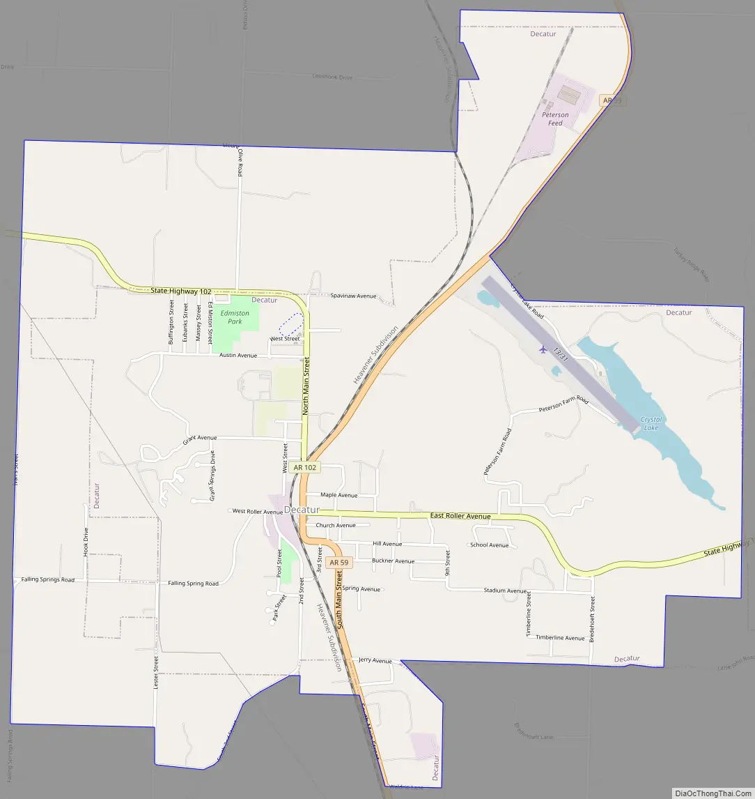
Decatur Road Map
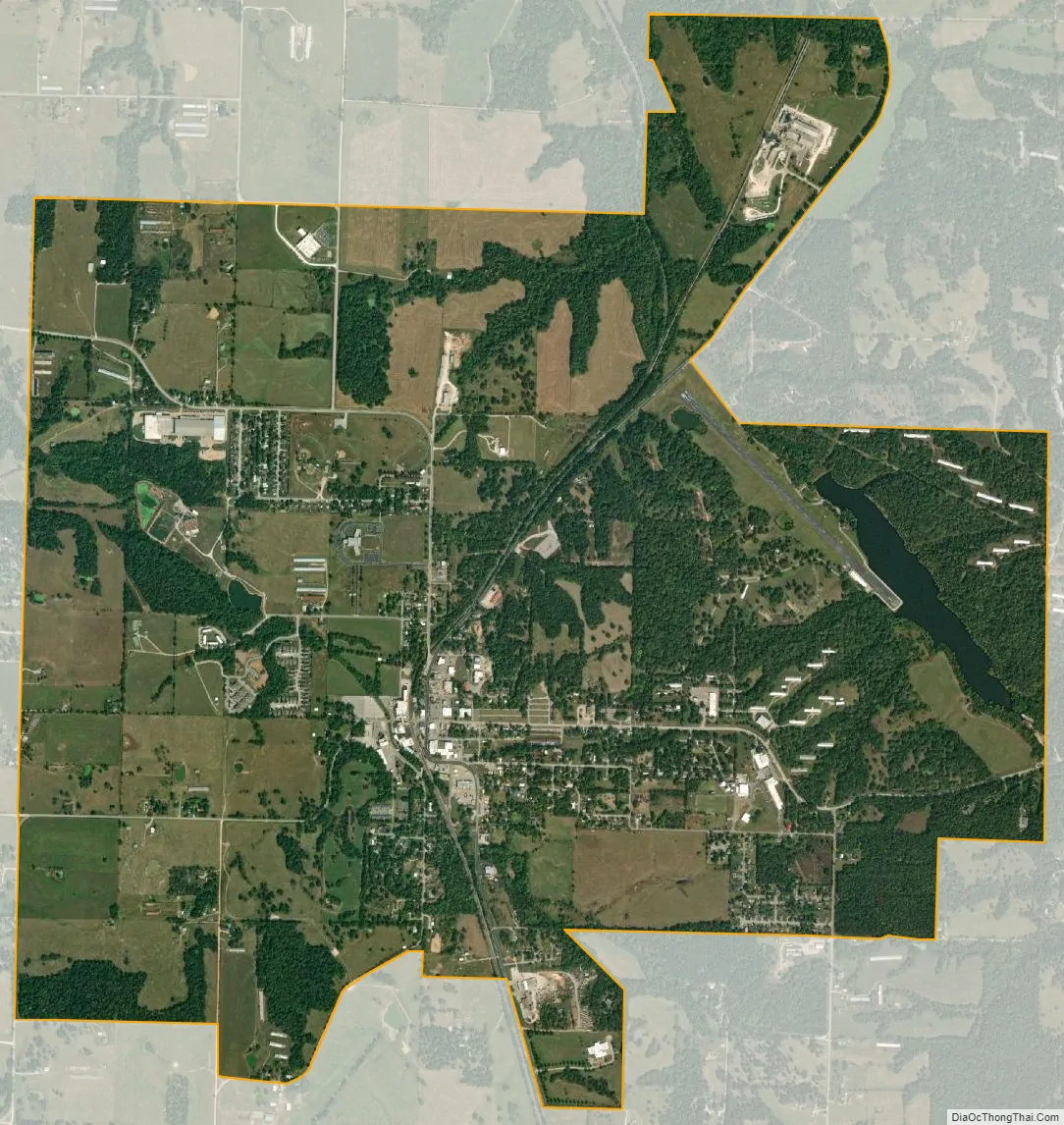
Decatur city Satellite Map
Geography
Decatur is located in western Benton County at 36°20′15″N 94°27′24″W / 36.33750°N 94.45667°W / 36.33750; -94.45667 (36.337541, -94.456721). Arkansas Highway 59 passes through the city, leading north 6 miles (10 km) to Gravette and 13 miles (21 km) to the Missouri border, and south 13 miles (21 km) to Siloam Springs. Arkansas Highway 102 leads east 16 miles (26 km) to Bentonville and west 10 miles (16 km) to the Oklahoma border.
According to the United States Census Bureau, Decatur has a total area of 4.5 square miles (11.7 km), of which 4.4 square miles (11.5 km) is land and 0.039 square miles (0.1 km), or 1.21%, is water.
See also
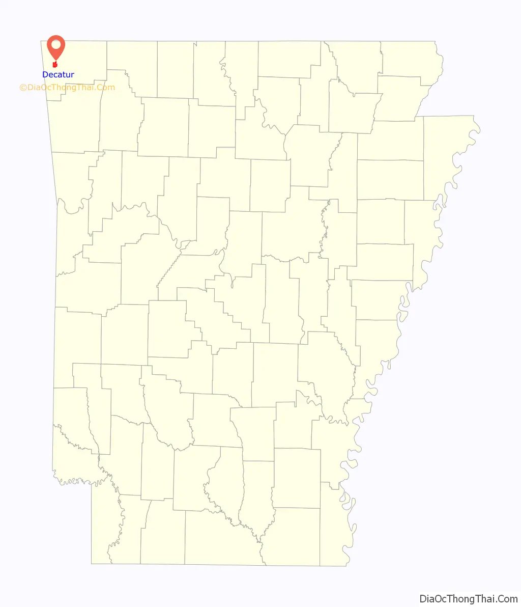
Map of Arkansas State and its subdivision:- Arkansas
- Ashley
- Baxter
- Benton
- Boone
- Bradley
- Calhoun
- Carroll
- Chicot
- Clark
- Clay
- Cleburne
- Cleveland
- Columbia
- Conway
- Craighead
- Crawford
- Crittenden
- Cross
- Dallas
- Desha
- Drew
- Faulkner
- Franklin
- Fulton
- Garland
- Grant
- Greene
- Hempstead
- Hot Spring
- Howard
- Independence
- Izard
- Jackson
- Jefferson
- Johnson
- Lafayette
- Lawrence
- Lee
- Lincoln
- Little River
- Logan
- Lonoke
- Madison
- Marion
- Miller
- Mississippi
- Monroe
- Montgomery
- Nevada
- Newton
- Ouachita
- Perry
- Phillips
- Pike
- Poinsett
- Polk
- Pope
- Prairie
- Pulaski
- Randolph
- Saint Francis
- Saline
- Scott
- Searcy
- Sebastian
- Sevier
- Sharp
- Stone
- Union
- Van Buren
- Washington
- White
- Woodruff
- Yell
- Alabama
- Alaska
- Arizona
- Arkansas
- California
- Colorado
- Connecticut
- Delaware
- District of Columbia
- Florida
- Georgia
- Hawaii
- Idaho
- Illinois
- Indiana
- Iowa
- Kansas
- Kentucky
- Louisiana
- Maine
- Maryland
- Massachusetts
- Michigan
- Minnesota
- Mississippi
- Missouri
- Montana
- Nebraska
- Nevada
- New Hampshire
- New Jersey
- New Mexico
- New York
- North Carolina
- North Dakota
- Ohio
- Oklahoma
- Oregon
- Pennsylvania
- Rhode Island
- South Carolina
- South Dakota
- Tennessee
- Texas
- Utah
- Vermont
- Virginia
- Washington
- West Virginia
- Wisconsin
- Wyoming