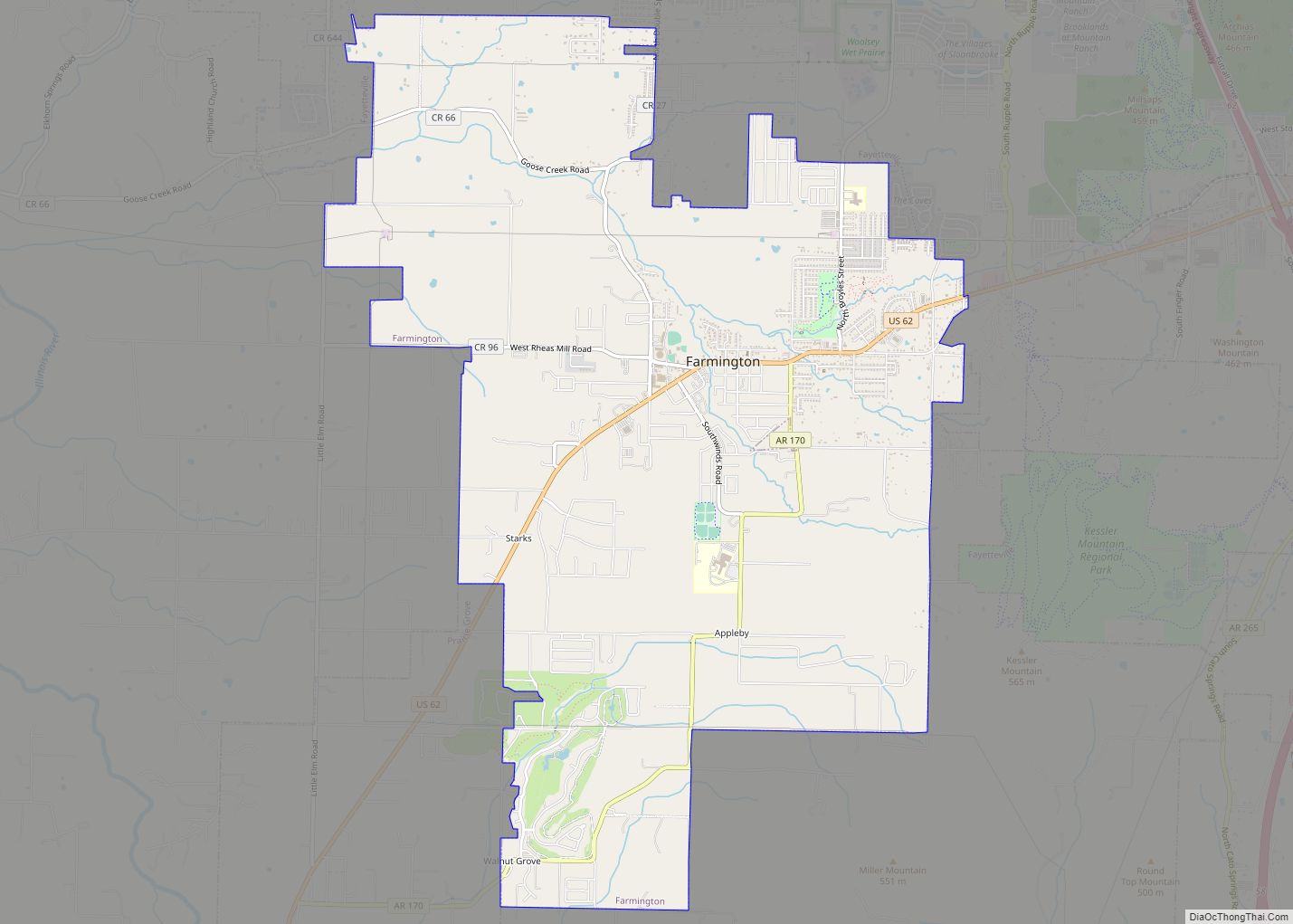
Farmington is a city in Washington County, Arkansas, United States. The community is nestled in a valley among the Boston Mountains, a subset of the Ozark Mountains. Although the first settlers came from the Deep South in 1828, the community did not incorporate until 1946. Located immediately west of Fayetteville in the Northwest Arkansas metropolitan statistical area, Farmington has been experiencing a population boom in recent years, as indicated by a 66% growth in population between the 2000 and 2010 censuses. It has been characterized as a bedroom community by the University of Arkansas Community Design Center.
| Name: | Farmington city |
|---|---|
| LSAD Code: | 25 |
| LSAD Description: | city (suffix) |
| State: | Arkansas |
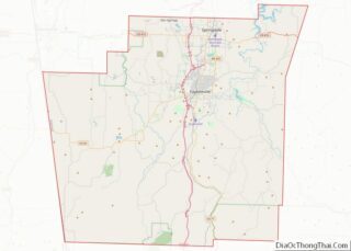
| County: | Washington County |
| Incorporated: | October 15, 1946 |
| Elevation: | 1,217 ft (371 m) |
| Land Area: | 9.83 sq mi (25.45 km²) |
| Water Area: | 0.05 sq mi (0.13 km²) |
| Population Density: | 771.75/sq mi (297.99/km²) |
| ZIP code: | 72730 |
| Area code: | 479 |
| FIPS code: | 0523170 |
| GNISfeature ID: | 2403598 |
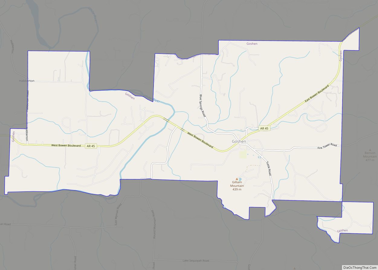
Online Interactive Map
Click on ![]() to view map in "full screen" mode.
to view map in "full screen" mode.
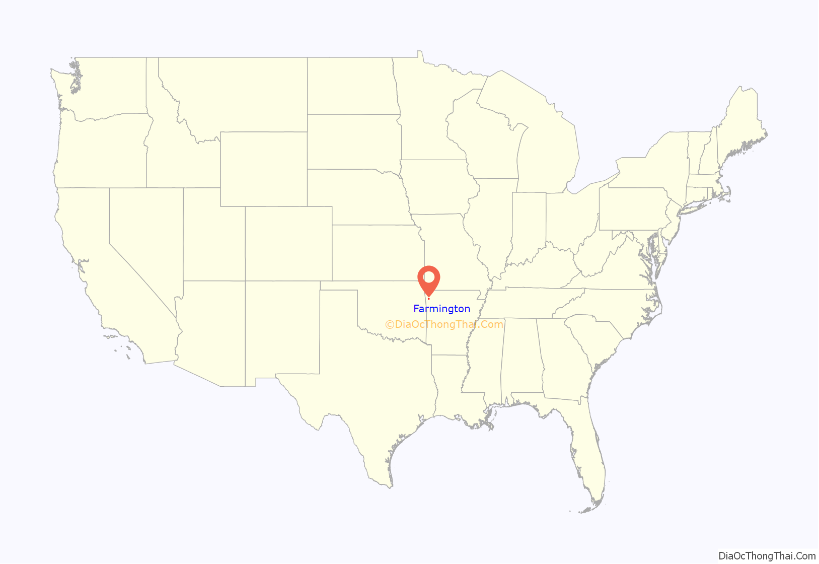
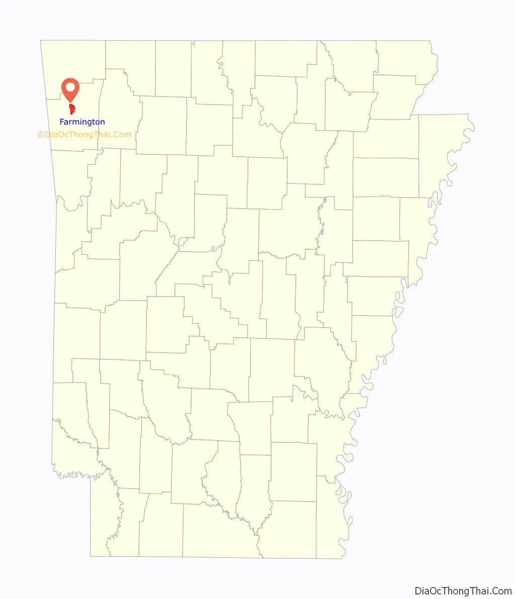
Farmington location map. Where is Farmington city?
History
Settlement through Civil War
The first settlers came from the Deep South in 1828, and the area was known as Engel’s Mill until a post office was built in 1868 and the village was renamed. The Civil War had a great impact on the community, as the area were mainly Confederates. The Battle of Prairie Grove occurred not far from Farmington, and the city was subject to raids by both armies as well as unaffiliated guerrillas and roughnecks.
The city was platted ca. 1870.
Reconstruction through present
Around the 1890s, residents found prosperity by growing strawberries and grapes and shipping them on the St. Louis–San Francisco Railway. The tracks were pulled up during World War II, something the company had wanted to do for years, under the guise of the war effort. Farmington was incorporated on October 15, 1946.
Farmington Road Map
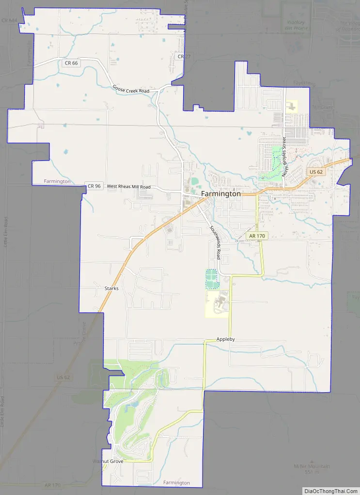
Farmington city Satellite Map

Geography
According to the United States Census Bureau, the city has a total area of 4.8 square miles (12 km), all land.
See also
Map of Arkansas State and its subdivision:- Arkansas
- Ashley
- Baxter
- Benton
- Boone
- Bradley
- Calhoun
- Carroll
- Chicot
- Clark
- Clay
- Cleburne
- Cleveland
- Columbia
- Conway
- Craighead
- Crawford
- Crittenden
- Cross
- Dallas
- Desha
- Drew
- Faulkner
- Franklin
- Fulton
- Garland
- Grant
- Greene
- Hempstead
- Hot Spring
- Howard
- Independence
- Izard
- Jackson
- Jefferson
- Johnson
- Lafayette
- Lawrence
- Lee
- Lincoln
- Little River
- Logan
- Lonoke
- Madison
- Marion
- Miller
- Mississippi
- Monroe
- Montgomery
- Nevada
- Newton
- Ouachita
- Perry
- Phillips
- Pike
- Poinsett
- Polk
- Pope
- Prairie
- Pulaski
- Randolph
- Saint Francis
- Saline
- Scott
- Searcy
- Sebastian
- Sevier
- Sharp
- Stone
- Union
- Van Buren
- Washington
- White
- Woodruff
- Yell
- Alabama
- Alaska
- Arizona
- Arkansas
- California
- Colorado
- Connecticut
- Delaware
- District of Columbia
- Florida
- Georgia
- Hawaii
- Idaho
- Illinois
- Indiana
- Iowa
- Kansas
- Kentucky
- Louisiana
- Maine
- Maryland
- Massachusetts
- Michigan
- Minnesota
- Mississippi
- Missouri
- Montana
- Nebraska
- Nevada
- New Hampshire
- New Jersey
- New Mexico
- New York
- North Carolina
- North Dakota
- Ohio
- Oklahoma
- Oregon
- Pennsylvania
- Rhode Island
- South Carolina
- South Dakota
- Tennessee
- Texas
- Utah
- Vermont
- Virginia
- Washington
- West Virginia
- Wisconsin
- Wyoming