Marmaduke is a city in Greene County, Arkansas, United States. The population was 1,212 in 2020.
| Name: | Marmaduke city |
|---|---|
| LSAD Code: | 25 |
| LSAD Description: | city (suffix) |
| State: | Arkansas |
| County: | Greene County |
| Elevation: | 272 ft (83 m) |
| Total Area: | 1.40 sq mi (3.62 km²) |
| Land Area: | 1.40 sq mi (3.62 km²) |
| Water Area: | 0.00 sq mi (0.00 km²) |
| Total Population: | 1,212 |
| Population Density: | 866.95/sq mi (334.68/km²) |
| Area code: | 870 |
| FIPS code: | 0544240 |
| GNISfeature ID: | 0058126 |
| Website: | www.marmadukear.com |
Online Interactive Map
Click on ![]() to view map in "full screen" mode.
to view map in "full screen" mode.
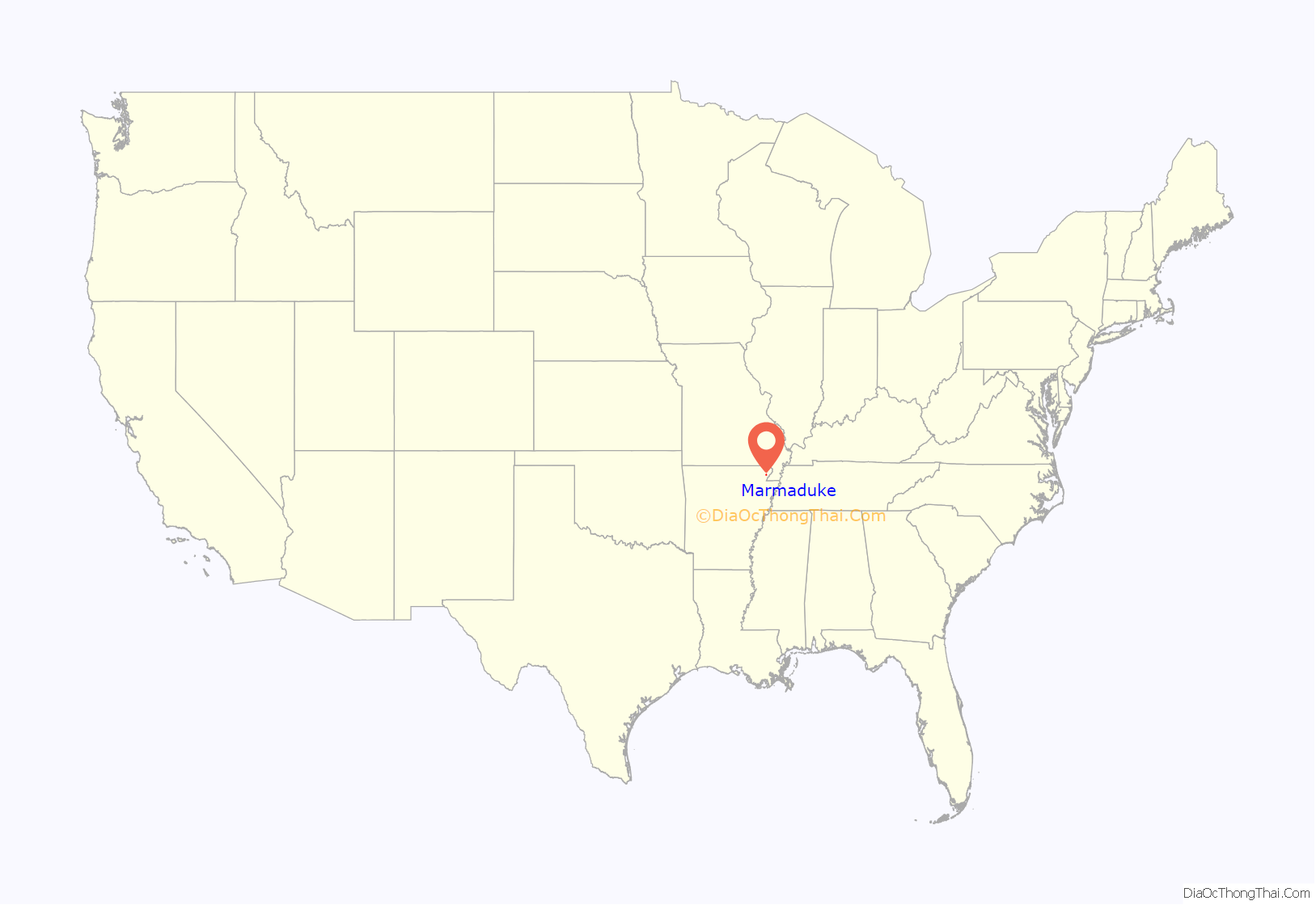
Marmaduke location map. Where is Marmaduke city?
History
The town of Marmaduke was named for Confederate Major General John Sappington Marmaduke, who later served as governor of Missouri. Marmaduke was said to have established a camp for his soldiers near the site of the present town. The Texas and St. Louis Railroad was built through the area in 1882.
Marmaduke was incorporated on August 2, 1909, and, by 1914, had expanded to include two drugstores, three banks, three restaurants, a Methodist and a Southern Baptist church, two barber shops, a hotel, a boarding house, and two dime stores. The primary employers at the time were a sawmill, a lumber mill, a stave mill, and large and cut timber distributors.
Current industry includes the Anchor plastics company and the American Railcar Company.
The community was severely damaged by a severe tornado on April 2, 2006. At least half of the town was reported to have been destroyed or even flattened, and nearly every structure received some degree of damage. No one was killed in Marmaduke, but at least 50 people were injured, some seriously. In 2009 a major ice storm came across the northern part of Arkansas, causing the village, together with other regions, to lose electricity for a few weeks. Since then the town has almost fully recovered.
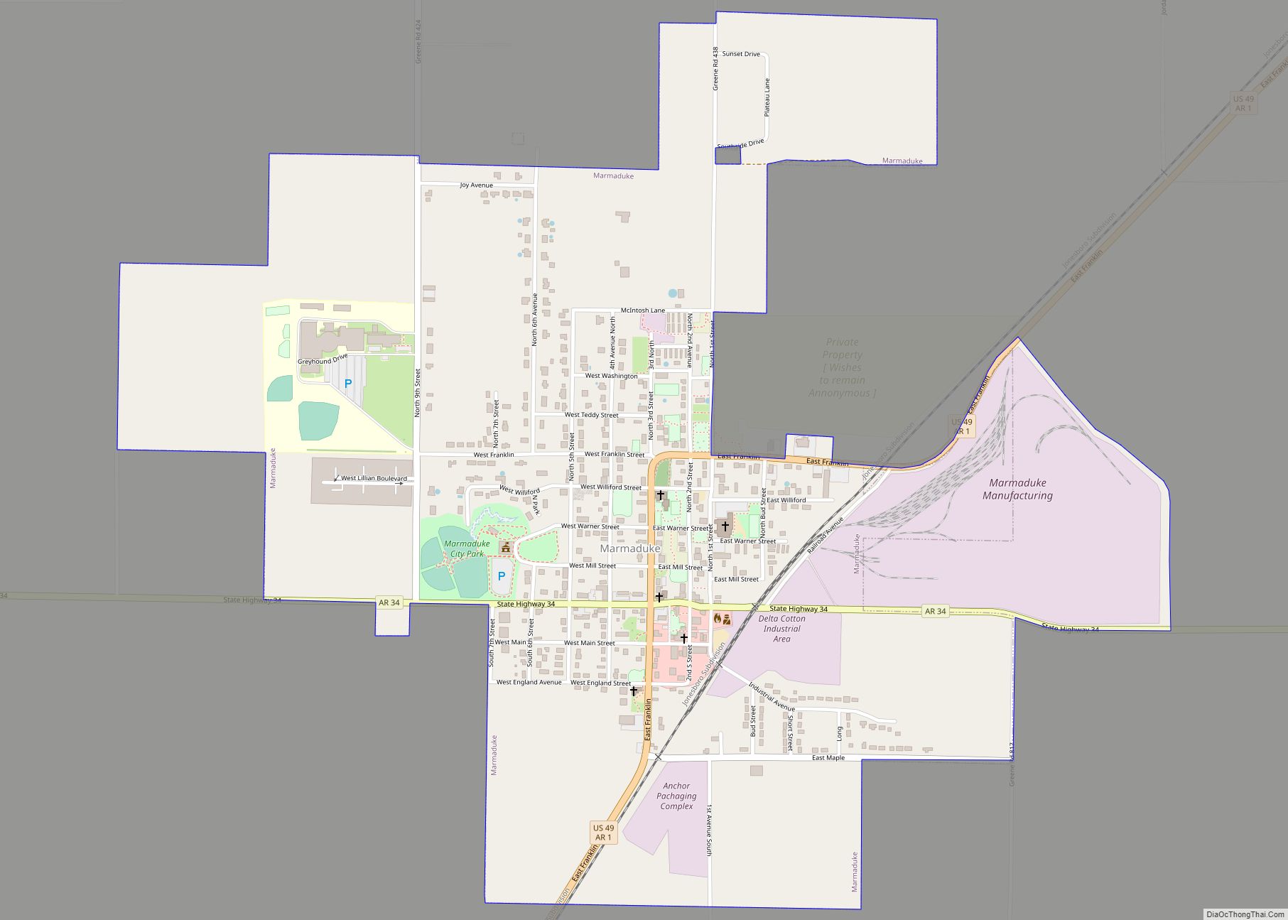
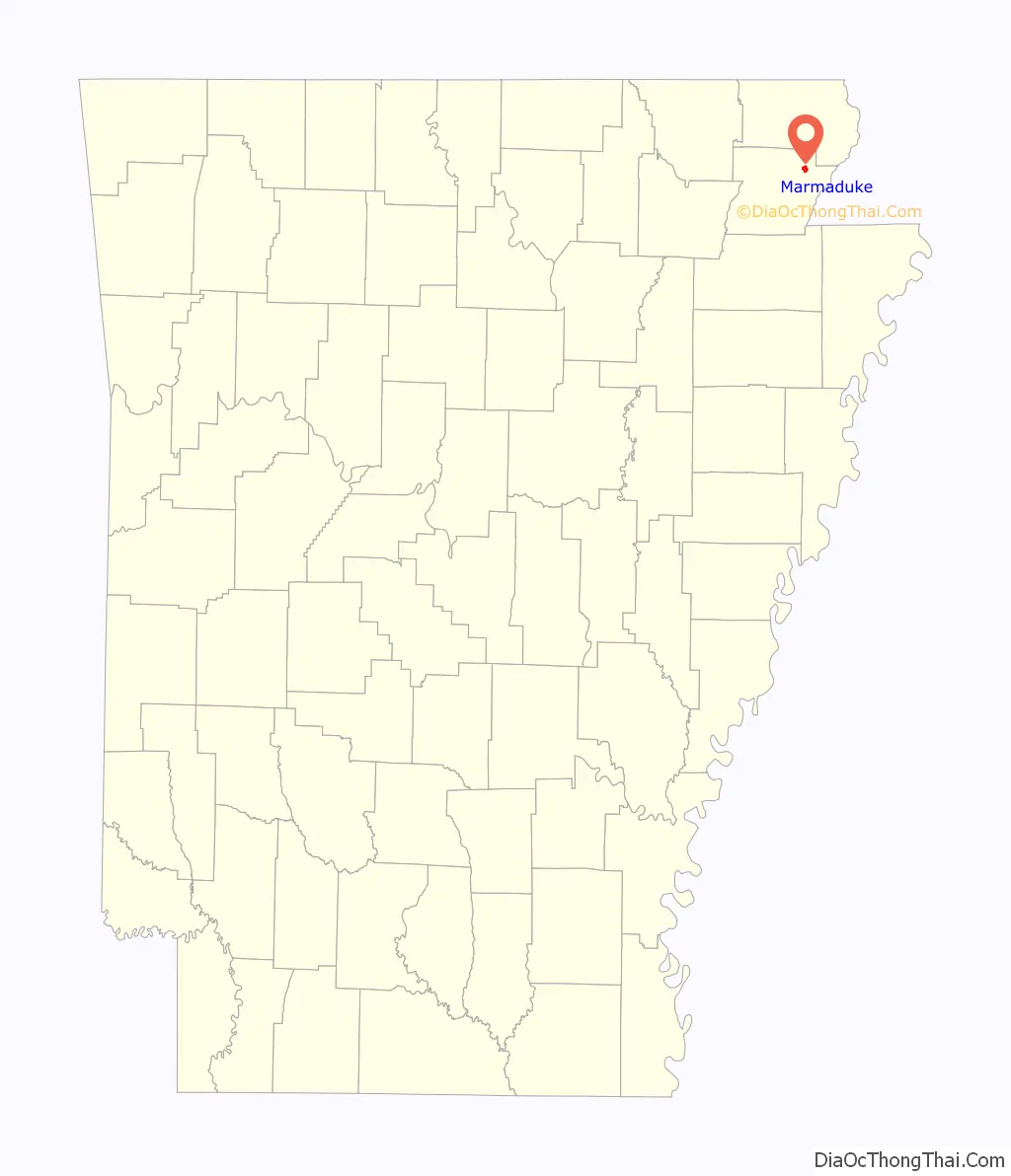
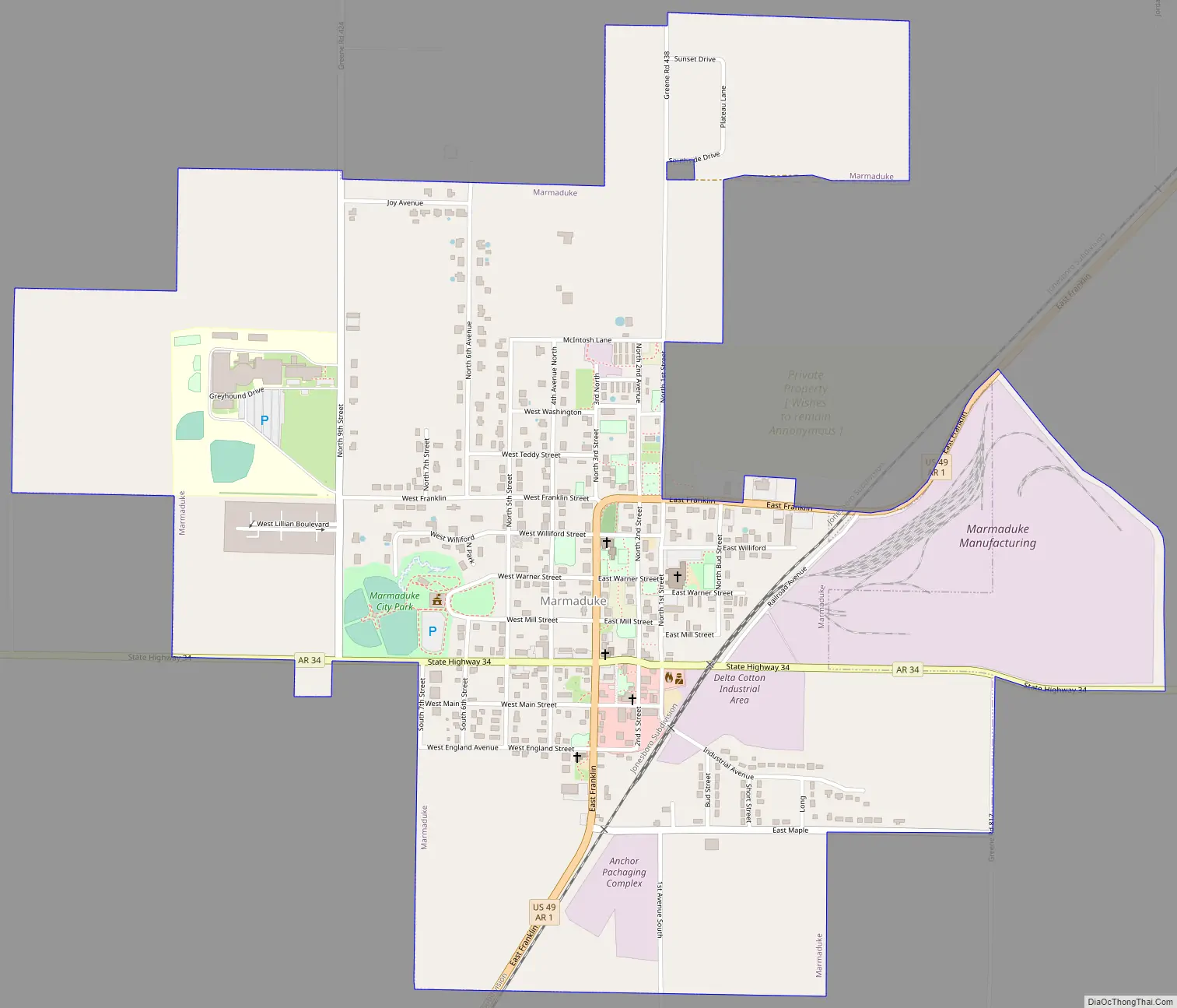
Marmaduke Road Map
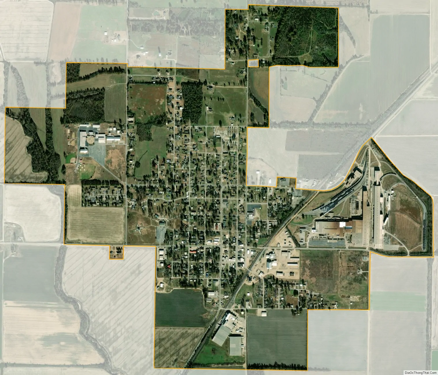
Marmaduke city Satellite Map
Geography
Marmaduke is located in northeastern Greene County. U.S. Route 49 passes through the center of Marmaduke, leading northeast 16 miles (26 km) to Piggott and southwest 10 miles (16 km) to Paragould, the Greene County seat. Arkansas Highway 34 crosses US 49 in the center of town; it leads east 5 miles (8 km) to Arkansas Highway 139 at Fritz and west 7 miles (11 km) to Lafe.
The city has a total area of 1.3 square miles (3.4 km), all land. Marmaduke is in the northern part of the Arkansas Delta physical region and sits just east of Crowley’s Ridge. The Missouri state line, following the St. Francis River, is 9 miles (14 km) to the east.
See also
Map of Arkansas State and its subdivision:- Arkansas
- Ashley
- Baxter
- Benton
- Boone
- Bradley
- Calhoun
- Carroll
- Chicot
- Clark
- Clay
- Cleburne
- Cleveland
- Columbia
- Conway
- Craighead
- Crawford
- Crittenden
- Cross
- Dallas
- Desha
- Drew
- Faulkner
- Franklin
- Fulton
- Garland
- Grant
- Greene
- Hempstead
- Hot Spring
- Howard
- Independence
- Izard
- Jackson
- Jefferson
- Johnson
- Lafayette
- Lawrence
- Lee
- Lincoln
- Little River
- Logan
- Lonoke
- Madison
- Marion
- Miller
- Mississippi
- Monroe
- Montgomery
- Nevada
- Newton
- Ouachita
- Perry
- Phillips
- Pike
- Poinsett
- Polk
- Pope
- Prairie
- Pulaski
- Randolph
- Saint Francis
- Saline
- Scott
- Searcy
- Sebastian
- Sevier
- Sharp
- Stone
- Union
- Van Buren
- Washington
- White
- Woodruff
- Yell
- Alabama
- Alaska
- Arizona
- Arkansas
- California
- Colorado
- Connecticut
- Delaware
- District of Columbia
- Florida
- Georgia
- Hawaii
- Idaho
- Illinois
- Indiana
- Iowa
- Kansas
- Kentucky
- Louisiana
- Maine
- Maryland
- Massachusetts
- Michigan
- Minnesota
- Mississippi
- Missouri
- Montana
- Nebraska
- Nevada
- New Hampshire
- New Jersey
- New Mexico
- New York
- North Carolina
- North Dakota
- Ohio
- Oklahoma
- Oregon
- Pennsylvania
- Rhode Island
- South Carolina
- South Dakota
- Tennessee
- Texas
- Utah
- Vermont
- Virginia
- Washington
- West Virginia
- Wisconsin
- Wyoming