Paragould is the county seat of Greene County, and the 19th-largest city in Arkansas, in the United States. The city is located in northeastern Arkansas on the eastern edge of Crowley’s Ridge, a geologic anomaly contained within the Arkansas delta.
Paragould is the principal city of the Paragould, Arkansas Micropolitan Statistical Area and is also a part of the Jonesboro-Paragould Combined Statistical Area. The Paragould micropolitan area’s population was 42,090 at the 2010 census, and the Jonesboro-Paragould Combined Statistical Area’s population was 163,116.
The city had a population of 26,113 at the 2010 census and an estimated population of 28,986 in 2019.
| Name: | Paragould city |
|---|---|
| LSAD Code: | 25 |
| LSAD Description: | city (suffix) |
| State: | Arkansas |
| County: | Greene County |
| Elevation: | 299 ft (91 m) |
| Total Area: | 32.02 sq mi (82.93 km²) |
| Land Area: | 31.86 sq mi (82.51 km²) |
| Water Area: | 0.16 sq mi (0.42 km²) |
| Total Population: | 29,537 |
| Population Density: | 927.17/sq mi (357.99/km²) |
| ZIP code: | 72450-72451 |
| Area code: | 870 |
| FIPS code: | 0553390 |
| GNISfeature ID: | 0077948 |
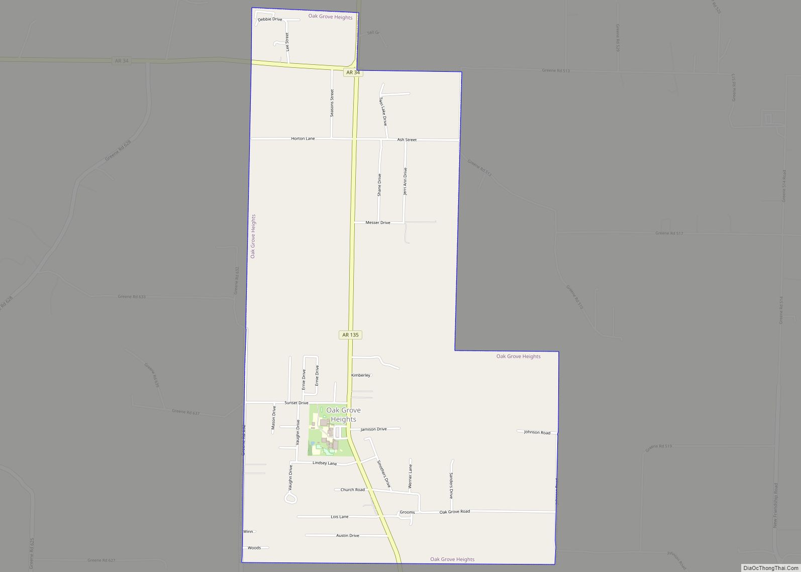
Online Interactive Map
Click on ![]() to view map in "full screen" mode.
to view map in "full screen" mode.
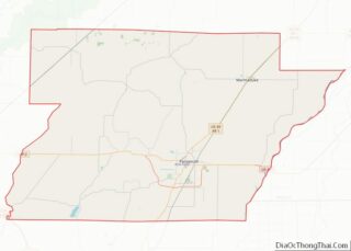
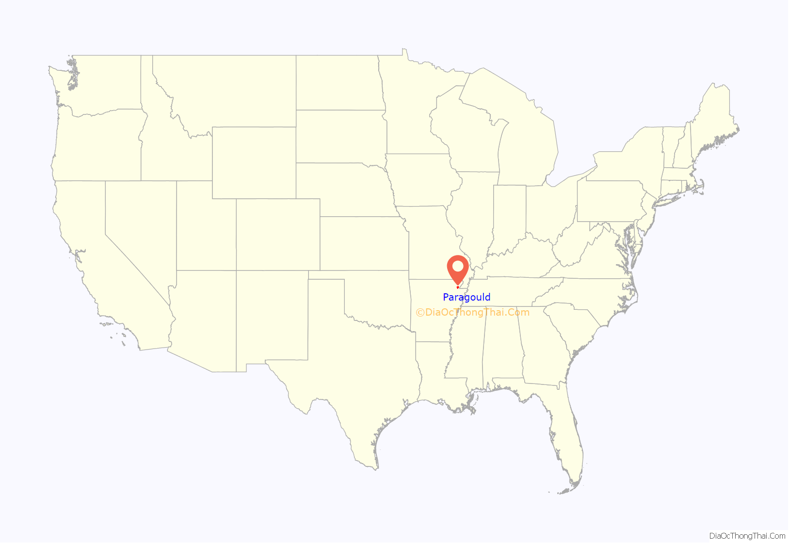
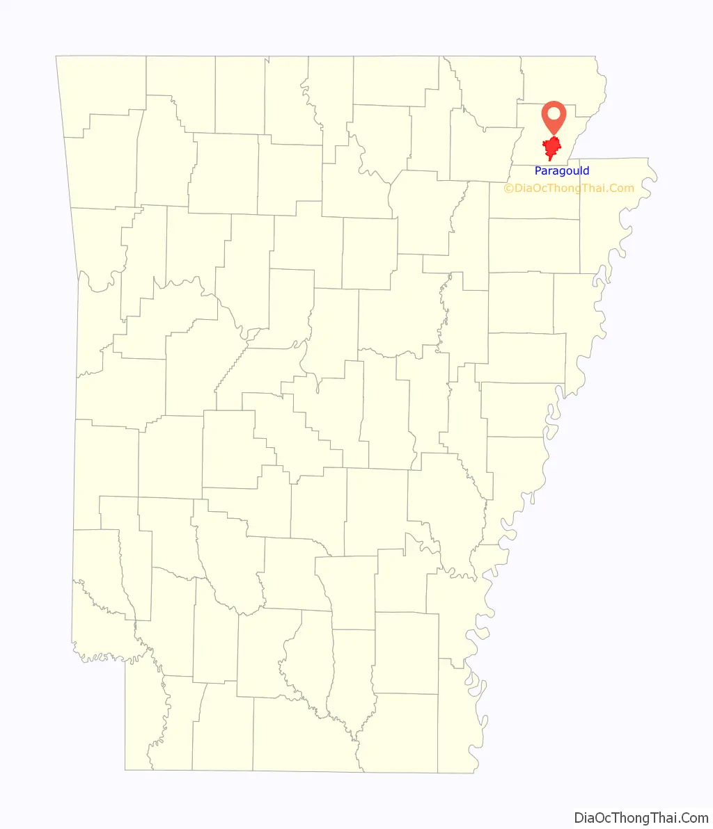
Paragould location map. Where is Paragould city?
History
The city’s name is a blend combining the last names of competing railroad magnates J. W. Paramore and Jay Gould. Paramore’s Texas & St. Louis Railway (later the Cotton Belt) and Gould’s St. Louis, Iron Mountain and Southern Railway (later the Missouri Pacific) intersected here in 1882. A group of citizens chose the name, and it is believed to be the only city in the world with this name. Gould objected to his name’s being second and refused to list the new town on his schedules.
Sundown town
From 1888 to 1908, Paragould experienced a series of incidents in which White residents threatened and attacked Black residents. Some Black residents were flogged, and some of their homes and churches were burned. Arkansas Governor Jeff Davis ordered the state militia not to intervene on behalf of Black citizens. On numerous occasions White residents ordered Black citizens to leave and never return. In 1908, they threatened them to leave or die, which resulted in an almost complete depopulation of African-Americans in the county, and earned Paragould the designation of a sundown town. Black children were not allowed to participate in any form of public education until 1948, and then by busing them out of the county to Booker T. Washington High School in Jonesboro. In 1957, facing mandated integration, Jonesboro terminated this practice. Prior to 1982, no hotel in Paragould would allow Black people to spend the night. In 1983, when two Black Union Pacific workers attempted to eat at a restaurant, they were locked out. When police reached the scene, they accused the workers of attempting to break into the restaurant. An informal ban on hiring African-Americans was alleged to exist in Paragould until at least 2002.
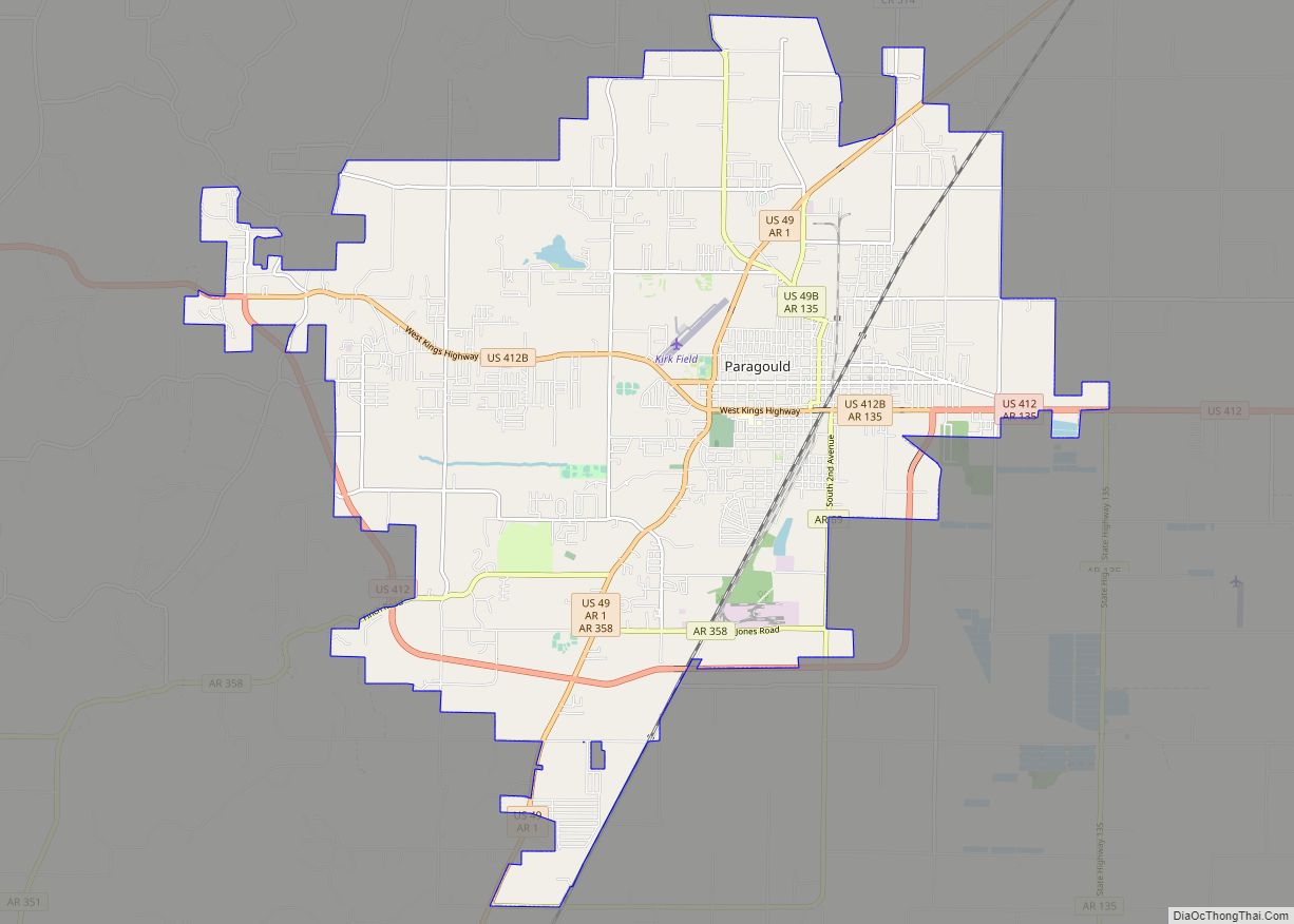
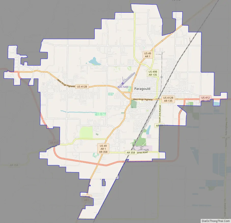
Paragould Road Map
Paragould city Satellite Map
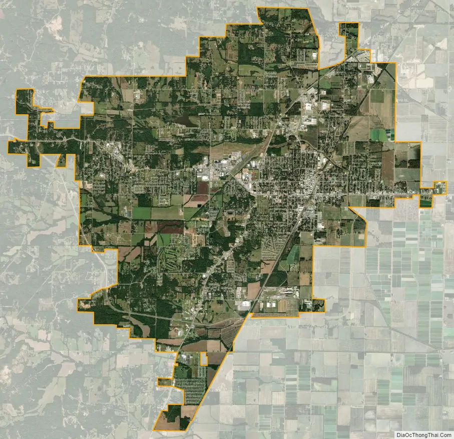
Geography
Paragould is located southeast of the center of Greene County. U.S. Routes 412 and 49 intersect in the city west of downtown. US 412 leads east 9 miles (14 km) to the Missouri state line at the St. Francis River, and a further 23 miles (37 km) northeast to Kennett, Missouri; to the west US 412 leads 26 miles (42 km) to Walnut Ridge. US 49 leads northeast 32 miles (51 km) to Piggott and southwest 20 miles (32 km) to Jonesboro. The closest major city is Memphis, Tennessee, 82 miles (132 km) to the southeast.
According to the United States Census Bureau, the city has a total area of 31.4 square miles (81.2 km), of which 31.2 square miles (80.8 km) is land and 0.2 square miles (0.4 km), or 0.52%, is water.
Climate
Paragould has a humid subtropical climate (Köppen climate classification Cfa).
See also
Map of Arkansas State and its subdivision:- Arkansas
- Ashley
- Baxter
- Benton
- Boone
- Bradley
- Calhoun
- Carroll
- Chicot
- Clark
- Clay
- Cleburne
- Cleveland
- Columbia
- Conway
- Craighead
- Crawford
- Crittenden
- Cross
- Dallas
- Desha
- Drew
- Faulkner
- Franklin
- Fulton
- Garland
- Grant
- Greene
- Hempstead
- Hot Spring
- Howard
- Independence
- Izard
- Jackson
- Jefferson
- Johnson
- Lafayette
- Lawrence
- Lee
- Lincoln
- Little River
- Logan
- Lonoke
- Madison
- Marion
- Miller
- Mississippi
- Monroe
- Montgomery
- Nevada
- Newton
- Ouachita
- Perry
- Phillips
- Pike
- Poinsett
- Polk
- Pope
- Prairie
- Pulaski
- Randolph
- Saint Francis
- Saline
- Scott
- Searcy
- Sebastian
- Sevier
- Sharp
- Stone
- Union
- Van Buren
- Washington
- White
- Woodruff
- Yell
- Alabama
- Alaska
- Arizona
- Arkansas
- California
- Colorado
- Connecticut
- Delaware
- District of Columbia
- Florida
- Georgia
- Hawaii
- Idaho
- Illinois
- Indiana
- Iowa
- Kansas
- Kentucky
- Louisiana
- Maine
- Maryland
- Massachusetts
- Michigan
- Minnesota
- Mississippi
- Missouri
- Montana
- Nebraska
- Nevada
- New Hampshire
- New Jersey
- New Mexico
- New York
- North Carolina
- North Dakota
- Ohio
- Oklahoma
- Oregon
- Pennsylvania
- Rhode Island
- South Carolina
- South Dakota
- Tennessee
- Texas
- Utah
- Vermont
- Virginia
- Washington
- West Virginia
- Wisconsin
- Wyoming